Origin
Roanoke, VA
Morning in Roanoke on Tuesday
Local time
6:36 AM
EDT
Current temp
70°F
Unavailable
Live forecast
Compiled and reviewed by the US Trip Planner planning team at COD Solutions Oy · Last reviewed Apr 21, 2026 · Editorial standards
Drive Time
4h 19m
Distance
207.9 mi
335 km
Drive Score
9/10
Great drive
Same Day?
Yes, doable
Fuel Cost
$33
one way
EV Charging
Unknown
Estimated drive times based on typical traffic patterns. Actual times may vary with weather, construction, and real-time conditions.

Roanoke, VA
Wikimedia Commons

King George, VA
Wikimedia Commons
This 207.9-mile journey from Roanoke to King George, Virginia, is a manageable one-day trip, estimated to take about 4 hours and 19 minutes. The drive predominantly uses major highways, with 78% of the route being on interstate or major roads, making for an efficient transit. You can expect a fuel cost of approximately $33 for this drive. Given its relatively short duration and highway focus, it’s a straightforward trip that doesn't necessitate an overnight stay. This route keeps you within the Southeast region throughout your travels.
Trip Pace
Same-day drive is realistic
A same-day return is possible, but it will make for a full day on the road.
Break Rhythm
1 planned break
Plan on a short reset every 3 to 4 hours to stay fresh behind the wheel.
Midpoint
103.9 miles from Roanoke, VA
A natural place for your longest stop of the day , about 1h 57m into the drive .
| Road | Distance | Duration |
|---|---|---|
| I 81 | 64.7 mi | 1h 9m |
| I 64 | 55.7 mi | 1h 1m |
| Courthouse Road | 26.7 mi | 39m |
| Blue and Gray Parkway | 18.1 mi | 25m |
| US 220 | 13.1 mi | 15m |
| Bibb Store Road | 5.9 mi | 8m |
| I 581 | 5.6 mi | 7m |
| Lake Anna Parkway | 4 mi | 5m |
Step-by-step road directions between Roanoke, VA and King George, VA.
Start on this road
Turn left onto 1st Street Southwest
Turn sharp left onto US 221; US 220 BUS
Turn left onto US 221; US 220 BUS; VA 116
Continue on US 11; US 221; US 220 BUS; VA 116
Take the ramp onto US 220 BUS
Merge onto I 581; US 220
Keep slight right at fork onto US 220
Continue on I 81
Keep slight right at fork onto I 64
Take the exit
Turn left onto VA 208
Turn left onto US 33; VA 22
Turn right onto SR 628
Continue on SR 628
At end of road, turn right onto SR 613
Continue on SR 613
At end of road, turn left onto US 522; VA 208
Turn right
Turn right onto VA 208
Continue on VA 208
Continue on VA 208
Continue on VA 208
Continue on VA 208
Continue on US 1 BUS
Enter roundabout onto US 1 BUS
Continue on US 1 BUS
Turn right onto VA 3
Arrive at destination
To make the most of this 4-hour, 19-minute drive, consider an early morning departure to avoid potential traffic, especially as you get closer to King George. Since this is a single-day trip, you have flexibility with stops; plan for one main stop to stretch your legs and refuel. Keep an eye on your fuel gauge, as the longest stretch without exits is 64.7 miles on I-81. The $33 fuel cost is a good estimate, but always factor in a little extra for comfort. A practical tip: ensure your navigation is set to avoid tolls if you prefer, as some sections might have them.
Morning Departure
An early start around 7-8 AM gets you there with plenty of daylight left.
Evening Departure
A late afternoon start means arriving after dark. Morning is better.
This is a comfortable same-day trip.
Departure
Before you leave
Start with fuel, water, and navigation already sorted so the first hour feels easy.
First stop
Around 46 miles or 54m in
Use this first pause for coffee, a restroom break, and a quick traffic check ahead.
Halfway reset
Around 103.9 miles or 1h 57m in
This is the best place for your longest stop, a real meal, and a full fuel check.
Final approach
Final hour starts around 3h 22m
Traffic, exits, and arrival timing usually matter more near King George, VA than in the middle of the route.
Open the route before leaving Roanoke, VA so your first major turns are already loaded.
Leave with enough water and a charging cable within reach, not packed away.
Check your fuel range against the first long segment, especially if you are starting outside city service areas.
Day 1
Settle into the route from Roanoke, VA
This is one driving day of about 207.9 miles and 4h 19m.
Rest stops, refuel points, and overnight suggestions along this route.

Mid-route town
Meal stop
104 mi into the route
Best for: Lunch, fuel, and a longer reset
This sits close to the middle of the route, so it works well for the longest stop of the day.
A short stop after about 46 miles helps settle the day before fatigue starts building.
The midpoint is around 103.9 miles from Roanoke, VA, which is a good place for a longer meal and fuel stop.
Before the longest stretch
Fuel checkTop up before I 81 if your tank is already low. That segment runs about 64.7 miles.
These stop ideas are pacing suggestions — the exact town or exit can change with traffic, hotel plans, and fuel range.
5 decision points cluster between mile 0.1 and 6.7 — GPS handles the exact turns, but know they're coming. Your lane choice matters more than the turn itself.
Turn left onto 1st Street Southwest
Navigation decision point
Turn sharp left onto US 221; US 220 BUS / Franklin Road Southwest
Sharp turn - reduce speed on approach
Take the ramp onto US 220 BUS toward I 581 North, US 220 North: Lexington, Bristol
Lane positioning matters here. Multiple destination signs - pick the right one
Merge onto I 581; US 220
Merge point - match speed before joining. Lane positioning matters here
Keep slight right at fork onto US 220 toward I 81 North, US 220 North: Lexington
Highway fork - watch signs carefully. Lane positioning matters here. Multiple destination signs - pick the right one
Regular Gas
$32.51 one way
$65.02 round trip
| Fuel Type | $/gal | One Way | Round Trip |
|---|---|---|---|
| midgrade | $4.34 | $35.55 | $71.10 |
| premium | $4.70 | $38.48 | $76.96 |
| diesel | $5.61 | $45.90 | $91.80 |
No toll roads detected on this route.
Estimated Trip Cost (one way, 1 person)
Fuel
$33
Meals
$25–$50
Total
$58–$83
Rough estimate based on US averages. Hotel $80–$140/night, meals $25–$50/day.
Estimated CO2 emission: 72.7 kg one way. Prices: EIA weekly data, 2026-04-13.
Driving Electric?
About $22 in charging · 0 stops · 67% less CO2
| Vehicle Type | kWh | Stops | DC Fast | Home Charge |
|---|---|---|---|---|
| Average EV | 62.4 | 0 | $21.83 | $9.98 |
| Efficient EV | 52 | 0 | $18.19 | $8.32 |
| EV Truck/SUV | 83.2 | 1 | $29.11 | $13.31 |
Gas CO2
73 kg
EV CO2
24 kg (67% less)
This trip is well within single-charge range for most EVs. No charging stops needed if you start fully charged.
DC fast charging avg $0.35/kWh. Home charging avg $0.16/kWh. US grid CO2: 0.39 kg/kWh.
Current conditions at both ends of the drive.
Origin
Morning in Roanoke on Tuesday
Local time
6:36 AM
EDT
Current temp
70°F
Unavailable
Destination
Morning in King George on Tuesday
Local time
6:36 AM
EDT
Current temp
50°F
Unavailable
Seasonal Notes
Summer travel usually means heavier construction, hotter rest stops, and busier weekend traffic around major cities.
Winter travel shortens daylight, so a route that looks manageable on paper can feel much longer after dark.
Holiday weekends tend to make both departure and arrival windows slower than the raw route time suggests.
Time zone
Origin and destination are on the same clock, so arrival timing is easier to judge at a glance.
Temperature spread
A meaningful temperature swing is a good cue to rethink layers, water, and how soon you want to arrive.
Road read
An early start around 7-8 AM gets you there with plenty of daylight left.
Weather data from the National Weather Service. Conditions may change; check closer to your travel date.
Worth a detour if your schedule allows.
National Monument
George Washington Birthplace National Monument is located in the Northern Neck of Virginia. It encompasses 551 acres of land where seven generations of the Washington family lived and where George Was...

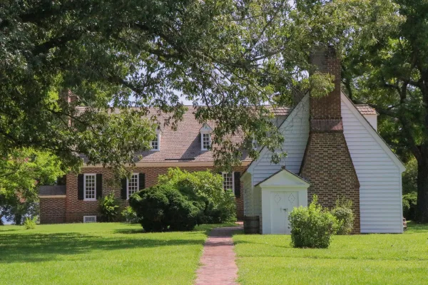
National Monument
Booker T. Washington was born a slave in April 1856 on the 207-acre farm of James Burroughs. After the Civil War, Washington became the first principal of Tuskegee Normal and Industrial School. Later...
Park data from the National Park Service API. Alerts update every 2 hours.
Expect a highway-focused drive for the majority of this trip. With 78% of the route on interstates and major roadways, you'll experience efficient travel for much of the 207.9 miles. The longest uninterrupted stretch you'll encounter is 64.7 miles along I-81, offering a consistent pace. While primarily highway, the route does incorporate sections of Courthouse Road, which may offer a slight change of pace as you approach your destination. Overall, the personality of this drive is geared towards covering distance effectively.
This is a straightforward highway drive that stays mostly on I 81 and I 64. You will hit about 16 points where you need to pay attention to lane position or signs. The trickiest moment comes around 0.1 miles in near 1st Street Southwest.
Moderate - straightforward overall, but long enough or busy enough to require pacing
Balances navigation complexity with total wheel time.
This drive requires moderate attention. Across 207.9 miles you will encounter 16 spots where lane choice or exit timing matters. Not difficult for experienced highway drivers, but worth previewing the tricky sections before you go.
Where does it get tricky?
The main spots that need attention: at 0.1 miles (1st Street Southwest): Navigation decision point; at 0.2 miles (US 221; US 220 BUS / Franklin Road Southwest): Sharp turn - reduce speed on approach; at 0.9 miles (US 220 BUS): Lane positioning matters here. Multiple destination signs - pick the right one.
Based on OSRM destination-sign hints, not a full list of every settlement the road passes.
On the drive from Roanoke, VA to King George, VA, road signs begin pointing toward Ferncliff along the way.
Ferncliff
Weekend Trip
Doable as a same-day drive at 4h 19m. Total distance: 207.9 miles.
Family Friendly
Moderate complexity with 1 natural rest stops along the way.
Solo Traveler
4h 19m drive, comfortable solo distance.
First-Time Driver
Mostly highway driving (78%). Some complex stretches to watch for.
Compiled by the US Trip Planner planning team at COD Solutions Oy from open government datasets — OSRM over OpenStreetMap for geometry, EIA for fuel prices, and NPS for national parks. See our methodology for refresh cadence and limitations.
Was this helpful?
Thanks for your feedback!
Your tip has been submitted. Thanks!
/500
Recent Tips
·
Explore more options from Roanoke, VA or browse trips ending in King George, VA.
Looking for more statewide routes? Browse VA road trips.