King George, VA to Roanoke, VA is 207.6 miles and takes about 4h 18m via I 64 and I 81, with a fuel budget near $32 and enough daylight to finish in a day. This trip stays within Virginia, moving from the Southeast region of the state to its western part. Given its mostly highway profile, expect a relatively straightforward drive with fewer turns. With a recommended one-day duration, it's a manageable distance for most drivers looking to cover ground efficiently.
Trip Pace
Same-day drive is realistic
A same-day return is possible, but it will make for a full day on the road.
Break Rhythm
1 planned break
Plan on a short reset every 3 to 4 hours to stay fresh behind the wheel.
Midpoint
103.8 miles from King George, VA
A natural place for your longest stop of the day
, about 2h 21m into the drive
.
Main Roads
Road
Distance
Duration
I 64
85.7 mi
1h 33m
I 81
47.7 mi
52m
Courthouse Road
26.6 mi
39m
Kings Highway
16.2 mi
22m
US 220
5.9 mi
8m
Bibb Store Road
5.9 mi
8m
Lake Anna Parkway
4 mi
5m
New Bridge Road
3.8 mi
5m
Longest stretch:
I 64
— 85.7 mi, about 1h 33m
Traffic on I-64
Hour-of-day weekday pattern from 39 FHWA count stations on your route.
Peak
4 PM
~1,623 veh/hr typical
· worst 1,988
Quietest
2 AM
~90 veh/hr
Peak-to-quiet ratio
18×
busier at peak than in the quiet hours
12a6anoon6p11p
Averaged across 52 weeks of 2023 FHWA Travel Monitoring Analysis System data. Weekday hours only (Mon–Fri).
Turn-by-Turn Driving Directions
Step-by-step road directions between King George, VA and Roanoke, VA.
1
Start on VA 3
16 mi·22 min·Kings Highway
2
Turn straight onto VA 3
1.8 mi·3 min·VA 3
Toward VA 3 West, Culpeper
3
Turn left onto US 1 BUS
0.2 mi·41 sec·Lafayette Boulevard
4
Enter roundabout onto US 1 BUS
106 ft·2 sec·Lafayette Boulevard
5
Continue on US 1 BUS
2.7 mi·5 min·Lafayette Boulevard
Use the straight / right lanes.
6
Continue on VA 208
6.0 mi·9 min·Courthouse Road
Use the left / straight lanes.
7
Continue on VA 208
0.9 mi·1 min·Courthouse Bypass
8
Continue on VA 208
4.0 mi·5 min·Lake Anna Parkway
9
Continue on VA 208
12 mi·16 min·Courthouse Road
10
Continue on VA 208
3.8 mi·5 min·New Bridge Road
11
Turn right
93 ft·4 sec
12
Turn left
192 ft·5 sec
13
Turn right onto US 522; VA 208
294 ft·6 sec·Zachary Taylor Highway
14
Turn right onto SR 613
2.8 mi·4 min·Mansfield Road
15
Turn right onto SR 613
1.7 mi·2 min·Goldmine Road
16
Turn left onto SR 628
5.9 mi·8 min·Bibb Store Road
17
Continue on SR 628
0.4 mi·1 min·Fredericksburg Avenue
18
Turn left onto US 33; VA 22
0.2 mi·18 sec·East Main Street
19
Turn right onto VA 208
8.7 mi·12 min·Courthouse Road
20
Take the ramp
0.3 mi·37 sec
21
Merge onto I 64
86 mi·1 hr 33 min·I 64
22
Keep slight left at fork onto I 81
48 mi·52 min·I 81
Use the straight lane.
23
Take the exit onto US 220
5.9 mi·8 min·US 220
Exit 143Toward I 581, US 220 South: Airport, RoanokeUse the slight left lane.
24
Take the exit onto US 220 BUS
0.1 mi·17 sec·US 220 BUS
Toward US 11 South, US 220 Business South: Downtown
25
Keep slight left at fork onto US 220 BUS
0.3 mi·56 sec·US 220 BUS
26
Turn right onto Salem Avenue Southeast
0.2 mi·30 sec·Salem Avenue Southeast
27
Turn left onto South Jefferson Street
477 ft·20 sec·South Jefferson Street
28
Turn right onto Kirk Avenue Southwest
379 ft·22 sec·Kirk Avenue Southwest
29
Turn left
115 ft·13 sec
30
Turn left
132 ft·9 sec
31
Arrive at destination
Trip Plan
To make the most of this 4h 18m drive, consider leaving King George in the morning to avoid potential afternoon traffic. The route is efficient, allowing for a single stop if needed, perhaps around the halfway point. Keep an eye on your fuel gauge, especially before entering longer stretches of highway; your estimated fuel cost is around $32. Since this is a single-day trip, you have flexibility to depart when convenient, but aiming for an earlier start will give you more time upon arrival in Roanoke.
Morning Departure
An early start around 7-8 AM gets you there with plenty of daylight left.
Evening Departure
A late afternoon start means arriving after dark. Morning is better.
You can normally do this drive in one day.
Plan roughly 1 meaningful break for fuel, food, and rest.
The halfway point lands around 103.8 miles from King George, VA, or about 2h 21m into the drive.
The longest continuous stretch on this route runs about 85.7 miles.
This is a comfortable same-day trip.
Departure
Before you leave
Start with fuel, water, and navigation already sorted so the first hour feels easy.
First stop
Around 46 miles or 1h 8m in
Use this first pause for coffee, a restroom break, and a quick traffic check ahead.
Halfway reset
Around 103.8 miles or 2h 21m in
This is the best place for your longest stop, a real meal, and a full fuel check.
Final approach
Final hour starts around 3h 34m
Traffic, exits, and arrival timing usually matter more near Roanoke, VA than in the middle of the route.
Before You Leave
+
Open the route before leaving King George, VA so your first major turns are already loaded.
+
Leave with enough water and a charging cable within reach, not packed away.
+
Check your fuel range against the first long segment, especially if you are starting outside city service areas.
Day 1
Settle into the route from King George, VA
This is one driving day of about 207.6 miles and 4h 18m.
Your first comfortable stop window is around 46 miles from King George, VA.
This route can stay practical as a one-day drive if traffic stays reasonable.
Plan about 1 real break rather than only quick fuel stops.
The longest stretch is on I 64 for about 85.7 miles.
Where to Stop
Rest stops, refuel points, and overnight suggestions along this route.
Place data sourced from public business listings. Hours and availability may vary.
Heads-up: tricky spots
5 of 22
5 decision points cluster between mile 18.2 and 207.4 — GPS handles the exact turns, but know they're coming. Your lane choice matters more than the turn itself.
5
18.2 mi into trip|~26m in|US 1 BUS / Lafayette Boulevard
Enter roundabout onto US 1 BUS / Lafayette Boulevard
Roundabout - know your exit number before entering
6
153.2 mi into trip|~3h 15m in|I 81
Keep slight left at fork onto I 81
Highway fork - watch signs carefully. Lane positioning matters here
Use the straight lane.
8
200.9 mi into trip|~4h 7m in|US 220
Take the exit onto US 220 toward I 581, US 220 South: Airport, Roanoke
Exit ramp - move to the correct lane early. Lane positioning matters here. Multiple destination signs - pick the right one
Use the slight left lane.
Exit 143
Toward I 581, US 220 South: Airport, Roanoke
5
206.8 mi into trip|~4h 15m in|US 220 BUS
Take the exit onto US 220 BUS toward US 11 South, US 220 Business South: Downtown
Exit ramp - move to the correct lane early. Multiple destination signs - pick the right one
Toward US 11 South, US 220 Business South: Down...
5
207.4 mi into trip|~4h 17m in|South Jefferson Street
Turn left onto South Jefferson Street
Navigation decision point
Fuel & Cost
Regular Gas
$30.65 one way
$61.30 round trip
$3.75/gal25.4 MPG avg73 kg CO2
Fuel Type
$/gal
One Way
Round Trip
midgrade
$4.12
$33.68
$67.36
premium
$4.49
$36.71
$73.43
diesel
$4.80
$39.20
$78.40
No toll roads detected on this route.
Estimated Trip Cost (one way, 1 person)
Fuel
$31
Meals
$25–$50
Total
$56–$81
Rough estimate based on US averages. Hotel $80–$140/night, meals $25–$50/day.
Estimated CO2 emission: 72.6 kg one way.
Prices: EIA weekly data, 2026-07-13.
Driving Electric?
About $22 in charging
· 0 stops
· 67% less CO2
Vehicle Type
kWh
Stops
DC Fast
Home Charge
Average EV
62.3
0
$21.80
$9.96
Efficient EV
51.9
0
$18.17
$8.30
EV Truck/SUV
83
1
$29.06
$13.29
Gas CO2
73 kg
EV CO2
24 kg (67% less)
This trip is well within single-charge range for most EVs. No charging stops needed if you start fully charged.
DC fast charging avg $0.35/kWh. Home charging avg $0.16/kWh. US grid CO2: 0.39 kg/kWh.
Travel Intel
Current conditions at both ends of the drive.
Forecast as of Jul 18, 2026
Origin
King George, VA
Morning
in King George on Sunday
Local time
7:05 AM
EDT
Current temp
95°F
Scattered Showers And Thunderstorms
SW 12 mph53% chanceLive forecast
Severe Thunderstorm Warning
Severe Thunderstorm Warning issued July 18 at 4:47PM EDT until July 18 at 5:15PM EDT by NWS Wakefield VA
Severe Thunderstorm Warning
Severe Thunderstorm Warning issued July 18 at 4:46PM EDT until July 18 at 5:30PM EDT by NWS Wakefield VA
Destination
Roanoke, VA
Morning
in Roanoke on Sunday
Local time
7:05 AM
EDT
Current temp
94°F
Scattered Showers And Thunderstorms
W 9 mph53% chanceLive forecast
Severe Thunderstorm Warning
Severe Thunderstorm Warning issued July 18 at 4:47PM EDT until July 18 at 5:15PM EDT by NWS Wakefield VA
Severe Thunderstorm Warning
Severe Thunderstorm Warning issued July 18 at 4:46PM EDT until July 18 at 5:30PM EDT by NWS Wakefield VA
Seasonal Notes
Summer travel usually means heavier construction, hotter rest stops, and busier weekend traffic around major cities.
Winter travel shortens daylight, so a route that looks manageable on paper can feel much longer after dark.
Holiday weekends tend to make both departure and arrival windows slower than the raw route time suggests.
Time zone
Same local time
Origin and destination are on the same clock, so arrival timing is easier to judge at a glance.
Temperature spread
1 degrees cooler at arrival
A meaningful temperature swing is a good cue to rethink layers, water, and how soon you want to arrive.
Road read
4h 18m on the road
An early start around 7-8 AM gets you there with plenty of daylight left.
Weather data from the National Weather Service. Conditions may change; check closer to your travel date.
National Parks Near This Route
Worth a detour if your schedule allows.
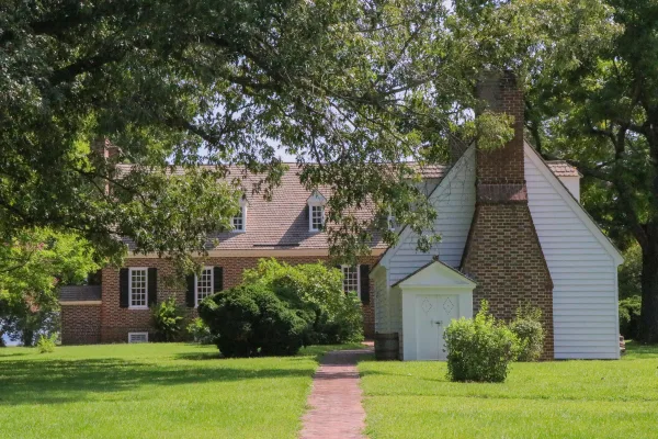
George Washington Birthplace National Monument
National Monument
George Washington Birthplace National Monument is located in the Northern Neck of Virginia. It encompasses 551 acres of land where seven generations of the Washington family lived and where George Was...
Booker T. Washington was born a slave in April 1856 on the 207-acre farm of James Burroughs. After the Civil War, Washington became the first principal of Tuskegee Normal and Industrial School. Later...
16 mi from route
~39 min detour
Free
near mile 207.6
Park data from the National Park Service API. Alerts update every 2 hours.
More Details
What kind of drive is this?
You'll spend about 70% of this 207.6-mile trip on highways, with a significant stretch of 85.7 miles on I 64. The remainder of your drive will be on surface roads, like Courthouse Road, likely involving more local traffic and potentially more frequent intersections. Expect a change in driving pace as you transition from the open highway to more developed areas with denser exit ramps.
70% highway — fuel and pacing are the main things to plan.
31 navigation steps total — most of the decisions cluster near the start and finish.
Longest single stretch: 85.7 mi on I 64.
How Hard Is This Drive?
5/10
This is a straightforward highway drive that stays mostly on I 64 and I 81. You will hit about 22 points where you need to pay attention to lane position or signs. The trickiest moment comes around 18.2 miles in near US 1 BUS / Lafayette Boulevard.
Driving Effort5/10
Moderate - straightforward overall, but long enough or busy enough to require pacing
Balances navigation complexity with total wheel time.
This drive requires moderate attention. Across 207.6 miles you will encounter 22 spots where lane choice or exit timing matters. Not difficult for experienced highway drivers, but worth previewing the tricky sections before you go.
Where does it get tricky?
The main spots that need attention: at 18.2 miles (US 1 BUS / Lafayette Boulevard): Roundabout - know your exit number before entering; at 153.2 miles (I 81): Highway fork - watch signs carefully. Lane positioning matters here; at 200.9 miles (US 220): Exit ramp - move to the correct lane early. Lane positioning matters here. Multiple destination signs - pick the right one.
Elevation Profile
Gently rolling terrain
1,644 ft61 ft
Total Climb
1,961 ft
Total Descent
1,246 ft
Highest Point
1,644 ft
~133.4 mi in
Elevation Range
1,583 ft
Towns Mentioned on Route Signs
Based on OSRM destination-sign hints, not a full list of every settlement the road passes.
On the drive from King George, VA to Roanoke, VA, road signs begin pointing toward Culpeper along the way.
Roanoke, Virginia, called the "Star City of the South" and "Magic City," is a charming city with beautiful views. A colorfully lit 100-ft star atop Mill Mountain graces the Roanoke Valley. The city sits between Virginia Tech and Smith Mountain Lake in Southwest Virginia. The Roanoke Valley had a population of around 315,000 in 2020.
Top landmarks
•Hotel Roanoke — Historic hotel in Roanoke, Virginia
•Colony House Motor Lodge — motel in Roanoke, Virginia
•Roanoke City Market Historic District — historic district in Roanoke, Virginia, United States
Doable as a same-day drive at 4h 18m. Total distance: 207.6 miles.
Family Friendly
Moderate complexity with 1 natural rest stops along the way.
Solo Traveler
4h 18m drive, comfortable solo distance.
First-Time Driver
Mostly highway driving (70%). Some complex stretches to watch for.
Frequently Asked Questions
The longest stretch is about 85.7 miles on I 64. The full list of main roads is in the Roads section above.
Yes — we found about 12 rest areas or service plazas within a short detour of the route (from OpenStreetMap). See the Rest Stops tab under Nearby Places for locations and mile markers. Plan to stretch, use the bathroom, and top off fluids every 2–3 hours on longer drives.
Yes, with realistic expectations. Build in a stop roughly every 2 hours, have snacks and activities ready, and check the Nearby Places tabs for kid-friendly stops along the way.
The main spots that need attention: at 18.2 miles (US 1 BUS / Lafayette Boulevard): Roundabout - know your exit number before entering; at 153.2 miles (I 81): Highway fork - watch signs carefully. Lane positioning matters here; at 200.9 miles (US 220): Exit ramp - move to the correct lane early. Lane positioning matters here. Multiple destination signs - pick the right one.
Yes — George Washington Birthplace National Monument and Booker T Washington National Monument. See the National Parks section for detour distances and tips on detours.
Possible but tiring. At 4.3 hours each way, an in-and-out day trip would put you behind the wheel for 8.6 hours — manageable with a long break at Roanoke, VA, but most travelers stay overnight.