Spanning 215.7 miles across Virginia, this trip connects Roanoke to Bowling Green in approximately 4 hours and 5 minutes of driving time. Because the route is a turn-heavy local drive rather than an interstate sprint, it is best suited for a single, focused day trip. Budget roughly $35 for fuel to cover the distance between these two Southeast locations. While you could technically push through in one go, staying mindful of the local road navigation will help keep your journey stress-free. It is a straightforward trek that avoids major highways entirely, offering a more hands-on driving experience than your typical cross-country transit.
Trip Pace
Same-day drive is realistic
A same-day return is possible, but it will make for a full day on the road.
Break Rhythm
1 planned break
Plan on a short reset every 3 to 4 hours to stay fresh behind the wheel.
Midpoint
107.8 miles from Roanoke, VA
A natural place for your longest stop of the day
, about 2h 1m into the drive
.
Main Roads
Road
Distance
Duration
I 64
90 mi
1h 38m
I 81
64.7 mi
1h 9m
I 95
19.5 mi
21m
US 220
13.1 mi
15m
Rogers Clark Boulevard
9.9 mi
13m
Korean War Veterans Memorial Highway
7.8 mi
8m
I 581
5.6 mi
7m
Milford Street
0.9 mi
2m
Longest stretch:
I 64
— 90 mi, about 1h 38m
Traffic on I-64
Hour-of-day weekday pattern from 67 FHWA count stations on your route.
Peak
4 PM
~1,849 veh/hr typical
· worst 2,234
Quietest
2 AM
~90 veh/hr
Peak-to-quiet ratio
20.5×
busier at peak than in the quiet hours
12a6anoon6p11p
Averaged across 52 weeks of 2023 FHWA Travel Monitoring Analysis System data. Weekday hours only (Mon–Fri).
Turn-by-Turn Driving Directions
Step-by-step road directions between Roanoke, VA and Bowling Green, VA.
1
Start on this road
285 ft·26 sec·this road
2
Turn left onto 1st Street Southwest
0.1 mi·34 sec·1st Street Southwest
3
Turn sharp left onto US 221; US 220 BUS
0.2 mi·26 sec·Franklin Road Southwest
4
Turn left onto US 221; US 220 BUS; VA 116
0.2 mi·35 sec·Williamson Road Southeast
5
Continue on US 11; US 221; US 220 BUS; VA 116
0.3 mi·48 sec·Williamson Road Northeast
Use the straight lane.
6
Take the ramp onto US 220 BUS
0.2 mi·35 sec·US 220 BUS
Toward I 581 North, US 220 North: Lexington, BristolUse the slight right lane.
7
Merge onto I 581; US 220
5.6 mi·7 min·I 581; US 220
Use the straight lane.
8
Keep slight right at fork onto US 220
13 mi·15 min·US 220
Exit 1NToward I 81 North, US 220 North: LexingtonUse the straight lane.
9
Continue on I 81
65 mi·1 hr 9 min·I 81
10
Keep slight right at fork onto I 64
90 mi·1 hr 38 min·I 64
Toward I 64 East: RichmondUse the straight lane.
11
Take the exit
1.2 mi·1 min
Exit 177Toward I 295 North: Washington, NorfolkUse the slight right lane.
12
Continue on I 295
7.8 mi·8 min·Korean War Veterans Memorial Highway
13
Take the exit
0.2 mi·26 sec
Exit 43D-C-B-AToward I 95, US 1: Richmond, Washington
14
Keep slight left at fork
0.3 mi·38 sec
Toward I 95, US 1 North: Richmond, Washington
15
Keep slight left at fork
0.3 mi·38 sec
Toward I 95: Richmond, WashingtonUse the straight / right lanes.
16
Keep slight left at fork
0.2 mi·28 sec
Toward I 95 North: Washington
17
Keep slight right at fork
0.2 mi·25 sec
Exit 43AToward I 95 North: WashingtonUse the straight / slight right lanes.
18
Continue on this road
0.1 mi·14 sec·this road
Exit 43AToward I 95 North: Washington
19
Merge onto I 95
20 mi·21 min·I 95
Use the straight lane.
20
Take the exit
0.2 mi·30 sec
Exit 104Toward VA 207: Carmel Church, Bowling GreenUse the slight right lane.
21
Keep slight right at fork
0.1 mi·19 sec
Toward SR 782 North, SR 782 South: Bowling Green, Fort Ambrose Powell HillUse the slight right lane.
22
Merge onto VA 207
9.7 mi·12 min·Rogers Clark Boulevard
23
Continue on VA 207 BUS
0.3 mi·35 sec·Rogers Clark Boulevard
24
Turn right onto SR 619
0.9 mi·2 min·Milford Street
25
Turn right onto US 301 BUS; VA 2
120 ft·3 sec·South Main Street
26
Arrive at destination
US 301 BUS; VA 2
Trip Plan
To make the most of this 4-hour and 5-minute drive, plan for at least one dedicated stop to break up the local road navigation. Since you are relying on city streets and local routes, try to depart early in the morning to avoid peak traffic congestion that often slows down these types of roads. Keep a close eye on your fuel gauge, as the stop-and-go nature of local driving can sometimes impact your efficiency more than highway travel. A concrete tip for this specific route: verify your GPS settings to ensure you are comfortable with the turn-heavy local navigation before you pull away from Roanoke.
Morning Departure
An early start around 7-8 AM gets you there with plenty of daylight left.
Evening Departure
A late afternoon start means arriving after dark. Morning is better.
You can normally do this drive in one day.
Plan roughly 1 meaningful break for fuel, food, and rest.
The halfway point lands around 107.8 miles from Roanoke, VA, or about 2h 1m into the drive.
The longest continuous stretch on this route runs about 90 miles.
This is a comfortable same-day trip.
Departure
Before you leave
Start with fuel, water, and navigation already sorted so the first hour feels easy.
First stop
Around 47 miles or 55m in
Use this first pause for coffee, a restroom break, and a quick traffic check ahead.
Halfway reset
Around 107.8 miles or 2h 1m in
This is the best place for your longest stop, a real meal, and a full fuel check.
Final approach
Final hour starts around 3h 17m
Traffic, exits, and arrival timing usually matter more near Bowling Green, VA than in the middle of the route.
Before You Leave
+
Open the route before leaving Roanoke, VA so your first major turns are already loaded.
+
Leave with enough water and a charging cable within reach, not packed away.
+
Check your fuel range against the first long segment, especially if you are starting outside city service areas.
Day 1
Settle into the route from Roanoke, VA
This is one driving day of about 215.7 miles and 4h 5m.
Your first comfortable stop window is around 47 miles from Roanoke, VA.
This route can stay practical as a one-day drive if traffic stays reasonable.
Plan about 1 real break rather than only quick fuel stops.
The longest stretch is on I 64 for about 90 miles.
Where to Stop
Rest stops, refuel points, and overnight suggestions along this route.
Place data sourced from public business listings. Hours and availability may vary.
Heads-up: tricky spots
5 of 21
5 decision points cluster between mile 6.7 and 204.6 — GPS handles the exact turns, but know they're coming. Your lane choice matters more than the turn itself.
9
6.7 mi into trip|~11m in|US 220
Keep slight right at fork onto US 220 toward I 81 North, US 220 North: Lexington
Highway fork - watch signs carefully. Lane positioning matters here. Multiple destination signs - pick the right one
Use the straight lane.
Exit 1N
Toward I 81 North, US 220 North: Lexington
8
174.5 mi into trip|~3h 14m in
Take the exit toward I 295 North: Washington, Norfolk
Exit ramp - move to the correct lane early. Lane positioning matters here. Multiple destination signs - pick the right one
Use the slight right lane.
Exit 177
Toward I 295 North: Washington, Norfolk
9
184 mi into trip|~3h 25m in
Keep slight left at fork toward I 95: Richmond, Washington
Highway fork - watch signs carefully. Lane positioning matters here. Multiple destination signs - pick the right one
Use the straight / right lanes.
Toward I 95: Richmond, Washington
9
184.5 mi into trip|~3h 26m in
Keep slight right at fork toward I 95 North: Washington
Highway fork - watch signs carefully. Lane positioning matters here
Use the straight / slight right lanes.
Exit 43A
Toward I 95 North: Washington
9
204.6 mi into trip|~3h 49m in
Keep slight right at fork toward SR 782 North, SR 782 South: Bowling Green, Fort Ambrose Powell Hill
Highway fork - watch signs carefully. Lane positioning matters here. Multiple destination signs - pick the right one
Use the slight right lane.
Toward SR 782 North, SR 782 South: Bowling Gree...
Fuel & Cost
Regular Gas
$31.85 one way
$63.69 round trip
$3.75/gal25.4 MPG avg76 kg CO2
Fuel Type
$/gal
One Way
Round Trip
midgrade
$4.12
$35.00
$69.99
premium
$4.49
$38.15
$76.29
diesel
$4.80
$40.73
$81.46
No toll roads detected on this route.
Estimated Trip Cost (one way, 1 person)
Fuel
$32
Meals
$25–$50
Total
$57–$82
Rough estimate based on US averages. Hotel $80–$140/night, meals $25–$50/day.
Estimated CO2 emission: 75.5 kg one way.
Prices: EIA weekly data, 2026-07-13.
Driving Electric?
About $23 in charging
· 0 stops
· 67% less CO2
Vehicle Type
kWh
Stops
DC Fast
Home Charge
Average EV
64.7
0
$22.65
$10.35
Efficient EV
53.9
0
$18.87
$8.63
EV Truck/SUV
86.3
1
$30.20
$13.80
Gas CO2
75 kg
EV CO2
25 kg (67% less)
This trip is well within single-charge range for most EVs. No charging stops needed if you start fully charged.
DC fast charging avg $0.35/kWh. Home charging avg $0.16/kWh. US grid CO2: 0.39 kg/kWh.
Travel Intel
Current conditions at both ends of the drive.
Forecast as of Jul 18, 2026
Origin
Roanoke, VA
Late night
in Roanoke on Sunday
Local time
3:05 AM
EDT
Current temp
94°F
Chance Showers And Thunderstorms
W 9 mph39% chanceLive forecast
Severe Thunderstorm Warning
Severe Thunderstorm Warning issued July 18 at 6:29PM EDT until July 18 at 7:30PM EDT by NWS Wakefield VA
Special Weather Statement
Special Weather Statement issued July 18 at 6:13PM EDT by NWS Wakefield VA
Destination
Bowling Green, VA
Late night
in Bowling Green on Sunday
Local time
3:05 AM
EDT
Current temp
74°F
Showers And Thunderstorms Likely
SW 3 to 10 mph61% chanceLive forecast
Severe Thunderstorm Warning
Severe Thunderstorm Warning issued July 18 at 6:29PM EDT until July 18 at 7:30PM EDT by NWS Wakefield VA
Special Weather Statement
Special Weather Statement issued July 18 at 6:13PM EDT by NWS Wakefield VA
Seasonal Notes
Summer travel usually means heavier construction, hotter rest stops, and busier weekend traffic around major cities.
Winter travel shortens daylight, so a route that looks manageable on paper can feel much longer after dark.
Holiday weekends tend to make both departure and arrival windows slower than the raw route time suggests.
Time zone
Same local time
Origin and destination are on the same clock, so arrival timing is easier to judge at a glance.
Temperature spread
20 degrees cooler at arrival
A meaningful temperature swing is a good cue to rethink layers, water, and how soon you want to arrive.
Road read
4h 5m on the road
An early start around 7-8 AM gets you there with plenty of daylight left.
Weather data from the National Weather Service. Conditions may change; check closer to your travel date.
National Parks Near This Route
Worth a detour if your schedule allows.
Booker T Washington National Monument
National Monument
Booker T. Washington was born a slave in April 1856 on the 207-acre farm of James Burroughs. After the Civil War, Washington became the first principal of Tuskegee Normal and Industrial School. Later...
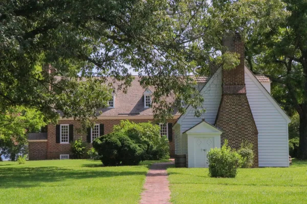
George Washington Birthplace National Monument is located in the Northern Neck of Virginia. It encompasses 551 acres of land where seven generations of the Washington family lived and where George Was...
25 mi from route
~63 min detour
Free
near mile 215.7
Park data from the National Park Service API. Alerts update every 2 hours.
More Details
What kind of drive is this?
Expect a very different experience than the standard interstate grind, as this route features a 0% highway share. You will navigate via local thoroughfares including 1st Street Southwest, Franklin Road Southwest, and Williamson Road Southeast for the duration of the trip. The road’s personality is defined by its turn-heavy nature, requiring your full attention as you transition between local streets. Because the path relies on surface roads rather than major expressways, you will find a consistent, winding pace that keeps you engaged behind the wheel throughout the 215.7-mile journey.
90% highway — fuel and pacing are the main things to plan.
26 navigation steps total — most of the decisions cluster near the start and finish.
Longest single stretch: 90 mi on I 64.
How Hard Is This Drive?
9/10
This is a straightforward highway drive that stays mostly on I 64 and I 81. This route has several spots where lane changes, forks, or exits need your full attention. The trickiest moment comes around 6.7 miles in near US 220.
Driving Effort9/10
High effort - long or complex enough to need steady focus all day
Balances navigation complexity with total wheel time.
This is a demanding drive. With 21 significant decision points across 215.7 miles, you will need to stay alert - especially through interchange areas and urban stretches. Consider splitting it into segments if you are not comfortable with fast highway navigation.
Where does it get tricky?
The main spots that need attention: at 6.7 miles (US 220): Highway fork - watch signs carefully. Lane positioning matters here. Multiple destination signs - pick the right one; at 174.5 miles: Exit ramp - move to the correct lane early. Lane positioning matters here. Multiple destination signs - pick the right one; at 184 miles: Highway fork - watch signs carefully. Lane positioning matters here. Multiple destination signs - pick the right one.
Elevation Profile
Gently rolling terrain
1,737 ft119 ft
Total Climb
1,481 ft
Total Descent
2,183 ft
Highest Point
1,737 ft
~61.6 mi in
Elevation Range
1,618 ft
Towns Mentioned on Route Signs
Based on OSRM destination-sign hints, not a full list of every settlement the road passes.
Between Roanoke, VA and Bowling Green, VA, road signs point toward Norfolk, Washington and Fort Ambrose Powell Hill.
Roanoke, Virginia, called the "Star City of the South" and "Magic City," is a charming city with beautiful views. A colorfully lit 100-ft star atop Mill Mountain graces the Roanoke Valley. The city sits between Virginia Tech and Smith Mountain Lake in Southwest Virginia. The Roanoke Valley had a population of around 315,000 in 2020.
Top landmarks
•Hotel Roanoke — Historic hotel in Roanoke, Virginia
•Colony House Motor Lodge — motel in Roanoke, Virginia
•Roanoke City Market Historic District — historic district in Roanoke, Virginia, United States
Doable as a same-day drive at 4h 5m. Total distance: 215.7 miles.
Family Friendly
Moderate complexity with 1 natural rest stops along the way.
Solo Traveler
4h 5m drive, comfortable solo distance.
First-Time Driver
Mostly highway driving (90%). Some complex stretches to watch for.
Frequently Asked Questions
The longest stretch is about 90 miles on I 64. The full list of main roads is in the Roads section above.
Yes — we found about 19 rest areas or service plazas within a short detour of the route (from OpenStreetMap). See the Rest Stops tab under Nearby Places for locations and mile markers. Plan to stretch, use the bathroom, and top off fluids every 2–3 hours on longer drives.
It helps. This route has a higher-than-average number of complex decision points, which get harder in the dark. If the last hour of the trip is on surface roads or mountain grades, aim to arrive at Bowling Green, VA before sunset when you can. Check the Trip Plan for departure windows that land you in daylight.
Only with planning. This is a long drive for kids — consider splitting it into two days rather than pushing through. Plan at least 1 meaningful breaks. There are 19 rest areas along the route for bathroom stops.
The main spots that need attention: at 6.7 miles (US 220): Highway fork - watch signs carefully. Lane positioning matters here. Multiple destination signs - pick the right one; at 174.5 miles: Exit ramp - move to the correct lane early. Lane positioning matters here. Multiple destination signs - pick the right one; at 184 miles: Highway fork - watch signs carefully. Lane positioning matters here. Multiple destination signs - pick the right one.
Yes — Booker T Washington National Monument and George Washington Birthplace National Monument. See the National Parks section for detour distances and tips on detours.
Possible but tiring. At 4.1 hours each way, an in-and-out day trip would put you behind the wheel for 8.2 hours — manageable with a long break at Bowling Green, VA, but most travelers stay overnight.