Driving from Oakland to Susanville covers 256.1 miles and typically takes about 5 hours and 33 minutes. You will primarily navigate via CA 99, the Deer Creek Highway, and the Dwight D. Eisenhower Highway. This route is well-suited for a single-day trip, though you should budget approximately $59 for fuel to complete the journey. Because both the origin and destination are located within the Pacific Coast region, the transition remains consistent throughout the drive. It is a straightforward trip that works best if you enjoy a steady pace behind the wheel. Use this summary to decide if this direct connection fits your travel schedule.
Trip Pace
Same-day drive is realistic
A same-day return is possible, but it will make for a full day on the road.
Break Rhythm
1 planned break
Plan on a short reset every 3 to 4 hours to stay fresh behind the wheel.
Midpoint
128 miles from Oakland, CA
A natural place for your longest stop of the day
, about 2h 41m into the drive
.
Main Roads
Road
Distance
Duration
CA 99
53.5 mi
1h 8m
Deer Creek Highway
52.3 mi
1h 9m
Dwight D. Eisenhower Highway
41.7 mi
48m
CA 36
29.5 mi
40m
State Highway 36 East
18.1 mi
26m
CA 113
17.4 mi
23m
Eastshore Freeway
14.3 mi
16m
Vic Fazio Highway
11.1 mi
12m
Longest stretch:
CA 99
— 53.5 mi, about 1h 8m
Traffic on I-80
Hour-of-day weekday pattern from 35 FHWA count stations on your route.
Peak
3 PM
~4,091 veh/hr typical
Quietest
1 AM
~388 veh/hr
Peak-to-quiet ratio
10.5×
busier at peak than in the quiet hours
12a6anoon6p11p
Averaged across 13 weeks of 2023 FHWA Travel Monitoring Analysis System data. Weekday hours only (Mon–Fri).
Turn-by-Turn Driving Directions
Step-by-step road directions between Oakland, CA and Susanville, CA.
1
Start on 14th Street
0.4 mi·1 min·14th Street
2
Turn right onto Castro Street
0.2 mi·34 sec·Castro Street
3
Take the ramp
0.2 mi·25 sec
Toward I 980 East, CA 24: Walnut Creek, San Francisco, Hayward
4
Merge onto I 980
0.4 mi·25 sec·John B. Williams Freeway
5
Take the exit
0.3 mi·38 sec
Toward I 580: San Francisco, HaywardUse the slight right lane.
6
Keep slight left at fork
0.6 mi·1 min
Toward I 580 West: San Francisco, MacArthur FreewayUse the slight left / slight right lanes.
7
Merge onto I 580
1.7 mi·2 min·MacArthur Freeway
Use the straight / slight right lanes.
8
Continue on I 80; I 580
3.3 mi·4 min·Eastshore Freeway
Use the straight / slight right lanes.
9
Keep slight left at fork onto I 80
7.4 mi·8 min·Eastshore Freeway
Toward I 80 East: Vallejo, SacramentoUse the straight / slight right lanes.
10
Continue on I 80
3.2 mi·3 min·Eastshore Freeway
Exit 21Use the straight / slight left lanes.
11
Continue on I 80
3.5 mi·3 min·Linus F. Claeys Freeway
Use the straight / slight right lanes.
12
Continue on I 80
0.3 mi·26 sec·Eastshore Freeway
13
Continue on I 80
1.0 mi·1 min·Carquinez Bridge
14
Continue on I 80
14 mi·16 min·Dwight D. Eisenhower Highway
Use the straight / slight left lanes.
15
Keep slight left at fork onto I 80
27 mi·31 min·Dwight D. Eisenhower Highway
Use the straight / slight right lanes.
16
Keep slight right at fork onto CA 113
11 mi·12 min·Vic Fazio Highway
Exit 70Toward CA 113 North: WoodlandUse the straight / slight right lanes.
17
Take the exit
0.5 mi·1 min
Exit 37Toward I 5 South: Main StreetUse the slight right lane.
18
Turn right onto I 5 BUS
1.1 mi·2 min·East Main Street
Use the straight lane.
19
Turn left onto E8
227 ft·9 sec·County Road 102
Use the left lane.
20
Continue on E8
7.9 mi·11 min·County Road 102
21
Continue on CA 113
17 mi·23 min·CA 113
Use the straight lane.
22
Take the ramp
0.2 mi·27 sec
Toward CA 99 North: Yuba CityUse the slight right lane.
23
Merge onto CA 99
54 mi·1 hr 8 min·CA 99
Use the straight lane.
24
Take the exit
0.2 mi·15 sec
Toward CA 32: Orland, Chester
25
Turn right onto CA 32
52 mi·1 hr 9 min·Deer Creek Highway
Use the right lane.
26
At end of road, turn right onto CA 36; CA 89
18 mi·26 min·State Highway 36 East
27
Enter roundabout onto CA 36
92 ft·6 sec·CA 36
28
Continue on CA 36
29 mi·39 min·CA 36
29
Turn right onto Foss Street
61 ft·2 sec·Foss Street
30
Arrive at destination
Foss Street
Trip Plan
To keep your 5-hour and 33-minute journey manageable, plan for at least one dedicated stop to stretch your legs and refresh. Since the trip is feasible in a single day, departing early in the morning helps you avoid potential congestion on the more heavily traveled sections of the highway. Keep a close eye on your fuel gauge, especially as you move off the main interstate corridors, to ensure you stay within your $59 gas budget. Given the 53.5-mile stretch on CA 99, try to time your breaks around the conclusion of these longer segments to maximize your comfort. This flexibility allows you to maintain a steady pace while reaching your destination efficiently.
Morning Departure
An early start around 7-8 AM gets you there with plenty of daylight left.
Evening Departure
A late afternoon start means arriving after dark. Morning is better.
You can normally do this drive in one day.
Plan roughly 1 meaningful break for fuel, food, and rest.
The halfway point lands around 128 miles from Oakland, CA, or about 2h 41m into the drive.
The longest continuous stretch on this route runs about 53.5 miles.
This is a comfortable same-day trip.
Departure
Before you leave
Start with fuel, water, and navigation already sorted so the first hour feels easy.
First stop
Around 56 miles or 1h 7m in
Use this first pause for coffee, a restroom break, and a quick traffic check ahead.
Halfway reset
Around 128 miles or 2h 41m in
This is the best place for your longest stop, a real meal, and a full fuel check.
Final approach
Final hour starts around 4h 29m
Traffic, exits, and arrival timing usually matter more near Susanville, CA than in the middle of the route.
Before You Leave
+
Open the route before leaving Oakland, CA so your first major turns are already loaded.
+
Leave with enough water and a charging cable within reach, not packed away.
+
Check your fuel range against the first long segment, especially if you are starting outside city service areas.
Day 1
Settle into the route from Oakland, CA
This is one driving day of about 256.1 miles and 5h 33m.
Your first comfortable stop window is around 56 miles from Oakland, CA.
This route can stay practical as a one-day drive if traffic stays reasonable.
Plan about 1 real break rather than only quick fuel stops.
The longest stretch is on CA 99 for about 53.5 miles.
Where to Stop
Rest stops, refuel points, and overnight suggestions along this route.
Place data sourced from public business listings. Hours and availability may vary.
Heads-up: tricky spots
5 of 20
5 decision points cluster between mile 1.2 and 75.3 — GPS handles the exact turns, but know they're coming. Your lane choice matters more than the turn itself.
7
1.2 mi into trip|~2m in
Take the exit toward I 580: San Francisco, Hayward
Exit ramp - move to the correct lane early. Lane positioning matters here. Multiple destination signs - pick the right one
Use the slight right lane.
Toward I 580: San Francisco, Hayward
8
1.5 mi into trip|~3m in
Keep slight left at fork toward I 580 West: San Francisco, MacArthur Freeway
Highway fork - watch signs carefully. Lane positioning matters here. Multiple destination signs - pick the right one
Use the slight left / slight right lanes.
Toward I 580 West: San Francisco, MacArthur Fre...
8
7.1 mi into trip|~11m in|I 80 / Eastshore Freeway
Keep slight left at fork onto I 80 / Eastshore Freeway toward I 80 East: Vallejo, Sacramento
Highway fork - watch signs carefully. Lane positioning matters here. Multiple destination signs - pick the right one
Use the straight / slight right lanes.
Toward I 80 East: Vallejo, Sacramento
8
64.2 mi into trip|~1h 17m in|CA 113 / Vic Fazio Highway
Keep slight right at fork onto CA 113 / Vic Fazio Highway toward CA 113 North: Woodland
Highway fork - watch signs carefully. Lane positioning matters here
Use the straight / slight right lanes.
Exit 70
Toward CA 113 North: Woodland
7
75.3 mi into trip|~1h 30m in
Take the exit toward I 5 South: Main Street
Exit ramp - move to the correct lane early. Lane positioning matters here
Use the slight right lane.
Exit 37
Toward I 5 South: Main Street
Fuel & Cost
Regular Gas
$53.58 one way
$107.16 round trip
$5.31/gal25.4 MPG avg90 kg CO2
Fuel Type
$/gal
One Way
Round Trip
midgrade
$5.52
$55.65
$111.29
premium
$5.67
$57.12
$114.24
diesel
$4.80
$48.36
$96.71
No toll roads detected on this route.
Estimated Trip Cost (one way, 1 person)
Fuel
$54
Meals
$25–$50
Total
$79–$104
Rough estimate based on US averages. Hotel $80–$140/night, meals $25–$50/day.
Estimated CO2 emission: 89.6 kg one way.
Prices: EIA weekly data, 2026-07-13.
Driving Electric?
About $27 in charging
· 0 stops
· 67% less CO2
Vehicle Type
kWh
Stops
DC Fast
Home Charge
Average EV
76.8
0
$26.89
$12.29
Efficient EV
64
0
$22.41
$10.24
EV Truck/SUV
102.4
1
$35.85
$16.39
Gas CO2
90 kg
EV CO2
30 kg (67% less)
Plan for 0 charging stops, roughly every 270 miles. Allow 25-40 minutes per stop at a DC fast charger.
DC fast charging avg $0.35/kWh. Home charging avg $0.16/kWh. US grid CO2: 0.39 kg/kWh.
Travel Intel
Current conditions at both ends of the drive.
Forecast as of Jul 18, 2026
Origin
Oakland, CA
Morning
in Oakland on Sunday
Local time
8:58 AM
PDT
Current temp
56°F
Cloudy
SW 6 mph1% chanceLive forecast
Beach Hazards Statement
Beach Hazards Statement issued July 18 at 1:24AM PDT until July 21 at 11:00PM PDT by NWS Los Angeles/Oxnard CA
Destination
Susanville, CA
Morning
in Susanville on Sunday
Local time
8:58 AM
PDT
Current temp
52°F
Mostly Clear
NW 0 to 5 mph0% chanceLive forecast
Beach Hazards Statement
Beach Hazards Statement issued July 18 at 1:24AM PDT until July 21 at 11:00PM PDT by NWS Los Angeles/Oxnard CA
Seasonal Notes
Summer travel usually means heavier construction, hotter rest stops, and busier weekend traffic around major cities.
Winter travel shortens daylight, so a route that looks manageable on paper can feel much longer after dark.
Holiday weekends tend to make both departure and arrival windows slower than the raw route time suggests.
Time zone
Same local time
Origin and destination are on the same clock, so arrival timing is easier to judge at a glance.
Temperature spread
4 degrees cooler at arrival
A meaningful temperature swing is a good cue to rethink layers, water, and how soon you want to arrive.
Road read
5h 33m on the road
An early start around 7-8 AM gets you there with plenty of daylight left.
Weather data from the National Weather Service. Conditions may change; check closer to your travel date.
National Parks Near This Route
Worth a detour if your schedule allows.
Rosie the Riveter WWII Home Front National Historical Park
National Historical Park
Celebrate and honor the contributions and sacrifices of American civilians on the WWII home front. Discover how diverse communities lived, worked, and interacted. Many faces, many stories, many truths...
Established in 1988, San Francisco Maritime National Historical Park celebrates America’s maritime heritage on the Pacific Coast. Our 50-acre park has grown around Aquatic Park Cove, a protected area...
On July 17, 1944, a massive explosion jolted the San Francisco East Bay area, shattering windows and lighting up the night sky. At Port Chicago Naval Magazine, 320 men were killed instantly when two s...
12 mi from route
~29 min detour
Free
near mile 26.5
Walk among old growth coast redwoods, cooling their roots in the fresh water of Redwood Creek and lifting their crowns to reach the sun and fog. Federally protected as a National Monument since 1908,...
Experience a park so rich it supports 19 distinct ecosystems with over 2,000 plant and animal species. Go for a hike, enjoy a vista, have a picnic or learn about the centuries of overlapping history f...
16 mi from route
~40 min detour
Free
near mile 8.8
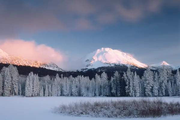
Lassen Volcanic National Park is home to steaming fumaroles, meadows freckled with wildflowers, clear mountain lakes, and numerous volcanoes. Jagged peaks tell the story of its eruptive past while hot...
16 mi from route
~40 min detour
$30
near mile 220.7
Park data from the National Park Service API. Alerts update every 2 hours.
More Details
What kind of drive is this?
Expect a mixed driving experience that transitions between high-speed transit and more localized road segments. With a highway share of 54%, you will spend a little over half your time on major routes, including a longest uninterrupted stretch of 53.5 miles on CA 99. The road changes personality as you move from the busy corridors near Oakland toward the more rural stretches leading into Susanville. You should be prepared for the shift in infrastructure as you transition off the Eisenhower Highway onto smaller connectors. It is a balanced drive that requires steady focus rather than technical maneuvering.
54% highway, the rest on surface roads — varied driving throughout.
30 navigation steps total — most of the decisions cluster near the start and finish.
Longest single stretch: 53.5 mi on CA 99.
How Hard Is This Drive?
9/10
This route mixes highway mileage with some local-road sections near the start or finish. This route has several spots where lane changes, forks, or exits need your full attention. The trickiest moment comes around 1.2 miles in.
Driving Effort9/10
High effort - long or complex enough to need steady focus all day
Balances navigation complexity with total wheel time.
This is a demanding drive. With 20 significant decision points across 256.1 miles, you will need to stay alert - especially through interchange areas and urban stretches. Consider splitting it into segments if you are not comfortable with fast highway navigation.
Where does it get tricky?
The main spots that need attention: at 1.2 miles: Exit ramp - move to the correct lane early. Lane positioning matters here. Multiple destination signs - pick the right one; at 1.5 miles: Highway fork - watch signs carefully. Lane positioning matters here. Multiple destination signs - pick the right one; at 7.1 miles (I 80 / Eastshore Freeway): Highway fork - watch signs carefully. Lane positioning matters here. Multiple destination signs - pick the right one.
Elevation Profile
High-altitude sections with notable climbs
5,092 ft26 ft
Total Climb
5,178 ft
Total Descent
1,027 ft
Highest Point
5,092 ft
~237.8 mi in
Elevation Range
5,066 ft
Notable High Points
5,092 ft at ~237.8 miles+549 ft prominence
Towns Mentioned on Route Signs
Based on OSRM destination-sign hints, not a full list of every settlement the road passes.
On the drive from Oakland, CA to Susanville, CA, road signs begin pointing toward Chester along the way.
Oakland is a port city in the Bay Area of California in the United States. Once an industrial area overshadowed by San Francisco, its larger neighbor to the west, this city of 440,000 people (2020) has begun to step out from under San Francisco's shadow with its notable natural and architectural features and its rise as the multicultural "hipster" city of the Bay Area.
Top landmarks
•San Francisco–Oakland Bay Bridge — suspension bridge connecting San Francisco and Oakland, California, USA
•Lake Merritt — lagoon in Oakland, California, USA
•Oakland Museum of California — art museum in Oakland, California
Doable as a same-day drive at 5h 33m. Total distance: 256.1 miles.
Family Friendly
Moderate complexity with 1 natural rest stops along the way.
Solo Traveler
5h 33m drive, comfortable solo distance.
Scenic Drive
Mixed highway & surface route profile with national parks nearby.
Frequently Asked Questions
The longest stretch is about 53.5 miles on CA 99. The full list of main roads is in the Roads section above.
Yes — we found about 3 rest areas or service plazas within a short detour of the route (from OpenStreetMap). See the Rest Stops tab under Nearby Places for locations and mile markers. Plan to stretch, use the bathroom, and top off fluids every 2–3 hours on longer drives.
It helps. This route has a higher-than-average number of complex decision points, which get harder in the dark. If the last hour of the trip is on surface roads or mountain grades, aim to arrive at Susanville, CA before sunset when you can. Check the Trip Plan for departure windows that land you in daylight.
Only with planning. This is a long drive for kids — consider splitting it into two days rather than pushing through. Plan at least 1 meaningful breaks. There are 3 rest areas along the route for bathroom stops.
The main spots that need attention: at 1.2 miles: Exit ramp - move to the correct lane early. Lane positioning matters here. Multiple destination signs - pick the right one; at 1.5 miles: Highway fork - watch signs carefully. Lane positioning matters here. Multiple destination signs - pick the right one; at 7.1 miles (I 80 / Eastshore Freeway): Highway fork - watch signs carefully. Lane positioning matters here. Multiple destination signs - pick the right one.
Yes — Rosie the Riveter WWII Home Front National Historical Park, San Francisco Maritime National Historical Park and Port Chicago Naval Magazine National Memorial (6 total within detour distance). See the National Parks section for detour distances and tips on detours.
Not recommended in a single day. At 5.6 hours each way, a round trip means 11.1 hours of driving — that is an unsafe level of fatigue for most drivers. Plan at least one night at Susanville, CA before the return drive.