Spanning 166.4 miles across the Missouri Midwest, this journey from Neosho to East Independence is a straightforward trek that typically takes about 2 hours and 43 minutes. Because of the manageable duration, this route works perfectly as a one-day trip, allowing you to reach your destination without the need for an overnight stay. You should budget approximately $25 for fuel to cover the distance comfortably. Navigating through the heart of the state, you will rely on local thoroughfares like South Washington Street, East Coler Street, and North College Street rather than major interstates. It is a practical, no-nonsense drive that connects two distinct parts of the region while keeping your travel logistics simple.
Trip Pace
Same-day drive is realistic
A same-day return is realistic if you keep stops short.
Break Rhythm
1 planned break
A short stop every 2 to 3 hours is enough for this drive.
Midpoint
82 miles from Neosho, MO
A natural place for your longest stop of the day
, about 1h 35m into the drive
.
Step-by-step road directions between Neosho, MO and East Independence, MO.
1
Start on East Main Street
218 ft·15 sec·East Main Street
2
Turn left onto South Washington Street
0.3 mi·53 sec·South Washington Street
3
At end of road, turn left onto MO 86
0.2 mi·26 sec·East Coler Street
4
Turn right onto US 60 Business
1.3 mi·2 min·North College Street
5
Continue on US 60 Business
3.1 mi·4 min·Elwood Junction Road
6
Turn left
0.3 mi·50 sec
7
Turn straight onto MO 59
22 mi·28 min·MO 59
8
Continue on I 49; US 71
10 mi·11 min·Trooper Charles P. Corbin Memorial Highway
9
Continue on I 49; US 71
93 mi·1 hr 39 min·Purple Heart Trail
10
Take the exit
0.2 mi·17 sec
Exit 160Toward MO 291 North: Lee's Summit
11
Keep slight right at fork
243 ft·6 sec
Toward MO 291 North: Lee's Summit
12
Merge onto MO 291
8.3 mi·12 min·MO 291
13
Turn slight left onto MO 58; MO 291
8.5 mi·11 min·MO 58; MO 291
14
Take the exit onto MO 291
0.6 mi·52 sec·MO 291
Toward US 50 East, MO 291 North: Sedalia
15
Take the exit onto MO 291
0.2 mi·37 sec·MO 291
Toward MO 291 North: Independence, Hamblen RoadUse the slight right lane.
16
Turn left
300 ft·7 sec
17
Continue on MO 291
13 mi·18 min·MO 291
18
Take the exit
0.3 mi·45 sec
Toward East Truman Road
19
At end of road, turn left onto East Truman Road
1.2 mi·2 min·East Truman Road
20
Turn left onto Main Road
0.3 mi·1 min·Main Road
21
Turn right onto East 9th Street South
79 ft·3 sec·East 9th Street South
22
Arrive at destination
East 9th Street South
Trip Plan
Since this 166.4-mile trip is relatively short, you have plenty of flexibility to plan your departure time around your personal schedule. With only one recommended stop, you can easily pace yourself to stretch your legs without worrying about a rigid itinerary. Keep your $25 fuel budget in mind as you prepare, and make sure your vehicle is ready for a route that prioritizes local street driving over heavy highway use. Because this path avoids major interstates, it is wise to double-check your GPS settings to ensure you remain on the planned route through the various turns. Taking advantage of the route's simplicity allows you to enjoy the transition from Neosho to East Independence at your own comfortable pace.
Morning Departure
An early start around 7-8 AM gets you there with plenty of daylight left.
Evening Departure
A late afternoon start means arriving after dark. Morning is better.
You can normally do this drive in one day.
Plan roughly 1 meaningful break for fuel, food, and rest.
The halfway point lands around 82 miles from Neosho, MO, or about 1h 35m into the drive.
The longest continuous stretch on this route runs about 92.9 miles.
This is a comfortable same-day trip.
Departure
Before you leave
Start with fuel, water, and navigation already sorted so the first hour feels easy.
First stop
Around 36 miles or 46m in
Use this first pause for coffee, a restroom break, and a quick traffic check ahead.
Halfway reset
Around 82 miles or 1h 35m in
This is the best place for your longest stop, a real meal, and a full fuel check.
Final approach
Final hour starts around 2h 33m
Traffic, exits, and arrival timing usually matter more near East Independence, MO than in the middle of the route.
Before You Leave
+
Open the route before leaving Neosho, MO so your first major turns are already loaded.
+
Leave with enough water and a charging cable within reach, not packed away.
+
Check your fuel range against the first long segment, especially if you are starting outside city service areas.
Day 1
Settle into the route from Neosho, MO
This is one driving day of about 164 miles and 3h 17m.
Your first comfortable stop window is around 36 miles from Neosho, MO.
This route can stay practical as a one-day drive if traffic stays reasonable.
Plan about 1 real break rather than only quick fuel stops.
The longest stretch is on Purple Heart Trail for about 92.9 miles.
Where to Stop
Rest stops, refuel points, and overnight suggestions along this route.
Place data sourced from public business listings. Hours and availability may vary.
Heads-up: tricky spots
5 of 14
5 decision points cluster between mile 0 and 148.6 — GPS handles the exact turns, but know they're coming. Your lane choice matters more than the turn itself.
5
0 mi into trip|~0m in|South Washington Street
Turn left onto South Washington Street
Navigation decision point
6
0.3 mi into trip|~1m in|MO 86 / East Coler Street
At end of road, turn left onto MO 86 / East Coler Street
Complex interchange - multiple decisions in a short stretch
5
131.1 mi into trip|~2h 28m in
Take the exit toward MO 291 North: Lee's Summit
Exit ramp - move to the correct lane early
Exit 160
Toward MO 291 North: Lee's Summit
6
131.2 mi into trip|~2h 28m in
Keep slight right at fork toward MO 291 North: Lee's Summit
Highway fork - watch signs carefully
Toward MO 291 North: Lee's Summit
7
148.6 mi into trip|~2h 53m in|MO 291
Take the exit onto MO 291 toward MO 291 North: Independence, Hamblen Road
Exit ramp - move to the correct lane early. Lane positioning matters here. Multiple destination signs - pick the right one
Use the slight right lane.
Toward MO 291 North: Independence, Hamblen Road
Fuel & Cost
Regular Gas
$25.64 one way
$51.28 round trip
$3.97/gal25.4 MPG avg57 kg CO2
Fuel Type
$/gal
One Way
Round Trip
midgrade
$4.36
$28.15
$56.30
premium
$4.89
$31.56
$63.12
diesel
$5.61
$36.21
$72.42
No toll roads detected on this route.
Estimated Trip Cost (one way, 1 person)
Fuel
$26
Meals
$25–$50
Total
$51–$76
Rough estimate based on US averages. Hotel $80–$140/night, meals $25–$50/day.
Estimated CO2 emission: 57.4 kg one way.
Prices: EIA weekly data, 2026-04-13.
Driving Electric?
About $17 in charging
· 0 stops
· 67% less CO2
Vehicle Type
kWh
Stops
DC Fast
Home Charge
Average EV
49.2
0
$17.22
$7.87
Efficient EV
41
0
$14.35
$6.56
EV Truck/SUV
65.6
0
$22.96
$10.50
Gas CO2
57 kg
EV CO2
19 kg (67% less)
This trip is well within single-charge range for most EVs. No charging stops needed if you start fully charged.
DC fast charging avg $0.35/kWh. Home charging avg $0.16/kWh. US grid CO2: 0.39 kg/kWh.
Travel Intel
Current conditions at both ends of the drive.
Forecast as of Apr 15, 2026
Origin
Neosho, MO
Night
in Neosho on Saturday
Local time
11:16 PM
CDT
Current temp
57°F
Unavailable
Live forecast
Destination
East Independence, MO
Night
in East Independence on Saturday
Local time
11:16 PM
CDT
Current temp
56°F
Unavailable
Live forecast
73°F
Nevada, MO
82 mi in
Seasonal Notes
Summer travel usually means heavier construction, hotter rest stops, and busier weekend traffic around major cities.
Winter travel shortens daylight, so a route that looks manageable on paper can feel much longer after dark.
Holiday weekends tend to make both departure and arrival windows slower than the raw route time suggests.
Time zone
Same local time
Origin and destination are on the same clock, so arrival timing is easier to judge at a glance.
Temperature spread
1 degrees cooler at arrival
A meaningful temperature swing is a good cue to rethink layers, water, and how soon you want to arrive.
Road read
3h 17m on the road
Use the two city cards together: check the sky where you start, then compare it with the local time and temperature at arrival.
Weather data from the National Weather Service. Conditions may change; check closer to your travel date.
National Parks Near This Route
Worth a detour if your schedule allows.
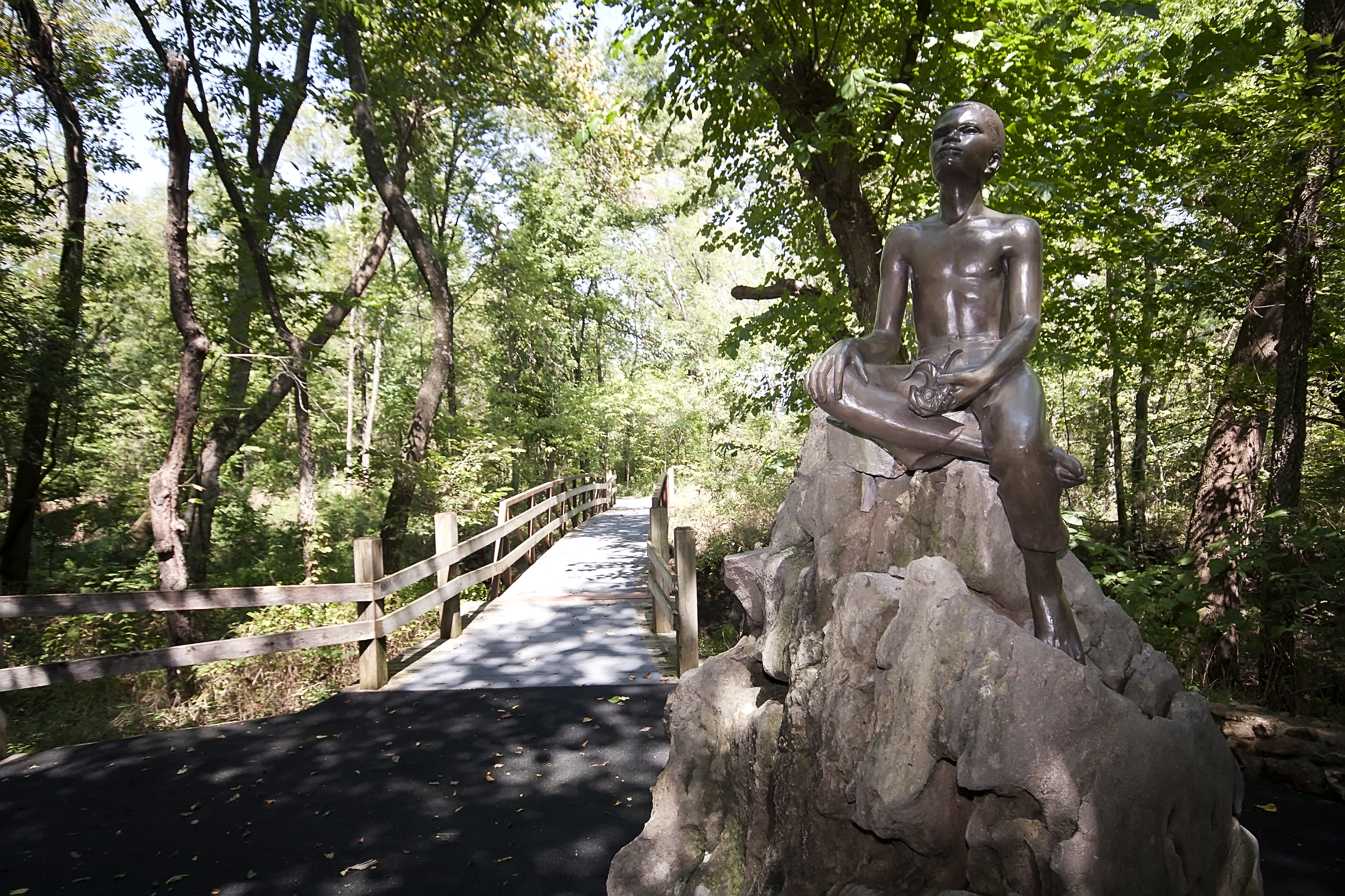
George Washington Carver National Monument
National Monument
The young child known as the "Plant Doctor" tended his secret garden while observing the day-to-day operations of a 19th century farm. Nature and nurture ultimately influenced George on his quest for...
Park data from the National Park Service API. Alerts update every 2 hours.
More Details
What kind of drive is this?
Expect a turn-heavy local drive rather than a high-speed interstate cruise, as this route maintains a 0% highway share. Your time behind the wheel will be defined by navigating local roads, requiring your full attention as you transition between South Washington, East Coler, and North College streets. Because the path relies entirely on local infrastructure, the pace is steady and demands constant engagement compared to a monotonous highway stretch. You will find that the road's personality changes frequently as you navigate these specific streets, keeping the driving experience far from a repetitive grind. Prepare for a more hands-on journey that prioritizes local navigation over open-road speed.
33% highway, the rest on surface roads — varied driving throughout.
22 navigation steps total — most of the decisions cluster near the start and finish.
Longest single stretch: 92.9 mi on Purple Heart Trail.
How Hard Is This Drive?
4/10
This route mixes highway mileage with some local-road sections near the start or finish. There are only a few real navigation decisions along the way. The trickiest moment comes early in the drive near South Washington Street.
Driving Effort4/10
Easy - simple navigation with a manageable amount of wheel time
Balances navigation complexity with total wheel time.
This is a straightforward 3h 17m drive. You will face about 14 decision points, but nothing that requires special attention if you follow navigation.
Where does it get tricky?
The main spots that need attention: near the start (South Washington Street): Navigation decision point; at 0.3 miles (MO 86 / East Coler Street): Complex interchange - multiple decisions in a short stretch; at 131.1 miles: Exit ramp - move to the correct lane early.
Elevation Profile
Mostly flat terrain
1,174 ft760 ft
Total Climb
390 ft
Total Descent
597 ft
Highest Point
1,174 ft
~11.7 mi in
Elevation Range
414 ft
Who Is This Route For?
Weekend Trip
Doable as a same-day drive at 3h 17m. Total distance: 164 miles.
Family Friendly
Moderate complexity with 1 natural rest stops along the way.
Mixed highway & surface route profile with national parks nearby.
Frequently Asked Questions
The longest stretch is about 92.9 miles on Purple Heart Trail. The full list of main roads is in the Roads section above.
We did not find dedicated rest areas on this route. For a drive this long, plan bathroom and stretch breaks around gas stations, fast-food stops, or small-town downtowns — check the Nearby Places section for options.
Yes, with realistic expectations. Build in a stop roughly every 2 hours, have snacks and activities ready, and check the Nearby Places tabs for kid-friendly stops along the way.
The main spots that need attention: near the start (South Washington Street): Navigation decision point; at 0.3 miles (MO 86 / East Coler Street): Complex interchange - multiple decisions in a short stretch; at 131.1 miles: Exit ramp - move to the correct lane early.
Yes — George Washington Carver National Monument. See the National Parks section for detour distances and tips on detours.
Possible but tiring. At 3.3 hours each way, an in-and-out day trip would put you behind the wheel for 6.6 hours — manageable with a long break at East Independence, MO, but most travelers stay overnight.