Traveling from Neosho to Jefferson City covers 211.1 miles of Missouri heartland, making for a manageable 4-hour and 6-minute excursion. Because the total duration is quite reasonable, this trip works perfectly as a straightforward one-day journey without the need for an overnight stay. You should budget approximately $32 for fuel to complete the trek. Navigating through the Midwest, the route utilizes a combination of Congressman Gene Taylor Highway, US 54, and MO 5 to connect these two Missouri hubs. Whether you are heading to the state capital for business or a change of scenery, the trip offers a predictable and efficient path across the state.
Trip Pace
Same-day drive is realistic
A same-day return is possible, but it will make for a full day on the road.
Break Rhythm
1 planned break
Plan on a short reset every 3 to 4 hours to stay fresh behind the wheel.
Midpoint
105.5 miles from Neosho, MO
A natural place for your longest stop of the day
, about 2h 2m into the drive
.
Main Roads
Road
Distance
Duration
Congressman Gene Taylor Highway
110.1 mi
1h 59m
US 54
57.1 mi
1h 5m
MO 5
23.7 mi
29m
MO 59
11.7 mi
17m
Elwood Junction Road
3.1 mi
4m
South Jefferson Avenue
1.6 mi
2m
North College Street
1.3 mi
2m
West McCarty Street
0.3 mi
<1m
Longest stretch:
Congressman Gene Taylor Highway
— 110.1 mi, about 1h 59m
Traffic on I-44
Hour-of-day weekday pattern from 4 FHWA count stations on your route.
Peak
4 PM
~1,682 veh/hr typical
· worst 1,963
Quietest
2 AM
~197 veh/hr
Peak-to-quiet ratio
8.5×
busier at peak than in the quiet hours
12a6anoon6p11p
Averaged across 52 weeks of 2023 FHWA Travel Monitoring Analysis System data. Weekday hours only (Mon–Fri).
Turn-by-Turn Driving Directions
Step-by-step road directions between Neosho, MO and Jefferson City, MO.
1
Start on East Main Street
218 ft·15 sec·East Main Street
2
Turn left onto South Washington Street
0.3 mi·53 sec·South Washington Street
3
At end of road, turn left onto MO 86
0.2 mi·26 sec·East Coler Street
4
Turn right onto US 60 Business
1.3 mi·2 min·North College Street
5
Continue on US 60 Business
3.1 mi·4 min·Elwood Junction Road
6
Turn left
0.3 mi·50 sec
7
Turn straight onto MO 59
12 mi·17 min·MO 59
8
Take the ramp
0.4 mi·42 sec
Toward I 44 East: Springfield
9
Merge onto I 44
110 mi·1 hr 59 min·Congressman Gene Taylor Highway
Use the straight / slight right lanes.
10
Take the exit
0.2 mi·26 sec
Exit 129Toward MO 64, MO 5, MO 32: Hartville
11
Turn left onto MO 5; MO 32; MO 64
1.6 mi·2 min·South Jefferson Avenue
12
Continue on MO 5
24 mi·29 min·MO 5
13
Take the exit
0.2 mi·23 sec
Toward US 54: Camdenton, Nevada, Osage Beach, Jefferson City
14
Turn right onto US 54
31 mi·35 min·US 54
Use the slight right lane.
15
Turn straight onto US 54
26 mi·29 min·US 54
16
Take the exit
0.3 mi·32 sec
Toward US 50 Business
17
Keep slight right at fork
158 ft·4 sec
18
Turn right onto US 50 Business
0.2 mi·29 sec·Missouri Boulevard
Use the left lane.
19
Turn right onto West McCarty Street
0.3 mi·50 sec·West McCarty Street
20
Turn left onto Washington Street
250 ft·12 sec·Washington Street
21
Turn right onto East Wall Way
341 ft·25 sec·East Wall Way
22
Arrive at destination
East Wall Way
Trip Plan
To keep your drive stress-free, plan for at least one dedicated stop to stretch your legs and refuel during the 211.1-mile journey. Departing early in the day is your best strategy to avoid fatigue and navigate the varying road types while you are fresh. Since the total travel time is just over four hours, you have the flexibility to choose a lunch break that suits your pacing preference. Keep a close eye on your fuel levels before leaving the more populated areas, as the shift from major highways to state routes can change the availability of service stations. Prioritizing this single stop will help you maintain comfort throughout the entire duration of the trip.
Morning Departure
An early start around 7-8 AM gets you there with plenty of daylight left.
Evening Departure
A late afternoon start means arriving after dark. Morning is better.
You can normally do this drive in one day.
Plan roughly 1 meaningful break for fuel, food, and rest.
The halfway point lands around 105.5 miles from Neosho, MO, or about 2h 2m into the drive.
The longest continuous stretch on this route runs about 110.1 miles.
This is a comfortable same-day trip.
Departure
Before you leave
Start with fuel, water, and navigation already sorted so the first hour feels easy.
First stop
Around 46 miles or 57m in
Use this first pause for coffee, a restroom break, and a quick traffic check ahead.
Halfway reset
Around 105.5 miles or 2h 2m in
This is the best place for your longest stop, a real meal, and a full fuel check.
Final approach
Final hour starts around 3h 21m
Traffic, exits, and arrival timing usually matter more near Jefferson City, MO than in the middle of the route.
Before You Leave
+
Open the route before leaving Neosho, MO so your first major turns are already loaded.
+
Leave with enough water and a charging cable within reach, not packed away.
+
Check your fuel range against the first long segment, especially if you are starting outside city service areas.
Day 1
Settle into the route from Neosho, MO
This is one driving day of about 211.1 miles and 4h 6m.
Your first comfortable stop window is around 46 miles from Neosho, MO.
This route can stay practical as a one-day drive if traffic stays reasonable.
Plan about 1 real break rather than only quick fuel stops.
The longest stretch is on Congressman Gene Taylor Highway for about 110.1 miles.
Where to Stop
Rest stops, refuel points, and overnight suggestions along this route.
Place data sourced from public business listings. Hours and availability may vary.
Heads-up: tricky spots
5 of 16
5 decision points cluster between mile 0 and 210.5 — GPS handles the exact turns, but know they're coming. Your lane choice matters more than the turn itself.
5
0 mi into trip|~0m in|South Washington Street
Turn left onto South Washington Street
Navigation decision point
6
0.3 mi into trip|~1m in|MO 86 / East Coler Street
At end of road, turn left onto MO 86 / East Coler Street
Complex interchange - multiple decisions in a short stretch
5
17.3 mi into trip|~26m in|I 44 / Congressman Gene Taylor Highway
Merge onto I 44 / Congressman Gene Taylor Highway
Merge point - match speed before joining. Lane positioning matters here
Use the straight / slight right lanes.
6
127.5 mi into trip|~2h 25m in
Take the exit toward MO 64, MO 5, MO 32: Hartville
Exit ramp - move to the correct lane early. Multiple destination signs - pick the right one
Exit 129
Toward MO 64, MO 5, MO 32: Hartville
6
210.5 mi into trip|~4h 4m in|US 50 Business / Missouri Boulevard
Turn right onto US 50 Business / Missouri Boulevard
Lane positioning matters here
Use the left lane.
Fuel & Cost
Regular Gas
$31.17 one way
$62.35 round trip
$3.75/gal25.4 MPG avg74 kg CO2
Fuel Type
$/gal
One Way
Round Trip
midgrade
$4.14
$34.42
$68.83
premium
$4.72
$39.19
$78.39
diesel
$4.80
$39.86
$79.72
No toll roads detected on this route.
Estimated Trip Cost (one way, 1 person)
Fuel
$31
Meals
$25–$50
Total
$56–$81
Rough estimate based on US averages. Hotel $80–$140/night, meals $25–$50/day.
Estimated CO2 emission: 73.9 kg one way.
Prices: EIA weekly data, 2026-07-13.
Driving Electric?
About $22 in charging
· 0 stops
· 66% less CO2
Vehicle Type
kWh
Stops
DC Fast
Home Charge
Average EV
63.3
0
$22.17
$10.13
Efficient EV
52.8
0
$18.47
$8.44
EV Truck/SUV
84.4
1
$29.55
$13.51
Gas CO2
74 kg
EV CO2
25 kg (66% less)
This trip is well within single-charge range for most EVs. No charging stops needed if you start fully charged.
DC fast charging avg $0.35/kWh. Home charging avg $0.16/kWh. US grid CO2: 0.39 kg/kWh.
Travel Intel
Current conditions at both ends of the drive.
Forecast as of Jul 18, 2026
Origin
Neosho, MO
Morning
in Neosho on Sunday
Local time
6:01 AM
CDT
Current temp
73°F
Slight Chance Showers And Thunderstorms
S 2 to 8 mph18% chanceLive forecast
Heat Advisory
Heat Advisory issued July 18 at 3:26PM CDT until July 18 at 7:00PM CDT by NWS Quad Cities IA IL
Heat Advisory
Heat Advisory issued July 18 at 12:07PM CDT until July 18 at 8:00PM CDT by NWS Memphis TN
Destination
Jefferson City, MO
Morning
in Jefferson City on Sunday
Local time
6:01 AM
CDT
Current temp
75°F
Slight Chance Showers And Thunderstorms then Mostly Clear
W 0 to 6 mph16% chanceLive forecast
Heat Advisory
Heat Advisory issued July 18 at 3:26PM CDT until July 18 at 7:00PM CDT by NWS Quad Cities IA IL
Heat Advisory
Heat Advisory issued July 18 at 12:07PM CDT until July 18 at 8:00PM CDT by NWS Memphis TN
91°F
Morgan, MO
106 mi in
Seasonal Notes
Summer travel usually means heavier construction, hotter rest stops, and busier weekend traffic around major cities.
Winter travel shortens daylight, so a route that looks manageable on paper can feel much longer after dark.
Holiday weekends tend to make both departure and arrival windows slower than the raw route time suggests.
Time zone
Same local time
Origin and destination are on the same clock, so arrival timing is easier to judge at a glance.
Temperature spread
2 degrees warmer at arrival
A meaningful temperature swing is a good cue to rethink layers, water, and how soon you want to arrive.
Road read
4h 6m on the road
An early start around 7-8 AM gets you there with plenty of daylight left.
Weather data from the National Weather Service. Conditions may change; check closer to your travel date.
National Parks Near This Route
Worth a detour if your schedule allows.
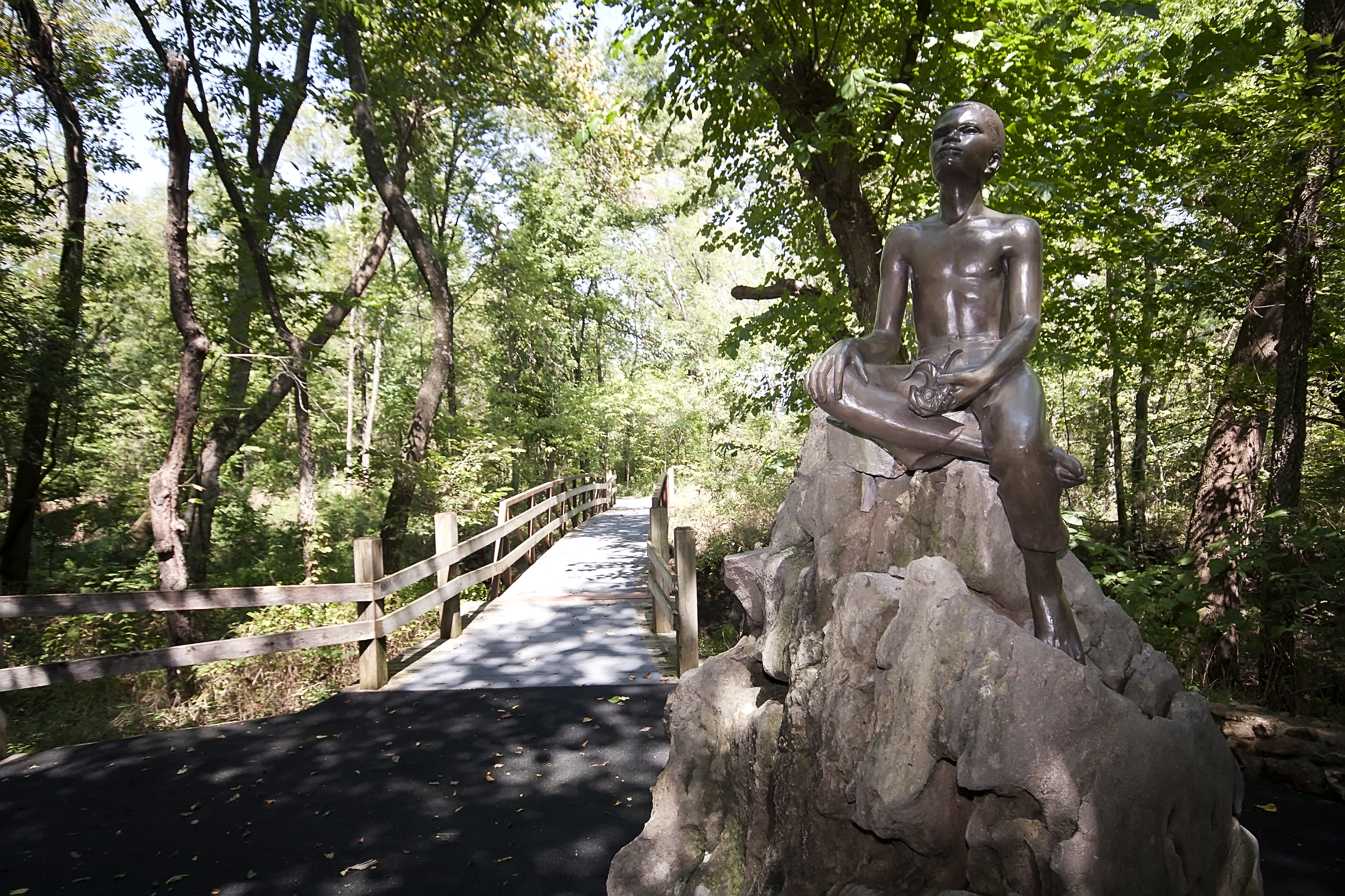
George Washington Carver National Monument
National Monument
The young child known as the "Plant Doctor" tended his secret garden while observing the day-to-day operations of a 19th century farm. Nature and nurture ultimately influenced George on his quest for...
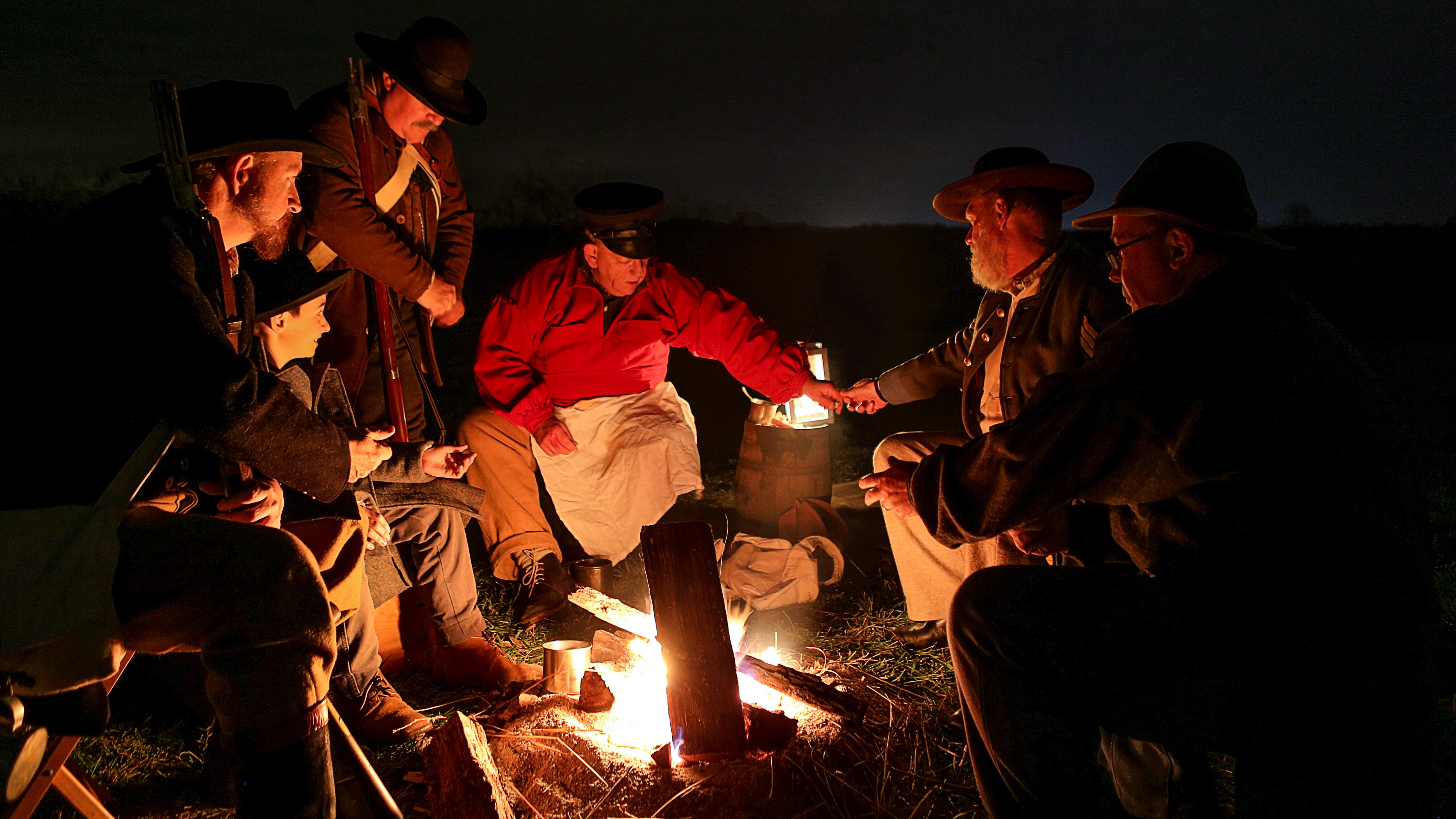
Wilson's Creek was the first major Civil War battle fought west of the Mississippi River, and where the first Union general was killed in action. The costly Southern victory on August 10, 1861, focuse...
7 mi from route
~18 min detour
Free
near mile 65.5
Park data from the National Park Service API. Alerts update every 2 hours.
More Details
What kind of drive is this?
Expect a mixed driving experience that transitions between different road types as you make your way toward Jefferson City. The route features a 44% highway share, balancing faster, high-speed travel with more traditional roadway segments. Your longest uninterrupted stint behind the wheel will be a 110.1-mile stretch on the Congressman Gene Taylor Highway, which allows you to settle into a steady rhythm. Because the profile is categorized as a mixed drive, you will find variety in the road conditions rather than a monotonous interstate grind. Staying alert for these transitions ensures a smooth transition between the major highway legs and the secondary roads that complete the journey.
44% highway, the rest on surface roads — varied driving throughout.
22 navigation steps total — most of the decisions cluster near the start and finish.
Longest single stretch: 110.1 mi on Congressman Gene Taylor Highway.
How Hard Is This Drive?
5/10
This route mixes highway mileage with some local-road sections near the start or finish. You will hit about 16 points where you need to pay attention to lane position or signs. The trickiest moment comes early in the drive near South Washington Street.
Driving Effort5/10
Moderate - straightforward overall, but long enough or busy enough to require pacing
Balances navigation complexity with total wheel time.
This drive requires moderate attention. Across 211.1 miles you will encounter 16 spots where lane choice or exit timing matters. Not difficult for experienced highway drivers, but worth previewing the tricky sections before you go.
Where does it get tricky?
The main spots that need attention: near the start (South Washington Street): Navigation decision point; at 0.3 miles (MO 86 / East Coler Street): Complex interchange - multiple decisions in a short stretch; at 17.3 miles (I 44 / Congressman Gene Taylor Highway): Merge point - match speed before joining. Lane positioning matters here.
Elevation Profile
Mostly flat terrain
1,494 ft1,037 ft
Total Climb
505 ft
Total Descent
48 ft
Highest Point
1,494 ft
~90.5 mi in
Elevation Range
457 ft
Towns Mentioned on Route Signs
Based on OSRM destination-sign hints, not a full list of every settlement the road passes.
Between Neosho, MO and Jefferson City, MO, road signs point toward Nevada and Osage Beach.
Neosho is a sizeable town in Southwest Missouri and has several monikers, among them "Gateway To The Ozarks," "City of Springs," and "Flower Box City". The latter two pertain to characteristics of the town, namely the source of numerous springs as well as a citywide initiative involving flower boxes. The name Neosho is derived from a Native American word meaning "clear, cold water".
Top landmarks
•Neosho Commercial Historic District — historic district in Neosho, Missouri
Doable as a same-day drive at 4h 6m. Total distance: 211.1 miles.
Family Friendly
Moderate complexity with 1 natural rest stops along the way.
Solo Traveler
4h 6m drive, comfortable solo distance.
First-Time Driver
Mostly highway driving (44%). Some complex stretches to watch for.
Scenic Drive
Mixed highway & surface route profile with national parks nearby.
Frequently Asked Questions
The longest stretch is about 110.1 miles on Congressman Gene Taylor Highway. The full list of main roads is in the Roads section above.
Yes — we found about 12 rest areas or service plazas within a short detour of the route (from OpenStreetMap). See the Rest Stops tab under Nearby Places for locations and mile markers. Plan to stretch, use the bathroom, and top off fluids every 2–3 hours on longer drives.
Yes, with realistic expectations. Build in a stop roughly every 2 hours, have snacks and activities ready, and check the Nearby Places tabs for kid-friendly stops along the way.
The main spots that need attention: near the start (South Washington Street): Navigation decision point; at 0.3 miles (MO 86 / East Coler Street): Complex interchange - multiple decisions in a short stretch; at 17.3 miles (I 44 / Congressman Gene Taylor Highway): Merge point - match speed before joining. Lane positioning matters here.
Yes — George Washington Carver National Monument and Wilson's Creek National Battlefield. See the National Parks section for detour distances and tips on detours.
Possible but tiring. At 4.1 hours each way, an in-and-out day trip would put you behind the wheel for 8.2 hours — manageable with a long break at Jefferson City, MO, but most travelers stay overnight.