Houston, TX to Del Rio, TX is 347.9 miles and takes about 6h 21m via Katy Freeway and US Highway 90 West, with a fuel budget near $53 and enough daylight to finish in a day. This highway-focused drive takes you across the Great Plains region of Texas, offering a straightforward journey. With a recommended one-day drive, you can expect a predominantly highway experience. This route is a practical option for getting from Houston to Del Rio efficiently.
Trip Pace
Same-day drive is realistic
A same-day return is possible, but it will make for a full day on the road.
Break Rhythm
1 planned break
Plan on a short reset every 3 to 4 hours to stay fresh behind the wheel.
Midpoint
174 miles from Houston, TX
A natural place for your longest stop of the day
, about 3h 1m into the drive
.
Main Roads
Road
Distance
Duration
Katy Freeway
174.9 mi
3h 1m
West US Highway 90
62.8 mi
1h 11m
US Highway 90 West
37.7 mi
43m
East Military Highway
24.6 mi
28m
Cleto Rodriguez Freeway
12.5 mi
14m
I 10
12 mi
12m
Jose Lopez Freeway
8.4 mi
9m
US Highway 90 East
5.3 mi
6m
Longest stretch:
Katy Freeway
— 174.9 mi, about 3h 1m
Traffic on I-10
Hour-of-day weekday pattern from 60 FHWA count stations on your route.
Peak
3 PM
~2,987 veh/hr typical
· worst 3,856
Quietest
2 AM
~378 veh/hr
Peak-to-quiet ratio
7.9×
busier at peak than in the quiet hours
12a6anoon6p11p
Averaged across 52 weeks of 2023 FHWA Travel Monitoring Analysis System data. Weekday hours only (Mon–Fri).
Turn-by-Turn Driving Directions
Step-by-step road directions between Houston, TX and Del Rio, TX.
1
Start on Louisiana Street
0.1 mi·24 sec·Louisiana Street
Use the straight / left lanes.
2
Take the ramp
0.4 mi·52 sec
Toward I 10 West: San Antonio
3
Merge onto I 10; US 90
175 mi·3 hr 1 min·Katy Freeway
Use the straight / slight right lanes.
4
Keep slight left at fork onto I 10; US 90; TX 130
12 mi·12 min·I 10; US 90; TX 130
Use the straight / slight right lanes.
5
Keep slight left at fork onto I 10; US 90; TX 130
0.8 mi·51 sec·90th Infantry Division Highway
Use the straight / slight right lanes.
6
Continue on I 10; US 90
8.4 mi·9 min·Jose Lopez Freeway
Use the straight / slight right lanes.
7
Continue on US 90
13 mi·14 min·Cleto Rodriguez Freeway
Use the straight / slight right lanes.
8
Continue on US 90
25 mi·28 min·West US Highway 90
9
Continue on US 90
2.1 mi·3 min·19th Street
10
Continue on US 90
38 mi·43 min·US Highway 90 West
11
Continue on US 90
4.9 mi·5 min·East Main Street
12
Continue on US 90
37 mi·42 min·West US Highway 90
13
Continue on US 90
25 mi·28 min·East Military Highway
14
Continue on US 90
5.3 mi·6 min·US Highway 90 East
15
Continue on US 90
0.9 mi·1 min·East Gibbs Street
16
Turn left onto Spur 297
0.2 mi·22 sec·Spur 297
17
Turn left onto US 277 Spur
377 ft·30 sec·East Garfield Street
18
Turn left onto Spur 297
107 ft·2 sec·Spur 297
19
Arrive at destination
Spur 297
Trip Plan
Given the 6h 21m duration, starting your drive from Houston early in the morning is recommended to make the most of daylight. The route has only one designated stop, so plan your fuel and rest breaks accordingly, especially considering the longest stretch without a break is nearly 175 miles. Keep an eye on your fuel gauge as you approach Del Rio, as services can become more spread out in the western parts of Texas. This is a manageable one-day trip, offering flexibility for spontaneous stops if desired.
Morning Departure
Start early — leave by 6-7 AM to arrive at a reasonable hour.
Evening Departure
This is a long drive — plan for a morning departure or consider splitting it into two days.
You can normally do this drive in one day.
Plan roughly 1 meaningful break for fuel, food, and rest.
The halfway point lands around 174 miles from Houston, TX, or about 3h 1m into the drive.
The longest continuous stretch on this route runs about 174.9 miles.
This is a comfortable same-day trip.
Departure
Before you leave
Start with fuel, water, and navigation already sorted so the first hour feels easy.
First stop
Around 77 miles or 1h 20m in
Use this first pause for coffee, a restroom break, and a quick traffic check ahead.
Halfway reset
Around 174 miles or 3h 1m in
This is the best place for your longest stop, a real meal, and a full fuel check.
Final approach
Final hour starts around 5h 12m
Traffic, exits, and arrival timing usually matter more near Del Rio, TX than in the middle of the route.
Before You Leave
+
Open the route before leaving Houston, TX so your first major turns are already loaded.
+
Leave with enough water and a charging cable within reach, not packed away.
+
Check your fuel range against the first long segment, especially if you are starting outside city service areas.
Day 1
Settle into the route from Houston, TX
This is one driving day of about 347.9 miles and 6h 21m.
Your first comfortable stop window is around 77 miles from Houston, TX.
This route can stay practical as a one-day drive if traffic stays reasonable.
Plan about 1 real break rather than only quick fuel stops.
The longest stretch is on Katy Freeway for about 174.9 miles.
Where to Stop
Rest stops, refuel points, and overnight suggestions along this route.
Place data sourced from public business listings. Hours and availability may vary.
Heads-up: tricky spots
5 of 7
5 decision points cluster between mile 0.1 and 347.9 — GPS handles the exact turns, but know they're coming. Your lane choice matters more than the turn itself.
3
0.1 mi into trip|~0m in
Take the ramp toward I 10 West: San Antonio
Navigation decision point
Toward I 10 West: San Antonio
5
0.6 mi into trip|~1m in|I 10; US 90 / Katy Freeway
Merge onto I 10; US 90 / Katy Freeway
Merge point - match speed before joining. Lane positioning matters here
Use the straight / slight right lanes.
6
175.5 mi into trip|~3h 3m in|I 10; US 90; TX 130
Keep slight left at fork onto I 10; US 90; TX 130
Highway fork - watch signs carefully. Lane positioning matters here
Use the straight / slight right lanes.
6
187.5 mi into trip|~3h 16m in|I 10; US 90; TX 130 / 90th Infantry Division Highway
Keep slight left at fork onto I 10; US 90; TX 130 / 90th Infantry Division Highway
Highway fork - watch signs carefully. Lane positioning matters here
Use the straight / slight right lanes.
5
347.9 mi into trip|~6h 21m in|Spur 297
Turn left onto Spur 297
Navigation decision point
Fuel & Cost
Regular Gas
$47.65 one way
$95.30 round trip
$3.48/gal25.4 MPG avg122 kg CO2
Fuel Type
$/gal
One Way
Round Trip
midgrade
$3.89
$53.23
$106.45
premium
$4.23
$57.87
$115.74
diesel
$4.80
$65.69
$131.38
No toll roads detected on this route.
Estimated Trip Cost (one way, 1 person)
Fuel
$48
Meals
$25–$50
Total
$73–$98
Rough estimate based on US averages. Hotel $80–$140/night, meals $25–$50/day.
Estimated CO2 emission: 121.7 kg one way.
Prices: EIA weekly data, 2026-07-13.
Driving Electric?
About $37 in charging
· 1 stop
· 66% less CO2
Vehicle Type
kWh
Stops
DC Fast
Home Charge
Average EV
104.4
1
$36.53
$16.70
Efficient EV
87
0
$30.44
$13.92
EV Truck/SUV
139.2
1
$48.71
$22.27
Gas CO2
122 kg
EV CO2
41 kg (66% less)
Plan for 1 charging stop. A 30-minute DC fast charge mid-route should be enough to complete the trip comfortably.
DC fast charging avg $0.35/kWh. Home charging avg $0.16/kWh. US grid CO2: 0.39 kg/kWh.
Travel Intel
Current conditions at both ends of the drive.
Forecast as of Jul 14, 2026
Origin
Houston, TX
Late night
in Houston on Monday
Local time
2:40 AM
CDT
Current temp
75°F
Chance Showers And Thunderstorms
E 0 to 5 mph61% chanceLive forecast
Flash Flood Warning
Flash Flood Warning issued July 14 at 5:51AM CDT until July 14 at 9:00AM CDT by NWS Lake Charles LA
Flash Flood Warning
Flash Flood Warning issued July 14 at 5:40AM CDT until July 14 at 9:00AM CDT by NWS Midland/Odessa TX
Destination
Del Rio, TX
Late night
in Del Rio on Monday
Local time
2:40 AM
CDT
Current temp
84°F
Showers And Thunderstorms
ESE 5 mph95% chanceLive forecast
Flash Flood Warning
Flash Flood Warning issued July 14 at 5:51AM CDT until July 14 at 9:00AM CDT by NWS Lake Charles LA
Flash Flood Warning
Flash Flood Warning issued July 14 at 5:40AM CDT until July 14 at 9:00AM CDT by NWS Midland/Odessa TX
Seasonal Notes
Summer travel usually means heavier construction, hotter rest stops, and busier weekend traffic around major cities.
Winter travel shortens daylight, so a route that looks manageable on paper can feel much longer after dark.
Holiday weekends tend to make both departure and arrival windows slower than the raw route time suggests.
Time zone
Same local time
Origin and destination are on the same clock, so arrival timing is easier to judge at a glance.
Temperature spread
9 degrees warmer at arrival
A meaningful temperature swing is a good cue to rethink layers, water, and how soon you want to arrive.
Road read
6h 21m on the road
Start early — leave by 6-7 AM to arrive at a reasonable hour.
Weather data from the National Weather Service. Conditions may change; check closer to your travel date.
National Parks Near This Route
Worth a detour if your schedule allows.
San Antonio Missions National Historical Park
National Historical Park
Welcome to San Antonio Missions, a National Park Service site and the only UNESCO World Heritage Site in Texas. Each mission in the park is a center of community and has been since the early 1700s. Th...
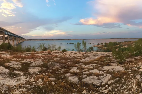
An oasis in the desert, Amistad National Recreation Area consists of the US portion of the International Amistad Reservoir. Amistad, a Spanish word meaning "friendship," is known for excellent water-b...
16 mi from route
~40 min detour
Free
near mile 347.9
Park data from the National Park Service API. Alerts update every 2 hours.
More Details
What kind of drive is this?
This trip is primarily a highway-focused drive, with 90% of the journey utilizing major roadways like the Katy Freeway and US Highway 90 West. You'll encounter a longest uninterrupted stretch of 174.9 miles on the Katy Freeway, indicating a significant portion of the drive will be on this high-speed road. Expect the character of the drive to be consistent, largely maintaining a highway pace as you head west.
90% highway — fuel and pacing are the main things to plan.
19 navigation steps total — most of the decisions cluster near the start and finish.
Longest single stretch: 174.9 mi on Katy Freeway.
How Hard Is This Drive?
5/10
This is a straightforward highway drive that stays mostly on Katy Freeway and West US Highway 90. You will hit about 7 points where you need to pay attention to lane position or signs. The trickiest moment comes around 0.1 miles in.
Driving Effort5/10
Moderate - straightforward overall, but long enough or busy enough to require pacing
Balances navigation complexity with total wheel time.
This drive requires moderate attention. Across 347.9 miles you will encounter 7 spots where lane choice or exit timing matters. Not difficult for experienced highway drivers, but worth previewing the tricky sections before you go.
Where does it get tricky?
The main spots that need attention: at 0.1 miles: Navigation decision point; at 0.6 miles (I 10; US 90 / Katy Freeway): Merge point - match speed before joining. Lane positioning matters here; at 175.5 miles (I 10; US 90; TX 130): Highway fork - watch signs carefully. Lane positioning matters here.
Elevation Profile
Gently rolling terrain
1,119 ft35 ft
Total Climb
1,154 ft
Total Descent
225 ft
Highest Point
1,119 ft
~323.1 mi in
Elevation Range
1,084 ft
Detours Along the Way
Tagged by where each one fits in your drive — first break, midpoint, final stretch.
Houston is a sprawling port city in Southeastern Texas. An oil boom and continuing international immigration has brought explosive growth to the city, and it is now the fifth largest metropolitan area in the United States and the most diverse large city since 2021. While at first glance, the city appears to be a 9-5 central business district surrounded by a sea of suburbs and strip malls, there are many hidden gems to be discovered.
=== Welcome World Cup fans ===
Games will be played at NRG Stadium on the south side of Houston
The best way to get to the stadium on game day is to use MetroRail trains (red line to NRG Stadium/Astrodome). Fare cards can be purchased at kiosks at train platforms and cost US$1.25 per ride
The best hotels for football fans are downtown or near the medical center (both areas have easy access to MetroRail).
Top landmarks
•Museum of Fine Arts, Houston — art museum in Houston, Texas
•Astrodome — historic place in Houston, Harris County, Texas
•Rothko Chapel — building in Houston, Harris County, Texas
Doable as a same-day drive at 6h 21m. Total distance: 347.9 miles.
Family Friendly
Moderate complexity with 1 natural rest stops along the way.
Solo Traveler
6h 21m drive, plan rest stops for pacing.
First-Time Driver
Mostly highway driving (90%). Some complex stretches to watch for.
Frequently Asked Questions
The longest stretch is about 174.9 miles on Katy Freeway. The full list of main roads is in the Roads section above.
Yes — we found about 28 rest areas or service plazas within a short detour of the route (from OpenStreetMap). See the Rest Stops tab under Nearby Places for locations and mile markers. Plan to stretch, use the bathroom, and top off fluids every 2–3 hours on longer drives.
It helps. This is a long drive, so arriving tired and in the dark compounds. If the last hour of the trip is on surface roads or mountain grades, aim to arrive at Del Rio, TX before sunset when you can. Check the Trip Plan for departure windows that land you in daylight.
Only with planning. This is a long drive for kids — consider splitting it into two days rather than pushing through. Plan at least 1 meaningful breaks. There are 28 rest areas along the route for bathroom stops.
The main spots that need attention: at 0.1 miles: Navigation decision point; at 0.6 miles (I 10; US 90 / Katy Freeway): Merge point - match speed before joining. Lane positioning matters here; at 175.5 miles (I 10; US 90; TX 130): Highway fork - watch signs carefully. Lane positioning matters here.
Yes — San Antonio Missions National Historical Park and Amistad National Recreation Area. See the National Parks section for detour distances and tips on detours.
Not recommended in a single day. At 6.4 hours each way, a round trip means 12.7 hours of driving — that is an unsafe level of fatigue for most drivers. Plan at least one night at Del Rio, TX before the return drive.