Traveling from Austin to Del Rio covers 231.3 miles and takes approximately 4 hours and 25 minutes of driving time. Since this trek is easily manageable within a single day, you won't need to worry about booking an overnight stay unless you prefer a slower pace. You should budget around $34 for fuel to complete the journey. The route primarily utilizes Interstate 35 and the Purple Heart Trail as you transition across the Texas landscape. Because both cities are located within the Great Plains region, you will experience a consistent geographical feel throughout your time on the road. It is a straightforward trip that serves as a practical connection between these two Texas hubs.
Trip Pace
Same-day drive is realistic
A same-day return is possible, but it will make for a full day on the road.
Break Rhythm
1 planned break
Plan on a short reset every 3 to 4 hours to stay fresh behind the wheel.
Midpoint
115.7 miles from Austin, TX
A natural place for your longest stop of the day
, about 2h 11m into the drive
.
Main Roads
Road
Distance
Duration
West US Highway 90
62.8 mi
1h 11m
Purple Heart Trail
58.3 mi
1h 3m
US Highway 90 West
37.7 mi
43m
East Military Highway
24.6 mi
28m
Connally Loop
19.3 mi
22m
North Pan Am Expressway
6.9 mi
7m
US Highway 90 East
5.3 mi
6m
East Main Street
4.9 mi
5m
Longest stretch:
West US Highway 90
— 62.8 mi, about 1h 11m
Traffic on I-35
Hour-of-day weekday pattern from 28 FHWA count stations on your route.
Peak
3 PM
~4,203 veh/hr typical
Quietest
3 AM
~766 veh/hr
Peak-to-quiet ratio
5.5×
busier at peak than in the quiet hours
12a6anoon6p11p
Averaged across 51 weeks of 2023 FHWA Travel Monitoring Analysis System data. Weekday hours only (Mon–Fri).
Turn-by-Turn Driving Directions
Step-by-step road directions between Austin, TX and Del Rio, TX.
1
Start on East 5th Street
0.5 mi·1 min·East 5th Street
Use the straight / right lanes.
2
At end of road, turn right onto North Interstate 35
0.4 mi·39 sec·North Interstate 35
Use the straight / slight left lanes.
3
Take the ramp
0.2 mi·21 sec
Toward I 35 South
4
Merge onto I 35; US 290
46 mi·50 min·Purple Heart Trail
Use the straight / slight right lanes.
5
Continue on I 35
1.7 mi·1 min·Interstate Highway 35
Use the straight / slight right lanes.
6
Continue on I 35
12 mi·12 min·Purple Heart Trail
Use the straight / slight right lanes.
7
Continue on I 35
6.9 mi·7 min·North Pan Am Expressway
Use the straight / slight right lanes.
8
Take the exit
0.4 mi·55 sec
Exit 166Toward I 410 West, Loop 368 SouthUse the straight / slight right lanes.
9
Keep slight left at fork
0.3 mi·33 sec
Toward I 410 WestUse the straight / slight right lanes.
10
Merge onto I 410
19 mi·22 min·Connally Loop
Use the straight / slight right lanes.
11
Take the exit
1.4 mi·2 min
Exit 6AToward US 90 West: Del RioUse the straight / slight right lanes.
12
Merge onto US 90
3.2 mi·3 min·Cleto Rodriguez Freeway
13
Continue on US 90
25 mi·28 min·West US Highway 90
14
Continue on US 90
2.1 mi·3 min·19th Street
15
Continue on US 90
38 mi·43 min·US Highway 90 West
16
Continue on US 90
4.9 mi·5 min·East Main Street
17
Continue on US 90
37 mi·42 min·West US Highway 90
18
Continue on US 90
25 mi·28 min·East Military Highway
19
Continue on US 90
5.3 mi·6 min·US Highway 90 East
20
Continue on US 90
0.9 mi·1 min·East Gibbs Street
21
Turn left onto Spur 297
0.2 mi·22 sec·Spur 297
22
Turn left onto US 277 Spur
377 ft·30 sec·East Garfield Street
23
Turn left onto Spur 297
107 ft·2 sec·Spur 297
24
Arrive at destination
Spur 297
Trip Plan
To make the most of your 4-hour and 25-minute trip, aim to depart Austin early to avoid peak traffic congestion when exiting the city. Plan for at least one dedicated stop along the way to stretch your legs, as the turn-heavy nature of the drive can be more taxing than a straight interstate stretch. Since your estimated fuel cost is $34, it is wise to keep an eye on your tank levels before leaving the more populated areas near Austin. Flexibility is your biggest advantage on a route of this length, allowing you to adjust your pace based on local traffic or weather. Because the drive is under five hours, you have plenty of time to reach Del Rio by the late afternoon without feeling rushed.
Morning Departure
An early start around 7-8 AM gets you there with plenty of daylight left.
Evening Departure
A late afternoon start means arriving after dark. Morning is better.
You can normally do this drive in one day.
Plan roughly 1 meaningful break for fuel, food, and rest.
The halfway point lands around 115.7 miles from Austin, TX, or about 2h 11m into the drive.
The longest continuous stretch on this route runs about 62.8 miles.
This is a comfortable same-day trip.
Departure
Before you leave
Start with fuel, water, and navigation already sorted so the first hour feels easy.
First stop
Around 51 miles or 56m in
Use this first pause for coffee, a restroom break, and a quick traffic check ahead.
Halfway reset
Around 115.7 miles or 2h 11m in
This is the best place for your longest stop, a real meal, and a full fuel check.
Final approach
Final hour starts around 3h 37m
Traffic, exits, and arrival timing usually matter more near Del Rio, TX than in the middle of the route.
Before You Leave
+
Open the route before leaving Austin, TX so your first major turns are already loaded.
+
Leave with enough water and a charging cable within reach, not packed away.
+
Check your fuel range against the first long segment, especially if you are starting outside city service areas.
Day 1
Settle into the route from Austin, TX
This is one driving day of about 231.3 miles and 4h 25m.
Your first comfortable stop window is around 51 miles from Austin, TX.
This route can stay practical as a one-day drive if traffic stays reasonable.
Plan about 1 real break rather than only quick fuel stops.
The longest stretch is on West US Highway 90 for about 62.8 miles.
Where to Stop
Rest stops, refuel points, and overnight suggestions along this route.
Place data sourced from public business listings. Hours and availability may vary.
Heads-up: tricky spots
5 of 12
5 decision points cluster between mile 0.5 and 88 — GPS handles the exact turns, but know they're coming. Your lane choice matters more than the turn itself.
7
0.5 mi into trip|~1m in|North Interstate 35
At end of road, turn right onto North Interstate 35
Lane positioning matters here
Use the straight / slight left lanes.
5
1 mi into trip|~2m in|I 35; US 290 / Purple Heart Trail
Merge onto I 35; US 290 / Purple Heart Trail
Merge point - match speed before joining. Lane positioning matters here
Use the straight / slight right lanes.
8
68 mi into trip|~1h 15m in
Take the exit toward I 410 West, Loop 368 South
Exit ramp - move to the correct lane early. Lane positioning matters here. Multiple destination signs - pick the right one
Use the straight / slight right lanes.
Exit 166
Toward I 410 West, Loop 368 South
7
68.4 mi into trip|~1h 15m in
Keep slight left at fork toward I 410 West
Highway fork - watch signs carefully. Lane positioning matters here
Use the straight / slight right lanes.
Toward I 410 West
7
88 mi into trip|~1h 38m in
Take the exit toward US 90 West: Del Rio
Exit ramp - move to the correct lane early. Lane positioning matters here
Use the straight / slight right lanes.
Exit 6A
Toward US 90 West: Del Rio
Fuel & Cost
Regular Gas
$31.68 one way
$63.36 round trip
$3.48/gal25.4 MPG avg81 kg CO2
Fuel Type
$/gal
One Way
Round Trip
midgrade
$3.89
$35.39
$70.77
premium
$4.23
$38.47
$76.95
diesel
$4.80
$43.67
$87.35
No toll roads detected on this route.
Estimated Trip Cost (one way, 1 person)
Fuel
$32
Meals
$25–$50
Total
$57–$82
Rough estimate based on US averages. Hotel $80–$140/night, meals $25–$50/day.
Estimated CO2 emission: 80.9 kg one way.
Prices: EIA weekly data, 2026-07-13.
Driving Electric?
About $24 in charging
· 0 stops
· 67% less CO2
Vehicle Type
kWh
Stops
DC Fast
Home Charge
Average EV
69.4
0
$24.29
$11.10
Efficient EV
57.8
0
$20.24
$9.25
EV Truck/SUV
92.5
1
$32.38
$14.80
Gas CO2
81 kg
EV CO2
27 kg (67% less)
Plan for 0 charging stops, roughly every 270 miles. Allow 25-40 minutes per stop at a DC fast charger.
DC fast charging avg $0.35/kWh. Home charging avg $0.16/kWh. US grid CO2: 0.39 kg/kWh.
Travel Intel
Current conditions at both ends of the drive.
Forecast as of Jul 18, 2026
Origin
Austin, TX
Late night
in Austin on Monday
Local time
2:40 AM
CDT
Current temp
95°F
Partly Sunny
S 5 to 10 mph1% chanceLive forecast
Flood Warning
Flood Warning issued July 18 at 9:55AM CDT until July 19 at 11:00AM CDT by NWS Austin/San Antonio TX
Flood Warning
Flood Warning issued July 18 at 9:53AM CDT until July 19 at 7:15PM CDT by NWS Austin/San Antonio TX
Destination
Del Rio, TX
Late night
in Del Rio on Monday
Local time
2:40 AM
CDT
Current temp
90°F
Mostly Cloudy
SE 10 to 15 mph3% chanceLive forecast
Flood Warning
Flood Warning issued July 18 at 9:55AM CDT until July 19 at 11:00AM CDT by NWS Austin/San Antonio TX
Flood Warning
Flood Warning issued July 18 at 9:53AM CDT until July 19 at 7:15PM CDT by NWS Austin/San Antonio TX
Seasonal Notes
Summer travel usually means heavier construction, hotter rest stops, and busier weekend traffic around major cities.
Winter travel shortens daylight, so a route that looks manageable on paper can feel much longer after dark.
Holiday weekends tend to make both departure and arrival windows slower than the raw route time suggests.
Time zone
Same local time
Origin and destination are on the same clock, so arrival timing is easier to judge at a glance.
Temperature spread
5 degrees cooler at arrival
A meaningful temperature swing is a good cue to rethink layers, water, and how soon you want to arrive.
Road read
4h 25m on the road
An early start around 7-8 AM gets you there with plenty of daylight left.
Weather data from the National Weather Service. Conditions may change; check closer to your travel date.
National Parks Near This Route
Worth a detour if your schedule allows.
San Antonio Missions National Historical Park
National Historical Park
Welcome to San Antonio Missions, a National Park Service site and the only UNESCO World Heritage Site in Texas. Each mission in the park is a center of community and has been since the early 1700s. Th...
14 mi from route
~35 min detour
Free
near mile 71.8
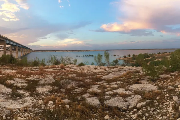
An oasis in the desert, Amistad National Recreation Area consists of the US portion of the International Amistad Reservoir. Amistad, a Spanish word meaning "friendship," is known for excellent water-b...
16 mi from route
~40 min detour
Free
near mile 231.3
Park data from the National Park Service API. Alerts update every 2 hours.
More Details
What kind of drive is this?
Expect a turn-heavy local drive rather than a monotonous interstate haul on this 231.3-mile journey. While you start by navigating sections of I-35 South, the route transitions into more technical local roads that demand your full attention behind the wheel. You will notice a shift in the road's personality as you move away from the major highway corridors and onto the Purple Heart Trail. There is no significant highway percentage to lean on here, as the route favors local navigation. Keep in mind that this is a hands-on driving experience where the road conditions change frequently, making it feel less like a standard highway cruise and more like a focused transit.
51% highway, the rest on surface roads — varied driving throughout.
24 navigation steps total — most of the decisions cluster near the start and finish.
Longest single stretch: 62.8 mi on West US Highway 90.
How Hard Is This Drive?
6/10
This route mixes highway mileage with some local-road sections near the start or finish. You will hit about 12 points where you need to pay attention to lane position or signs. The trickiest moment comes around 0.5 miles in near North Interstate 35.
Driving Effort6/10
Moderate - straightforward overall, but long enough or busy enough to require pacing
Balances navigation complexity with total wheel time.
This drive requires moderate attention. Across 231.3 miles you will encounter 12 spots where lane choice or exit timing matters. Not difficult for experienced highway drivers, but worth previewing the tricky sections before you go.
Where does it get tricky?
The main spots that need attention: at 0.5 miles (North Interstate 35): Lane positioning matters here; at 1 miles (I 35; US 290 / Purple Heart Trail): Merge point - match speed before joining. Lane positioning matters here; at 68 miles: Exit ramp - move to the correct lane early. Lane positioning matters here. Multiple destination signs - pick the right one.
Elevation Profile
Mostly flat terrain
1,149 ft487 ft
Total Climb
915 ft
Total Descent
438 ft
Highest Point
1,149 ft
~198.3 mi in
Elevation Range
662 ft
Towns Mentioned on Route Signs
Based on OSRM destination-sign hints, not a full list of every settlement the road passes.
On the drive from Austin, TX to Del Rio, TX, road signs begin pointing toward Loop 368 South along the way.
Austin is a city of about 1,054,000 (2026) surpassing Fort Worth to become the 4th most populous city in Texas. It is on the southeast edge of the Hill Country region of Texas, making it the fourth-largest city in the state and the 11th-largest in the country. It is the capital of Texas and a college town, and also a center of an alternative culture away from the major cities on the US coasts, though the city is rapidly gentrifying with its rising popularity. Austin's attitude is commonly emblazoned about town on T-shirts and bumper stickers that read: "Keep Austin Weird." Austin is also marketed as the Live Music Capital of the World due to the large number of venues.
Top landmarks
•Texas State Capitol — capitol and seat of government of the U.S. state of Texas
•Lyndon Baines Johnson Library and Museum — presidential library and museum for U.S. President Lyndon B. Johnson in Austin,...
•Texas State Cemetery — historic cemetery in Austin, Texas, USA
Doable as a same-day drive at 4h 25m. Total distance: 231.3 miles.
Family Friendly
Moderate complexity with 1 natural rest stops along the way.
Solo Traveler
4h 25m drive, comfortable solo distance.
Scenic Drive
Mixed highway & surface route profile with national parks nearby.
Frequently Asked Questions
The longest stretch is about 62.8 miles on West US Highway 90. The full list of main roads is in the Roads section above.
We did not find dedicated rest areas on this route. For a drive this long, plan bathroom and stretch breaks around gas stations, fast-food stops, or small-town downtowns — check the Nearby Places section for options.
It helps. This route has a higher-than-average number of complex decision points, which get harder in the dark. If the last hour of the trip is on surface roads or mountain grades, aim to arrive at Del Rio, TX before sunset when you can. Check the Trip Plan for departure windows that land you in daylight.
Only with planning. This is a long drive for kids — consider splitting it into two days rather than pushing through. Plan at least 1 meaningful breaks. Dedicated rest areas are limited, so plan gas or food stops as your bathroom breaks.
The main spots that need attention: at 0.5 miles (North Interstate 35): Lane positioning matters here; at 1 miles (I 35; US 290 / Purple Heart Trail): Merge point - match speed before joining. Lane positioning matters here; at 68 miles: Exit ramp - move to the correct lane early. Lane positioning matters here. Multiple destination signs - pick the right one.
Yes — San Antonio Missions National Historical Park and Amistad National Recreation Area. See the National Parks section for detour distances and tips on detours.
Possible but tiring. At 4.4 hours each way, an in-and-out day trip would put you behind the wheel for 8.9 hours — manageable with a long break at Del Rio, TX, but most travelers stay overnight.