This 425.7-mile journey from Del Rio, TX, to Dallas, TX, is a solid day trip, estimated to take around 7 hours and 48 minutes of pure driving time. You'll navigate using the Purple Heart Trail, East US Highway 90, and I-35E, with about half of your travel on highways. The drive is estimated to cost around $64 for fuel, and with two planned stops, it's a manageable single-day adventure. Both Del Rio and Dallas are situated within the Great Plains region, so expect a consistent landscape throughout your travels. This route offers a straightforward path north, making it a practical choice for reaching Dallas from South Texas.
Trip Pace
Same-day drive is realistic
A same-day return is possible, but it will make for a full day on the road.
Break Rhythm
2 planned breaks
Plan on a short reset every 3 to 4 hours to stay fresh behind the wheel.
Midpoint
212.9 miles from Del Rio, TX
A natural place for your longest stop of the day
, about 4h 4m into the drive
.
Hour-of-day weekday pattern from 96 FHWA count stations on your route.
Peak
5 PM
~4,090 veh/hr typical
Quietest
2 AM
~671 veh/hr
Peak-to-quiet ratio
6.1×
busier at peak than in the quiet hours
12a6anoon6p11p
Averaged across 51 weeks of 2023 FHWA Travel Monitoring Analysis System data. Weekday hours only (Mon–Fri).
Turn-by-Turn Driving Directions
Step-by-step road directions between Del Rio, TX and Dallas, TX.
1
Start on Spur 297
0.2 mi·27 sec·Spur 297
2
Turn right onto US 90; US 277
0.9 mi·1 min·East Gibbs Street
3
Continue on US 90
5.5 mi·6 min·US Highway 90 East
4
Merge onto US 90
24 mi·27 min·US 90
5
Continue on US 90
37 mi·42 min·East US Highway 90
6
Continue on US 90
4.9 mi·5 min·West Main Street
7
Continue on US 90
38 mi·43 min·East US Highway 90
8
Continue on US 90
2.1 mi·3 min·19th Street
9
Continue on US 90
25 mi·29 min·US Highway 90 East
10
Continue on US 90
3.3 mi·3 min·Cleto Rodriguez Freeway
Use the straight / slight right lanes.
11
Take the exit
1.3 mi·2 min
Toward I 410 North, TX 16 NorthUse the straight / slight right lanes.
12
Merge onto I 410; TX 16
20 mi·22 min·Connally Loop
Use the straight / slight right lanes.
13
Keep slight left at fork
0.3 mi·41 sec
Toward I 35 North: Austin
14
Merge onto I 35
6.8 mi·7 min·North Pan Am Expressway
Use the straight / slight right lanes.
15
Continue on I 35
12 mi·12 min·Purple Heart Trail
Use the straight / slight right lanes.
16
Continue on I 35
1.9 mi·2 min·Interstate Highway 35
Use the straight / slight right lanes.
17
Continue on I 35
48 mi·52 min·Purple Heart Trail
Use the straight / slight right lanes.
18
Keep slight right at fork onto I 35; US 290
96 mi·1 hr 40 min·Purple Heart Trail
Use the straight / slight right lanes.
19
Continue on I 35
6.6 mi·7 min·South Jack Kultgen Expressway
Use the straight / slight right lanes.
20
Continue on I 35; US 77
33 mi·33 min·Purple Heart Trail
Use the straight / slight right lanes.
21
Keep slight right at fork onto I 35E
58 mi·1 hr·I 35E
Toward I 35E: DallasUse the slight right lane.
22
Take the exit
0.2 mi·30 sec
Exit 429AToward Continental AvenueUse the slight right lane.
23
Turn right onto Continental Avenue
0.2 mi·31 sec·Continental Avenue
Use the right lane.
24
Turn slight right onto North Lamar Street
433 ft·10 sec·North Lamar Street
25
Arrive at destination
North Lamar Street
Trip Plan
To make the most of this 7-hour, 48-minute drive, consider an early morning departure from Del Rio to avoid the bulk of traffic and maximize daylight. With two stops factored in, you can comfortably break up the 425.7 miles. The longest stretch is on the Purple Heart Trail, so plan your first stop strategically before or after this segment. Keep an eye on your fuel, especially during the initial highway portions, as fuel availability might be more spread out. This single-day trip offers flexibility, allowing you to adjust your pace as needed.
Morning Departure
Start early — leave by 6-7 AM to arrive at a reasonable hour.
Evening Departure
This is a long drive — plan for a morning departure or consider splitting it into two days.
You can normally do this drive in one day.
Plan roughly 2 meaningful breaks for fuel, food, and rest.
The halfway point lands around 212.9 miles from Del Rio, TX, or about 4h 4m into the drive.
The longest continuous stretch on this route runs about 188.3 miles.
This is a comfortable same-day trip.
Departure
Before you leave
Start with fuel, water, and navigation already sorted so the first hour feels easy.
First stop
Around 94 miles or 1h 47m in
Use this first pause for coffee, a restroom break, and a quick traffic check ahead.
Halfway reset
Around 212.9 miles or 4h 4m in
This is the best place for your longest stop, a real meal, and a full fuel check.
Final approach
Final hour starts around 6h 44m
Traffic, exits, and arrival timing usually matter more near Dallas, TX than in the middle of the route.
Before You Leave
+
Open the route before leaving Del Rio, TX so your first major turns are already loaded.
+
Leave with enough water and a charging cable within reach, not packed away.
+
Check your fuel range against the first long segment, especially if you are starting outside city service areas.
+
Pick one backup stop option before the midpoint in case traffic changes your pacing.
Day 1
Settle into the route from Del Rio, TX
This is one driving day of about 425.7 miles and 7h 48m.
Your first comfortable stop window is around 94 miles from Del Rio, TX.
This route can stay practical as a one-day drive if traffic stays reasonable.
Plan about 2 real breaks rather than only quick fuel stops.
The longest stretch is on Purple Heart Trail for about 188.3 miles.
Where to Stop
Rest stops, refuel points, and overnight suggestions along this route.
Place data sourced from public business listings. Hours and availability may vary.
Heads-up: tricky spots
5 of 10
5 decision points cluster between mile 142 and 425.4 — GPS handles the exact turns, but know they're coming. Your lane choice matters more than the turn itself.
7
142 mi into trip|~2h 43m in
Take the exit toward I 410 North, TX 16 North
Exit ramp - move to the correct lane early. Lane positioning matters here. Multiple destination signs - pick the right one
Use the straight / slight right lanes.
Toward I 410 North, TX 16 North
6
231.9 mi into trip|~4h 24m in|I 35; US 290 / Purple Heart Trail
Keep slight right at fork onto I 35; US 290 / Purple Heart Trail
Highway fork - watch signs carefully. Lane positioning matters here
Use the straight / slight right lanes.
7
367.1 mi into trip|~6h 45m in|I 35E
Keep slight right at fork onto I 35E toward I 35E: Dallas
Highway fork - watch signs carefully. Lane positioning matters here
Use the slight right lane.
Toward I 35E: Dallas
7
425.2 mi into trip|~7h 46m in
Take the exit toward Continental Avenue
Exit ramp - move to the correct lane early. Lane positioning matters here
Use the slight right lane.
Exit 429A
Toward Continental Avenue
6
425.4 mi into trip|~7h 47m in|Continental Avenue
Turn right onto Continental Avenue
Lane positioning matters here
Use the right lane.
Fuel & Cost
Regular Gas
$58.31 one way
$116.61 round trip
$3.48/gal25.4 MPG avg149 kg CO2
Fuel Type
$/gal
One Way
Round Trip
midgrade
$3.89
$65.13
$130.26
premium
$4.23
$70.81
$141.62
diesel
$4.80
$80.38
$160.76
No toll roads detected on this route.
Estimated Trip Cost (one way, 1 person)
Fuel
$58
Meals
$25–$50
Total
$83–$108
Rough estimate based on US averages. Hotel $80–$140/night, meals $25–$50/day.
Estimated CO2 emission: 148.9 kg one way.
Prices: EIA weekly data, 2026-07-13.
Driving Electric?
About $45 in charging
· 1 stop
· 66% less CO2
Vehicle Type
kWh
Stops
DC Fast
Home Charge
Average EV
127.7
1
$44.70
$20.43
Efficient EV
106.4
1
$37.25
$17.03
EV Truck/SUV
170.3
2
$59.60
$27.24
Gas CO2
149 kg
EV CO2
50 kg (66% less)
Plan for 1 charging stop. A 30-minute DC fast charge mid-route should be enough to complete the trip comfortably.
DC fast charging avg $0.35/kWh. Home charging avg $0.16/kWh. US grid CO2: 0.39 kg/kWh.
Travel Intel
Current conditions at both ends of the drive.
Forecast as of Jul 17, 2026
Origin
Del Rio, TX
Late night
in Del Rio on Monday
Local time
1:42 AM
CDT
Current temp
73°F
Chance Showers And Thunderstorms
ESE 5 to 10 mph81% chanceLive forecast
Flood Warning
Flood Warning issued July 16 at 8:42PM CDT until July 17 at 6:38AM CDT by NWS Austin/San Antonio TX
Flood Warning
Flood Warning issued July 16 at 8:37PM CDT until July 18 at 3:00PM CDT by NWS Austin/San Antonio TX
Destination
Dallas, TX
Late night
in Dallas on Monday
Local time
1:42 AM
CDT
Current temp
75°F
Chance Showers And Thunderstorms then Mostly Cloudy
S 5 mph32% chanceLive forecast
Flood Warning
Flood Warning issued July 16 at 8:42PM CDT until July 17 at 6:38AM CDT by NWS Austin/San Antonio TX
Flood Warning
Flood Warning issued July 16 at 8:37PM CDT until July 18 at 3:00PM CDT by NWS Austin/San Antonio TX
Seasonal Notes
Summer travel usually means heavier construction, hotter rest stops, and busier weekend traffic around major cities.
Winter travel shortens daylight, so a route that looks manageable on paper can feel much longer after dark.
Holiday weekends tend to make both departure and arrival windows slower than the raw route time suggests.
Time zone
Same local time
Origin and destination are on the same clock, so arrival timing is easier to judge at a glance.
Temperature spread
2 degrees warmer at arrival
A meaningful temperature swing is a good cue to rethink layers, water, and how soon you want to arrive.
Road read
7h 48m on the road
Start early — leave by 6-7 AM to arrive at a reasonable hour.
Weather data from the National Weather Service. Conditions may change; check closer to your travel date.
National Parks Near This Route
Worth a detour if your schedule allows.
Waco Mammoth National Monument
National Monument
Standing as tall as 14 feet and weighing 20,000 pounds, Columbian mammoths roamed across what is present-day Texas thousands of years ago. Today, the fossil specimens represent the nation's first and...
5 mi from route
~13 min detour
Free
near mile 337.7
Welcome to San Antonio Missions, a National Park Service site and the only UNESCO World Heritage Site in Texas. Each mission in the park is a center of community and has been since the early 1700s. Th...
14 mi from route
~35 min detour
Free
near mile 161.5
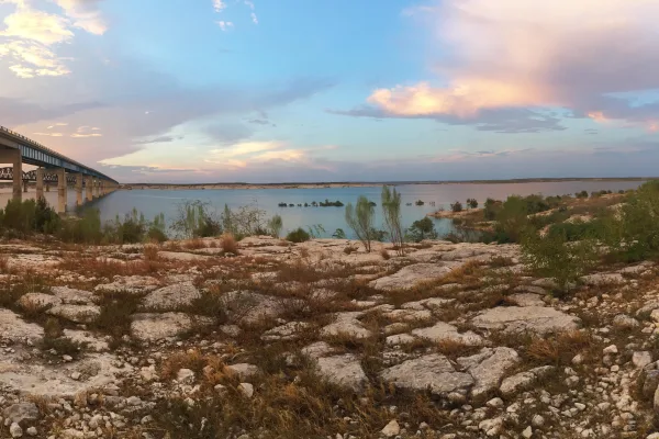
An oasis in the desert, Amistad National Recreation Area consists of the US portion of the International Amistad Reservoir. Amistad, a Spanish word meaning "friendship," is known for excellent water-b...
Park data from the National Park Service API. Alerts update every 2 hours.
More Details
What kind of drive is this?
Expect a mixed driving experience on this route, with 49% of it being highway. You'll begin with stretches on the Purple Heart Trail and East US Highway 90, which can offer a more varied drive before merging onto I-35E. The longest uninterrupted segment you'll encounter is 188.3 miles on the Purple Heart Trail, so be prepared for a significant portion of the drive on this roadway. As you progress north, the road character will transition, eventually leading you to the faster pace of interstate travel as you approach the Dallas metroplex.
49% highway, the rest on surface roads — varied driving throughout.
25 navigation steps total — most of the decisions cluster near the start and finish.
Longest single stretch: 188.3 mi on Purple Heart Trail.
How Hard Is This Drive?
8/10
This route mixes highway mileage with some local-road sections near the start or finish. This route has several spots where lane changes, forks, or exits need your full attention. The trickiest moment comes around 142 miles in.
Driving Effort8/10
Demanding - plan breaks and stay ahead of the key maneuvers
Balances navigation complexity with total wheel time.
This is a demanding drive. With 10 significant decision points across 425.7 miles, you will need to stay alert - especially through interchange areas and urban stretches. Consider splitting it into segments if you are not comfortable with fast highway navigation.
Where does it get tricky?
The main spots that need attention: at 142 miles: Exit ramp - move to the correct lane early. Lane positioning matters here. Multiple destination signs - pick the right one; at 231.9 miles (I 35; US 290 / Purple Heart Trail): Highway fork - watch signs carefully. Lane positioning matters here; at 367.1 miles (I 35E): Highway fork - watch signs carefully. Lane positioning matters here.
Dallas, with a population of more than 1.3 million residents, is the ninth largest city in the United States and the third largest in the state of Texas. It is an impressive melting pot of culture and character. Boasting high-end luxury hotels, innumerable fine dining spots, and one of the busiest airports in the world, Dallas maintains an upscale ethos reflected by an affluent population, world-class museums, and a shimmering modern skyline. Its history was marred by the infamous assassination of U.S. President John F. Kennedy, but there is more historic and contemporary heritage to be discovered in the city.
As a center of the oil and cotton industries in the late 1800s and early 1900s, Dallas was a classic American boom town and remains one of the fastest growing cities in the nation.
Top landmarks
•Dallas Museum of Art — art museum in Dallas, Texas
•Texas School Book Depository — building in Dallas, Texas, United States
•George W. Bush Presidential Center — Presidential library and museum for U.S. President George W. Bush, located in Da...
Doable as a same-day drive at 7h 48m. Total distance: 425.7 miles.
Family Friendly
Moderate complexity with 2 natural rest stops along the way.
Solo Traveler
7h 48m drive, plan rest stops for pacing.
Scenic Drive
Mixed highway & surface route profile with national parks nearby.
Frequently Asked Questions
The longest stretch is about 188.3 miles on Purple Heart Trail. The full list of main roads is in the Roads section above.
Yes — we found about 31 rest areas or service plazas within a short detour of the route (from OpenStreetMap). See the Rest Stops tab under Nearby Places for locations and mile markers. Plan to stretch, use the bathroom, and top off fluids every 2–3 hours on longer drives.
It helps. This route has a higher-than-average number of complex decision points, which get harder in the dark. If the last hour of the trip is on surface roads or mountain grades, aim to arrive at Dallas, TX before sunset when you can. Check the Trip Plan for departure windows that land you in daylight.
Only with planning. This is a long drive for kids — consider splitting it into two days rather than pushing through. Plan at least 2 meaningful breaks. There are 31 rest areas along the route for bathroom stops.
The main spots that need attention: at 142 miles: Exit ramp - move to the correct lane early. Lane positioning matters here. Multiple destination signs - pick the right one; at 231.9 miles (I 35; US 290 / Purple Heart Trail): Highway fork - watch signs carefully. Lane positioning matters here; at 367.1 miles (I 35E): Highway fork - watch signs carefully. Lane positioning matters here.
Yes — Waco Mammoth National Monument, San Antonio Missions National Historical Park and Amistad National Recreation Area. See the National Parks section for detour distances and tips on detours.
Not recommended in a single day. At 7.8 hours each way, a round trip means 15.6 hours of driving — that is an unsafe level of fatigue for most drivers. Plan at least one night at Dallas, TX before the return drive.