This 162.3-mile drive from Culpeper, VA to Roanoke, VA takes approximately 3 hours and 17 minutes. It's a straightforward trip that easily fits into a single day, making it ideal for a quick getaway or efficient travel. The route is largely highway-focused, covering 73% on major interstates, and you can expect to spend around $26 on fuel. Given its relatively short duration and limited stops, this journey through Virginia's Southeast region offers a practical way to get from point A to point B without significant logistical planning.
Trip Pace
Same-day drive is realistic
A same-day return is realistic if you keep stops short.
Break Rhythm
1 planned break
A short stop every 2 to 3 hours is enough for this drive.
Midpoint
81.2 miles from Culpeper, VA
A natural place for your longest stop of the day
, about 1h 45m into the drive
.
Main Roads
Road
Distance
Duration
I 64
60.8 mi
1h 6m
I 81
47.7 mi
52m
North Seminole Trail
33.8 mi
47m
James Monroe Highway
6.4 mi
7m
US 220
5.9 mi
8m
US 29
3.9 mi
5m
Madison Road
1.4 mi
2m
South Main Street
0.6 mi
1m
Longest stretch:
I 64
— 60.8 mi, about 1h 6m
Turn-by-Turn Driving Directions
Step-by-step road directions between Culpeper, VA and Roanoke, VA.
1
Start on this road
94 ft·9 sec·this road
2
Turn right onto West Davis Street
143 ft·7 sec·West Davis Street
3
Turn right onto US 522; US 15 BUS; US 29 BUS
0.6 mi·1 min·South Main Street
4
Continue on US 29 BUS
1.4 mi·2 min·Madison Road
5
Take the ramp onto US 29 BUS
0.3 mi·44 sec·US 29 BUS
Toward US 29 South: Charlottesville, Madison
6
Merge onto US 29
6.4 mi·7 min·James Monroe Highway
7
Continue on US 29
34 mi·47 min·North Seminole Trail
8
Continue on US 29
0.3 mi·41 sec·Emmet Street North
Use the straight lane.
9
Take the exit onto US 29
3.9 mi·5 min·US 29
Toward US 29 South, US 250 West
10
Take the exit
0.4 mi·50 sec
Toward I 64 West
11
Merge onto I 64
61 mi·1 hr 6 min·I 64
12
Keep slight left at fork onto I 81
48 mi·52 min·I 81
Use the straight lane.
13
Take the exit onto US 220
5.9 mi·8 min·US 220
Exit 143Toward I 581, US 220 South: Airport, RoanokeUse the slight left lane.
14
Take the exit onto US 220 BUS
0.1 mi·17 sec·US 220 BUS
Toward US 11 South, US 220 Business South: Downtown
15
Keep slight left at fork onto US 220 BUS
0.3 mi·56 sec·US 220 BUS
16
Turn right onto Salem Avenue Southeast
0.2 mi·30 sec·Salem Avenue Southeast
17
Turn left onto South Jefferson Street
477 ft·20 sec·South Jefferson Street
18
Turn right onto Kirk Avenue Southwest
379 ft·22 sec·Kirk Avenue Southwest
19
Turn left
115 ft·13 sec
20
Turn left
132 ft·9 sec
21
Arrive at destination
Trip Plan
With a total duration of just over 3 hours, this route is perfectly suited for a single-day trip. Aim to depart in the morning to maximize your daylight hours and allow for an unhurried arrival. You'll have one recommended stop along the way, but with a longest stretch of 60.8 miles, you can easily plan your breaks around your own comfort level. The estimated fuel cost of $26 is a helpful budget marker for this 162.3-mile journey, so ensure your tank is topped up before you set off to avoid unnecessary detours.
Morning Departure
An early start around 7-8 AM gets you there with plenty of daylight left.
Evening Departure
A late afternoon start means arriving after dark. Morning is better.
You can normally do this drive in one day.
Plan roughly 1 meaningful break for fuel, food, and rest.
The halfway point lands around 81.2 miles from Culpeper, VA, or about 1h 45m into the drive.
The longest continuous stretch on this route runs about 60.8 miles.
This is a comfortable same-day trip.
Departure
Before you leave
Start with fuel, water, and navigation already sorted so the first hour feels easy.
First stop
Around 36 miles or 52m in
Use this first pause for coffee, a restroom break, and a quick traffic check ahead.
Halfway reset
Around 81.2 miles or 1h 45m in
This is the best place for your longest stop, a real meal, and a full fuel check.
Final approach
Final hour starts around 2h 42m
Traffic, exits, and arrival timing usually matter more near Roanoke, VA than in the middle of the route.
Before You Leave
+
Open the route before leaving Culpeper, VA so your first major turns are already loaded.
+
Leave with enough water and a charging cable within reach, not packed away.
+
Check your fuel range against the first long segment, especially if you are starting outside city service areas.
Day 1
Settle into the route from Culpeper, VA
This is one driving day of about 162.3 miles and 3h 17m.
Your first comfortable stop window is around 36 miles from Culpeper, VA.
This route can stay practical as a one-day drive if traffic stays reasonable.
Plan about 1 real break rather than only quick fuel stops.
The longest stretch is on I 64 for about 60.8 miles.
Where to Stop
Rest stops, refuel points, and overnight suggestions along this route.
Place data sourced from public business listings. Hours and availability may vary.
Heads-up: tricky spots
5 of 16
5 decision points cluster between mile 0 and 161.5 — GPS handles the exact turns, but know they're coming. Your lane choice matters more than the turn itself.
5
0 mi into trip|~0m in|West Davis Street
Turn right onto West Davis Street
Navigation decision point
5
42.9 mi into trip|~1h 2m in|US 29
Take the exit onto US 29 toward US 29 South, US 250 West
Exit ramp - move to the correct lane early. Multiple destination signs - pick the right one
Toward US 29 South, US 250 West
6
107.9 mi into trip|~2h 14m in|I 81
Keep slight left at fork onto I 81
Highway fork - watch signs carefully. Lane positioning matters here
Use the straight lane.
8
155.6 mi into trip|~3h 7m in|US 220
Take the exit onto US 220 toward I 581, US 220 South: Airport, Roanoke
Exit ramp - move to the correct lane early. Lane positioning matters here. Multiple destination signs - pick the right one
Use the slight left lane.
Exit 143
Toward I 581, US 220 South: Airport, Roanoke
5
161.5 mi into trip|~3h 15m in|US 220 BUS
Take the exit onto US 220 BUS toward US 11 South, US 220 Business South: Downtown
Exit ramp - move to the correct lane early. Multiple destination signs - pick the right one
Toward US 11 South, US 220 Business South: Down...
Fuel & Cost
Regular Gas
$25.38 one way
$50.76 round trip
$3.97/gal25.4 MPG avg57 kg CO2
Fuel Type
$/gal
One Way
Round Trip
midgrade
$4.34
$27.75
$55.50
premium
$4.70
$30.04
$60.08
diesel
$5.61
$35.83
$71.67
No toll roads detected on this route.
Estimated Trip Cost (one way, 1 person)
Fuel
$25
Meals
$25–$50
Total
$50–$75
Rough estimate based on US averages. Hotel $80–$140/night, meals $25–$50/day.
Estimated CO2 emission: 56.8 kg one way.
Prices: EIA weekly data, 2026-04-13.
Driving Electric?
About $17 in charging
· 0 stops
· 67% less CO2
Vehicle Type
kWh
Stops
DC Fast
Home Charge
Average EV
48.7
0
$17.04
$7.79
Efficient EV
40.6
0
$14.20
$6.49
EV Truck/SUV
64.9
0
$22.72
$10.39
Gas CO2
57 kg
EV CO2
19 kg (67% less)
This trip is well within single-charge range for most EVs. No charging stops needed if you start fully charged.
DC fast charging avg $0.35/kWh. Home charging avg $0.16/kWh. US grid CO2: 0.39 kg/kWh.
Travel Intel
Current conditions at both ends of the drive.
Forecast as of Apr 15, 2026
Origin
Culpeper, VA
Late night
in Culpeper on Sunday
Local time
3:45 AM
EDT
Current temp
50°F
Unavailable
Live forecast
Destination
Roanoke, VA
Late night
in Roanoke on Sunday
Local time
3:45 AM
EDT
Current temp
59°F
Unavailable
Live forecast
Seasonal Notes
Summer travel usually means heavier construction, hotter rest stops, and busier weekend traffic around major cities.
Winter travel shortens daylight, so a route that looks manageable on paper can feel much longer after dark.
Holiday weekends tend to make both departure and arrival windows slower than the raw route time suggests.
Time zone
Same local time
Origin and destination are on the same clock, so arrival timing is easier to judge at a glance.
Temperature spread
9 degrees warmer at arrival
A meaningful temperature swing is a good cue to rethink layers, water, and how soon you want to arrive.
Road read
3h 17m on the road
Use the two city cards together: check the sky where you start, then compare it with the local time and temperature at arrival.
Weather data from the National Weather Service. Conditions may change; check closer to your travel date.
National Parks Near This Route
Worth a detour if your schedule allows.
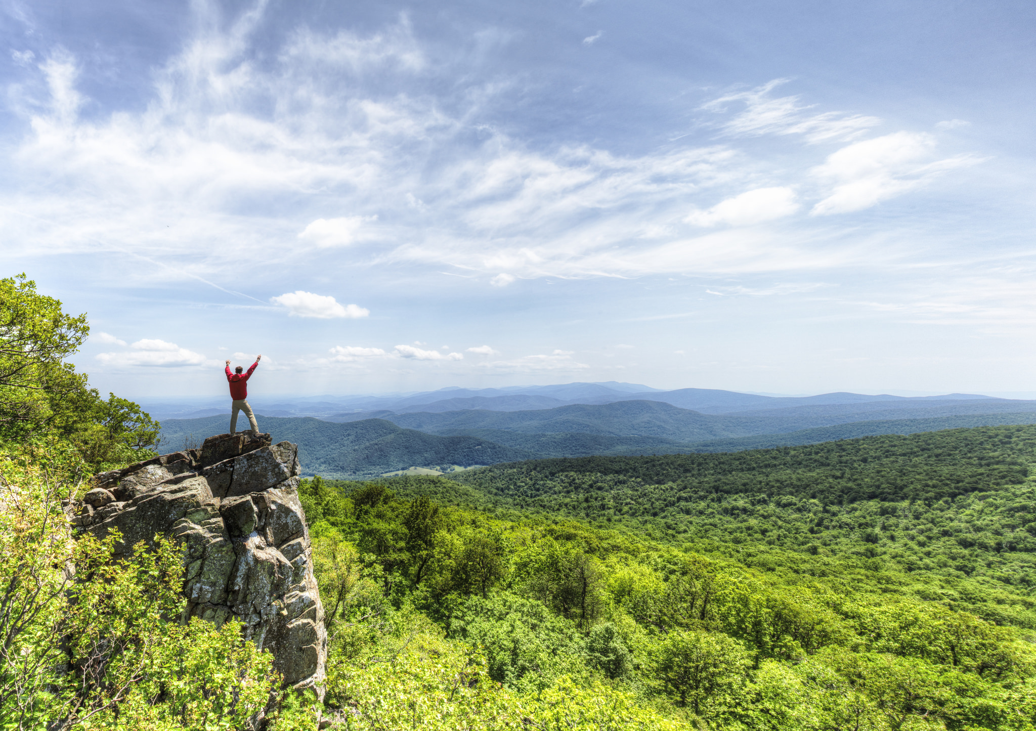
Shenandoah National Park
National Park
Just 75 miles from the bustle of Washington, D.C., Shenandoah National Park is a land bursting with cascading waterfalls, spectacular vistas, fields of wildflowers, and quiet wooded hollows. With over...
14 mi from route
~35 min detour
$30
near mile 16.8
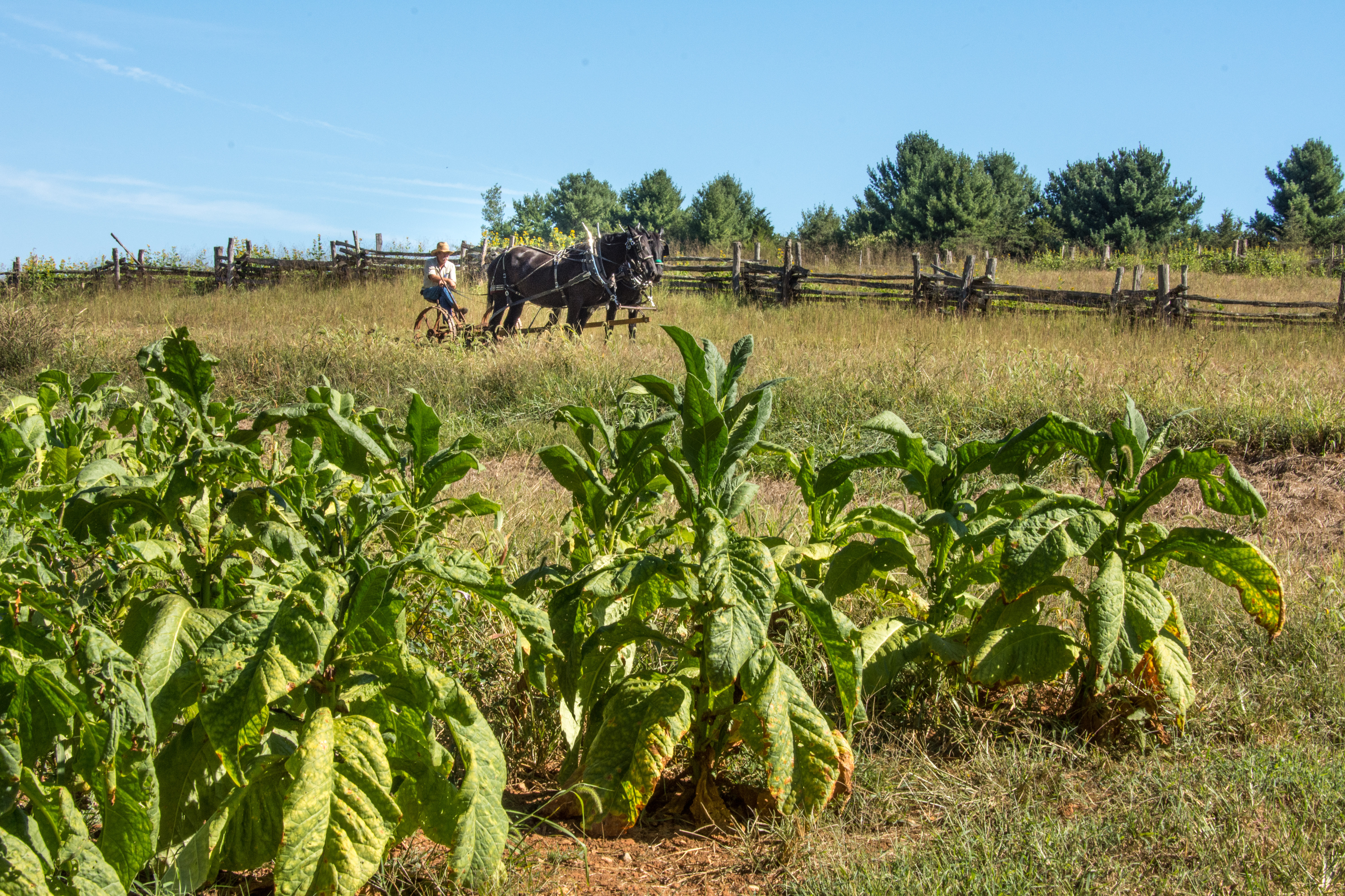
Booker T. Washington was born a slave in April 1856 on the 207-acre farm of James Burroughs. After the Civil War, Washington became the first principal of Tuskegee Normal and Industrial School. Later...
16 mi from route
~39 min detour
Free
near mile 162.3
Park data from the National Park Service API. Alerts update every 2 hours.
More Details
What kind of drive is this?
Expect a highway-focused drive for the majority of this trip, with 73% of the route utilizing major interstates like I-64 and I-81, as well as North Seminole Trail. The longest uninterrupted stretch you'll encounter is 60.8 miles on I-64. This means you'll experience a good amount of consistent, faster-paced driving. While predominantly interstate, this profile suggests a smooth journey with fewer technical sections, allowing for steady progress towards your destination.
73% highway — fuel and pacing are the main things to plan.
21 navigation steps total — most of the decisions cluster near the start and finish.
Longest single stretch: 60.8 mi on I 64.
How Hard Is This Drive?
7/10
This is a straightforward highway drive that stays mostly on I 64 and I 81. This route has several spots where lane changes, forks, or exits need your full attention. The trickiest moment comes early in the drive near West Davis Street.
Driving Effort7/10
Demanding - plan breaks and stay ahead of the key maneuvers
Balances navigation complexity with total wheel time.
This is a demanding drive. With 16 significant decision points across 162.3 miles, you will need to stay alert - especially through interchange areas and urban stretches. Consider splitting it into segments if you are not comfortable with fast highway navigation.
Where does it get tricky?
The main spots that need attention: near the start (West Davis Street): Navigation decision point; at 42.9 miles (US 29): Exit ramp - move to the correct lane early. Multiple destination signs - pick the right one; at 107.9 miles (I 81): Highway fork - watch signs carefully. Lane positioning matters here.
Elevation Profile
Gently rolling terrain
1,821 ft419 ft
Total Climb
2,157 ft
Total Descent
1,652 ft
Highest Point
1,821 ft
~92.7 mi in
Elevation Range
1,402 ft
Who Is This Route For?
Weekend Trip
Doable as a same-day drive at 3h 17m. Total distance: 162.3 miles.
Family Friendly
Moderate complexity with 1 natural rest stops along the way.
Solo Traveler
3h 17m drive, comfortable solo distance.
First-Time Driver
Mostly highway driving (73%). Some complex stretches to watch for.
Frequently Asked Questions
The longest stretch is about 60.8 miles on I 64. The full list of main roads is in the Roads section above.
We did not find dedicated rest areas on this route. For a drive this long, plan bathroom and stretch breaks around gas stations, fast-food stops, or small-town downtowns — check the Nearby Places section for options.
It helps. This route has a higher-than-average number of complex decision points, which get harder in the dark. If the last hour of the trip is on surface roads or mountain grades, aim to arrive at Roanoke, VA before sunset when you can. Check the Trip Plan for departure windows that land you in daylight.
Only with planning. This is a long drive for kids — consider splitting it into two days rather than pushing through. Plan at least 1 meaningful breaks. Dedicated rest areas are limited, so plan gas or food stops as your bathroom breaks.
The main spots that need attention: near the start (West Davis Street): Navigation decision point; at 42.9 miles (US 29): Exit ramp - move to the correct lane early. Multiple destination signs - pick the right one; at 107.9 miles (I 81): Highway fork - watch signs carefully. Lane positioning matters here.
Yes — Shenandoah National Park and Booker T Washington National Monument. See the National Parks section for detour distances and tips on detours.
Possible but tiring. At 3.3 hours each way, an in-and-out day trip would put you behind the wheel for 6.6 hours — manageable with a long break at Roanoke, VA, but most travelers stay overnight.