This 387.7-mile drive from Wilson, Wyoming, to Laramie, Wyoming, is estimated to take about 6 hours and 10 minutes. It's a manageable day trip with a fuel cost around $61, making it an economical choice. The route primarily follows local roads, including Second Street and Highways 22 and 89, with no interstate driving. This makes for a turn-heavy local experience rather than a high-speed journey. Given its duration and road profile, tackling this entire stretch in a single day is feasible, offering a straightforward way to travel within the Mountain West region.
Trip Pace
Same-day drive is realistic
A same-day return is possible, but it will make for a full day on the road.
Break Rhythm
2 planned breaks
Plan on a short reset every 3 to 4 hours to stay fresh behind the wheel.
Midpoint
193.9 miles from Wilson, WY
A natural place for your longest stop of the day
, about 3h 49m into the drive
.
Main Roads
Road
Distance
Duration
Dwight D. Eisenhower Highway
204.8 mi
3h 21m
US 26
162.2 mi
3h 7m
South Highway 89
11.8 mi
17m
West Highway 22
5.3 mi
8m
West Curtis Street
1.4 mi
2m
North 4th Street
1 mi
2m
Main Street
0.3 mi
1m
Second Street
0.1 mi
<1m
Longest stretch:
Dwight D. Eisenhower Highway
— 204.8 mi, about 3h 21m
Traffic on I-80
Hour-of-day weekday pattern from 12 FHWA count stations on your route.
Peak
2 PM
~453 veh/hr typical
· worst 694
Quietest
2 AM
~88 veh/hr
Peak-to-quiet ratio
5.1×
busier at peak than in the quiet hours
12a6anoon6p11p
Averaged across 50 weeks of 2023 FHWA Travel Monitoring Analysis System data. Weekday hours only (Mon–Fri).
Turn-by-Turn Driving Directions
Step-by-step road directions between Wilson, WY and Laramie, WY.
1
Start on Main Street
0.3 mi·1 min·Main Street
2
Turn right onto Second Street
0.1 mi·42 sec·Second Street
3
Turn left onto WY 22
5.3 mi·8 min·West Highway 22
4
Turn right onto US 26; US 89; US 189; US 191
12 mi·17 min·South Highway 89
5
Enter roundabout onto US 26; US 89; US 189; US 191
165 ft·4 sec·US 26; US 89; US 189; US 191
6
Continue on US 26; US 89; US 189; US 191
162 mi·3 hr 7 min·US 26; US 89; US 189; US 191
7
Take the exit
0.4 mi·53 sec
8
Merge onto I 80; US 30
205 mi·3 hr 21 min·Dwight D. Eisenhower Highway
9
Take the exit
0.3 mi·49 sec
Toward I 80 Business East: West Curtis Street
10
Turn left onto I 80 Business
1.4 mi·2 min·West Curtis Street
Use the straight lane.
11
Turn right onto North 4th Street
1.0 mi·2 min·North 4th Street
12
Turn left onto East Ivinson Avenue
363 ft·12 sec·East Ivinson Avenue
13
Turn right onto South 5th Street
199 ft·10 sec·South 5th Street
14
Turn right
45 ft·3 sec
15
Arrive at destination
Trip Plan
For this 387.7-mile trip from Wilson to Laramie, consider an early morning departure to make the most of the 6-hour, 10-minute travel time and avoid potential afternoon traffic. The $61 fuel cost is quite reasonable, but plan for at least one stop to refuel and stretch your legs, especially given the turn-heavy nature of the drive. Since this is a single-day trip, you have flexibility, but being mindful of the local road profile will help you maintain a steady pace. Keep an eye on your fuel gauge as you pass through less populated areas between towns along Highways 22 and 89.
Morning Departure
Start early — leave by 6-7 AM to arrive at a reasonable hour.
Evening Departure
This is a long drive — plan for a morning departure or consider splitting it into two days.
You can normally do this drive in one day.
Plan roughly 2 meaningful breaks for fuel, food, and rest.
The halfway point lands around 193.9 miles from Wilson, WY, or about 3h 49m into the drive.
The longest continuous stretch on this route runs about 204.8 miles.
This is a comfortable same-day trip.
Departure
Before you leave
Start with fuel, water, and navigation already sorted so the first hour feels easy.
First stop
Around 85 miles or 1h 45m in
Use this first pause for coffee, a restroom break, and a quick traffic check ahead.
Halfway reset
Around 193.9 miles or 3h 49m in
This is the best place for your longest stop, a real meal, and a full fuel check.
Final approach
Final hour starts around 6h 1m
Traffic, exits, and arrival timing usually matter more near Laramie, WY than in the middle of the route.
Before You Leave
+
Open the route before leaving Wilson, WY so your first major turns are already loaded.
+
Leave with enough water and a charging cable within reach, not packed away.
+
Check your fuel range against the first long segment, especially if you are starting outside city service areas.
+
Pick one backup stop option before the midpoint in case traffic changes your pacing.
Day 1
Settle into the route from Wilson, WY
This is one driving day of about 387.8 miles and 7h 4m.
Your first comfortable stop window is around 85 miles from Wilson, WY.
This route can stay practical as a one-day drive if traffic stays reasonable.
Plan about 2 real breaks rather than only quick fuel stops.
The longest stretch is on Dwight D. Eisenhower Highway for about 204.8 miles.
Where to Stop
Rest stops, refuel points, and overnight suggestions along this route.
Place data sourced from public business listings. Hours and availability may vary.
Heads-up: tricky spots
5 of 12
5 decision points cluster between mile 0.3 and 387.8 — GPS handles the exact turns, but know they're coming. Your lane choice matters more than the turn itself.
4
0.3 mi into trip|~1m in|Second Street
Turn right onto Second Street
Navigation decision point
5
179.7 mi into trip|~3h 35m in
Take the exit
Exit ramp - move to the correct lane early
5
385.3 mi into trip|~6h 58m in|I 80 Business / West Curtis Street
Turn left onto I 80 Business / West Curtis Street
Lane positioning matters here
Use the straight lane.
5
387.7 mi into trip|~7h 4m in|South 5th Street
Turn right onto South 5th Street
Navigation decision point
5
387.8 mi into trip|~7h 4m in
Turn right
Navigation decision point
Fuel & Cost
Regular Gas
$60.44 one way
$120.89 round trip
$3.96/gal25.4 MPG avg136 kg CO2
Fuel Type
$/gal
One Way
Round Trip
midgrade
$4.17
$63.71
$127.42
premium
$4.47
$68.31
$136.62
diesel
$4.80
$73.22
$146.45
No toll roads detected on this route.
Estimated Trip Cost (one way, 1 person)
Fuel
$60
Meals
$25–$50
Total
$85–$110
Rough estimate based on US averages. Hotel $80–$140/night, meals $25–$50/day.
Estimated CO2 emission: 135.7 kg one way.
Prices: EIA weekly data, 2026-07-13.
Driving Electric?
About $41 in charging
· 1 stop
· 67% less CO2
Vehicle Type
kWh
Stops
DC Fast
Home Charge
Average EV
116.3
1
$40.72
$18.61
Efficient EV
97
1
$33.93
$15.51
EV Truck/SUV
155.1
1
$54.29
$24.82
Gas CO2
136 kg
EV CO2
45 kg (67% less)
Plan for 1 charging stop. A 30-minute DC fast charge mid-route should be enough to complete the trip comfortably.
DC fast charging avg $0.35/kWh. Home charging avg $0.16/kWh. US grid CO2: 0.39 kg/kWh.
Travel Intel
Current conditions at both ends of the drive.
Forecast as of Jul 17, 2026
Origin
Wilson, WY
Evening
in Wilson on Saturday
Local time
7:32 PM
MDT
Current temp
50°F
Slight Chance Showers And Thunderstorms
N 2 mph24% chanceLive forecast
Flood Watch
Flood Watch issued July 16 at 10:55PM MDT until July 16 at 11:00PM MDT by NWS Riverton WY
Heat Advisory
Heat Advisory issued July 16 at 7:09PM MDT until July 19 at 9:00PM MDT by NWS Rapid City SD
Destination
Laramie, WY
Evening
in Laramie on Saturday
Local time
7:32 PM
MDT
Current temp
53°F
Mostly Clear
SE 5 to 15 mph1% chanceLive forecast
Flood Watch
Flood Watch issued July 16 at 10:55PM MDT until July 16 at 11:00PM MDT by NWS Riverton WY
Heat Advisory
Heat Advisory issued July 16 at 7:09PM MDT until July 19 at 9:00PM MDT by NWS Rapid City SD
Seasonal Notes
Summer travel usually means heavier construction, hotter rest stops, and busier weekend traffic around major cities.
Winter travel shortens daylight, so a route that looks manageable on paper can feel much longer after dark.
Holiday weekends tend to make both departure and arrival windows slower than the raw route time suggests.
Time zone
Same local time
Origin and destination are on the same clock, so arrival timing is easier to judge at a glance.
Temperature spread
3 degrees warmer at arrival
A meaningful temperature swing is a good cue to rethink layers, water, and how soon you want to arrive.
Road read
7h 4m on the road
Start early — leave by 6-7 AM to arrive at a reasonable hour.
Weather data from the National Weather Service. Conditions may change; check closer to your travel date.
National Parks Near This Route
Worth a detour if your schedule allows.
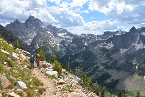
Grand Teton National Park
National Park
Soaring over a landscape rich with wildlife, pristine lakes, and majestic alpine vistas, the Teton Range stands as a testament to generations of stewards. For over 11,000 years, communities have thriv...
Park data from the National Park Service API. Alerts update every 2 hours.
More Details
What kind of drive is this?
Expect a turn-heavy local drive for this entire 387.7-mile journey. With a 0% highway share, you'll be navigating primarily on local roads and state highways, including Second Street and Highways 22 and 89. The longest uninterrupted stretch is not specified, but the 'turn-heavy' profile suggests frequent changes in direction and potentially varying speed limits. This kind of driving experience means you'll be more actively engaged with the road, making the 6-hour, 10-minute duration feel more dynamic than a monotonous highway cruise.
46% highway, the rest on surface roads — varied driving throughout.
15 navigation steps total — most of the decisions cluster near the start and finish.
Longest single stretch: 204.8 mi on Dwight D. Eisenhower Highway.
How Hard Is This Drive?
4/10
This route mixes highway mileage with some local-road sections near the start or finish. There are only a few real navigation decisions along the way. The trickiest moment comes around 0.3 miles in near Second Street.
Driving Effort4/10
Easy - simple navigation with a manageable amount of wheel time
Balances navigation complexity with total wheel time.
The route itself is not hard, but at 7h 4m, endurance matters. Plan breaks every 2-3 hours. The 12 decision points are all manageable with basic attention.
Where does it get tricky?
The main spots that need attention: at 0.3 miles (Second Street): Navigation decision point; at 179.7 miles: Exit ramp - move to the correct lane early; at 385.3 miles (I 80 Business / West Curtis Street): Lane positioning matters here.
Mixed highway & surface route profile with national parks nearby.
Frequently Asked Questions
The longest stretch is about 204.8 miles on Dwight D. Eisenhower Highway. The full list of main roads is in the Roads section above.
Yes — we found about 12 rest areas or service plazas within a short detour of the route (from OpenStreetMap). See the Rest Stops tab under Nearby Places for locations and mile markers. Plan to stretch, use the bathroom, and top off fluids every 2–3 hours on longer drives.
It helps. This is a long drive, so arriving tired and in the dark compounds. If the last hour of the trip is on surface roads or mountain grades, aim to arrive at Laramie, WY before sunset when you can. Check the Trip Plan for departure windows that land you in daylight.
Only with planning. This is a long drive for kids — consider splitting it into two days rather than pushing through. Plan at least 2 meaningful breaks. There are 12 rest areas along the route for bathroom stops.
Mostly yes along the main roads, but rural stretches through WY can have sparse or no coverage. Before you leave, download offline Google Maps or Apple Maps for the route, and consider downloading music or podcasts instead of streaming. If you depend on data for navigation, keep a paper backup of the turn-by-turn directions.
The main spots that need attention: at 0.3 miles (Second Street): Navigation decision point; at 179.7 miles: Exit ramp - move to the correct lane early; at 385.3 miles (I 80 Business / West Curtis Street): Lane positioning matters here.
Yes — Grand Teton National Park. See the National Parks section for detour distances and tips on detours.
Not recommended in a single day. At 7.1 hours each way, a round trip means 14.1 hours of driving — that is an unsafe level of fatigue for most drivers. Plan at least one night at Laramie, WY before the return drive.