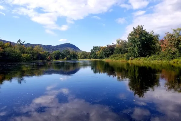
Spanning 298.4 miles from Sanford to Ashland, this journey through Maine covers a significant portion of the state in approximately 5 hours and 52 minutes. Because the route relies entirely on local roads like Washington, River, and Cottage Street rather than interstates, it functions best as a dedicated day trip. You should budget roughly $48 for fuel to complete the trek. While it is possible to tackle this in one go, the turn-heavy nature of the drive makes it feel quite long, so plan your schedule accordingly. This trip takes you deep into the heart of the Northeast, offering a focused look at Maine’s local infrastructure as you head north.
Trip Pace
Same-day drive is realistic
A same-day return is possible, but it will make for a full day on the road.
Break Rhythm
1 planned break
Plan on a short reset every 3 to 4 hours to stay fresh behind the wheel.
Midpoint
149.2 miles from Sanford, ME
A natural place for your longest stop of the day
, about 2h 49m into the drive
.
Main Roads
Road
Distance
Duration
Maine Turnpike
172.9 mi
3h 2m
I 295
52.5 mi
1h 1m
Aroostook Scenic Highway
30.2 mi
44m
Masardis Road
11.7 mi
17m
Alfred Road
8.2 mi
9m
Station Road
5.2 mi
7m
North Road
4.4 mi
6m
South Patten Road
3.2 mi
4m
Longest stretch:
Maine Turnpike
— 172.9 mi, about 3h 2m
Traffic on I-295
Hour-of-day weekday pattern from 39 FHWA count stations on your route.
Peak
4 PM
~2,557 veh/hr typical
· worst 3,064
Quietest
2 AM
~87 veh/hr
Peak-to-quiet ratio
29.4×
busier at peak than in the quiet hours
12a6anoon6p11p
Averaged across 52 weeks of 2023 FHWA Travel Monitoring Analysis System data. Weekday hours only (Mon–Fri).
Turn-by-Turn Driving Directions
Step-by-step road directions between Sanford, ME and Ashland, ME.
1
Start on this road
89 ft·8 sec·this road
2
Turn right onto Washington Street
0.1 mi·23 sec·Washington Street
3
Continue on River Street
0.2 mi·26 sec·River Street
4
Turn right onto US 202; ME 4A
1.2 mi·3 min·Cottage Street
5
Continue on US 202; ME 4A
2.4 mi·3 min·Sanford Road
6
Continue on ME 111
1.8 mi·2 min·Biddeford Road
Use the left / straight / right lanes.
7
Continue on ME 111
8.2 mi·9 min·Alfred Road
8
Continue on ME 111
1.4 mi·1 min·Alfred Street
9
Take the ramp
0.1 mi·1 min
Use the straight / left lanes.
10
Keep slight right at fork
0.2 mi·33 sec
Toward I 95 North Toll: Portland, Augusta
11
Merge onto I 95
12 mi·13 min·Maine Turnpike
12
Keep slight right at fork onto I 295
52 mi·1 hr 1 min·I 295
Exit 44Toward Downtown PortlandUse the slight right lane.
13
Merge onto I 95
161 mi·2 hr 49 min·Maine Turnpike
14
Take the exit
0.3 mi·42 sec
Exit 264Toward ME 158: Sherman, Patten
15
Keep slight left at fork
70 ft·2 sec
16
Turn left onto Main Street
0.4 mi·32 sec·Main Street
17
Continue on Station Road
1.7 mi·2 min·Station Road
18
Continue on Route 11
0.2 mi·15 sec·Route 11
19
Continue on ME 11
3.5 mi·5 min·Station Road
20
Continue on ME 11
3.2 mi·4 min·South Patten Road
21
Continue on ME 11
1.1 mi·2 min·Main Street
22
Continue on ME 11
4.4 mi·6 min·North Road
23
Continue on ME 11
30 mi·44 min·Aroostook Scenic Highway
24
Continue on ME 11
12 mi·17 min·Masardis Road
25
Continue on ME 11
0.4 mi·42 sec·Main Street
26
Turn left onto ME 11
0.1 mi·12 sec·Station Street
27
Turn right
110 ft·8 sec
28
Arrive at destination
Trip Plan
Given the nearly six-hour duration and the complexity of navigating local streets, I recommend hitting the road early in the morning to maximize daylight. Since this is a turn-heavy drive, you should budget for at least one planned stop to stretch your legs and refresh your focus. Keep a close eye on your fuel gauge, as the $48 estimate can fluctuate depending on your vehicle's efficiency and local station pricing. Because there are no long, uninterrupted highway stretches, you will find it easy to pull over whenever you need a break. My best tip for this specific route is to rely on a reliable GPS or offline map, as the reliance on local streets like Washington and Cottage can make navigation tricky without clear guidance.
Morning Departure
An early start around 7-8 AM gets you there with plenty of daylight left.
Evening Departure
A late afternoon start means arriving after dark. Morning is better.
You can normally do this drive in one day.
Plan roughly 1 meaningful break for fuel, food, and rest.
The halfway point lands around 149.2 miles from Sanford, ME, or about 2h 49m into the drive.
The longest continuous stretch on this route runs about 172.9 miles.
This is a comfortable same-day trip.
Departure
Before you leave
Start with fuel, water, and navigation already sorted so the first hour feels easy.
First stop
Around 66 miles or 1h 20m in
Use this first pause for coffee, a restroom break, and a quick traffic check ahead.
Halfway reset
Around 149.2 miles or 2h 49m in
This is the best place for your longest stop, a real meal, and a full fuel check.
Final approach
Final hour starts around 4h 31m
Traffic, exits, and arrival timing usually matter more near Ashland, ME than in the middle of the route.
Before You Leave
+
Open the route before leaving Sanford, ME so your first major turns are already loaded.
+
Leave with enough water and a charging cable within reach, not packed away.
+
Check your fuel range against the first long segment, especially if you are starting outside city service areas.
Day 1
Settle into the route from Sanford, ME
This is one driving day of about 298.4 miles and 5h 52m.
Your first comfortable stop window is around 66 miles from Sanford, ME.
This route can stay practical as a one-day drive if traffic stays reasonable.
Plan about 1 real break rather than only quick fuel stops.
The longest stretch is on Maine Turnpike for about 172.9 miles.
Where to Stop
Rest stops, refuel points, and overnight suggestions along this route.
Place data sourced from public business listings. Hours and availability may vary.
Heads-up: tricky spots
5 of 12
5 decision points cluster between mile 15.5 and 298.4 — GPS handles the exact turns, but know they're coming. Your lane choice matters more than the turn itself.
7
15.5 mi into trip|~22m in
Keep slight right at fork toward I 95 North Toll: Portland, Augusta
Highway fork - watch signs carefully. Multiple destination signs - pick the right one
Toward I 95 North Toll: Portland, Augusta
8
28 mi into trip|~35m in|I 295
Keep slight right at fork onto I 295 toward Downtown Portland
Highway fork - watch signs carefully. Lane positioning matters here
Use the slight right lane.
Exit 44
Toward Downtown Portland
6
241.1 mi into trip|~4h 26m in
Take the exit toward ME 158: Sherman, Patten
Exit ramp - move to the correct lane early. Multiple destination signs - pick the right one
Exit 264
Toward ME 158: Sherman, Patten
5
241.4 mi into trip|~4h 27m in
Keep slight left at fork
Highway fork - watch signs carefully
5
298.4 mi into trip|~5h 52m in
Turn right
Navigation decision point
Fuel & Cost
Regular Gas
$46.83 one way
$93.66 round trip
$3.99/gal25.4 MPG avg104 kg CO2
Fuel Type
$/gal
One Way
Round Trip
midgrade
$4.48
$52.58
$105.17
premium
$4.81
$56.53
$113.06
diesel
$4.80
$56.34
$112.69
Estimated Tolls: $10.37
Maine Turnpike
(172.9 mi)$10.37
Toll estimates based on average 2024-2025 rates. EZ-Pass/SunPass discounts may lower the actual cost.
Estimated Trip Cost (one way, 1 person)
Fuel
$47
Tolls
$10
Meals
$25–$50
Total
$82–$107
Rough estimate based on US averages. Hotel $80–$140/night, meals $25–$50/day.
Estimated CO2 emission: 104.4 kg one way.
Prices: EIA weekly data, 2026-07-13.
Driving Electric?
About $31 in charging
· 1 stop
· 66% less CO2
Vehicle Type
kWh
Stops
DC Fast
Home Charge
Average EV
89.5
1
$31.33
$14.32
Efficient EV
74.6
0
$26.11
$11.94
EV Truck/SUV
119.4
1
$41.78
$19.10
Gas CO2
104 kg
EV CO2
35 kg (66% less)
Plan for 1 charging stop. A 30-minute DC fast charge mid-route should be enough to complete the trip comfortably.
DC fast charging avg $0.35/kWh. Home charging avg $0.16/kWh. US grid CO2: 0.39 kg/kWh.
Travel Intel
Current conditions at both ends of the drive.
Forecast as of Jul 17, 2026
Origin
Sanford, ME
Night
in Sanford on Saturday
Local time
9:32 PM
EDT
Current temp
81°F
Sunny
W 10 mph0% chanceLive forecast
Beach Hazards Statement
Beach Hazards Statement issued July 17 at 2:06AM EDT until July 17 at 8:00PM EDT by NWS Caribou ME
Destination
Ashland, ME
Night
in Ashland on Saturday
Local time
9:32 PM
EDT
Current temp
75°F
Sunny
NW 13 mph0% chanceLive forecast
Beach Hazards Statement
Beach Hazards Statement issued July 17 at 2:06AM EDT until July 17 at 8:00PM EDT by NWS Caribou ME
Seasonal Notes
Summer travel usually means heavier construction, hotter rest stops, and busier weekend traffic around major cities.
Winter travel shortens daylight, so a route that looks manageable on paper can feel much longer after dark.
Holiday weekends tend to make both departure and arrival windows slower than the raw route time suggests.
Time zone
Same local time
Origin and destination are on the same clock, so arrival timing is easier to judge at a glance.
Temperature spread
6 degrees cooler at arrival
A meaningful temperature swing is a good cue to rethink layers, water, and how soon you want to arrive.
Road read
5h 52m on the road
An early start around 7-8 AM gets you there with plenty of daylight left.
Weather data from the National Weather Service. Conditions may change; check closer to your travel date.
National Parks Near This Route
Worth a detour if your schedule allows.
Katahdin Woods and Waters National Monument
National Monument
Spread across a wild landscape offering spectacular views of Katahdin, Katahdin Woods and Waters invites discovery of its rivers, streams, woods, flora, fauna, geology, and the night skies that have a...
13 mi from route
~31 min detour
Free
near mile 247
Known as the first woman to hold a presidential cabinet position and the “Woman behind the New Deal,” Frances Perkins championed many labor rights that Americans enjoy today, including safety standard...
Park data from the National Park Service API. Alerts update every 2 hours.
More Details
What kind of drive is this?
Expect a hands-on driving experience, as this route features a 0% highway share and relies exclusively on local road navigation. You will navigate a turn-heavy path that demands your full attention, moving away from the typical monotonous interstate grind. Because you are sticking to local thoroughfares, the pace is dictated by the road layout rather than high-speed cruising. The character of the drive remains consistent throughout, requiring you to stay alert through every intersection and turn. It is a technical, low-speed route that rewards drivers who prefer the intimacy of local roads over the detachment of a major highway.
76% highway — fuel and pacing are the main things to plan.
28 navigation steps total — most of the decisions cluster near the start and finish.
Longest single stretch: 172.9 mi on Maine Turnpike.
How Hard Is This Drive?
7/10
This is a straightforward highway drive that stays mostly on Maine Turnpike and I 295. This route has several spots where lane changes, forks, or exits need your full attention. The trickiest moment comes around 15.5 miles in.
Driving Effort7/10
Demanding - plan breaks and stay ahead of the key maneuvers
Balances navigation complexity with total wheel time.
This is a demanding drive. With 12 significant decision points across 298.4 miles, you will need to stay alert - especially through interchange areas and urban stretches. Consider splitting it into segments if you are not comfortable with fast highway navigation.
Where does it get tricky?
The main spots that need attention: at 15.5 miles: Highway fork - watch signs carefully. Multiple destination signs - pick the right one; at 28 miles (I 295): Highway fork - watch signs carefully. Lane positioning matters here; at 241.1 miles: Exit ramp - move to the correct lane early. Multiple destination signs - pick the right one.
Elevation Profile
Mostly flat terrain
885 ft109 ft
Total Climb
915 ft
Total Descent
522 ft
Highest Point
885 ft
~255.8 mi in
Elevation Range
776 ft
Towns Mentioned on Route Signs
Based on OSRM destination-sign hints, not a full list of every settlement the road passes.
Between Sanford, ME and Ashland, ME, road signs point toward Augusta, Portland and Patten.
Doable as a same-day drive at 5h 52m. Total distance: 298.4 miles.
Family Friendly
Moderate complexity with 1 natural rest stops along the way.
Solo Traveler
5h 52m drive, comfortable solo distance.
First-Time Driver
Mostly highway driving (76%). Some complex stretches to watch for.
Frequently Asked Questions
The longest stretch is about 172.9 miles on Maine Turnpike. The full list of main roads is in the Roads section above.
Expect about $10.37 in tolls one way, starting with Maine Turnpike. Most Northeast and Midwest toll agencies accept E-ZPass; in the West and Texas, transponders like TxTag or FasTrak apply. If you do not have a transponder, cashless tolling plates will mail a bill to the vehicle's registered address — usually with a surcharge, so a rental-car toll pass is often cheaper than paying by mail.
Yes — we found about 12 rest areas or service plazas within a short detour of the route (from OpenStreetMap). See the Rest Stops tab under Nearby Places for locations and mile markers. Plan to stretch, use the bathroom, and top off fluids every 2–3 hours on longer drives.
It helps. This route has a higher-than-average number of complex decision points, which get harder in the dark. If the last hour of the trip is on surface roads or mountain grades, aim to arrive at Ashland, ME before sunset when you can. Check the Trip Plan for departure windows that land you in daylight.
Only with planning. This is a long drive for kids — consider splitting it into two days rather than pushing through. Plan at least 1 meaningful breaks. There are 12 rest areas along the route for bathroom stops.
Mostly yes along the main roads, but rural stretches through ME can have sparse or no coverage. Before you leave, download offline Google Maps or Apple Maps for the route, and consider downloading music or podcasts instead of streaming. If you depend on data for navigation, keep a paper backup of the turn-by-turn directions.
The main spots that need attention: at 15.5 miles: Highway fork - watch signs carefully. Multiple destination signs - pick the right one; at 28 miles (I 295): Highway fork - watch signs carefully. Lane positioning matters here; at 241.1 miles: Exit ramp - move to the correct lane early. Multiple destination signs - pick the right one.
Yes — Katahdin Woods and Waters National Monument and Frances Perkins National Monument. See the National Parks section for detour distances and tips on detours.
Not recommended in a single day. At 5.9 hours each way, a round trip means 11.8 hours of driving — that is an unsafe level of fatigue for most drivers. Plan at least one night at Ashland, ME before the return drive.