Origin
Morehead City, NC
Late night in Morehead City on Sunday
Local time
12:26 AM
EDT
Current temp
51°F
Unavailable
Live forecast
Compiled and reviewed by the US Trip Planner planning team at COD Solutions Oy · Last reviewed Apr 19, 2026 · Editorial standards
Drive Time
2h 24m
Distance
101.3 mi
163 km
Drive Score
9/10
Great drive
Same Day?
Yes, doable
Fuel Cost
$16
one way
EV Charging
Unknown
Estimated drive times based on typical traffic patterns. Actual times may vary with weather, construction, and real-time conditions.

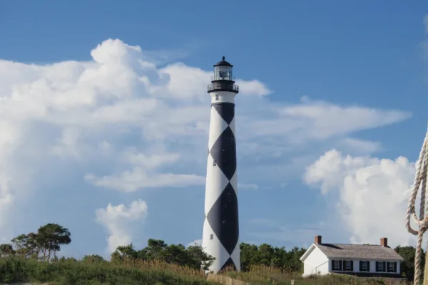
Morehead City, NC
Wikimedia Commons
This 101.3-mile drive from Morehead City, NC, to Wilmington, NC, is easily manageable as a single-day trip, taking approximately 2 hours and 24 minutes. You'll primarily navigate Wilmington Highway and NC 24, with a segment on the John Jay Burney Jr Freeway. The estimated fuel cost for this journey is around $16. Given that both your origin and destination are in the Southeast region, you're staying within a familiar geographical area. This route offers a straightforward connection between two coastal North Carolina communities, making it a practical choice for a day trip or a short leg of a larger adventure.
Trip Pace
Same-day drive is realistic
A same-day return is realistic if you keep stops short.
Midpoint
50.7 miles from Morehead City, NC
A natural place for your longest stop of the day , about 1h 15m into the drive .
| Road | Distance | Duration |
|---|---|---|
| Wilmington Highway | 29.3 mi | 40m |
| NC 24 | 16.3 mi | 23m |
| John Jay Burney Jr Freeway | 12.4 mi | 13m |
| Freedom Way | 9.3 mi | 11m |
| US 17 | 8.8 mi | 13m |
| Lejeune Boulevard | 5 mi | 7m |
| US 421 | 4.6 mi | 6m |
| Arendell Street | 4.1 mi | 5m |
Step-by-step road directions between Morehead City, NC and Wilmington, NC.
Start on this road
At end of road, turn left onto North 18th Street
Turn right onto US 70
Turn left onto NC 24
Continue on NC 24
Continue on NC 24
Continue on NC 24
Continue on NC 24
Keep slight left at fork onto NC 24; NC 53; I 397
Continue on US 17; NC 24; I 97
Continue on US 17; NC 24; I 97
Take the exit onto US 17; I 97
Merge onto US 17
Continue on US 17; NC 210
Continue on NC 140
Take the exit
Turn right onto US 421
Keep slight left at fork onto US 421
Merge onto US 17; US 76; US 421
Continue on US 17; US 76; US 421
Turn left onto US 421; US 17 Business
Arrive at destination
For this relatively short 2-hour and 24-minute trip, you have the flexibility to depart at your convenience. Leaving mid-morning could allow for a relaxed start and an arrival in Wilmington with plenty of daylight. With only 101.3 miles, you won't need to plan for extensive rest stops, but it's always wise to take a break during the 29.3-mile stretch on Wilmington Highway if needed. Keep an eye on your fuel gauge, as the estimated cost is $16, and plan your refueling accordingly before you set off or upon arrival in Wilmington.
Morning Departure
Leave by 9 AM and you'll arrive before lunch.
Evening Departure
Even a 4 PM departure gets you there before dark in summer.
This is a comfortable same-day trip.
Departure
Before you leave
Start with fuel, water, and navigation already sorted so the first hour feels easy.
First stop
Around 22 miles or 33m in
Use this first pause for coffee, a restroom break, and a quick traffic check ahead.
Halfway reset
Around 50.7 miles or 1h 15m in
This is the best place for your longest stop, a real meal, and a full fuel check.
Final approach
Final hour starts around 2h 2m
Traffic, exits, and arrival timing usually matter more near Wilmington, NC than in the middle of the route.
Open the route before leaving Morehead City, NC so your first major turns are already loaded.
Leave with enough water and a charging cable within reach, not packed away.
Check your fuel range against the first long segment, especially if you are starting outside city service areas.
Day 1
Settle into the route from Morehead City, NC
This is one driving day of about 101.3 miles and 2h 24m.
Rest stops, refuel points, and overnight suggestions along this route.

Mid-route town
Meal stop
51 mi into the route
Best for: Lunch, fuel, and a longer reset
This sits close to the middle of the route, so it works well for the longest stop of the day.
A short stop after about 22 miles helps settle the day before fatigue starts building.
The midpoint is around 50.7 miles from Morehead City, NC, which is a good place for a longer meal and fuel stop.
These stop ideas are pacing suggestions — the exact town or exit can change with traffic, hotel plans, and fuel range.
5 decision points cluster between mile 0 and 95.4 — GPS handles the exact turns, but know they're coming. Your lane choice matters more than the turn itself.
At end of road, turn left onto North 18th Street
Complex interchange - multiple decisions in a short stretch
Turn right onto US 70 / Arendell Street
Lane positioning matters here
Turn left onto NC 24
Lane positioning matters here
Merge onto US 17 / Wilmington Highway
Merge point - match speed before joining. Lane positioning matters here
Turn right onto US 421
Lane positioning matters here
Regular Gas
$15.84 one way
$31.68 round trip
| Fuel Type | $/gal | One Way | Round Trip |
|---|---|---|---|
| midgrade | $4.34 | $17.32 | $34.64 |
| premium | $4.70 | $18.75 | $37.50 |
| diesel | $5.61 | $22.37 | $44.73 |
No toll roads detected on this route.
Estimated Trip Cost (one way, 1 person)
Fuel
$16
Meals
$25–$50
Total
$41–$66
Rough estimate based on US averages. Hotel $80–$140/night, meals $25–$50/day.
Estimated CO2 emission: 35.4 kg one way. Prices: EIA weekly data, 2026-04-13.
Driving Electric?
About $11 in charging · 0 stops · 66% less CO2
| Vehicle Type | kWh | Stops | DC Fast | Home Charge |
|---|---|---|---|---|
| Average EV | 30.4 | 0 | $10.64 | $4.86 |
| Efficient EV | 25.3 | 0 | $8.86 | $4.05 |
| EV Truck/SUV | 40.5 | 0 | $14.18 | $6.48 |
Gas CO2
35 kg
EV CO2
12 kg (66% less)
This trip is well within single-charge range for most EVs. No charging stops needed if you start fully charged.
DC fast charging avg $0.35/kWh. Home charging avg $0.16/kWh. US grid CO2: 0.39 kg/kWh.
Current conditions at both ends of the drive.
Origin
Late night in Morehead City on Sunday
Local time
12:26 AM
EDT
Current temp
51°F
Unavailable
Destination
Late night in Wilmington on Sunday
Local time
12:26 AM
EDT
Current temp
65°F
Clear
73°F
Jacksonville, NC
51 mi in
Seasonal Notes
Summer travel usually means heavier construction, hotter rest stops, and busier weekend traffic around major cities.
Winter travel shortens daylight, so a route that looks manageable on paper can feel much longer after dark.
Holiday weekends tend to make both departure and arrival windows slower than the raw route time suggests.
Time zone
Origin and destination are on the same clock, so arrival timing is easier to judge at a glance.
Temperature spread
A meaningful temperature swing is a good cue to rethink layers, water, and how soon you want to arrive.
Road read
The weather snapshot is not static. If you are leaving later, give both cities one more quick forecast check before departure.
Weather data from the National Weather Service. Conditions may change; check closer to your travel date.
Worth a detour if your schedule allows.

National Battlefield
In the early morning hours of February 27, 1776, Loyalist forces charged across a partially dismantled Moores Creek Bridge. Beyond the bridge, nearly 1,000 North Carolina Patriots waited quietly with...
National Seashore
A boat ride three miles off-shore brings you to the barrier islands of Cape Lookout National Seashore. Horse watching, shelling, fishing, birding, camping, lighthouse climbing, and touring historic vi...
Park data from the National Park Service API. Alerts update every 2 hours.
The character of this drive is a mixed bag, with 45% of the journey on highways. Expect stretches that feel like a typical highway cruise, interspersed with more local road driving. The longest uninterrupted stretch you'll encounter is 29.3 miles on Wilmington Highway, offering a good opportunity to settle in. As you progress, the road will transition between these different types, keeping the driving experience varied without being overly demanding. It's not an all-highway grind, nor is it a purely scenic byway, but rather a functional blend designed for efficient travel.
This route mixes highway mileage with some local-road sections near the start or finish. This route has several spots where lane changes, forks, or exits need your full attention. The trickiest moment comes early in the drive near North 18th Street.
Demanding - plan breaks and stay ahead of the key maneuvers
Balances navigation complexity with total wheel time.
This is a demanding drive. With 11 significant decision points across 101.3 miles, you will need to stay alert - especially through interchange areas and urban stretches. Consider splitting it into segments if you are not comfortable with fast highway navigation.
Where does it get tricky?
The main spots that need attention: near the start (North 18th Street): Complex interchange - multiple decisions in a short stretch; at 0.1 miles (US 70 / Arendell Street): Lane positioning matters here; at 4.1 miles (NC 24): Lane positioning matters here.
Based on OSRM destination-sign hints, not a full list of every settlement the road passes.
On the drive from Morehead City, NC to Wilmington, NC, road signs begin pointing toward Carolina Beach along the way.
Carolina Beach
Wilmington is a city in the southeastern part of North Carolina. It is the county seat of New Hanover County, and home to the University of North Carolina at Wilmington, the U.S.S. North Carolina Battleship Memorial, the Cape Fear Museum, Airlie Gardens, and a large historic district. It is convenient to nearby beaches, and is a relatively short drive from the Triangle (Raleigh, Durham, and Chapel Hill), Charlotte, Myrtle Beach, SC, and the I-95 corridor.
City content from Wikivoyage (CC BY-SA 4.0) and Wikidata (CC0).
Weekend Trip
Doable as a same-day drive at 2h 24m. Total distance: 101.3 miles.
Family Friendly
Moderate complexity with 0 natural rest stops along the way.
Solo Traveler
2h 24m drive, comfortable solo distance.
First-Time Driver
Mostly highway driving (45%). Some complex stretches to watch for.
Scenic Drive
Mixed highway & surface route profile with national parks nearby.
Compiled by the US Trip Planner planning team at COD Solutions Oy from open government datasets — OSRM over OpenStreetMap for geometry, EIA for fuel prices, and NPS for national parks. See our methodology for refresh cadence and limitations.
Was this helpful?
Thanks for your feedback!
Your tip has been submitted. Thanks!
/500
Recent Tips
·
Explore more options from Morehead City, NC or browse trips ending in Wilmington, NC.
Looking for more statewide routes? Browse NC road trips.