Traveling from Morehead City to Greensboro covers 226.4 miles of North Carolina terrain, typically taking about 3 hours and 52 minutes of driving time. Because this route stays off the major interstates, it functions best as a focused one-day trip rather than a multi-day excursion. You should budget approximately $36 for fuel to complete the journey. The path transitions from the coastal environment of Morehead City toward the inland Piedmont region, offering a distinct shift in scenery. Since the entire trip is manageable in under four hours, it provides a straightforward transit between the coast and Greensboro, though the turn-heavy nature of the roads requires your full attention.
Trip Pace
Same-day drive is realistic
A same-day return is possible, but it will make for a full day on the road.
Break Rhythm
1 planned break
Plan on a short reset every 3 to 4 hours to stay fresh behind the wheel.
Midpoint
113.6 miles from Morehead City, NC
A natural place for your longest stop of the day
, about 2h 19m into the drive
.
Main Roads
Road
Distance
Duration
I 40
85.5 mi
1h 38m
Arendell Street
69.2 mi
1h 26m
US 70
23.2 mi
29m
Goldsboro Bypass
20.2 mi
21m
US 70 BYP
10.1 mi
12m
Clayton Bypass Scenic Byway
10 mi
11m
East Gate City Boulevard
3.4 mi
7m
West New Bern Road
3.3 mi
4m
Longest stretch:
I 40
— 85.5 mi, about 1h 38m
Traffic on I-40
Hour-of-day weekday pattern from 14 FHWA count stations on your route.
Peak
5 PM
~5,646 veh/hr typical
Quietest
2 AM
~369 veh/hr
Peak-to-quiet ratio
15.3×
busier at peak than in the quiet hours
12a6anoon6p11p
Averaged across 52 weeks of 2023 FHWA Travel Monitoring Analysis System data. Weekday hours only (Mon–Fri).
Turn-by-Turn Driving Directions
Step-by-step road directions between Morehead City, NC and Greensboro, NC.
1
Start on this road
247 ft·23 sec·this road
2
At end of road, turn left onto North 18th Street
123 ft·6 sec·North 18th Street
3
Turn right onto US 70
69 mi·1 hr 26 min·Arendell Street
Use the straight lane.
4
Continue on US 70; US 258
1.1 mi·1 min·West New Bern Road
Use the straight lane.
5
Keep slight right at fork onto US 70; US 258
2.1 mi·3 min·West New Bern Road
Use the straight lane.
6
Continue on US 70; US 258
1.6 mi·2 min·West Vernon Avenue
Use the straight / right lanes.
7
Continue on US 70
9.6 mi·11 min·US 70
Use the straight lane.
8
Continue on I 42
20 mi·21 min·Goldsboro Bypass
9
Continue on US 70
1.2 mi·1 min·US 70
Use the straight lane.
10
Continue on US 70
10 mi·14 min·US 70
Use the straight lane.
11
Continue on US 70
2.0 mi·2 min·US 70
Use the straight lane.
12
Keep slight left at fork onto US 70 BYP
10 mi·12 min·US 70 BYP
13
Continue on I 42
10.0 mi·11 min·Clayton Bypass Scenic Byway
14
Merge onto I 40
82 mi·1 hr 34 min·I 40
Use the straight / slight right lanes.
15
Keep slight right at fork onto I 40
3.3 mi·3 min·I 40
Use the straight / slight left lanes.
16
Take the exit
0.2 mi·24 sec
Toward NC 6Use the slight right lane.
17
Turn straight onto East Gate City Boulevard
3.4 mi·7 min·East Gate City Boulevard
Use the straight / right lanes.
18
Turn right onto South Eugene Street
0.6 mi·1 min·South Eugene Street
19
Turn right onto West Market Street
0.1 mi·24 sec·West Market Street
20
Arrive at destination
West Market Street
Trip Plan
Plan for a single stop during your 3 hour and 52 minute drive to keep your energy levels consistent. Since this is a local road route, avoid departing during peak local traffic hours to prevent unnecessary delays on smaller streets. Your fuel budget of $36 is a baseline, so check your vehicle's efficiency before heading out to ensure you have enough for the full 226.4-mile trip. Given that the route consists entirely of local roads, keep a close eye on your GPS as you transition between North 18th Street, Arendell Street, and West New Bern Road. Flexibility is your biggest advantage here, so feel free to take your time and adjust your pace as the road conditions dictate.
Morning Departure
An early start around 7-8 AM gets you there with plenty of daylight left.
Evening Departure
A late afternoon start means arriving after dark. Morning is better.
You can normally do this drive in one day.
Plan roughly 1 meaningful break for fuel, food, and rest.
The halfway point lands around 113.6 miles from Morehead City, NC, or about 2h 19m into the drive.
The longest continuous stretch on this route runs about 85.5 miles.
This is a comfortable same-day trip.
Departure
Before you leave
Start with fuel, water, and navigation already sorted so the first hour feels easy.
First stop
Around 50 miles or 1h 2m in
Use this first pause for coffee, a restroom break, and a quick traffic check ahead.
Halfway reset
Around 113.6 miles or 2h 19m in
This is the best place for your longest stop, a real meal, and a full fuel check.
Final approach
Final hour starts around 3h 44m
Traffic, exits, and arrival timing usually matter more near Greensboro, NC than in the middle of the route.
Before You Leave
+
Open the route before leaving Morehead City, NC so your first major turns are already loaded.
+
Leave with enough water and a charging cable within reach, not packed away.
+
Check your fuel range against the first long segment, especially if you are starting outside city service areas.
Day 1
Settle into the route from Morehead City, NC
This is one driving day of about 227.2 miles and 4h 36m.
Your first comfortable stop window is around 50 miles from Morehead City, NC.
This route can stay practical as a one-day drive if traffic stays reasonable.
Plan about 1 real break rather than only quick fuel stops.
The longest stretch is on I 40 for about 85.5 miles.
Where to Stop
Rest stops, refuel points, and overnight suggestions along this route.
Place data sourced from public business listings. Hours and availability may vary.
Heads-up: tricky spots
5 of 10
5 decision points cluster between mile 0 and 223 — GPS handles the exact turns, but know they're coming. Your lane choice matters more than the turn itself.
6
0 mi into trip|~0m in|North 18th Street
At end of road, turn left onto North 18th Street
Complex interchange - multiple decisions in a short stretch
6
0.1 mi into trip|~0m in|US 70 / Arendell Street
Turn right onto US 70 / Arendell Street
Lane positioning matters here
Use the straight lane.
6
70.4 mi into trip|~1h 28m in|US 70; US 258 / West New Bern Road
Keep slight right at fork onto US 70; US 258 / West New Bern Road
Highway fork - watch signs carefully. Lane positioning matters here
Use the straight lane.
6
219.6 mi into trip|~4h 23m in|I 40
Keep slight right at fork onto I 40
Highway fork - watch signs carefully. Lane positioning matters here
Use the straight / slight left lanes.
6
223 mi into trip|~4h 26m in
Take the exit toward NC 6
Exit ramp - move to the correct lane early. Lane positioning matters here
Use the slight right lane.
Toward NC 6
Fuel & Cost
Regular Gas
$33.54 one way
$67.09 round trip
$3.75/gal25.4 MPG avg80 kg CO2
Fuel Type
$/gal
One Way
Round Trip
midgrade
$4.12
$36.86
$73.72
premium
$4.49
$40.18
$80.36
diesel
$4.80
$42.90
$85.80
No toll roads detected on this route.
Estimated Trip Cost (one way, 1 person)
Fuel
$34
Meals
$25–$50
Total
$59–$84
Rough estimate based on US averages. Hotel $80–$140/night, meals $25–$50/day.
Estimated CO2 emission: 79.5 kg one way.
Prices: EIA weekly data, 2026-07-13.
Driving Electric?
About $24 in charging
· 0 stops
· 66% less CO2
Vehicle Type
kWh
Stops
DC Fast
Home Charge
Average EV
68.2
0
$23.86
$10.91
Efficient EV
56.8
0
$19.88
$9.09
EV Truck/SUV
90.9
1
$31.81
$14.54
Gas CO2
79 kg
EV CO2
27 kg (66% less)
Plan for 0 charging stops, roughly every 270 miles. Allow 25-40 minutes per stop at a DC fast charger.
DC fast charging avg $0.35/kWh. Home charging avg $0.16/kWh. US grid CO2: 0.39 kg/kWh.
Travel Intel
Current conditions at both ends of the drive.
Forecast as of Jul 18, 2026
Origin
Morehead City, NC
Late night
in Morehead City on Sunday
Local time
3:54 AM
EDT
Current temp
90°F
Sunny
SW 18 mph5% chanceLive forecast
Severe Thunderstorm Warning
Severe Thunderstorm Warning issued July 18 at 2:20PM EDT until July 18 at 2:30PM EDT by NWS Raleigh NC
Severe Thunderstorm Warning
Severe Thunderstorm Warning issued July 18 at 2:19PM EDT until July 18 at 3:15PM EDT by NWS Raleigh NC
Destination
Greensboro, NC
Late night
in Greensboro on Sunday
Local time
3:54 AM
EDT
Current temp
97°F
Chance Showers And Thunderstorms
SW 12 mph39% chanceLive forecast
Severe Thunderstorm Warning
Severe Thunderstorm Warning issued July 18 at 2:20PM EDT until July 18 at 2:30PM EDT by NWS Raleigh NC
Severe Thunderstorm Warning
Severe Thunderstorm Warning issued July 18 at 2:19PM EDT until July 18 at 3:15PM EDT by NWS Raleigh NC
68°F
Princeton, NC
114 mi in
Seasonal Notes
Summer travel usually means heavier construction, hotter rest stops, and busier weekend traffic around major cities.
Winter travel shortens daylight, so a route that looks manageable on paper can feel much longer after dark.
Holiday weekends tend to make both departure and arrival windows slower than the raw route time suggests.
Time zone
Same local time
Origin and destination are on the same clock, so arrival timing is easier to judge at a glance.
Temperature spread
7 degrees warmer at arrival
A meaningful temperature swing is a good cue to rethink layers, water, and how soon you want to arrive.
Road read
4h 36m on the road
An early start around 7-8 AM gets you there with plenty of daylight left.
Weather data from the National Weather Service. Conditions may change; check closer to your travel date.
National Parks Near This Route
Worth a detour if your schedule allows.
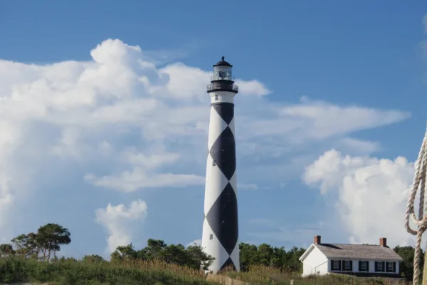
Cape Lookout National Seashore
National Seashore
A boat ride three miles off-shore brings you to the barrier islands of Cape Lookout National Seashore. Horse watching, shelling, fishing, birding, camping, lighthouse climbing, and touring historic vi...
Park data from the National Park Service API. Alerts update every 2 hours.
More Details
What kind of drive is this?
Expect a turn-heavy local drive that prioritizes backroads over high-speed interstate travel. With a highway share of 0%, you won't be spending your time cruising on monotonous multi-lane freeways. Instead, your journey relies on local thoroughfares like North 18th Street, Arendell Street, and West New Bern Road to navigate the distance. This layout keeps you engaged behind the wheel, as the road demands constant focus rather than allowing for the autopilot feel of a major highway. The route is defined by its technical, winding character rather than long, straight stretches, making it a more interactive experience for the driver.
52% highway, the rest on surface roads — varied driving throughout.
20 navigation steps total — most of the decisions cluster near the start and finish.
Longest single stretch: 85.5 mi on I 40.
How Hard Is This Drive?
7/10
This route mixes highway mileage with some local-road sections near the start or finish. This route has several spots where lane changes, forks, or exits need your full attention. The trickiest moment comes early in the drive near North 18th Street.
Driving Effort7/10
Demanding - plan breaks and stay ahead of the key maneuvers
Balances navigation complexity with total wheel time.
This is a demanding drive. With 10 significant decision points across 227.2 miles, you will need to stay alert - especially through interchange areas and urban stretches. Consider splitting it into segments if you are not comfortable with fast highway navigation.
Where does it get tricky?
The main spots that need attention: near the start (North 18th Street): Complex interchange - multiple decisions in a short stretch; at 0.1 miles (US 70 / Arendell Street): Lane positioning matters here; at 70.4 miles (US 70; US 258 / West New Bern Road): Highway fork - watch signs carefully. Lane positioning matters here.
Morehead City is the largest town in the Crystal Coast region of North Carolina, with a population of 7,691 (as of 2000). Morehead (as it is usually called) is not actually in the Outer Banks, being situated on the opposite shore of the Bogue Sound from Atlantic Beach, and is the main gateway to the island of Bogue Banks.
Greensboro is a city of almost 300,000 people (2020) in North Carolina. It is named after Nathanael Greene, a Patriot general who fought a battle here during the Revolutionary War. It's nicknamed the "Gate City" for its historical role as a transportation hub for the Piedmont. The famous author William Sydney Porter, better known as O. Henry, was born here. It can be sleepy and genteel but is enjoying a newfound reputation as a great place for young people. Downtown especially is experiencing a surfeit of bars, music venues and restaurants. Greensboro, Winston-Salem, and High Point are the three cities that make up the Piedmont Triad, halfway between Raleigh and Charlotte.
Top landmarks
•Guilford Courthouse National Military Park — site maintained by the U.S. National Park Service commemorating the battle
•Greensboro Science Center — science museum and zoological park
•Grimsley High School — public school in Greensboro, North Carolina, United States
Doable as a same-day drive at 4h 36m. Total distance: 227.2 miles.
Family Friendly
Moderate complexity with 1 natural rest stops along the way.
Solo Traveler
4h 36m drive, comfortable solo distance.
Scenic Drive
Mixed highway & surface route profile with national parks nearby.
Frequently Asked Questions
The longest stretch is about 85.5 miles on I 40. The full list of main roads is in the Roads section above.
Yes — we found about 13 rest areas or service plazas within a short detour of the route (from OpenStreetMap). See the Rest Stops tab under Nearby Places for locations and mile markers. Plan to stretch, use the bathroom, and top off fluids every 2–3 hours on longer drives.
It helps. This route has a higher-than-average number of complex decision points, which get harder in the dark. If the last hour of the trip is on surface roads or mountain grades, aim to arrive at Greensboro, NC before sunset when you can. Check the Trip Plan for departure windows that land you in daylight.
Only with planning. This is a long drive for kids — consider splitting it into two days rather than pushing through. Plan at least 1 meaningful breaks. There are 13 rest areas along the route for bathroom stops.
The main spots that need attention: near the start (North 18th Street): Complex interchange - multiple decisions in a short stretch; at 0.1 miles (US 70 / Arendell Street): Lane positioning matters here; at 70.4 miles (US 70; US 258 / West New Bern Road): Highway fork - watch signs carefully. Lane positioning matters here.
Yes — Cape Lookout National Seashore. See the National Parks section for detour distances and tips on detours.
Possible but tiring. At 4.6 hours each way, an in-and-out day trip would put you behind the wheel for 9.2 hours — manageable with a long break at Greensboro, NC, but most travelers stay overnight.