Morehead City, NC to Durham, NC is 174.9 miles and takes about 3h 32m via Arendell Street and I-40, with a fuel budget near $27 and enough daylight to finish in a day. This trip stays within North Carolina, moving from the Southeast region to the Southeast region. It's a straightforward, single-day drive that's practical for getting from the coast inland. Consider this route if you need an efficient way to cover the distance without extensive planning.
Trip Pace
Same-day drive is realistic
A same-day return is realistic if you keep stops short.
Break Rhythm
1 planned break
A short stop every 2 to 3 hours is enough for this drive.
Midpoint
87.5 miles from Morehead City, NC
A natural place for your longest stop of the day
, about 1h 49m into the drive
.
Main Roads
Road
Distance
Duration
Arendell Street
69.2 mi
1h 26m
I 40
29.5 mi
33m
US 70
23.2 mi
29m
Goldsboro Bypass
20.2 mi
21m
US 70 BYP
10.1 mi
12m
Clayton Bypass Scenic Byway
10 mi
11m
Durham Freeway
6.7 mi
8m
West New Bern Road
3.3 mi
4m
Longest stretch:
Arendell Street
— 69.2 mi, about 1h 26m
Turn-by-Turn Driving Directions
Step-by-step road directions between Morehead City, NC and Durham, NC.
1
Start on this road
247 ft·23 sec·this road
2
At end of road, turn left onto North 18th Street
123 ft·6 sec·North 18th Street
3
Turn right onto US 70
69 mi·1 hr 26 min·Arendell Street
Use the straight lane.
4
Continue on US 70; US 258
1.1 mi·1 min·West New Bern Road
Use the straight lane.
5
Keep slight right at fork onto US 70; US 258
2.1 mi·3 min·West New Bern Road
Use the straight lane.
6
Continue on US 70; US 258
1.6 mi·2 min·West Vernon Avenue
Use the straight / right lanes.
7
Continue on US 70
9.6 mi·11 min·US 70
Use the straight lane.
8
Continue on I 42
20 mi·21 min·Goldsboro Bypass
9
Continue on US 70
1.2 mi·1 min·US 70
Use the straight lane.
10
Continue on US 70
10 mi·14 min·US 70
Use the straight lane.
11
Continue on US 70
2.0 mi·2 min·US 70
Use the straight lane.
12
Keep slight left at fork onto US 70 BYP
10 mi·12 min·US 70 BYP
13
Continue on I 42
10.0 mi·11 min·Clayton Bypass Scenic Byway
14
Merge onto I 40
30 mi·33 min·I 40
Use the straight / slight right lanes.
15
Take the exit
0.6 mi·44 sec
Exit 279BToward I 885 North: Downtown DurhamUse the straight / slight right lanes.
16
Merge onto I 885
4.1 mi·4 min·Durham Freeway
Use the straight / slight right lanes.
17
Keep slight left at fork onto NC 147
2.6 mi·3 min·Durham Freeway
Exit 9Toward NC 147 North: Durham DowntownUse the slight left lane.
18
Take the exit
0.1 mi·18 sec
Toward Jackie Robinson Drive, Roxboro StreetUse the straight / slight right lanes.
19
Continue on Jackie Robinson Drive
0.1 mi·19 sec·Jackie Robinson Drive
20
Turn right onto US 15 Business; US 501 Business
0.3 mi·48 sec·South Roxboro Street
Use the right lane.
21
Turn left onto East Main Street
100 ft·2 sec·East Main Street
Use the straight / left lanes.
22
Arrive at destination
East Main Street
Trip Plan
For this 1-day trip of 174.9 miles, leaving in the morning is recommended to allow ample time for the 3h 32m drive. With only one stop suggested, you have flexibility in pacing yourself; consider a mid-drive break along I-40. Keep an eye on your fuel gauge, especially before heading onto I-40, as service areas can be spaced out. The estimated fuel cost is around $27, so plan accordingly.
Morning Departure
An early start around 7-8 AM gets you there with plenty of daylight left.
Evening Departure
A late afternoon start means arriving after dark. Morning is better.
You can normally do this drive in one day.
Plan roughly 1 meaningful break for fuel, food, and rest.
The halfway point lands around 87.5 miles from Morehead City, NC, or about 1h 49m into the drive.
The longest continuous stretch on this route runs about 69.2 miles.
This is a comfortable same-day trip.
Departure
Before you leave
Start with fuel, water, and navigation already sorted so the first hour feels easy.
First stop
Around 38 miles or 47m in
Use this first pause for coffee, a restroom break, and a quick traffic check ahead.
Halfway reset
Around 87.5 miles or 1h 49m in
This is the best place for your longest stop, a real meal, and a full fuel check.
Final approach
Final hour starts around 2h 55m
Traffic, exits, and arrival timing usually matter more near Durham, NC than in the middle of the route.
Before You Leave
+
Open the route before leaving Morehead City, NC so your first major turns are already loaded.
+
Leave with enough water and a charging cable within reach, not packed away.
+
Check your fuel range against the first long segment, especially if you are starting outside city service areas.
Day 1
Settle into the route from Morehead City, NC
This is one driving day of about 174.9 miles and 3h 32m.
Your first comfortable stop window is around 38 miles from Morehead City, NC.
This route can stay practical as a one-day drive if traffic stays reasonable.
Plan about 1 real break rather than only quick fuel stops.
The longest stretch is on Arendell Street for about 69.2 miles.
Where to Stop
Rest stops, refuel points, and overnight suggestions along this route.
Place data sourced from public business listings. Hours and availability may vary.
Heads-up: tricky spots
5 of 11
5 decision points cluster between mile 0 and 174.6 — GPS handles the exact turns, but know they're coming. Your lane choice matters more than the turn itself.
6
0 mi into trip|~0m in|North 18th Street
At end of road, turn left onto North 18th Street
Complex interchange - multiple decisions in a short stretch
7
167 mi into trip|~3h 22m in
Take the exit toward I 885 North: Downtown Durham
Exit ramp - move to the correct lane early. Lane positioning matters here
Use the straight / slight right lanes.
Exit 279B
Toward I 885 North: Downtown Durham
8
171.8 mi into trip|~3h 27m in|NC 147 / Durham Freeway
Keep slight left at fork onto NC 147 / Durham Freeway toward NC 147 North: Durham Downtown
Highway fork - watch signs carefully. Lane positioning matters here
Use the slight left lane.
Exit 9
Toward NC 147 North: Durham Downtown
7
174.4 mi into trip|~3h 31m in
Take the exit toward Jackie Robinson Drive, Roxboro Street
Exit ramp - move to the correct lane early. Lane positioning matters here. Multiple destination signs - pick the right one
Use the straight / slight right lanes.
Toward Jackie Robinson Drive, Roxboro Street
7
174.6 mi into trip|~3h 32m in|US 15 Business; US 501 Business / South Roxboro Street
Turn right onto US 15 Business; US 501 Business / South Roxboro Street
Lane positioning matters here
Use the right lane.
Fuel & Cost
Regular Gas
$27.35 one way
$54.70 round trip
$3.97/gal25.4 MPG avg61 kg CO2
Fuel Type
$/gal
One Way
Round Trip
midgrade
$4.34
$29.91
$59.81
premium
$4.70
$32.37
$64.74
diesel
$5.61
$38.62
$77.23
No toll roads detected on this route.
Estimated Trip Cost (one way, 1 person)
Fuel
$27
Meals
$25–$50
Total
$52–$77
Rough estimate based on US averages. Hotel $80–$140/night, meals $25–$50/day.
Estimated CO2 emission: 61.2 kg one way.
Prices: EIA weekly data, 2026-04-13.
Driving Electric?
About $18 in charging
· 0 stops
· 67% less CO2
Vehicle Type
kWh
Stops
DC Fast
Home Charge
Average EV
52.5
0
$18.36
$8.40
Efficient EV
43.7
0
$15.30
$7.00
EV Truck/SUV
70
0
$24.49
$11.19
Gas CO2
61 kg
EV CO2
20 kg (67% less)
This trip is well within single-charge range for most EVs. No charging stops needed if you start fully charged.
DC fast charging avg $0.35/kWh. Home charging avg $0.16/kWh. US grid CO2: 0.39 kg/kWh.
Travel Intel
Current conditions at both ends of the drive.
Forecast as of Apr 14, 2026
Origin
Morehead City, NC
Late night
in Morehead City on Tuesday
Local time
5:02 AM
EDT
Current temp
51°F
Unavailable
Live forecast
Destination
Durham, NC
Late night
in Durham on Tuesday
Local time
5:02 AM
EDT
Current temp
77°F
Unavailable
Live forecast
Seasonal Notes
Summer travel usually means heavier construction, hotter rest stops, and busier weekend traffic around major cities.
Winter travel shortens daylight, so a route that looks manageable on paper can feel much longer after dark.
Holiday weekends tend to make both departure and arrival windows slower than the raw route time suggests.
Time zone
Same local time
Origin and destination are on the same clock, so arrival timing is easier to judge at a glance.
Temperature spread
26 degrees warmer at arrival
A meaningful temperature swing is a good cue to rethink layers, water, and how soon you want to arrive.
Road read
3h 32m on the road
Use the two city cards together: check the sky where you start, then compare it with the local time and temperature at arrival.
Weather data from the National Weather Service. Conditions may change; check closer to your travel date.
National Parks Near This Route
Worth a detour if your schedule allows.
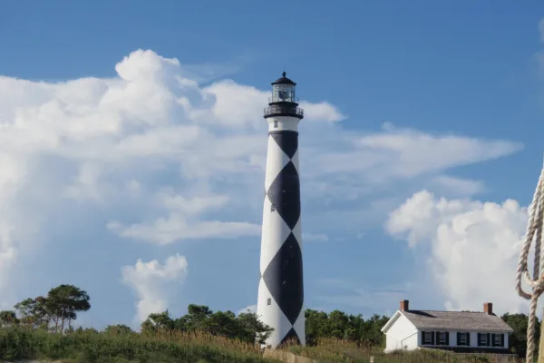
Cape Lookout National Seashore
National Seashore
A boat ride three miles off-shore brings you to the barrier islands of Cape Lookout National Seashore. Horse watching, shelling, fishing, birding, camping, lighthouse climbing, and touring historic vi...
Park data from the National Park Service API. Alerts update every 2 hours.
More Details
What kind of drive is this?
This route offers a mixed driving experience, with 40% of the drive on highways. You'll start on Arendell Street, which accounts for the longest uninterrupted stretch of 69.2 miles, suggesting a more local road feel initially. As you progress, you'll transition to I-40, providing faster travel for a significant portion of your journey. Expect a blend of moderate speeds on local roads and quicker transit on the interstate sections.
40% highway, the rest on surface roads — varied driving throughout.
22 navigation steps total — most of the decisions cluster near the start and finish.
Longest single stretch: 69.2 mi on Arendell Street.
How Hard Is This Drive?
8/10
This route mixes highway mileage with some local-road sections near the start or finish. This route has several spots where lane changes, forks, or exits need your full attention. The trickiest moment comes early in the drive near North 18th Street.
Driving Effort8/10
Demanding - plan breaks and stay ahead of the key maneuvers
Balances navigation complexity with total wheel time.
This is a demanding drive. With 11 significant decision points across 174.9 miles, you will need to stay alert - especially through interchange areas and urban stretches. Consider splitting it into segments if you are not comfortable with fast highway navigation.
Where does it get tricky?
The main spots that need attention: near the start (North 18th Street): Complex interchange - multiple decisions in a short stretch; at 167 miles: Exit ramp - move to the correct lane early. Lane positioning matters here; at 171.8 miles (NC 147 / Durham Freeway): Highway fork - watch signs carefully. Lane positioning matters here.
Morehead City is the largest town in the Crystal Coast region of North Carolina, with a population of 7,691 (as of 2000). Morehead (as it is usually called) is not actually in the Outer Banks, being situated on the opposite shore of the Bogue Sound from Atlantic Beach, and is the main gateway to the island of Bogue Banks.
Of the three cities that make up North Carolina's Research Triangle, Durham has traditionally been the one with the grittier, more working-class image. A city of just over 300,000 residents in 2026, Durham has moved beyond a "tobacco town" with a prestigious university at its center to become a regionally and nationally recognized symbol of urban renewal, gentrification, technology and diversity. Durham's vibrant African-American community was historically pioneering in United States Black culture, from the arts to finance.
These days, the tobacco warehouses and textile mills have been converted to other uses, as Durham has taken on a much more high-profile (and expensive) identity. Thanks to local anchor Duke University, a thriving, research-driven medical and tech industry has taken root.
Doable as a same-day drive at 3h 32m. Total distance: 174.9 miles.
Family Friendly
Moderate complexity with 1 natural rest stops along the way.
Solo Traveler
3h 32m drive, comfortable solo distance.
Scenic Drive
Mixed highway & surface route profile with national parks nearby.
Frequently Asked Questions
The longest stretch is about 69.2 miles on Arendell Street. The full list of main roads is in the Roads section above.
Yes — we found about 3 rest areas or service plazas within a short detour of the route (from OpenStreetMap). See the Rest Stops tab under Nearby Places for locations and mile markers. Plan to stretch, use the bathroom, and top off fluids every 2–3 hours on longer drives.
It helps. This route has a higher-than-average number of complex decision points, which get harder in the dark. If the last hour of the trip is on surface roads or mountain grades, aim to arrive at Durham, NC before sunset when you can. Check the Trip Plan for departure windows that land you in daylight.
Only with planning. This is a long drive for kids — consider splitting it into two days rather than pushing through. Plan at least 1 meaningful breaks. There are 3 rest areas along the route for bathroom stops.
The main spots that need attention: near the start (North 18th Street): Complex interchange - multiple decisions in a short stretch; at 167 miles: Exit ramp - move to the correct lane early. Lane positioning matters here; at 171.8 miles (NC 147 / Durham Freeway): Highway fork - watch signs carefully. Lane positioning matters here.
Yes — Cape Lookout National Seashore. See the National Parks section for detour distances and tips on detours.
Possible but tiring. At 3.5 hours each way, an in-and-out day trip would put you behind the wheel for 7.1 hours — manageable with a long break at Durham, NC, but most travelers stay overnight.