Origin
Del Rio, TX
Late night in Del Rio on Sunday
Local time
2:46 AM
CDT
Current temp
79°F
Unavailable
Live forecast
Compiled and reviewed by the US Trip Planner planning team at COD Solutions Oy · Last reviewed Apr 19, 2026 · Editorial standards
Drive Time
7h 32m
Distance
413.1 mi
665 km
Drive Score
8/10
Great drive
Same Day?
Yes, doable
Fuel Cost
$62
one way
EV Charging
Unknown
Estimated drive times based on typical traffic patterns. Actual times may vary with weather, construction, and real-time conditions.

Del Rio, TX
Wikimedia Commons

Arlington, TX
Wikimedia Commons
This 413.1-mile drive from Del Rio, TX, to Arlington, TX, will take approximately 7 hours and 32 minutes of driving time. It's a feasible one-day trip, though you might appreciate the flexibility if you decide to break it up. The majority of this journey, 96%, is on highways, making it a focused drive. You'll be traveling between two locations within the Great Plains region. Budget around $62 for fuel, and plan for at least two stops along the way. This route offers a straightforward path through Texas.
Trip Pace
Same-day drive is realistic
A same-day return is possible, but it will make for a full day on the road.
Break Rhythm
2 planned breaks
Plan on a short reset every 3 to 4 hours to stay fresh behind the wheel.
Midpoint
206.6 miles from Del Rio, TX
A natural place for your longest stop of the day , about 3h 51m into the drive .
| Road | Distance | Duration |
|---|---|---|
| US 277 | 225.3 mi | 4h 7m |
| I 20 | 137.1 mi | 2h 19m |
| West Freeway | 15.2 mi | 17m |
| Tom Landry Freeway | 12.3 mi | 15m |
| South Loop 306 | 6.4 mi | 6m |
| Veterans Boulevard | 4.3 mi | 6m |
| Winters Freeway | 2.9 mi | 3m |
| US Highway 87 South | 2.8 mi | 2m |
Step-by-step road directions between Del Rio, TX and Arlington, TX.
Start on Spur 297
Continue on US 90; US 277; US 377
Keep slight right at fork onto US 277; US 377
Turn left onto US 277; Loop 467
Take the exit onto US 277
Turn right onto US 87 Frontage Road
Take the ramp
Merge onto US 87; Loop 306
Continue on US 87; Loop 306
Take the exit onto Loop 306
Turn left onto Loop 306; FM 1223
Keep slight right at fork
Merge onto US 67; US 277
Take the exit onto US 277
Turn left onto US 277
Take the ramp onto US 277
Merge onto US 83; US 84; US 277
Take the exit
Merge onto I 20
Keep slight left at fork onto I 30
Continue on I 30
Take the exit
Turn right onto North Cooper Street
Turn left onto West Randol Mill Road
Turn right onto North Center Street
Turn right onto West Abram Street
Arrive at destination
To make the most of this 7.5-hour drive, aim for an early morning departure from Del Rio, TX, to maximize daylight and minimize traffic. With two recommended stops, plan to rest and refuel roughly every 2-3 hours to stay alert. The longest stretch is over 225 miles on US 277, so ensure you have ample fuel before embarking on that section. Given the highway-focused nature, keeping an eye on your fuel gauge will be important, and this is a drive where a little pre-planning on fuel stops can prevent delays.
Morning Departure
Start early — leave by 6-7 AM to arrive at a reasonable hour.
Evening Departure
This is a long drive — plan for a morning departure or consider splitting it into two days.
This is a comfortable same-day trip.
Departure
Before you leave
Start with fuel, water, and navigation already sorted so the first hour feels easy.
First stop
Around 91 miles or 1h 43m in
Use this first pause for coffee, a restroom break, and a quick traffic check ahead.
Halfway reset
Around 206.6 miles or 3h 51m in
This is the best place for your longest stop, a real meal, and a full fuel check.
Final approach
Final hour starts around 6h 23m
Traffic, exits, and arrival timing usually matter more near Arlington, TX than in the middle of the route.
Open the route before leaving Del Rio, TX so your first major turns are already loaded.
Leave with enough water and a charging cable within reach, not packed away.
Check your fuel range against the first long segment, especially if you are starting outside city service areas.
Pick one backup stop option before the midpoint in case traffic changes your pacing.
Day 1
Settle into the route from Del Rio, TX
This is one driving day of about 413.1 miles and 7h 32m.
Rest stops, refuel points, and overnight suggestions along this route.

Mid-route town
Meal stop
207 mi into the route
Best for: Lunch, fuel, and a longer reset
This sits close to the middle of the route, so it works well for the longest stop of the day.
A short stop after about 91 miles helps settle the day before fatigue starts building.
The midpoint is around 206.6 miles from Del Rio, TX, which is a good place for a longer meal and fuel stop.
Before the longest stretch
Fuel checkTop up before US 277 if your tank is already low. That segment runs about 225.3 miles.
These stop ideas are pacing suggestions — the exact town or exit can change with traffic, hotel plans, and fuel range.
5 decision points cluster between mile 160.7 and 412.1 — GPS handles the exact turns, but know they're coming. Your lane choice matters more than the turn itself.
Keep slight right at fork toward US 67 North, US 277 North
Highway fork - watch signs carefully. Multiple destination signs - pick the right one
Keep slight left at fork onto I 30 / West Freeway toward I 30 East: Downtown Fort Worth
Highway fork - watch signs carefully. Lane positioning matters here
Take the exit toward Lamar Boulevard, Cooper Street
Exit ramp - move to the correct lane early. Lane positioning matters here. Multiple destination signs - pick the right one
Turn left onto West Randol Mill Road
Lane positioning matters here
Turn right onto North Center Street
Lane positioning matters here
Regular Gas
$62.42 one way
$124.84 round trip
| Fuel Type | $/gal | One Way | Round Trip |
|---|---|---|---|
| midgrade | $4.20 | $68.32 | $136.65 |
| premium | $4.54 | $73.76 | $147.51 |
| diesel | $5.61 | $91.21 | $182.41 |
No toll roads detected on this route.
Estimated Trip Cost (one way, 1 person)
Fuel
$62
Meals
$25–$50
Total
$87–$112
Rough estimate based on US averages. Hotel $80–$140/night, meals $25–$50/day.
Estimated CO2 emission: 144.5 kg one way. Prices: EIA weekly data, 2026-04-13.
Driving Electric?
About $43 in charging · 1 stop · 67% less CO2
| Vehicle Type | kWh | Stops | DC Fast | Home Charge |
|---|---|---|---|---|
| Average EV | 123.9 | 1 | $43.38 | $19.83 |
| Efficient EV | 103.3 | 1 | $36.15 | $16.52 |
| EV Truck/SUV | 165.2 | 2 | $57.83 | $26.44 |
Gas CO2
145 kg
EV CO2
48 kg (67% less)
Plan for 1 charging stop. A 30-minute DC fast charge mid-route should be enough to complete the trip comfortably.
DC fast charging avg $0.35/kWh. Home charging avg $0.16/kWh. US grid CO2: 0.39 kg/kWh.
Current conditions at both ends of the drive.
Origin
Late night in Del Rio on Sunday
Local time
2:46 AM
CDT
Current temp
79°F
Unavailable
Destination
Late night in Arlington on Sunday
Local time
2:46 AM
CDT
Current temp
88°F
Mostly Sunny
Seasonal Notes
Summer travel usually means heavier construction, hotter rest stops, and busier weekend traffic around major cities.
Winter travel shortens daylight, so a route that looks manageable on paper can feel much longer after dark.
Holiday weekends tend to make both departure and arrival windows slower than the raw route time suggests.
Time zone
Origin and destination are on the same clock, so arrival timing is easier to judge at a glance.
Temperature spread
A meaningful temperature swing is a good cue to rethink layers, water, and how soon you want to arrive.
Road read
Start early — leave by 6-7 AM to arrive at a reasonable hour.
Weather data from the National Weather Service. Conditions may change; check closer to your travel date.
Worth a detour if your schedule allows.
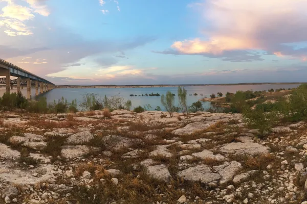
National Recreation Area
An oasis in the desert, Amistad National Recreation Area consists of the US portion of the International Amistad Reservoir. Amistad, a Spanish word meaning "friendship," is known for excellent water-b...
Park data from the National Park Service API. Alerts update every 2 hours.
Expect a highway-focused drive for most of this trip, with 96% of the route utilizing major roadways. The longest uninterrupted stretch you'll encounter is 225.3 miles on US 277, so be prepared for extended periods of consistent travel. While the primary roads are US 277 and I-20, the inclusion of West Freeway suggests some transition into more urban or suburban environments as you approach your destination. This is largely a functional drive, prioritizing efficient travel over winding scenic byways.
This is a straightforward highway drive that stays mostly on US 277 and I 20. This route has several spots where lane changes, forks, or exits need your full attention. The trickiest moment comes around 160.7 miles in.
High effort - long or complex enough to need steady focus all day
Balances navigation complexity with total wheel time.
This is a demanding drive. With 18 significant decision points across 413.1 miles, you will need to stay alert - especially through interchange areas and urban stretches. Consider splitting it into segments if you are not comfortable with fast highway navigation.
Where does it get tricky?
The main spots that need attention: at 160.7 miles: Highway fork - watch signs carefully. Multiple destination signs - pick the right one; at 383.2 miles (I 30 / West Freeway): Highway fork - watch signs carefully. Lane positioning matters here; at 410.7 miles: Exit ramp - move to the correct lane early. Lane positioning matters here. Multiple destination signs - pick the right one.
Based on OSRM destination-sign hints, not a full list of every settlement the road passes.
Between Del Rio, TX and Arlington, TX, road signs point toward Loop 306 East: Eden, Loop 306 North, Fm 1223 and Abilene.
Loop 306 East: Eden
Loop 306 North
Fm 1223
Abilene
Founded 1876
Arlington is a city in the Dallas-Fort Worth Metroplex metropolitan area, in the Prairies and Lakes region of Texas. With a population of almost 400,000 (2019), it is Texas' seventh largest, and the third largest in the Metroplex. Arlington is south of the sprawling DFW International Airport.
Top landmarks
City content from Wikivoyage (CC BY-SA 4.0) and Wikidata (CC0).
Weekend Trip
Doable as a same-day drive at 7h 32m. Total distance: 413.1 miles.
Family Friendly
Moderate complexity with 2 natural rest stops along the way.
Solo Traveler
7h 32m drive, plan rest stops for pacing.
Compiled by the US Trip Planner planning team at COD Solutions Oy from open government datasets — OSRM over OpenStreetMap for geometry, EIA for fuel prices, and NPS for national parks. See our methodology for refresh cadence and limitations.
Was this helpful?
Thanks for your feedback!
Your tip has been submitted. Thanks!
/500
Recent Tips
·
Explore more options from Del Rio, TX or browse trips ending in Arlington, TX.
Looking for more statewide routes? Browse TX road trips.