Traveling from Cloverdale to Long Beach covers 483.3 miles of California scenery, a journey that typically takes about 9 hours and 4 minutes of pure drive time. Because this is a significant distance, I highly recommend breaking the trip into two days to keep your fatigue levels manageable. You will primarily navigate via the Redwood Highway, the Westside Freeway, and the I-5 Truck route. Budgeting approximately $66 for fuel is a smart move for this highway-focused transit. While you remain within the Pacific Coast region for the duration of the trip, the landscape shifts significantly as you head south toward the bustling metropolitan sprawl of Long Beach. Planning for an overnight stay allows you to experience the transition between Northern and Southern California without feeling rushed.
Trip Pace
Best split across 2 days
Treat the return leg as its own travel day rather than an afterthought.
Break Rhythm
2 planned breaks
Plan on a short reset every 3 to 4 hours to stay fresh behind the wheel.
Midpoint
241.6 miles from Cloverdale, CA
A natural place for your longest stop of the day
, about 4h 33m into the drive
.
Main Roads
Road
Distance
Duration
Westside Freeway
224.4 mi
4h
Redwood Highway
68.6 mi
1h 19m
I 5 Truck
58.6 mi
1h 7m
Arthur H. Breed Junior Freeway
29.3 mi
33m
I 405 Truck
23 mi
26m
San Diego Freeway
18 mi
20m
William Elton Brown Freeway
17 mi
18m
MacArthur Freeway
16.4 mi
18m
Longest stretch:
Westside Freeway
— 224.4 mi, about 4h
Traffic on I-5
Hour-of-day weekday pattern from 89 FHWA count stations on your route.
Peak
2 PM
~1,926 veh/hr typical
· worst 2,652
Quietest
2 AM
~360 veh/hr
Peak-to-quiet ratio
5.4×
busier at peak than in the quiet hours
12a6anoon6p11p
Averaged across 44 weeks of 2023 FHWA Travel Monitoring Analysis System data. Weekday hours only (Mon–Fri).
Turn-by-Turn Driving Directions
Step-by-step road directions between Cloverdale, CA and Long Beach, CA.
1
Start on North Cloverdale Boulevard
0.2 mi·32 sec·North Cloverdale Boulevard
2
Turn left onto Citrus Fair Drive
0.2 mi·17 sec·Citrus Fair Drive
3
Take the ramp
0.3 mi·35 sec
Toward Citrus Fair Drive
4
Merge onto US 101; CA 128
69 mi·1 hr 19 min·Redwood Highway
Use the straight / slight right lanes.
5
Keep slight right at fork onto I 580
14 mi·17 min·John T. Knox Freeway
Exit 451BToward I 580: Richmond Bridge, OaklandUse the straight / slight right lanes.
6
Merge onto I 80; I 580
3.8 mi·4 min·Eastshore Freeway
Use the straight / slight right lanes.
7
Keep slight left at fork onto I 580
0.3 mi·21 sec·Interstate Highway 80
Toward I 580 East, I 880 South: Downtown Oakland, Hayward, Stockton, Alameda, San JoseUse the straight / slight right lanes.
8
Keep slight left at fork onto I 580
16 mi·18 min·MacArthur Freeway
Toward I 580: Downtown Oakland, Hayward, StocktonUse the slight left / slight right lanes.
9
Merge onto I 580
12 mi·13 min·Arthur H. Breed Junior Freeway
Use the straight / slight right lanes.
10
Keep slight right at fork onto I 580
18 mi·20 min·Arthur H. Breed Junior Freeway
Use the straight / slight right lanes.
11
Keep slight right at fork onto I 580
11 mi·11 min·William Elton Brown Freeway
12
Keep slight left at fork onto I 580
5.9 mi·6 min·William Elton Brown Freeway
13
Merge onto I 5
224 mi·4 hr·Westside Freeway
Use the straight / slight right lanes.
14
Keep slight right at fork onto I 5 Truck
58 mi·1 hr 6 min·I 5 Truck
Use the straight / slight right lanes.
15
Keep slight left at fork onto I 5
4.1 mi·4 min·Golden State Freeway
Use the straight / slight right lanes.
16
Keep slight right at fork onto I 5 Truck
0.3 mi·17 sec·I 5 Truck
Exit 158Toward I 405 SouthUse the straight / slight right lanes.
17
Keep slight right at fork onto I 405 Truck
23 mi·26 min·I 405 Truck
Use the straight / slight right lanes.
18
Keep slight right at fork onto I 405
18 mi·20 min·San Diego Freeway
Use the straight / slight right lanes.
19
Take the exit
377 ft·9 sec
Toward I 710 South: Long BeachUse the slight right lane.
20
Continue on this road
0.3 mi·39 sec·this road
Exit 32BToward I 710 South: Long Beach
21
Merge onto I 710
2.4 mi·3 min·Long Beach Freeway
Use the straight / slight right lanes.
22
Continue on I 710
0.5 mi·40 sec·Seaside Freeway
Use the straight / slight right lanes.
23
Take the exit
0.3 mi·37 sec
Toward Downtown Long Beach, Convention Center, AquariumUse the slight left / straight lanes.
24
Continue on Shoreline Drive
1.3 mi·2 min·Shoreline Drive
25
Turn left onto South Chestnut Place
0.2 mi·30 sec·South Chestnut Place
Use the left / uturn lanes.
26
Turn right onto West Ocean Boulevard
0.5 mi·1 min·West Ocean Boulevard
27
Continue on East Ocean Boulevard
0.1 mi·21 sec·East Ocean Boulevard
Use the left lane.
28
Arrive at destination
East Ocean Boulevard
Trip Plan
To tackle this 483.3-mile route effectively, aim for an early departure to get ahead of traffic patterns near the major urban hubs. You should plan for at least two deliberate stops to stretch your legs and refuel, keeping your $66 budget in mind. Given that the longest stretch is over 224 miles, monitor your fuel gauge closely while on the Westside Freeway to avoid finding yourself low on gas in rural sections. Since this is a two-day trip, look for a midpoint hotel that allows you to arrive in Long Beach refreshed rather than exhausted. Staying flexible with your departure time is your best tool for managing the heavy traffic often found on these primary California arteries.
Morning Departure
Start early — leave by 6-7 AM to arrive at a reasonable hour.
Evening Departure
This is a long drive — plan for a morning departure or consider splitting it into two days.
This drive is better paced as a 2-day trip.
Plan roughly 2 meaningful breaks for fuel, food, and rest.
The halfway point lands around 241.6 miles from Cloverdale, CA, or about 4h 33m into the drive.
The longest continuous stretch on this route runs about 224.4 miles.
Consider an overnight stop or starting very early.
Departure
Before you leave
Start with fuel, water, and navigation already sorted so the first hour feels easy.
First stop
Around 106 miles or 2h 5m in
Use this first pause for coffee, a restroom break, and a quick traffic check ahead.
Halfway reset
Around 241.6 miles or 4h 33m in
This is the best place for your longest stop, a real meal, and a full fuel check.
Overnight split
Day 1 wrap after about 241.6 miles or 4h 33m
Stop before fatigue turns the last few hours into a grind. You want day two to start fresh, not just resumed.
Final approach
Final hour starts around 7h 51m
Traffic, exits, and arrival timing usually matter more near Long Beach, CA than in the middle of the route.
Before You Leave
+
Open the route before leaving Cloverdale, CA so your first major turns are already loaded.
+
Leave with enough water and a charging cable within reach, not packed away.
+
Check your fuel range against the first long segment, especially if you are starting outside city service areas.
+
Pick one backup stop option before the midpoint in case traffic changes your pacing.
+
Treat this as a 2-day road trip and book the overnight stop before the busiest arrival window.
Day 1
Settle into the route from Cloverdale, CA
Aim for roughly 242 miles and 4.5 hours of wheel time on this day.
Day 2
Finish the approach into Long Beach, CA
Aim for roughly 242 miles and 4.5 hours of wheel time on this day.
Your first comfortable stop window is around 106 miles from Cloverdale, CA.
This route usually feels better as a 2-day drive than as one long push.
Plan about 2 real breaks rather than only quick fuel stops.
The longest stretch is on Westside Freeway for about 224.4 miles.
Where to Stop
Rest stops, refuel points, and overnight suggestions along this route.
Place data sourced from public business listings. Hours and availability may vary.
Heads-up: tricky spots
5 of 24
5 decision points cluster between mile 69.3 and 480.9 — GPS handles the exact turns, but know they're coming. Your lane choice matters more than the turn itself.
9
69.3 mi into trip|~1h 21m in|I 580 / John T. Knox Freeway
Keep slight right at fork onto I 580 / John T. Knox Freeway toward I 580: Richmond Bridge, Oakland
Highway fork - watch signs carefully. Lane positioning matters here. Multiple destination signs - pick the right one
Use the straight / slight right lanes.
Exit 451B
Toward I 580: Richmond Bridge, Oakland
8
86.6 mi into trip|~1h 43m in|I 580 / Interstate Highway 80
Keep slight left at fork onto I 580 / Interstate Highway 80 toward I 580 East, I 880 South: Downtown Oakland, Hayward, Stockton, Alameda, San Jose
Highway fork - watch signs carefully. Lane positioning matters here. Multiple destination signs - pick the right one
Use the straight / slight right lanes.
Toward I 580 East, I 880 South: Downtown Oaklan...
8
86.9 mi into trip|~1h 43m in|I 580 / MacArthur Freeway
Keep slight left at fork onto I 580 / MacArthur Freeway toward I 580: Downtown Oakland, Hayward, Stockton
Highway fork - watch signs carefully. Lane positioning matters here. Multiple destination signs - pick the right one
Use the slight left / slight right lanes.
Toward I 580: Downtown Oakland, Hayward, Stockt...
8
436.4 mi into trip|~8h 6m in|I 5 Truck
Keep slight right at fork onto I 5 Truck toward I 405 South
Highway fork - watch signs carefully. Lane positioning matters here
Use the straight / slight right lanes.
Exit 158
Toward I 405 South
7
480.9 mi into trip|~8h 58m in
Take the exit toward Downtown Long Beach, Convention Center, Aquarium
Exit ramp - move to the correct lane early. Lane positioning matters here. Multiple destination signs - pick the right one
Use the slight left / straight lanes.
Toward Downtown Long Beach, Convention Center,...
Fuel & Cost
Regular Gas
$101.11 one way
$202.22 round trip
$5.31/gal25.4 MPG avg169 kg CO2
Fuel Type
$/gal
One Way
Round Trip
midgrade
$5.52
$105.01
$210.03
premium
$5.67
$107.79
$215.58
diesel
$4.80
$91.26
$182.51
No toll roads detected on this route.
Estimated Trip Cost (one way, 1 person)
Fuel
$101
Hotel (1n)
$80–$140
Meals
$50–$100
Total
$231–$341
Rough estimate based on US averages. Hotel $80–$140/night, meals $25–$50/day.
Estimated CO2 emission: 169.1 kg one way.
Prices: EIA weekly data, 2026-07-13.
Driving Electric?
About $51 in charging
· 1 stop
· 66% less CO2
Vehicle Type
kWh
Stops
DC Fast
Home Charge
Average EV
145
1
$50.75
$23.20
Efficient EV
120.8
1
$42.29
$19.33
EV Truck/SUV
193.3
2
$67.66
$30.93
Gas CO2
169 kg
EV CO2
57 kg (66% less)
Plan for 1 charging stop. A 30-minute DC fast charge mid-route should be enough to complete the trip comfortably.
DC fast charging avg $0.35/kWh. Home charging avg $0.16/kWh. US grid CO2: 0.39 kg/kWh.
Travel Intel
Current conditions at both ends of the drive.
Forecast as of Jul 16, 2026
Origin
Cloverdale, CA
Morning
in Cloverdale on Sunday
Local time
8:23 AM
PDT
Current temp
87°F
Sunny
NW 8 mph0% chanceLive forecast
Special Weather Statement
Special Weather Statement issued July 16 at 4:05PM PDT by NWS San Diego CA
Special Weather Statement
Special Weather Statement issued July 16 at 3:22PM PDT by NWS San Diego CA
Destination
Long Beach, CA
Morning
in Long Beach on Sunday
Local time
8:23 AM
PDT
Current temp
85°F
Mostly Sunny
S 5 to 10 mph2% chanceLive forecast
Special Weather Statement
Special Weather Statement issued July 16 at 4:05PM PDT by NWS San Diego CA
Special Weather Statement
Special Weather Statement issued July 16 at 3:22PM PDT by NWS San Diego CA
Seasonal Notes
Summer travel usually means heavier construction, hotter rest stops, and busier weekend traffic around major cities.
Winter travel shortens daylight, so a route that looks manageable on paper can feel much longer after dark.
Holiday weekends tend to make both departure and arrival windows slower than the raw route time suggests.
For long drives, weather on day two can matter just as much as conditions at departure, so check the whole travel window rather than only the first day.
Time zone
Same local time
Origin and destination are on the same clock, so arrival timing is easier to judge at a glance.
Temperature spread
2 degrees cooler at arrival
A meaningful temperature swing is a good cue to rethink layers, water, and how soon you want to arrive.
Road read
9h 4m on the road
This is long enough that the arrival forecast matters almost as much as departure conditions. Recheck both ends before you roll.
Weather data from the National Weather Service. Conditions may change; check closer to your travel date.
National Parks Near This Route
Worth a detour if your schedule allows.
Rosie the Riveter WWII Home Front National Historical Park
National Historical Park
Celebrate and honor the contributions and sacrifices of American civilians on the WWII home front. Discover how diverse communities lived, worked, and interacted. Many faces, many stories, many truths...
Walk among old growth coast redwoods, cooling their roots in the fresh water of Redwood Creek and lifting their crowns to reach the sun and fog. Federally protected as a National Monument since 1908,...
Established in 1988, San Francisco Maritime National Historical Park celebrates America’s maritime heritage on the Pacific Coast. Our 50-acre park has grown around Aquatic Park Cove, a protected area...
8 mi from route
~20 min detour
Free
near mile 83.3
Experience a park so rich it supports 19 distinct ecosystems with over 2,000 plant and animal species. Go for a hike, enjoy a vista, have a picnic or learn about the centuries of overlapping history f...
10 mi from route
~25 min detour
Free
near mile 66.7
The Santa Monica Mountains offer easy access to surprisingly wild places. Experience the famous beaches of Malibu or explore more than 500 miles of trails. The park abounds with historical and cultura...
17 mi from route
~42 min detour
Free
near mile 449.9
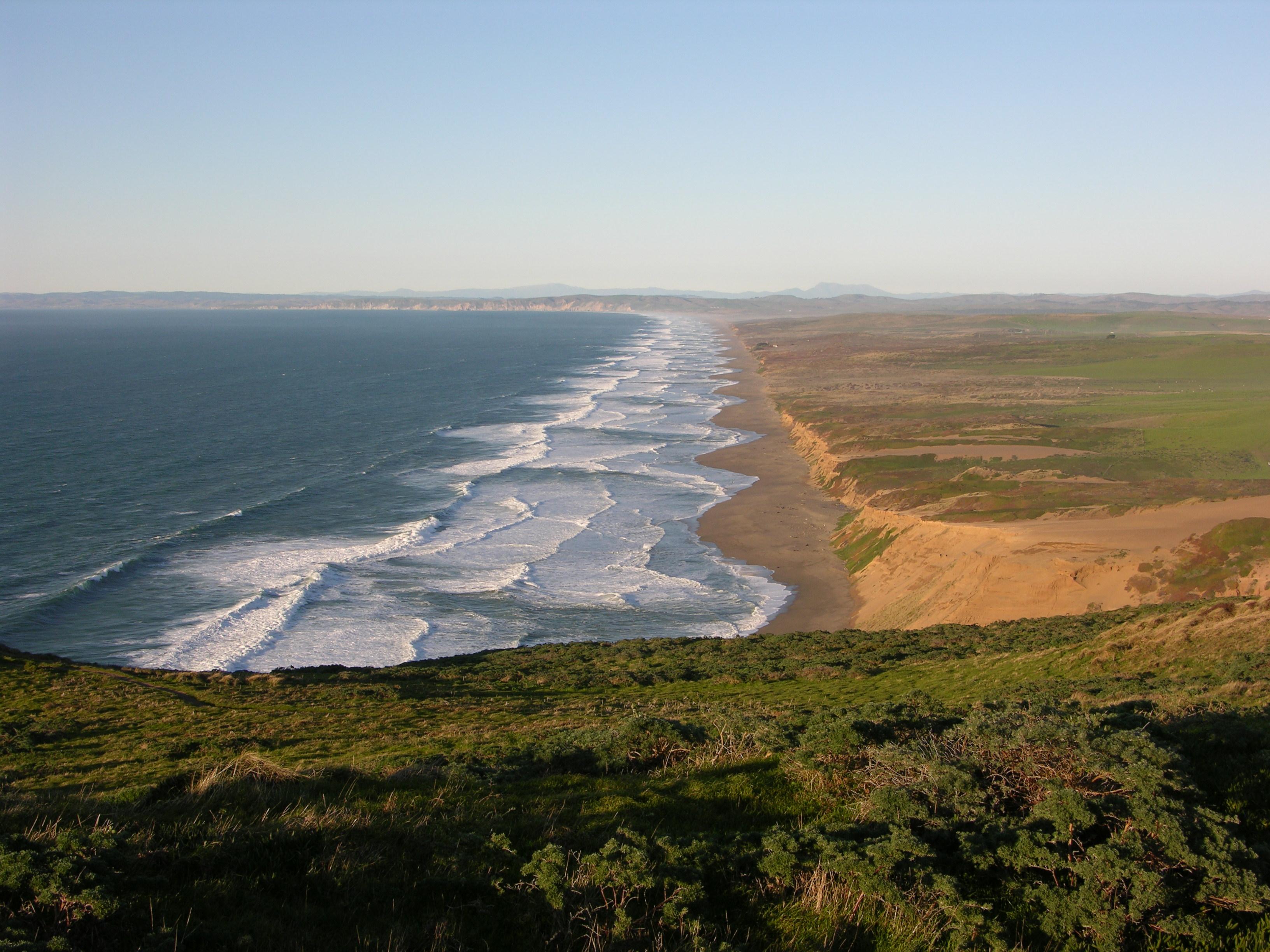
From its thunderous ocean breakers crashing against rocky headlands and expansive sand beaches to its open grasslands, brushy hillsides, and forested ridges, Point Reyes offers visitors over 1500 spec...
Park data from the National Park Service API. Alerts update every 2 hours.
More Details
What kind of drive is this?
Expect a very efficient trip, as 85% of this route consists of high-speed highway driving. You will spend a large portion of your time on the Westside Freeway, which includes the longest uninterrupted stretch of the journey at 224.4 miles. This is not a technical, winding backroad drive; instead, it is a straightforward interstate transit designed for steady progress. As you move away from the Redwood Highway and transition onto the major I-5 corridors, the personality of the road becomes much more utilitarian. Be prepared for a consistent, high-speed pace that favors reaching your destination quickly over navigating complex terrain.
85% highway — fuel and pacing are the main things to plan.
28 navigation steps total — most of the decisions cluster near the start and finish.
Longest single stretch: 224.4 mi on Westside Freeway.
How Hard Is This Drive?
9/10
This is a straightforward highway drive that stays mostly on Westside Freeway and Redwood Highway. This route has several spots where lane changes, forks, or exits need your full attention. The trickiest moment comes around 69.3 miles in near I 580 / John T. Knox Freeway.
Driving Effort9/10
High effort - long or complex enough to need steady focus all day
Balances navigation complexity with total wheel time.
This is a demanding drive. With 24 significant decision points across 483.3 miles, you will need to stay alert - especially through interchange areas and urban stretches. Consider splitting it into segments if you are not comfortable with fast highway navigation.
Where does it get tricky?
The main spots that need attention: at 69.3 miles (I 580 / John T. Knox Freeway): Highway fork - watch signs carefully. Lane positioning matters here. Multiple destination signs - pick the right one; at 86.6 miles (I 580 / Interstate Highway 80): Highway fork - watch signs carefully. Lane positioning matters here. Multiple destination signs - pick the right one; at 86.9 miles (I 580 / MacArthur Freeway): Highway fork - watch signs carefully. Lane positioning matters here. Multiple destination signs - pick the right one.
Elevation Profile
Gently rolling terrain
2,291 ft7 ft
Total Climb
2,809 ft
Total Descent
3,108 ft
Highest Point
2,291 ft
~414.2 mi in
Elevation Range
2,284 ft
Notable High Points
2,291 ft at ~414.2 miles+738 ft prominence
Towns Mentioned on Route Signs
Based on OSRM destination-sign hints, not a full list of every settlement the road passes.
Between Cloverdale, CA and Long Beach, CA, road signs point toward Oakland, Hayward, Stockton, Alameda and San Jose.
Long Beach is a large port city in Los Angeles County in Southern California. Long Beach has some nice people-gathering amenities and genuine tourist attractions, such as a world-class aquarium and the Queen Mary floating museum/hotel. Special events are also held in the city like the annual Long Beach Grand Prix (a premier racing event held on city streets) and the annual Long Beach Lesbian & Gay Pride event. When compared to other areas like Hollywood, West Hollywood, Santa Monica and West L.A., Long Beach may not always be at the top of someone's tourist visit to the Los Angeles area, but the city draws its fair share of visitors and has proven it can definitely hold its own.
Top landmarks
•RMS Queen Mary — retired British ocean liner
•Terminal Island — island in Los Angeles County, California, United States
•Aquarium of the Pacific — public aquarium in Long Beach, California
The longest stretch is about 224.4 miles on Westside Freeway. The full list of main roads is in the Roads section above.
Yes — a 2-day pace is more comfortable than one long haul. A sensible stopping point is after roughly 242 miles on day one.
We did not find dedicated rest areas on this route. For a drive this long, plan bathroom and stretch breaks around gas stations, fast-food stops, or small-town downtowns — check the Nearby Places section for options.
It helps. This route has a higher-than-average number of complex decision points, which get harder in the dark. If the last hour of the trip is on surface roads or mountain grades, aim to arrive at Long Beach, CA before sunset when you can. Check the Trip Plan for departure windows that land you in daylight.
Only with planning. This is a long drive for kids — consider splitting it into two days rather than pushing through. Plan at least 2 meaningful breaks. Dedicated rest areas are limited, so plan gas or food stops as your bathroom breaks.
The main spots that need attention: at 69.3 miles (I 580 / John T. Knox Freeway): Highway fork - watch signs carefully. Lane positioning matters here. Multiple destination signs - pick the right one; at 86.6 miles (I 580 / Interstate Highway 80): Highway fork - watch signs carefully. Lane positioning matters here. Multiple destination signs - pick the right one; at 86.9 miles (I 580 / MacArthur Freeway): Highway fork - watch signs carefully. Lane positioning matters here. Multiple destination signs - pick the right one.
Yes — Rosie the Riveter WWII Home Front National Historical Park, Muir Woods National Monument and San Francisco Maritime National Historical Park (6 total within detour distance). See the National Parks section for detour distances and tips on detours.
Not recommended in a single day. At 9.1 hours each way, a round trip means 18.1 hours of driving — that is an unsafe level of fatigue for most drivers. Plan at least one night at Long Beach, CA before the return drive.