This 457.3-mile journey from Boulder City, NV to Reno, NV will take approximately 9 hours and 5 minutes of driving time. Given its duration, this trip is best split over two days, allowing for a more relaxed pace. You'll primarily navigate Veterans Memorial Highway and US 95 ALT, with some sections on Silver Peak Road contributing to the overall driving experience. The estimated fuel cost for this route is around $91. As you travel within the Mountain West region of Nevada, expect a local drive with numerous turns. This route is not ideal for a single-day excursion.
Trip Pace
Best split across 2 days
Treat the return leg as its own travel day rather than an afterthought.
Break Rhythm
2 planned breaks
Plan on a short reset every 3 to 4 hours to stay fresh behind the wheel.
Midpoint
228.7 miles from Boulder City, NV
A natural place for your longest stop of the day
, about 4h 25m into the drive
.
Main Roads
Road
Distance
Duration
Veterans Memorial Highway
262.3 mi
4h 50m
US 95 ALT
50 mi
58m
Silver Peak Road
45.6 mi
57m
Purple Heart Highway
38.9 mi
44m
USA Parkway
19.6 mi
30m
Dwight D. Eisenhower Highway
18.6 mi
21m
West Main Street
6.2 mi
8m
Boulder City Parkway
4.2 mi
6m
Longest stretch:
Veterans Memorial Highway
— 262.3 mi, about 4h 50m
Traffic on I-80
Hour-of-day weekday pattern from 23 FHWA count stations on your route.
Peak
4 PM
~3,560 veh/hr typical
Quietest
2 AM
~266 veh/hr
Peak-to-quiet ratio
13.4×
busier at peak than in the quiet hours
12a6anoon6p11p
Averaged across 52 weeks of 2023 FHWA Travel Monitoring Analysis System data. Weekday hours only (Mon–Fri).
Turn-by-Turn Driving Directions
Step-by-step road directions between Boulder City, NV and Reno, NV.
1
Start on this road
177 ft·19 sec·this road
2
Turn left onto Avenue G
324 ft·16 sec·Avenue G
3
Turn right onto Arizona Street
0.3 mi·58 sec·Arizona Street
4
Turn left onto Nevada Way
0.7 mi·2 min·Nevada Way
5
Continue on Boulder City Parkway
0.6 mi·1 min·Boulder City Parkway
6
Continue on US 93 BUS
3.6 mi·4 min·Boulder City Parkway
Use the straight / slight right lanes.
7
Continue on I 11; US 93; US 95
39 mi·44 min·Purple Heart Highway
Use the straight / slight right lanes.
8
Continue on US 95
99 mi·1 hr 48 min·Veterans Memorial Highway
Use the straight / slight right lanes.
9
Continue on US 95
0.2 mi·46 sec·South 2nd Street
10
Turn right onto US 95
6.2 mi·8 min·West Main Street
11
Continue on US 95
60 mi·1 hr 4 min·Veterans Memorial Highway
12
Continue on US 95
0.4 mi·1 min·South Sundog Avenue
13
Continue on US 95
0.5 mi·1 min·East Crook Avenue
14
Continue on US 95
4.4 mi·5 min·Veterans Memorial Highway
15
Turn left onto 3457
25 mi·35 min·Silver Peak Road
16
Turn right onto Cinnabar Way
0.1 mi·28 sec·Cinnabar Way
17
Turn slight right onto Silver Peak Road
21 mi·22 min·Silver Peak Road
18
At end of road, turn left onto US 6; US 95
35 mi·37 min·Veterans Memorial Highway
19
Continue on US 95
1.2 mi·3 min·Front Street
20
Continue on US 95
7.8 mi·8 min·Veterans Memorial Highway
21
Continue on US 95
0.9 mi·2 min·Plymire Street
22
Continue on US 95
23 mi·25 min·Veterans Memorial Highway
23
Take the exit onto US 95 Truck
1.3 mi·2 min·US 95 Truck
24
Take the exit onto US 95 Truck
324 ft·12 sec·US 95 Truck
25
Merge onto US 95
33 mi·39 min·Veterans Memorial Highway
26
Turn left onto US 95 ALT
23 mi·25 min·US 95 ALT
27
Turn right onto US 95 ALT
1.0 mi·2 min·Goldfield Avenue
28
Turn right onto US 95 ALT
27 mi·32 min·US 95 ALT
29
Turn left onto Ramsey Weeks Cutoff
3.4 mi·5 min·Ramsey Weeks Cutoff
30
Turn right onto US 50
0.9 mi·1 min·California Emigrant Trail
31
Enter roundabout onto NV 439
267 ft·3 sec·USA Parkway
32
Continue on NV 439
20 mi·30 min·USA Parkway
33
Merge onto I 80
19 mi·21 min·Dwight D. Eisenhower Highway
34
Take the exit
0.2 mi·45 sec
Exit 13Toward US 395 BUS: Downtown Reno
35
Continue on East 8th Street
400 ft·18 sec·East 8th Street
36
Turn left onto US 395 BUS
0.4 mi·1 min·North Virginia Street
37
Turn left onto East 4th Street
202 ft·8 sec·East 4th Street
38
Turn right
171 ft·11 sec
39
Turn right
105 ft·7 sec
40
Arrive at destination
Trip Plan
With a 9-hour drive time, planning for an overnight stop is highly recommended to make this trip enjoyable. Consider breaking the journey roughly in half to avoid fatigue. The longest stretch, 262.3 miles on Veterans Memorial Highway, might be a good candidate for a substantial portion of your first day's driving. Keep an eye on your fuel gauge, especially on the less-trafficked local roads, and plan your refueling stops accordingly. Aim to depart in the morning to maximize daylight hours for navigating the turn-heavy sections.
Morning Departure
Start early — leave by 6-7 AM to arrive at a reasonable hour.
Evening Departure
This is a long drive — plan for a morning departure or consider splitting it into two days.
This drive is better paced as a 2-day trip.
Plan roughly 2 meaningful breaks for fuel, food, and rest.
The halfway point lands around 228.7 miles from Boulder City, NV, or about 4h 25m into the drive.
The longest continuous stretch on this route runs about 262.3 miles.
Consider an overnight stop or starting very early.
Departure
Before you leave
Start with fuel, water, and navigation already sorted so the first hour feels easy.
First stop
Around 101 miles or 1h 57m in
Use this first pause for coffee, a restroom break, and a quick traffic check ahead.
Halfway reset
Around 228.7 miles or 4h 25m in
This is the best place for your longest stop, a real meal, and a full fuel check.
Overnight split
Day 1 wrap after about 228.7 miles or 4h 25m
Stop before fatigue turns the last few hours into a grind. You want day two to start fresh, not just resumed.
Final approach
Final hour starts around 7h 44m
Traffic, exits, and arrival timing usually matter more near Reno, NV than in the middle of the route.
Before You Leave
+
Open the route before leaving Boulder City, NV so your first major turns are already loaded.
+
Leave with enough water and a charging cable within reach, not packed away.
+
Check your fuel range against the first long segment, especially if you are starting outside city service areas.
+
Pick one backup stop option before the midpoint in case traffic changes your pacing.
+
Treat this as a 2-day road trip and book the overnight stop before the busiest arrival window.
Day 1
Settle into the route from Boulder City, NV
Aim for roughly 229 miles and 4.5 hours of wheel time on this day.
Day 2
Finish the approach into Reno, NV
Aim for roughly 229 miles and 4.5 hours of wheel time on this day.
Your first comfortable stop window is around 101 miles from Boulder City, NV.
This route usually feels better as a 2-day drive than as one long push.
Plan about 2 real breaks rather than only quick fuel stops.
The longest stretch is on Veterans Memorial Highway for about 262.3 miles.
Where to Stop
Rest stops, refuel points, and overnight suggestions along this route.
Place data sourced from public business listings. Hours and availability may vary.
Heads-up: tricky spots
5 of 23
5 decision points cluster between mile 0 and 456.5 — GPS handles the exact turns, but know they're coming. Your lane choice matters more than the turn itself.
5
0 mi into trip|~0m in|Avenue G
Turn left onto Avenue G
Navigation decision point
4
0.1 mi into trip|~0m in|Arizona Street
Turn right onto Arizona Street
Navigation decision point
4
143.3 mi into trip|~2h 44m in|US 95 / West Main Street
Turn right onto US 95 / West Main Street
Navigation decision point
4
260.3 mi into trip|~5h 3m in|US 6; US 95 / Veterans Memorial Highway
At end of road, turn left onto US 6; US 95 / Veterans Memorial Highway
Navigation decision point
5
456.5 mi into trip|~9h 2m in
Take the exit toward US 395 BUS: Downtown Reno
Exit ramp - move to the correct lane early
Exit 13
Toward US 395 BUS: Downtown Reno
Fuel & Cost
Regular Gas
$81.04 one way
$162.07 round trip
$4.50/gal25.4 MPG avg160 kg CO2
Fuel Type
$/gal
One Way
Round Trip
midgrade
$4.82
$86.78
$173.56
premium
$5.04
$90.78
$181.55
diesel
$4.80
$86.35
$172.69
No toll roads detected on this route.
Estimated Trip Cost (one way, 1 person)
Fuel
$81
Hotel (1n)
$80–$140
Meals
$50–$100
Total
$211–$321
Rough estimate based on US averages. Hotel $80–$140/night, meals $25–$50/day.
Estimated CO2 emission: 160 kg one way.
Prices: EIA weekly data, 2026-07-13.
Driving Electric?
About $48 in charging
· 1 stop
· 66% less CO2
Vehicle Type
kWh
Stops
DC Fast
Home Charge
Average EV
137.2
1
$48.02
$21.95
Efficient EV
114.3
1
$40.01
$18.29
EV Truck/SUV
182.9
2
$64.02
$29.27
Gas CO2
160 kg
EV CO2
54 kg (66% less)
Plan for 1 charging stop. A 30-minute DC fast charge mid-route should be enough to complete the trip comfortably.
DC fast charging avg $0.35/kWh. Home charging avg $0.16/kWh. US grid CO2: 0.39 kg/kWh.
Travel Intel
Current conditions at both ends of the drive.
Forecast as of Jul 17, 2026
Origin
Boulder City, NV
Evening
in Boulder City on Saturday
Local time
7:50 PM
PDT
Current temp
104°F
Sunny
SSE 15 mph8% chanceLive forecast
Special Weather Statement
Special Weather Statement issued July 16 at 4:50PM PDT by NWS Elko NV
Special Weather Statement
Special Weather Statement issued July 16 at 4:41PM PDT by NWS Elko NV
Destination
Reno, NV
Evening
in Reno on Saturday
Local time
7:50 PM
PDT
Current temp
93°F
Sunny
W 10 mph0% chanceLive forecast
Special Weather Statement
Special Weather Statement issued July 16 at 4:50PM PDT by NWS Elko NV
Special Weather Statement
Special Weather Statement issued July 16 at 4:41PM PDT by NWS Elko NV
Seasonal Notes
Summer travel usually means heavier construction, hotter rest stops, and busier weekend traffic around major cities.
Winter travel shortens daylight, so a route that looks manageable on paper can feel much longer after dark.
Holiday weekends tend to make both departure and arrival windows slower than the raw route time suggests.
For long drives, weather on day two can matter just as much as conditions at departure, so check the whole travel window rather than only the first day.
Time zone
Same local time
Origin and destination are on the same clock, so arrival timing is easier to judge at a glance.
Temperature spread
11 degrees cooler at arrival
A meaningful temperature swing is a good cue to rethink layers, water, and how soon you want to arrive.
Road read
9h 5m on the road
This is long enough that the arrival forecast matters almost as much as departure conditions. Recheck both ends before you roll.
Weather data from the National Weather Service. Conditions may change; check closer to your travel date.
National Parks Near This Route
Worth a detour if your schedule allows.
Tule Springs Fossil Beds National Monument
National Monument
Over the last ~570,000 years, water has transformed the Upper Las Vegas Valley. Tule Springs Fossil Beds National Monument is an urban park that preserves the unique story of this ever-changing enviro...
3 mi from route
~6 min detour
Free
near mile 47.3
Park Closure: South Unit temporarily closed south of Grand Teton Drive; Trailheads remain open.
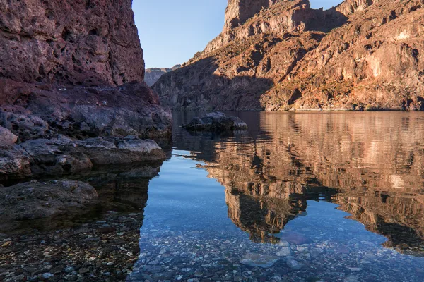
Experience outdoor thrills, striking landscapes, and brilliant blue waters. This year-round recreation area spreads across 1.5 million acres of mountains, canyons, valleys and two vast reservoirs. Vis...
Park data from the National Park Service API. Alerts update every 2 hours.
More Details
What kind of drive is this?
The character of this drive is a 'turn-heavy local drive' with only 16% of the route on highways. You'll experience the longest uninterrupted stretch of 262.3 miles on Veterans Memorial Highway, offering a more consistent driving segment before transitioning to other roads. The remaining portions will involve more frequent turns and potentially varied road conditions as you move through different local routes like US 95 ALT and Silver Peak Road. Be prepared for a less predictable driving rhythm compared to a pure interstate trip.
Only 16% highway — the rest is turn-by-turn surface driving.
40 navigation steps total — most of the decisions cluster near the start and finish.
Longest single stretch: 262.3 mi on Veterans Memorial Highway.
How Hard Is This Drive?
5/10
Expect a hands-on drive with frequent turns and local roads rather than long highway stretches. You will hit about 23 points where you need to pay attention to lane position or signs. The trickiest moment comes early in the drive near Avenue G.
Driving Effort5/10
Moderate - straightforward overall, but long enough or busy enough to require pacing
Balances navigation complexity with total wheel time.
This drive requires moderate attention. Across 457.3 miles you will encounter 23 spots where lane choice or exit timing matters. Not difficult for experienced highway drivers, but worth previewing the tricky sections before you go.
Where does it get tricky?
The main spots that need attention: near the start (Avenue G): Navigation decision point; at 0.1 miles (Arizona Street): Navigation decision point; at 143.3 miles (US 95 / West Main Street): Navigation decision point.
Boulder City is a city of 15,000 people (2021) in Southern Nevada, which was built for construction workers of the nearby Hoover Dam. It is one of only two cities in Nevada where gambling is prohibited.
Top landmarks
•Alan Bible Visitor Center — visitor center and botanical garden in Nevada, USA
Reno, the "Biggest Little City in the World", is in the beautiful north-west region of the State of Nevada, right at the base of the Sierra Nevada mountain range. Reno is the second largest tourist destination in Nevada, mainly thanks to its popular downtown casinos. It also has family entertainment, festivals, museums, and cuisine.
Top landmarks
•Reno — railway station in Reno, Nevada, United States
•Pioneer Center for the Performing Arts — theater in Reno, Nevada, United States
•Mizpah Hotel — former hotel building in Reno, Nevada, USA
Moderate complexity with 2 natural rest stops along the way.
Solo Traveler
9h 5m drive, plan rest stops for pacing.
Scenic Drive
Mostly surface roads route profile with national parks nearby.
Frequently Asked Questions
The longest stretch is about 262.3 miles on Veterans Memorial Highway. The full list of main roads is in the Roads section above.
Yes — a 2-day pace is more comfortable than one long haul. A sensible stopping point is after roughly 229 miles on day one.
Yes — we found about 12 rest areas or service plazas within a short detour of the route (from OpenStreetMap). See the Rest Stops tab under Nearby Places for locations and mile markers. Plan to stretch, use the bathroom, and top off fluids every 2–3 hours on longer drives.
It helps. This is a long drive, so arriving tired and in the dark compounds. If the last hour of the trip is on surface roads or mountain grades, aim to arrive at Reno, NV before sunset when you can. Check the Trip Plan for departure windows that land you in daylight.
Only with planning. This is a long drive for kids — consider splitting it into two days rather than pushing through. Plan at least 2 meaningful breaks. There are 12 rest areas along the route for bathroom stops.
Mostly yes along the main roads, but rural stretches through NV can have sparse or no coverage. Before you leave, download offline Google Maps or Apple Maps for the route, and consider downloading music or podcasts instead of streaming. If you depend on data for navigation, keep a paper backup of the turn-by-turn directions.
The main spots that need attention: near the start (Avenue G): Navigation decision point; at 0.1 miles (Arizona Street): Navigation decision point; at 143.3 miles (US 95 / West Main Street): Navigation decision point.
Yes — Tule Springs Fossil Beds National Monument and Lake Mead National Recreation Area. See the National Parks section for detour distances and tips on detours.
Not recommended in a single day. At 9.1 hours each way, a round trip means 18.2 hours of driving — that is an unsafe level of fatigue for most drivers. Plan at least one night at Reno, NV before the return drive.