Boulder City, NV to Yerington, NV is 386.8 miles and takes about 7h 30m via Veterans Memorial Highway, with a fuel budget near $80 and enough daylight to finish in a day. This drive stays within Nevada, connecting the Mountain West regions. You'll be on mostly surface roads for the majority of the trip, offering a straightforward path. It's a single-day drive, so you can depart in the morning and arrive by evening, making it a convenient option for a direct connection between these two locations.
Trip Pace
Same-day drive is realistic
A same-day return is possible, but it will make for a full day on the road.
Break Rhythm
2 planned breaks
Plan on a short reset every 3 to 4 hours to stay fresh behind the wheel.
Midpoint
193.4 miles from Boulder City, NV
A natural place for your longest stop of the day
, about 3h 39m into the drive
.
Main Roads
Road
Distance
Duration
Veterans Memorial Highway
262.3 mi
4h 50m
Silver Peak Road
45.6 mi
57m
Purple Heart Highway
38.9 mi
44m
US 95 ALT
23.9 mi
26m
West Main Street
6.2 mi
8m
Boulder City Parkway
4.2 mi
6m
US 95 Truck
1.4 mi
2m
Front Street
1.2 mi
3m
Longest stretch:
Veterans Memorial Highway
— 262.3 mi, about 4h 50m
Turn-by-Turn Driving Directions
Step-by-step road directions between Boulder City, NV and Yerington, NV.
1
Start on this road
177 ft·19 sec·this road
2
Turn left onto Avenue G
324 ft·16 sec·Avenue G
3
Turn right onto Arizona Street
0.3 mi·58 sec·Arizona Street
4
Turn left onto Nevada Way
0.7 mi·2 min·Nevada Way
5
Continue on Boulder City Parkway
0.6 mi·1 min·Boulder City Parkway
6
Continue on US 93 BUS
3.6 mi·4 min·Boulder City Parkway
Use the straight / slight right lanes.
7
Continue on I 11; US 93; US 95
39 mi·44 min·Purple Heart Highway
Use the straight / slight right lanes.
8
Continue on US 95
99 mi·1 hr 48 min·Veterans Memorial Highway
Use the straight / slight right lanes.
9
Continue on US 95
0.2 mi·46 sec·South 2nd Street
10
Turn right onto US 95
6.2 mi·8 min·West Main Street
11
Continue on US 95
60 mi·1 hr 4 min·Veterans Memorial Highway
12
Continue on US 95
0.4 mi·1 min·South Sundog Avenue
13
Continue on US 95
0.5 mi·1 min·East Crook Avenue
14
Continue on US 95
4.4 mi·5 min·Veterans Memorial Highway
15
Turn left onto 3457
25 mi·35 min·Silver Peak Road
16
Turn right onto Cinnabar Way
0.1 mi·28 sec·Cinnabar Way
17
Turn slight right onto Silver Peak Road
21 mi·22 min·Silver Peak Road
18
At end of road, turn left onto US 6; US 95
35 mi·37 min·Veterans Memorial Highway
19
Continue on US 95
1.2 mi·3 min·Front Street
20
Continue on US 95
7.8 mi·8 min·Veterans Memorial Highway
21
Continue on US 95
0.9 mi·2 min·Plymire Street
22
Continue on US 95
23 mi·25 min·Veterans Memorial Highway
23
Take the exit onto US 95 Truck
1.3 mi·2 min·US 95 Truck
24
Take the exit onto US 95 Truck
324 ft·12 sec·US 95 Truck
25
Merge onto US 95
33 mi·39 min·Veterans Memorial Highway
26
Turn left onto US 95 ALT
24 mi·26 min·US 95 ALT
27
Turn left onto Pacific Street
88 ft·3 sec·Pacific Street
28
Arrive at destination
Pacific Street
Trip Plan
Given the 7.5-hour estimated drive time, starting early from Boulder City is recommended to maximize daylight. Plan for your two stops strategically, perhaps around the halfway point or when you need a break from the 262.3-mile stretch on Veterans Memorial Highway. With a fuel cost estimate of $80, ensure your vehicle is topped off before you leave Boulder City, as fuel availability might be less frequent on the surface road sections. This is a manageable one-day trip, so you have flexibility in your departure time and stop duration.
Morning Departure
Start early — leave by 6-7 AM to arrive at a reasonable hour.
Evening Departure
This is a long drive — plan for a morning departure or consider splitting it into two days.
You can normally do this drive in one day.
Plan roughly 2 meaningful breaks for fuel, food, and rest.
The halfway point lands around 193.4 miles from Boulder City, NV, or about 3h 39m into the drive.
The longest continuous stretch on this route runs about 262.3 miles.
This is a comfortable same-day trip.
Departure
Before you leave
Start with fuel, water, and navigation already sorted so the first hour feels easy.
First stop
Around 85 miles or 1h 39m in
Use this first pause for coffee, a restroom break, and a quick traffic check ahead.
Halfway reset
Around 193.4 miles or 3h 39m in
This is the best place for your longest stop, a real meal, and a full fuel check.
Final approach
Final hour starts around 6h 19m
Traffic, exits, and arrival timing usually matter more near Yerington, NV than in the middle of the route.
Before You Leave
+
Open the route before leaving Boulder City, NV so your first major turns are already loaded.
+
Leave with enough water and a charging cable within reach, not packed away.
+
Check your fuel range against the first long segment, especially if you are starting outside city service areas.
+
Pick one backup stop option before the midpoint in case traffic changes your pacing.
Day 1
Settle into the route from Boulder City, NV
This is one driving day of about 386.8 miles and 7h 30m.
Your first comfortable stop window is around 85 miles from Boulder City, NV.
This route can stay practical as a one-day drive if traffic stays reasonable.
Plan about 2 real breaks rather than only quick fuel stops.
The longest stretch is on Veterans Memorial Highway for about 262.3 miles.
Where to Stop
Rest stops, refuel points, and overnight suggestions along this route.
Place data sourced from public business listings. Hours and availability may vary.
Heads-up: tricky spots
5 of 13
5 decision points cluster between mile 0 and 386.8 — GPS handles the exact turns, but know they're coming. Your lane choice matters more than the turn itself.
5
0 mi into trip|~0m in|Avenue G
Turn left onto Avenue G
Navigation decision point
4
0.1 mi into trip|~0m in|Arizona Street
Turn right onto Arizona Street
Navigation decision point
4
143.3 mi into trip|~2h 44m in|US 95 / West Main Street
Turn right onto US 95 / West Main Street
Navigation decision point
4
260.3 mi into trip|~5h 3m in|US 6; US 95 / Veterans Memorial Highway
At end of road, turn left onto US 6; US 95 / Veterans Memorial Highway
Navigation decision point
4
386.8 mi into trip|~7h 30m in|Pacific Street
Turn left onto Pacific Street
Navigation decision point
Fuel & Cost
Regular Gas
$68.54 one way
$137.09 round trip
$4.50/gal25.4 MPG avg135 kg CO2
Fuel Type
$/gal
One Way
Round Trip
midgrade
$4.82
$73.40
$146.80
premium
$5.04
$76.78
$153.56
diesel
$4.80
$73.04
$146.07
No toll roads detected on this route.
Estimated Trip Cost (one way, 1 person)
Fuel
$69
Meals
$25–$50
Total
$94–$119
Rough estimate based on US averages. Hotel $80–$140/night, meals $25–$50/day.
Estimated CO2 emission: 135.3 kg one way.
Prices: EIA weekly data, 2026-07-13.
Driving Electric?
About $41 in charging
· 1 stop
· 67% less CO2
Vehicle Type
kWh
Stops
DC Fast
Home Charge
Average EV
116
1
$40.61
$18.57
Efficient EV
96.7
1
$33.85
$15.47
EV Truck/SUV
154.7
1
$54.15
$24.76
Gas CO2
135 kg
EV CO2
45 kg (67% less)
Plan for 1 charging stop. A 30-minute DC fast charge mid-route should be enough to complete the trip comfortably.
DC fast charging avg $0.35/kWh. Home charging avg $0.16/kWh. US grid CO2: 0.39 kg/kWh.
Travel Intel
Current conditions at both ends of the drive.
Forecast as of Jul 17, 2026
Origin
Boulder City, NV
Late night
in Boulder City on Sunday
Local time
2:07 AM
PDT
Current temp
86°F
Slight Chance Showers And Thunderstorms
SSE 13 to 16 mph18% chanceLive forecast
Destination
Yerington, NV
Late night
in Yerington on Sunday
Local time
2:07 AM
PDT
Current temp
57°F
Mostly Clear
W 5 to 10 mph0% chanceLive forecast
Seasonal Notes
Summer travel usually means heavier construction, hotter rest stops, and busier weekend traffic around major cities.
Winter travel shortens daylight, so a route that looks manageable on paper can feel much longer after dark.
Holiday weekends tend to make both departure and arrival windows slower than the raw route time suggests.
Time zone
Same local time
Origin and destination are on the same clock, so arrival timing is easier to judge at a glance.
Temperature spread
29 degrees cooler at arrival
A meaningful temperature swing is a good cue to rethink layers, water, and how soon you want to arrive.
Road read
7h 30m on the road
Start early — leave by 6-7 AM to arrive at a reasonable hour.
Weather data from the National Weather Service. Conditions may change; check closer to your travel date.
National Parks Near This Route
Worth a detour if your schedule allows.
Tule Springs Fossil Beds National Monument
National Monument
Over the last ~570,000 years, water has transformed the Upper Las Vegas Valley. Tule Springs Fossil Beds National Monument is an urban park that preserves the unique story of this ever-changing enviro...
7 mi from route
~16 min detour
Free
near mile 53.4
Park Closure: South Unit temporarily closed south of Grand Teton Drive; Trailheads remain open.
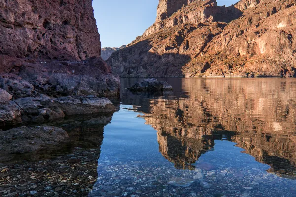
Experience outdoor thrills, striking landscapes, and brilliant blue waters. This year-round recreation area spreads across 1.5 million acres of mountains, canyons, valleys and two vast reservoirs. Vis...
Park data from the National Park Service API. Alerts update every 2 hours.
More Details
What kind of drive is this?
This route covers 386.8 miles, with only 8% on highways, meaning you'll spend most of your time on surface roads. The longest continuous stretch on Veterans Memorial Highway is 262.3 miles, so expect long segments of consistent cruising after you leave the main highway. You'll notice the transition from highway to primarily surface roads early on, setting the tone for the rest of your drive.
Only 8% highway — the rest is turn-by-turn surface driving.
28 navigation steps total — most of the decisions cluster near the start and finish.
Longest single stretch: 262.3 mi on Veterans Memorial Highway.
How Hard Is This Drive?
4/10
Expect a hands-on drive with frequent turns and local roads rather than long highway stretches. There are only a few real navigation decisions along the way. The trickiest moment comes early in the drive near Avenue G.
Driving Effort4/10
Easy - simple navigation with a manageable amount of wheel time
Balances navigation complexity with total wheel time.
The route itself is not hard, but at 7h 30m, endurance matters. Plan breaks every 2-3 hours. The 13 decision points are all manageable with basic attention.
Where does it get tricky?
The main spots that need attention: near the start (Avenue G): Navigation decision point; at 0.1 miles (Arizona Street): Navigation decision point; at 143.3 miles (US 95 / West Main Street): Navigation decision point.
Elevation Profile
High-altitude sections with notable climbs
5,048 ft2,072 ft
Total Climb
4,051 ft
Total Descent
2,172 ft
Highest Point
5,048 ft
~221.1 mi in
Elevation Range
2,976 ft
Notable High Points
5,048 ft at ~221.1 miles+119 ft prominence
Detours Along the Way
Tagged by where each one fits in your drive — first break, midpoint, final stretch.
Boulder City is a city of 15,000 people (2021) in Southern Nevada, which was built for construction workers of the nearby Hoover Dam. It is one of only two cities in Nevada where gambling is prohibited.
Top landmarks
•Alan Bible Visitor Center — visitor center and botanical garden in Nevada, USA
Doable as a same-day drive at 7h 30m. Total distance: 386.8 miles.
Family Friendly
Moderate complexity with 2 natural rest stops along the way.
Solo Traveler
7h 30m drive, plan rest stops for pacing.
Scenic Drive
Mostly surface roads route profile with national parks nearby.
Frequently Asked Questions
The longest stretch is about 262.3 miles on Veterans Memorial Highway. The full list of main roads is in the Roads section above.
Yes — we found about 9 rest areas or service plazas within a short detour of the route (from OpenStreetMap). See the Rest Stops tab under Nearby Places for locations and mile markers. Plan to stretch, use the bathroom, and top off fluids every 2–3 hours on longer drives.
It helps. This is a long drive, so arriving tired and in the dark compounds. If the last hour of the trip is on surface roads or mountain grades, aim to arrive at Yerington, NV before sunset when you can. Check the Trip Plan for departure windows that land you in daylight.
Only with planning. This is a long drive for kids — consider splitting it into two days rather than pushing through. Plan at least 2 meaningful breaks. There are 9 rest areas along the route for bathroom stops.
Mostly yes along the main roads, but rural stretches through NV can have sparse or no coverage. Before you leave, download offline Google Maps or Apple Maps for the route, and consider downloading music or podcasts instead of streaming. If you depend on data for navigation, keep a paper backup of the turn-by-turn directions.
The main spots that need attention: near the start (Avenue G): Navigation decision point; at 0.1 miles (Arizona Street): Navigation decision point; at 143.3 miles (US 95 / West Main Street): Navigation decision point.
Yes — Tule Springs Fossil Beds National Monument and Lake Mead National Recreation Area. See the National Parks section for detour distances and tips on detours.
Not recommended in a single day. At 7.5 hours each way, a round trip means 15.0 hours of driving — that is an unsafe level of fatigue for most drivers. Plan at least one night at Yerington, NV before the return drive.