Biloxi to Belmont is 352.2 miles and takes about 6 hours 55 minutes via Lance Corporal Roy M Wheat Memorial Highway and US 45, with a fuel budget near $53 and enough daylight to finish in a day. This drive stays within Mississippi, traversing the Southeast region from the coast to the northeastern part of the state. It's a straightforward, highway-focused journey that can easily be completed in a single day. Expect a consistent driving experience for most of the trip, making it a practical choice for reaching your destination without significant detours.
Trip Pace
Same-day drive is realistic
A same-day return is possible, but it will make for a full day on the road.
Break Rhythm
1 planned break
Plan on a short reset every 3 to 4 hours to stay fresh behind the wheel.
Midpoint
176.1 miles from Biloxi, MS
A natural place for your longest stop of the day
, about 3h 23m into the drive
.
Main Roads
Road
Distance
Duration
Lance Corporal Roy M Wheat Memorial Highway
88.4 mi
1h 35m
US 45
65.1 mi
1h 14m
US Highway 45 Alternate
53 mi
1h 3m
US 49
42.2 mi
49m
MS 15
20.7 mi
24m
Martin Luther King Drive
18.1 mi
20m
I 22
18 mi
19m
MS 25
16.6 mi
24m
Longest stretch:
Lance Corporal Roy M Wheat Memorial Highway
— 88.4 mi, about 1h 35m
Traffic on I-59
Hour-of-day weekday pattern from 12 FHWA count stations on your route.
Peak
4 PM
~976 veh/hr typical
· worst 1,182
Quietest
2 AM
~88 veh/hr
Peak-to-quiet ratio
11.1×
busier at peak than in the quiet hours
12a6anoon6p11p
Averaged across 52 weeks of 2023 FHWA Travel Monitoring Analysis System data. Weekday hours only (Mon–Fri).
Turn-by-Turn Driving Directions
Step-by-step road directions between Biloxi, MS and Belmont, MS.
1
Start on Howard Avenue
91 ft·6 sec·Howard Avenue
2
Turn right onto Main Street
0.5 mi·1 min·Main Street
3
Turn left onto Division Street
0.5 mi·1 min·Division Street
4
Take the ramp onto Bohn Street
139 ft·3 sec·Bohn Street
5
Turn straight
0.3 mi·37 sec
6
Merge onto I 110
3.1 mi·4 min·I 110
7
Continue on MS 15; MS 67
21 mi·24 min·MS 15; MS 67
Use the straight lane.
8
Keep slight right at fork
0.4 mi·47 sec
Toward US 49 North: Hattiesburg, Jackson
9
Merge onto US 49
40 mi·46 min·US 49
Use the straight lane.
10
Continue on US 49
2.4 mi·2 min·US 49
Use the straight / slight right lanes.
11
Take the exit
0.3 mi·51 sec
12
Merge onto US 98
2.5 mi·2 min·US 98
Use the straight / slight right lanes.
13
Take the exit onto US 98
0.8 mi·1 min·US 98
Toward I 59 North, US 98 West: Columbia, LaurelUse the straight / slight right lanes.
14
Merge onto I 59; US 98
88 mi·1 hr 35 min·Lance Corporal Roy M Wheat Memorial Highway
Use the straight / slight right lanes.
15
Keep slight right at fork onto I 59
9.0 mi·10 min·I 59
Toward I 59 North, I 20 East: Meridian, TuscaloosaUse the straight lane.
16
Take the exit
0.3 mi·47 sec
Toward US 45 North: MaconUse the slight right lane.
17
Merge onto US 45
65 mi·1 hr 14 min·US 45
Use the straight lane.
18
Keep slight left at fork onto US 45 ALT
53 mi·1 hr 3 min·US Highway 45 Alternate
Toward US 45 Alternate North: West Point, TupeloUse the straight / slight left lanes.
19
Continue on US 45 ALT
18 mi·20 min·Martin Luther King Drive
20
Take the exit
0.3 mi·38 sec
Toward Eason Boulevard
21
Turn straight onto South Eason Boulevard
4.9 mi·7 min·South Eason Boulevard
22
Continue on CR 931
0.1 mi·20 sec·Auburn Road
23
Take the ramp
0.3 mi·45 sec
24
Merge onto I 22; US 78
18 mi·19 min·I 22; US 78
25
Take the exit onto MS 25
0.3 mi·54 sec·MS 25
Toward 25: Belmont, Iuka
26
Turn left onto MS 25
6.8 mi·7 min·State Highway 25
Use the straight lane.
27
Turn left onto MS 25
16 mi·23 min·MS 25
28
Arrive at destination
MS 25
Trip Plan
Given the 6 hour 55 minute duration, starting your drive from Biloxi in the morning will allow ample time to reach Belmont before evening. With only one recommended stop, you can choose a convenient point along US 45 for a break. The fuel cost is estimated at $53, so ensure your tank is full before departing Biloxi. Keep an eye on the road signs for US 45 and its alternate designation, as this is your primary path for the majority of the 352.2-mile journey.
Morning Departure
Start early — leave by 6-7 AM to arrive at a reasonable hour.
Evening Departure
This is a long drive — plan for a morning departure or consider splitting it into two days.
You can normally do this drive in one day.
Plan roughly 1 meaningful break for fuel, food, and rest.
The halfway point lands around 176.1 miles from Biloxi, MS, or about 3h 23m into the drive.
The longest continuous stretch on this route runs about 88.4 miles.
This is a comfortable same-day trip.
Departure
Before you leave
Start with fuel, water, and navigation already sorted so the first hour feels easy.
First stop
Around 77 miles or 1h 34m in
Use this first pause for coffee, a restroom break, and a quick traffic check ahead.
Halfway reset
Around 176.1 miles or 3h 23m in
This is the best place for your longest stop, a real meal, and a full fuel check.
Final approach
Final hour starts around 5h 39m
Traffic, exits, and arrival timing usually matter more near Belmont, MS than in the middle of the route.
Before You Leave
+
Open the route before leaving Biloxi, MS so your first major turns are already loaded.
+
Leave with enough water and a charging cable within reach, not packed away.
+
Check your fuel range against the first long segment, especially if you are starting outside city service areas.
Day 1
Settle into the route from Biloxi, MS
This is one driving day of about 352.2 miles and 6h 55m.
Your first comfortable stop window is around 77 miles from Biloxi, MS.
This route can stay practical as a one-day drive if traffic stays reasonable.
Plan about 1 real break rather than only quick fuel stops.
The longest stretch is on Lance Corporal Roy M Wheat Memorial Highway for about 88.4 miles.
Where to Stop
Rest stops, refuel points, and overnight suggestions along this route.
Place data sourced from public business listings. Hours and availability may vary.
Heads-up: tricky spots
5 of 18
5 decision points cluster between mile 25.1 and 234 — GPS handles the exact turns, but know they're coming. Your lane choice matters more than the turn itself.
6
25.1 mi into trip|~32m in
Keep slight right at fork toward US 49 North: Hattiesburg, Jackson
Highway fork - watch signs carefully. Multiple destination signs - pick the right one
Toward US 49 North: Hattiesburg, Jackson
7
70.4 mi into trip|~1h 26m in|US 98
Take the exit onto US 98 toward I 59 North, US 98 West: Columbia, Laurel
Exit ramp - move to the correct lane early. Lane positioning matters here. Multiple destination signs - pick the right one
Use the straight / slight right lanes.
Toward I 59 North, US 98 West: Columbia, Laurel
8
159.6 mi into trip|~3h 3m in|I 59
Keep slight right at fork onto I 59 toward I 59 North, I 20 East: Meridian, Tuscaloosa
Highway fork - watch signs carefully. Lane positioning matters here. Multiple destination signs - pick the right one
Use the straight lane.
Toward I 59 North, I 20 East: Meridian, Tuscalo...
6
168.6 mi into trip|~3h 14m in
Take the exit toward US 45 North: Macon
Exit ramp - move to the correct lane early. Lane positioning matters here
Use the slight right lane.
Toward US 45 North: Macon
8
234 mi into trip|~4h 29m in|US 45 ALT / US Highway 45 Alternate
Keep slight left at fork onto US 45 ALT / US Highway 45 Alternate toward US 45 Alternate North: West Point, Tupelo
Highway fork - watch signs carefully. Lane positioning matters here. Multiple destination signs - pick the right one
Use the straight / slight left lanes.
Toward US 45 Alternate North: West Point, Tupel...
Fuel & Cost
Regular Gas
$48.89 one way
$97.78 round trip
$3.53/gal25.4 MPG avg123 kg CO2
Fuel Type
$/gal
One Way
Round Trip
midgrade
$3.95
$54.70
$109.40
premium
$4.29
$59.47
$118.94
diesel
$4.80
$66.50
$133.00
No toll roads detected on this route.
Estimated Trip Cost (one way, 1 person)
Fuel
$49
Meals
$25–$50
Total
$74–$99
Rough estimate based on US averages. Hotel $80–$140/night, meals $25–$50/day.
Estimated CO2 emission: 123.2 kg one way.
Prices: EIA weekly data, 2026-07-13.
Driving Electric?
About $37 in charging
· 1 stop
· 67% less CO2
Vehicle Type
kWh
Stops
DC Fast
Home Charge
Average EV
105.7
1
$36.98
$16.91
Efficient EV
88.1
1
$30.82
$14.09
EV Truck/SUV
140.9
1
$49.31
$22.54
Gas CO2
123 kg
EV CO2
41 kg (67% less)
Plan for 1 charging stop. A 30-minute DC fast charge mid-route should be enough to complete the trip comfortably.
DC fast charging avg $0.35/kWh. Home charging avg $0.16/kWh. US grid CO2: 0.39 kg/kWh.
Travel Intel
Current conditions at both ends of the drive.
Forecast as of Jul 17, 2026
Origin
Biloxi, MS
Evening
in Biloxi on Saturday
Local time
8:30 PM
CDT
Current temp
79°F
Partly Cloudy
W 10 mph2% chanceLive forecast
Destination
Belmont, MS
Evening
in Belmont on Saturday
Local time
8:30 PM
CDT
Current temp
71°F
Patchy Fog
0 mph4% chanceLive forecast
95°F
Meridian, MS
176 mi in
Seasonal Notes
Summer travel usually means heavier construction, hotter rest stops, and busier weekend traffic around major cities.
Winter travel shortens daylight, so a route that looks manageable on paper can feel much longer after dark.
Holiday weekends tend to make both departure and arrival windows slower than the raw route time suggests.
Time zone
Same local time
Origin and destination are on the same clock, so arrival timing is easier to judge at a glance.
Temperature spread
8 degrees cooler at arrival
A meaningful temperature swing is a good cue to rethink layers, water, and how soon you want to arrive.
Road read
6h 55m on the road
Start early — leave by 6-7 AM to arrive at a reasonable hour.
Weather data from the National Weather Service. Conditions may change; check closer to your travel date.
National Parks Near This Route
Worth a detour if your schedule allows.
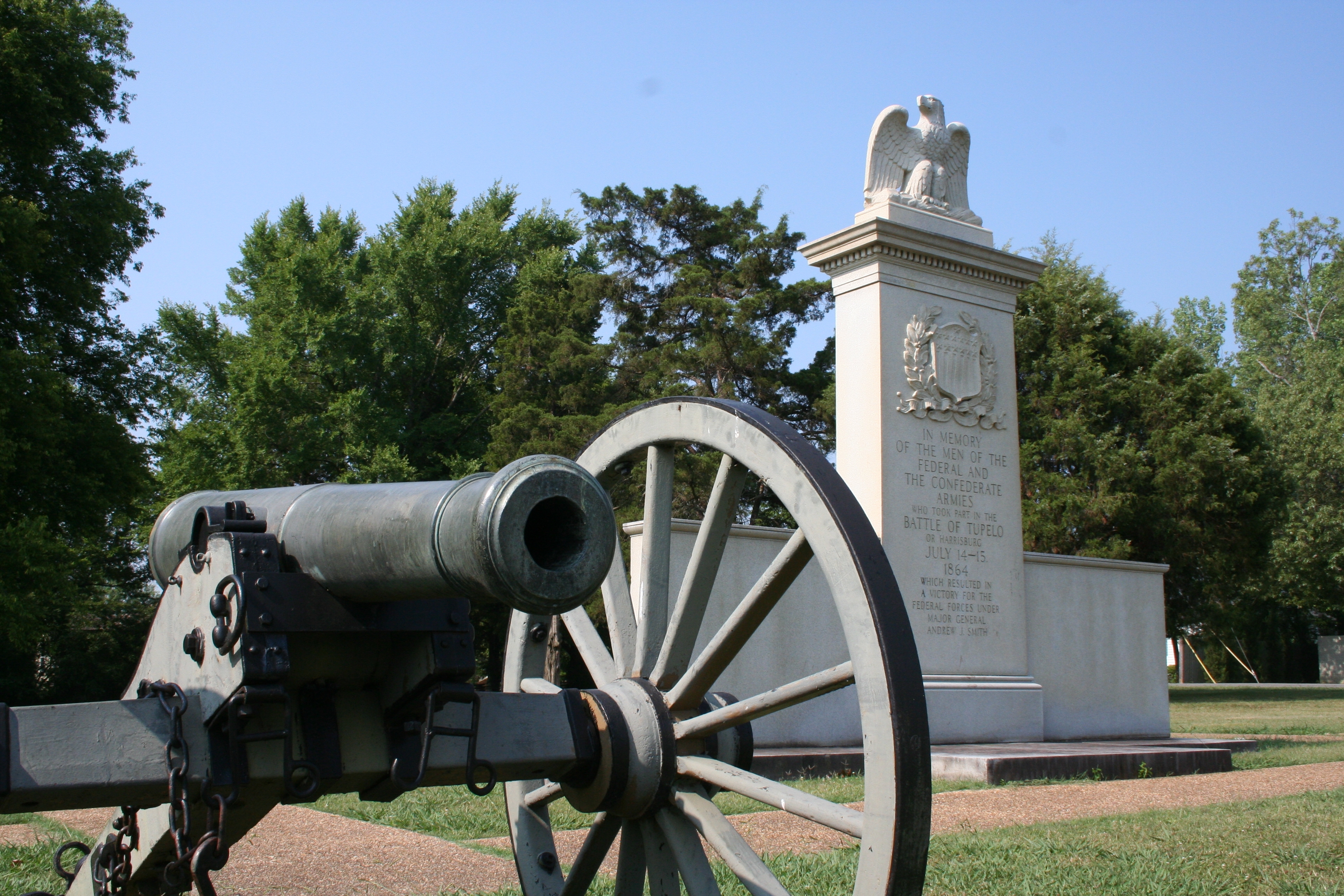
Tupelo National Battlefield
National Battlefield
In July, 1864, federal forces, including men from the United States Colored Troops, marched into Tupelo, Mississippi. Disorganized Confederate soldiers fought fiercely but could not overpower the fede...
4 mi from route
~9 min detour
Free
near mile 303.6
The Natchez Trace National Scenic Trail is five sections of hiking trail running roughly parallel to the 444-mile long Natchez Trace Parkway scenic motor road. The foot trails total more than 60 miles...
8 mi from route
~21 min detour
Free
near mile 303.6
Park data from the National Park Service API. Alerts update every 2 hours.
More Details
What kind of drive is this?
This is primarily a highway-focused drive, with 68% of the route utilizing major highways like US 45 and US Highway 45 Alternate. You'll encounter a considerable uninterrupted stretch of 88.4 miles on Lance Corporal Roy M Wheat Memorial Highway, offering a chance to settle into a rhythm. While largely highway-based, the route offers a mix of speeds and driving conditions as you transition between these main arteries. It's a direct path designed for efficient travel across the state.
68% highway — fuel and pacing are the main things to plan.
28 navigation steps total — most of the decisions cluster near the start and finish.
Longest single stretch: 88.4 mi on Lance Corporal Roy M Wheat Memorial Highway.
How Hard Is This Drive?
10/10
This is a straightforward highway drive that stays mostly on Lance Corporal Roy M Wheat Memorial Highway and US 45. This route has several spots where lane changes, forks, or exits need your full attention. The trickiest moment comes around 25.1 miles in.
Driving Effort10/10
High effort - long or complex enough to need steady focus all day
Balances navigation complexity with total wheel time.
This is a demanding drive. With 18 significant decision points across 352.2 miles, you will need to stay alert - especially through interchange areas and urban stretches. Consider splitting it into segments if you are not comfortable with fast highway navigation.
Where does it get tricky?
The main spots that need attention: at 25.1 miles: Highway fork - watch signs carefully. Multiple destination signs - pick the right one; at 70.4 miles (US 98): Exit ramp - move to the correct lane early. Lane positioning matters here. Multiple destination signs - pick the right one; at 159.6 miles (I 59): Highway fork - watch signs carefully. Lane positioning matters here. Multiple destination signs - pick the right one.
Elevation Profile
Mostly flat terrain
581 ft20 ft
Total Climb
853 ft
Total Descent
292 ft
Highest Point
581 ft
~352.2 mi in
Elevation Range
561 ft
Towns Mentioned on Route Signs
Based on OSRM destination-sign hints, not a full list of every settlement the road passes.
Between Biloxi, MS and Belmont, MS, road signs point toward Jackson, Laurel, Tuscaloosa, Tupelo, 25: Belmont and Iuka.
Biloxi is a city in Harrison County, on the Gulf Coast of Mississippi. It's well known for its beaches and nine casinos. It is also home to the "Jefferson Davis Presidential Library and Museum", which serves as a museum of the Confederacy.
Top landmarks
•Jefferson Davis Presidential Library and Museum — presidential library and museum for Confederate States President Jefferson Davis...
•Beauvoir — post-war home of the former President of the Confederate States of America, Jeff...
•Biloxi Light — lighthouse in Mississippi, United States
Doable as a same-day drive at 6h 55m. Total distance: 352.2 miles.
Family Friendly
Moderate complexity with 1 natural rest stops along the way.
Solo Traveler
6h 55m drive, plan rest stops for pacing.
Frequently Asked Questions
The longest stretch is about 88.4 miles on Lance Corporal Roy M Wheat Memorial Highway. The full list of main roads is in the Roads section above.
Yes — we found about 9 rest areas or service plazas within a short detour of the route (from OpenStreetMap). See the Rest Stops tab under Nearby Places for locations and mile markers. Plan to stretch, use the bathroom, and top off fluids every 2–3 hours on longer drives.
It helps. This route has a higher-than-average number of complex decision points, which get harder in the dark. If the last hour of the trip is on surface roads or mountain grades, aim to arrive at Belmont, MS before sunset when you can. Check the Trip Plan for departure windows that land you in daylight.
Only with planning. This is a long drive for kids — consider splitting it into two days rather than pushing through. Plan at least 1 meaningful breaks. There are 9 rest areas along the route for bathroom stops.
The main spots that need attention: at 25.1 miles: Highway fork - watch signs carefully. Multiple destination signs - pick the right one; at 70.4 miles (US 98): Exit ramp - move to the correct lane early. Lane positioning matters here. Multiple destination signs - pick the right one; at 159.6 miles (I 59): Highway fork - watch signs carefully. Lane positioning matters here. Multiple destination signs - pick the right one.
Yes — Tupelo National Battlefield and Natchez Trace National Scenic Trail. See the National Parks section for detour distances and tips on detours.
Not recommended in a single day. At 6.9 hours each way, a round trip means 13.9 hours of driving — that is an unsafe level of fatigue for most drivers. Plan at least one night at Belmont, MS before the return drive.