Yuma, AZ to Ajo, AZ is 158.5 miles and takes about 2 hours 56 minutes via Blue Star Memorial Highway and AZ 85, with a fuel budget near $32 and enough daylight to finish in a day. This route stays within the Desert Southwest, offering a straightforward drive between two Arizona locations. With only one recommended stop, it's a trip that can be completed with minimal interruption. The majority of the drive utilizes surface roads, so expect a more relaxed pace than a pure interstate experience.
Trip Pace
Same-day drive is realistic
A same-day return is realistic if you keep stops short.
Break Rhythm
1 planned break
A short stop every 2 to 3 hours is enough for this drive.
Midpoint
79.3 miles from Yuma, AZ
A natural place for your longest stop of the day
, about 1h 23m into the drive
.
Main Roads
Road
Distance
Duration
Blue Star Memorial Highway
114.2 mi
1h 59m
AZ 85
42 mi
53m
East Pima Street
1.2 mi
1m
North 4th Avenue
0.3 mi
<1m
I 8 Business
0.2 mi
<1m
Kumeyaay Highway
0.2 mi
<1m
Winterhaven Drive
0.1 mi
<1m
East Taladro Avenue
—
—
Some road-level metrics are being recalculated.
Longest stretch:
Blue Star Memorial Highway
— 114.2 mi, about 1h 59m
Turn-by-Turn Driving Directions
Step-by-step road directions between Yuma, AZ and Ajo, AZ.
1
Start on I 8 BUS
0.3 mi·22 sec·North 4th Avenue
2
Continue on I 8 BUS
0.1 mi·16 sec·Winterhaven Drive
3
Take the ramp
0.2 mi·31 sec
4
Merge onto I 8
0.2 mi·12 sec·Kumeyaay Highway
5
Continue on I 8
114 mi·1 hr 59 min·Blue Star Memorial Highway
6
Take the exit onto I 8 Business
0.2 mi·29 sec·I 8 Business
Toward 85: Phoenix, Ajo
7
Continue on I 8 Bus; US 80 Hist
1.2 mi·1 min·East Pima Street
Toward AZ-85: Phoenix, Gilda Bend
8
Turn left onto AZ 85
42 mi·53 min·AZ 85
Use the left lane.
9
Arrive at destination
AZ 85
Trip Plan
Given the 2 hour 56 minute duration, this is a perfect same-day trip. Aim to depart from Yuma in the morning to maximize your daylight and allow for flexibility. Plan for your single recommended stop strategically; consider it a mid-drive break rather than a destination. Keep an eye on your fuel gauge, as services can be spread out on these surface road sections, especially along the Blue Star Memorial Highway. Your estimated fuel cost is around $32, so ensure you have enough to cover this before you set off.
Morning Departure
Leave by 9 AM and you'll arrive before lunch.
Evening Departure
Even a 4 PM departure gets you there before dark in summer.
You can normally do this drive in one day.
Plan roughly 1 meaningful break for fuel, food, and rest.
The halfway point lands around 79.3 miles from Yuma, AZ, or about 1h 23m into the drive.
The longest continuous stretch on this route runs about 114.2 miles.
This is a comfortable same-day trip.
Departure
Before you leave
Start with fuel, water, and navigation already sorted so the first hour feels easy.
First stop
Around 35 miles or 37m in
Use this first pause for coffee, a restroom break, and a quick traffic check ahead.
Halfway reset
Around 79.3 miles or 1h 23m in
This is the best place for your longest stop, a real meal, and a full fuel check.
Final approach
Final hour starts around 2h 19m
Traffic, exits, and arrival timing usually matter more near Ajo, AZ than in the middle of the route.
Before You Leave
+
Open the route before leaving Yuma, AZ so your first major turns are already loaded.
+
Leave with enough water and a charging cable within reach, not packed away.
+
Check your fuel range against the first long segment, especially if you are starting outside city service areas.
Day 1
Settle into the route from Yuma, AZ
This is one driving day of about 158.5 miles and 2h 56m.
Your first comfortable stop window is around 35 miles from Yuma, AZ.
This route can stay practical as a one-day drive if traffic stays reasonable.
Plan about 1 real break rather than only quick fuel stops.
The longest stretch is on Blue Star Memorial Highway for about 114.2 miles.
Where to Stop
Rest stops, refuel points, and overnight suggestions along this route.
Place data sourced from public business listings. Hours and availability may vary.
Heads-up: tricky spots
4 of 4
4 decision points cluster between mile 0.4 and 116.5 — GPS handles the exact turns, but know they're coming. Your lane choice matters more than the turn itself.
3
0.4 mi into trip|~0m in
Take the ramp
Navigation decision point
4
0.6 mi into trip|~1m in|I 8 / Kumeyaay Highway
Merge onto I 8 / Kumeyaay Highway
Merge point - match speed before joining
5
115.1 mi into trip|~2h in|I 8 Business
Take the exit onto I 8 Business toward 85: Phoenix, Ajo
Exit ramp - move to the correct lane early. Multiple destination signs - pick the right one
Toward 85: Phoenix, Ajo
5
116.5 mi into trip|~2h 2m in|AZ 85
Turn left onto AZ 85
Lane positioning matters here
Use the left lane.
Fuel & Cost
Regular Gas
$28.09 one way
$56.17 round trip
$4.50/gal25.4 MPG avg56 kg CO2
Fuel Type
$/gal
One Way
Round Trip
midgrade
$4.82
$30.08
$60.16
premium
$5.04
$31.46
$62.93
diesel
$4.80
$29.93
$59.86
No toll roads detected on this route.
Estimated Trip Cost (one way, 1 person)
Fuel
$28
Meals
$25–$50
Total
$53–$78
Rough estimate based on US averages. Hotel $80–$140/night, meals $25–$50/day.
Estimated CO2 emission: 55.5 kg one way.
Prices: EIA weekly data, 2026-07-13.
Driving Electric?
About $17 in charging
· 0 stops
· 65% less CO2
Vehicle Type
kWh
Stops
DC Fast
Home Charge
Average EV
47.6
0
$16.64
$7.61
Efficient EV
39.6
0
$13.87
$6.34
EV Truck/SUV
63.4
0
$22.19
$10.14
Gas CO2
55 kg
EV CO2
19 kg (65% less)
This trip is well within single-charge range for most EVs. No charging stops needed if you start fully charged.
DC fast charging avg $0.35/kWh. Home charging avg $0.16/kWh. US grid CO2: 0.39 kg/kWh.
Travel Intel
Current conditions at both ends of the drive.
Forecast as of Jul 19, 2026
Origin
Yuma, AZ
Late night
in Yuma on Sunday
Local time
2:39 AM
MST
Current temp
84°F
Mostly Cloudy
S 0 to 10 mph4% chanceLive forecast
Flash Flood Warning
Flash Flood Warning issued July 18 at 9:11PM MST until July 19 at 12:15AM MST by NWS Flagstaff AZ
Flash Flood Warning
Flash Flood Warning issued July 18 at 8:18PM PDT until July 18 at 10:15PM PDT by NWS Las Vegas NV
Destination
Ajo, AZ
Late night
in Ajo on Sunday
Local time
2:39 AM
MST
Current temp
79°F
Mostly Cloudy
S 6 mph5% chanceLive forecast
Flash Flood Warning
Flash Flood Warning issued July 18 at 9:11PM MST until July 19 at 12:15AM MST by NWS Flagstaff AZ
Flash Flood Warning
Flash Flood Warning issued July 18 at 8:18PM PDT until July 18 at 10:15PM PDT by NWS Las Vegas NV
Seasonal Notes
Summer travel usually means heavier construction, hotter rest stops, and busier weekend traffic around major cities.
Winter travel shortens daylight, so a route that looks manageable on paper can feel much longer after dark.
Holiday weekends tend to make both departure and arrival windows slower than the raw route time suggests.
Time zone
Same local time
Origin and destination are on the same clock, so arrival timing is easier to judge at a glance.
Temperature spread
5 degrees cooler at arrival
A meaningful temperature swing is a good cue to rethink layers, water, and how soon you want to arrive.
Road read
2h 56m on the road
The weather snapshot is not static. If you are leaving later, give both cities one more quick forecast check before departure.
Weather data from the National Weather Service. Conditions may change; check closer to your travel date.
National Parks Near This Route
Worth a detour if your schedule allows.
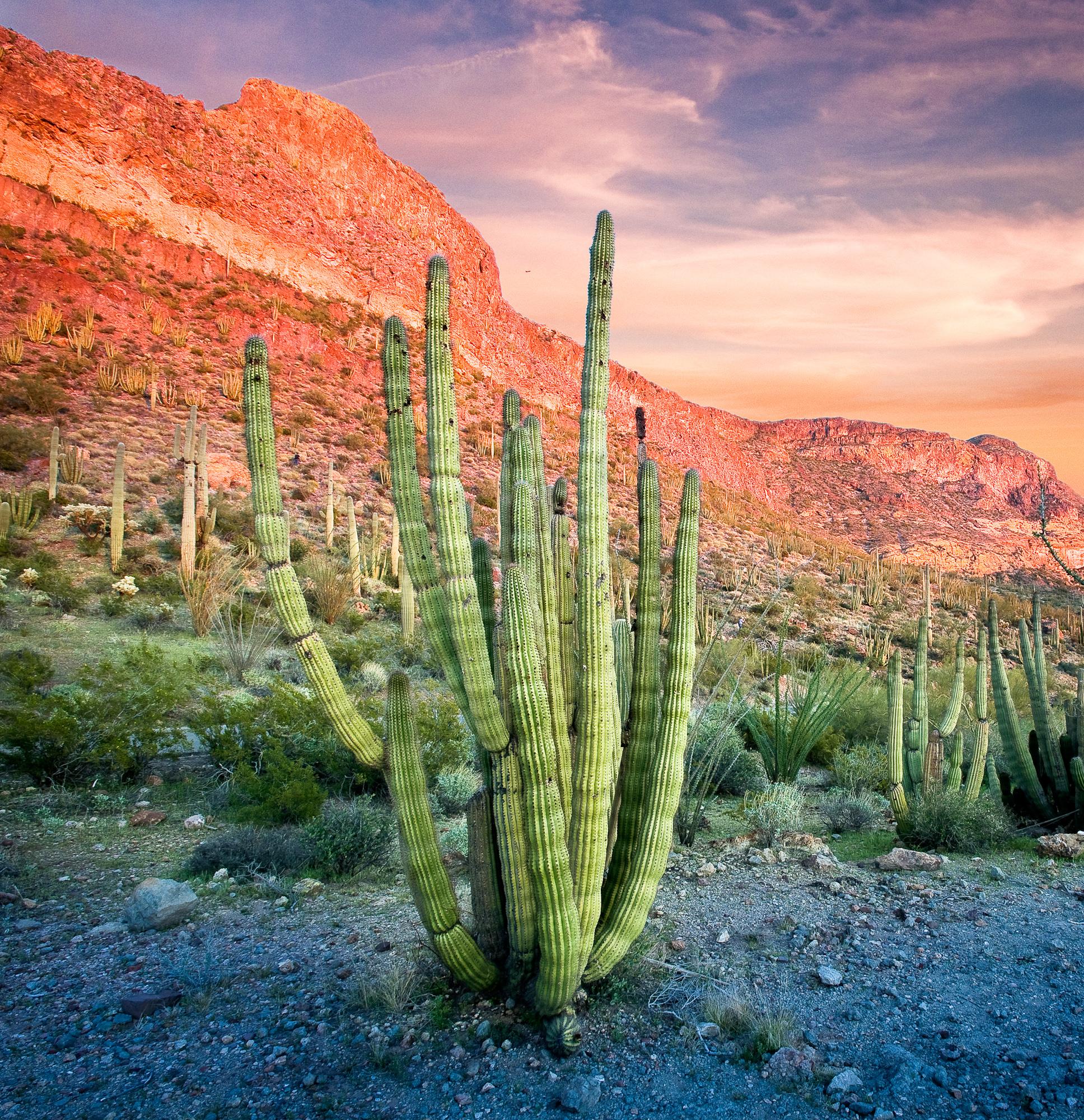
Organ Pipe Cactus National Monument
National Monument
Look closely. Look again. The sights and sounds of Organ Pipe Cactus National Monument, an International Biosphere Reserve, reveal a thriving community of plants and animals. Human stories echo throug...
23 mi from route
~58 min detour
$25
near mile 158.5
Park Closure: West and East Border Roads closed for public safety
Caution: Feral Dogs May Be Seen in Organ Pipe Cactus National Monument
Park data from the National Park Service API. Alerts update every 2 hours.
More Details
What kind of drive is this?
This drive is predominantly on surface roads, with highways accounting for 27% of the total distance. You'll experience a long stretch of 114.2 miles on the Blue Star Memorial Highway, offering a consistent cruising experience. After this, you'll transition to AZ 85 and then East Pima Street, which are also surface roads. Expect to notice a more rural feel as you navigate these stretches, with fewer services and a more open landscape.
Only 27% highway — the rest is turn-by-turn surface driving.
9 navigation steps total — most of the decisions cluster near the start and finish.
Longest single stretch: 114.2 mi on Blue Star Memorial Highway.
How Hard Is This Drive?
1/10
Expect a hands-on drive with frequent turns and local roads rather than long highway stretches. Navigation is very simple - set it and forget it for most of the drive. The trickiest moment comes around 0.4 miles in.
Driving Effort1/10
Very easy - short and simple to drive
Balances navigation complexity with total wheel time.
The drive from Yuma, AZ to Ajo, AZ is easy. At 2h 56m with 27% highway, most drivers will find it relaxed and low-stress.
Where does it get tricky?
The main spots that need attention: at 0.4 miles: Navigation decision point; at 0.6 miles (I 8 / Kumeyaay Highway): Merge point - match speed before joining; at 115.1 miles (I 8 Business): Exit ramp - move to the correct lane early. Multiple destination signs - pick the right one.
Elevation Profile
Gently rolling terrain
1,756 ft141 ft
Total Climb
1,627 ft
Total Descent
11 ft
Highest Point
1,756 ft
~158.5 mi in
Elevation Range
1,615 ft
Towns Mentioned on Route Signs
Based on OSRM destination-sign hints, not a full list of every settlement the road passes.
Between Yuma, AZ and Ajo, AZ, road signs point toward 85: Phoenix and Gilda Bend.
Yuma is the largest city and county seat of Yuma County, Arizona. It is in the southwest corner of the state, across the Colorado River from California and near two Mexican states of Baja California and Sonora.
Top landmarks
•Brown House — historic house in Yuma, Arizona, USA
•Masonic Temple — in Yuma, Arizona
•Gandolfo Theatre — former movie theater in Yuma, Arizona, United States
Mostly surface roads route profile with national parks nearby.
Frequently Asked Questions
The longest stretch is about 114.2 miles on Blue Star Memorial Highway. The full list of main roads is in the Roads section above.
Yes — we found about 10 rest areas or service plazas within a short detour of the route (from OpenStreetMap). See the Rest Stops tab under Nearby Places for locations and mile markers. Plan to stretch, use the bathroom, and top off fluids every 2–3 hours on longer drives.
Yes, with realistic expectations. Build in a stop roughly every 2 hours, have snacks and activities ready, and check the Nearby Places tabs for kid-friendly stops along the way.
The main spots that need attention: at 0.4 miles: Navigation decision point; at 0.6 miles (I 8 / Kumeyaay Highway): Merge point - match speed before joining; at 115.1 miles (I 8 Business): Exit ramp - move to the correct lane early. Multiple destination signs - pick the right one.
Yes — Organ Pipe Cactus National Monument. See the National Parks section for detour distances and tips on detours.
Yes. A round trip is manageable in a single day if you plan a break at Ajo, AZ before heading back.