Spanning 336.6 miles across the Desert Southwest, this journey from Yuma to Bisbee typically takes about 6 hours and 3 minutes to complete. You will navigate via the Blue Star Memorial Highway, the Casa Grande-Tucson Highway, and the Tucson-Benson Highway. While it is feasible to tackle the entire distance in a single day, be prepared for a full day of travel. Budget roughly $67 for fuel to cover the trip, and keep in mind that the route requires one planned stop to manage the duration comfortably. It is a straightforward transit between two distinct points in the Arizona desert, offering a reliable path for those looking to traverse the region efficiently.
Trip Pace
Same-day drive is realistic
A same-day return is possible, but it will make for a full day on the road.
Break Rhythm
1 planned break
Plan on a short reset every 3 to 4 hours to stay fresh behind the wheel.
Midpoint
168.3 miles from Yuma, AZ
A natural place for your longest stop of the day
, about 2h 53m into the drive
.
Main Roads
Road
Distance
Duration
Blue Star Memorial Highway
177.9 mi
3h 2m
Casa Grande-Tucson Highway
54.6 mi
55m
Tucson-Benson Highway
41.4 mi
43m
State Route 90
16.5 mi
19m
Whetstone TI-Junction SR 80 Highway
13.3 mi
16m
Huachuca Boulevard
9.1 mi
10m
AZ 80
6.9 mi
9m
North Freeway
6.1 mi
6m
Longest stretch:
Blue Star Memorial Highway
— 177.9 mi, about 3h 2m
Turn-by-Turn Driving Directions
Step-by-step road directions between Yuma, AZ and Bisbee, AZ.
1
Start on I 8 BUS
0.3 mi·22 sec·North 4th Avenue
2
Continue on I 8 BUS
0.1 mi·16 sec·Winterhaven Drive
3
Take the ramp
0.2 mi·31 sec
4
Merge onto I 8
0.2 mi·12 sec·Kumeyaay Highway
5
Continue on I 8
178 mi·3 hr 2 min·Blue Star Memorial Highway
6
Keep slight right at fork
0.6 mi·38 sec
Exit 178AToward I 10 East: Tucson
7
Continue on Phoenix Bypass Route
0.4 mi·27 sec·Phoenix Bypass Route
Exit 178AToward I 10 East: Tucson
8
Continue on I 10
55 mi·55 min·Casa Grande-Tucson Highway
Use the straight / slight right lanes.
9
Continue on I 10
6.1 mi·6 min·North Freeway
Use the straight / slight right lanes.
10
Continue on I 10
41 mi·43 min·Tucson-Benson Highway
Use the straight / slight right lanes.
11
Take the exit
0.6 mi·1 min
Exit 302Toward AZ 90 East: Fort Huachuca, Sierra Vista
12
Turn right onto AZ 90
1.2 mi·1 min·South State Highway 90
13
Continue on AZ 90
9.1 mi·10 min·Huachuca Boulevard
14
Continue on AZ 90
12 mi·14 min·State Route 90
15
Continue on AZ 90
2.2 mi·3 min·North Huachuca Boulevard
16
Continue on AZ 90
3.0 mi·3 min·State Route 90
17
Turn left onto AZ 90
4.4 mi·6 min·State Route 90 Bypass
18
Turn left onto AZ 90
1.5 mi·2 min·Whetstone TI-Junction SR 80 Highway
Use the left lane.
19
Continue on AZ 90
1.6 mi·2 min·State Route 90
20
Continue on AZ 90
12 mi·14 min·Whetstone TI-Junction SR 80 Highway
21
At end of road, turn right onto AZ 80; US 80 Hist
6.9 mi·9 min·AZ 80; US 80 Hist
22
Take the exit
290 ft·9 sec
23
Turn right
158 ft·4 sec
24
Keep slight right at fork
117 ft·3 sec
25
Continue on US 80 Hist
0.5 mi·1 min·Tombstone Canyon Road
26
Turn left onto Moon Canyon
47 ft·4 sec·Moon Canyon
27
Turn right
86 ft·6 sec
28
Arrive at destination
Trip Plan
Since the drive clocks in at over 6 hours, plan to depart early in the morning to reach Bisbee with plenty of daylight to spare. Given the turn-heavy nature of the local road segments, build in at least one substantial stop to stretch your legs and refresh your focus. Keep a close eye on your fuel gauge throughout the journey, especially during the 177.9-mile stretch on the Blue Star Memorial Highway where services may be spaced out. Because this is a one-day trip, your flexibility is your greatest asset; if you find the pace tiring, use your planned stop to adjust your arrival expectations. Prioritize steady pacing over speed to ensure you navigate the winding sections safely.
Morning Departure
Start early — leave by 6-7 AM to arrive at a reasonable hour.
Evening Departure
This is a long drive — plan for a morning departure or consider splitting it into two days.
You can normally do this drive in one day.
Plan roughly 1 meaningful break for fuel, food, and rest.
The halfway point lands around 168.3 miles from Yuma, AZ, or about 2h 53m into the drive.
The longest continuous stretch on this route runs about 177.9 miles.
This is a comfortable same-day trip.
Departure
Before you leave
Start with fuel, water, and navigation already sorted so the first hour feels easy.
First stop
Around 74 miles or 1h 16m in
Use this first pause for coffee, a restroom break, and a quick traffic check ahead.
Halfway reset
Around 168.3 miles or 2h 53m in
This is the best place for your longest stop, a real meal, and a full fuel check.
Final approach
Final hour starts around 4h 45m
Traffic, exits, and arrival timing usually matter more near Bisbee, AZ than in the middle of the route.
Before You Leave
+
Open the route before leaving Yuma, AZ so your first major turns are already loaded.
+
Leave with enough water and a charging cable within reach, not packed away.
+
Check your fuel range against the first long segment, especially if you are starting outside city service areas.
Day 1
Settle into the route from Yuma, AZ
This is one driving day of about 336.6 miles and 6h 3m.
Your first comfortable stop window is around 74 miles from Yuma, AZ.
This route can stay practical as a one-day drive if traffic stays reasonable.
Plan about 1 real break rather than only quick fuel stops.
The longest stretch is on Blue Star Memorial Highway for about 177.9 miles.
Where to Stop
Rest stops, refuel points, and overnight suggestions along this route.
Place data sourced from public business listings. Hours and availability may vary.
Heads-up: tricky spots
5 of 12
5 decision points cluster between mile 0.6 and 336.5 — GPS handles the exact turns, but know they're coming. Your lane choice matters more than the turn itself.
4
0.6 mi into trip|~1m in|I 8 / Kumeyaay Highway
Merge onto I 8 / Kumeyaay Highway
Merge point - match speed before joining
6
178.7 mi into trip|~3h 4m in
Keep slight right at fork toward I 10 East: Tucson
Highway fork - watch signs carefully
Exit 178A
Toward I 10 East: Tucson
6
281.7 mi into trip|~4h 51m in
Take the exit toward AZ 90 East: Fort Huachuca, Sierra Vista
Exit ramp - move to the correct lane early. Multiple destination signs - pick the right one
Exit 302
Toward AZ 90 East: Fort Huachuca, Sierra Vista
5
336 mi into trip|~6h 1m in
Keep slight right at fork
Highway fork - watch signs carefully
5
336.5 mi into trip|~6h 3m in
Turn right
Navigation decision point
Fuel & Cost
Regular Gas
$59.65 one way
$119.29 round trip
$4.50/gal25.4 MPG avg118 kg CO2
Fuel Type
$/gal
One Way
Round Trip
midgrade
$4.82
$63.87
$127.75
premium
$5.04
$66.82
$133.63
diesel
$4.80
$63.56
$127.11
No toll roads detected on this route.
Estimated Trip Cost (one way, 1 person)
Fuel
$60
Meals
$25–$50
Total
$85–$110
Rough estimate based on US averages. Hotel $80–$140/night, meals $25–$50/day.
Estimated CO2 emission: 117.8 kg one way.
Prices: EIA weekly data, 2026-07-13.
Driving Electric?
About $35 in charging
· 1 stop
· 67% less CO2
Vehicle Type
kWh
Stops
DC Fast
Home Charge
Average EV
101
1
$35.34
$16.16
Efficient EV
84.2
0
$29.45
$13.46
EV Truck/SUV
134.6
1
$47.12
$21.54
Gas CO2
118 kg
EV CO2
39 kg (67% less)
Plan for 1 charging stop. A 30-minute DC fast charge mid-route should be enough to complete the trip comfortably.
DC fast charging avg $0.35/kWh. Home charging avg $0.16/kWh. US grid CO2: 0.39 kg/kWh.
Travel Intel
Current conditions at both ends of the drive.
Forecast as of Jul 17, 2026
Origin
Yuma, AZ
Evening
in Yuma on Saturday
Local time
6:29 PM
MST
Current temp
104°F
Mostly Sunny
SE 5 to 10 mph8% chanceLive forecast
Flash Flood Warning
Flash Flood Warning issued July 17 at 3:29AM MST until July 17 at 6:30AM MST by NWS Flagstaff AZ
Destination
Bisbee, AZ
Evening
in Bisbee on Saturday
Local time
6:29 PM
MST
Current temp
80°F
Showers And Thunderstorms Likely
SW 5 to 8 mph55% chanceLive forecast
Flash Flood Warning
Flash Flood Warning issued July 17 at 3:29AM MST until July 17 at 6:30AM MST by NWS Flagstaff AZ
Seasonal Notes
Summer travel usually means heavier construction, hotter rest stops, and busier weekend traffic around major cities.
Winter travel shortens daylight, so a route that looks manageable on paper can feel much longer after dark.
Holiday weekends tend to make both departure and arrival windows slower than the raw route time suggests.
Time zone
Same local time
Origin and destination are on the same clock, so arrival timing is easier to judge at a glance.
Temperature spread
24 degrees cooler at arrival
A meaningful temperature swing is a good cue to rethink layers, water, and how soon you want to arrive.
Road read
6h 3m on the road
Start early — leave by 6-7 AM to arrive at a reasonable hour.
Weather data from the National Weather Service. Conditions may change; check closer to your travel date.
National Parks Near This Route
Worth a detour if your schedule allows.
Saguaro National Park
National Park
Tucson, Arizona is home to the nation's largest cacti. The giant saguaro is the universal symbol of the American west. These majestic plants, found only in a small portion of the United States, are pr...
10 mi from route
~26 min detour
$25
near mile 255.3
Park Closure: Red Hills Visitor Center (TMD) theater closed for repairs
It was a journey of conquest filled with exploration, wonder - and cruelty. Inspired by tales of vast cities of gold, 339 European soldiers and over a thousand Aztec allies embarked on an epic journey...
15 mi from route
~37 min detour
Free
near mile 313.3
An Ancestral Sonoran Desert People's farming community and "Great House" are preserved at Casa Grande Ruins. Whether a gathering place for people or simply a waypoint marker in an extensive system of...
17 mi from route
~42 min detour
Free
near mile 185.7
Park data from the National Park Service API. Alerts update every 2 hours.
More Details
What kind of drive is this?
Expect a varied experience behind the wheel, as this route is characterized as a turn-heavy local drive rather than a straight interstate cruise. Only 14% of your journey will be spent on major highways, meaning you will spend the bulk of your time navigating local roads. The longest uninterrupted stretch you will encounter is 177.9 miles along the Blue Star Memorial Highway. As you transition from the initial desert stretches toward your destination, the road profile shifts, requiring more active attention than a typical high-speed sprint. Prepare for a mix of cruising and more technical driving segments that demand your focus.
Only 14% highway — the rest is turn-by-turn surface driving.
28 navigation steps total — most of the decisions cluster near the start and finish.
Longest single stretch: 177.9 mi on Blue Star Memorial Highway.
How Hard Is This Drive?
5/10
Expect a hands-on drive with frequent turns and local roads rather than long highway stretches. You will hit about 12 points where you need to pay attention to lane position or signs. The trickiest moment comes around 0.6 miles in near I 8 / Kumeyaay Highway.
Driving Effort5/10
Moderate - straightforward overall, but long enough or busy enough to require pacing
Balances navigation complexity with total wheel time.
This drive requires moderate attention. Across 336.6 miles you will encounter 12 spots where lane choice or exit timing matters. Not difficult for experienced highway drivers, but worth previewing the tricky sections before you go.
Where does it get tricky?
The main spots that need attention: at 0.6 miles (I 8 / Kumeyaay Highway): Merge point - match speed before joining; at 178.7 miles: Highway fork - watch signs carefully; at 281.7 miles: Exit ramp - move to the correct lane early. Multiple destination signs - pick the right one.
Elevation Profile
High-altitude sections with notable climbs
5,524 ft141 ft
Total Climb
5,837 ft
Total Descent
454 ft
Highest Point
5,524 ft
~336.6 mi in
Elevation Range
5,384 ft
Notable High Points
4,573 ft at ~288.5 miles+83 ft prominence
Towns Mentioned on Route Signs
Based on OSRM destination-sign hints, not a full list of every settlement the road passes.
On the drive from Yuma, AZ to Bisbee, AZ, road signs begin pointing toward Sierra Vista along the way.
Yuma is the largest city and county seat of Yuma County, Arizona. It is in the southwest corner of the state, across the Colorado River from California and near two Mexican states of Baja California and Sonora.
Top landmarks
•Brown House — historic house in Yuma, Arizona, USA
•Masonic Temple — in Yuma, Arizona
•Gandolfo Theatre — former movie theater in Yuma, Arizona, United States
Bisbee is a town in Southeast Arizona, and the county seat for Cochise County. This former mining town has reinvented itself as an artist community, and it now attracts tourists for its vibrant cultural scene and well-preserved architecture. Notable are its many Victorian-era houses built into the hillsides, some of which can only be accessed by foot.
Top landmarks
•Evergreen Cemetery — cemetery in Bisbee, Arizona, United States
•Walter Douglas House — house in Bisbee, Arizona
•Muheim House — historic house in Bisbee, Arizona, United States
Doable as a same-day drive at 6h 3m. Total distance: 336.6 miles.
Family Friendly
Moderate complexity with 1 natural rest stops along the way.
Solo Traveler
6h 3m drive, plan rest stops for pacing.
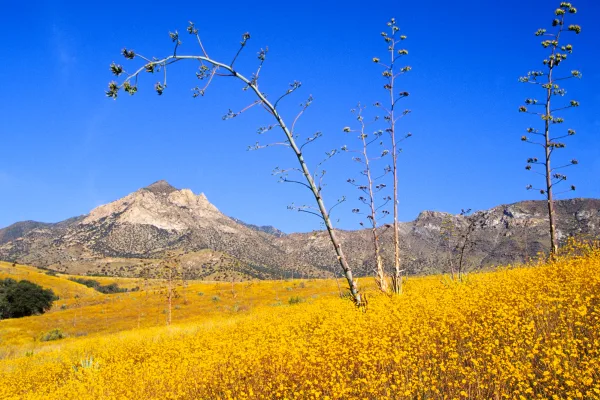
Scenic Drive
Mostly surface roads route profile with national parks nearby.
Frequently Asked Questions
The longest stretch is about 177.9 miles on Blue Star Memorial Highway. The full list of main roads is in the Roads section above.
Yes — we found about 26 rest areas or service plazas within a short detour of the route (from OpenStreetMap). See the Rest Stops tab under Nearby Places for locations and mile markers. Plan to stretch, use the bathroom, and top off fluids every 2–3 hours on longer drives.
It helps. This is a long drive, so arriving tired and in the dark compounds. If the last hour of the trip is on surface roads or mountain grades, aim to arrive at Bisbee, AZ before sunset when you can. Check the Trip Plan for departure windows that land you in daylight.
Only with planning. This is a long drive for kids — consider splitting it into two days rather than pushing through. Plan at least 1 meaningful breaks. There are 26 rest areas along the route for bathroom stops.
The main spots that need attention: at 0.6 miles (I 8 / Kumeyaay Highway): Merge point - match speed before joining; at 178.7 miles: Highway fork - watch signs carefully; at 281.7 miles: Exit ramp - move to the correct lane early. Multiple destination signs - pick the right one.
Yes — Saguaro National Park, Coronado National Memorial and Casa Grande Ruins National Monument. See the National Parks section for detour distances and tips on detours.
Not recommended in a single day. At 6.1 hours each way, a round trip means 12.1 hours of driving — that is an unsafe level of fatigue for most drivers. Plan at least one night at Bisbee, AZ before the return drive.