Tucson to Ajo is 134.5 miles and takes about 2h 48m via West Tucson-Ajo Highway, with a fuel budget near $27 and enough daylight to finish in a day. This trip stays within Arizona's Desert Southwest region, offering a straightforward drive. It's a single-day excursion, making it easy to fit into a travel plan without needing an overnight stay. You'll primarily be on surface roads for this route, so expect a more local driving experience rather than high-speed highway travel.
Trip Pace
Same-day drive is realistic
A same-day return is realistic if you keep stops short.
Break Rhythm
1 planned break
A short stop every 2 to 3 hours is enough for this drive.
Midpoint
67.2 miles from Tucson, AZ
A natural place for your longest stop of the day
, about 1h 27m into the drive
.
Main Roads
Road
Distance
Duration
West Tucson-Ajo Highway
93.7 mi
1h 51m
West Ajo Highway
23.1 mi
28m
Tucson-Ajo Highway
9.7 mi
12m
South Mission Road
2.3 mi
4m
East 22nd Street
1.7 mi
2m
East Broadway Boulevard
1 mi
2m
Gila Bend-Lukeville Highway
0.9 mi
1m
West Starr Pass Boulevard
0.7 mi
1m
Longest stretch:
West Tucson-Ajo Highway
— 93.7 mi, about 1h 51m
Turn-by-Turn Driving Directions
Step-by-step road directions between Tucson, AZ and Ajo, AZ.
1
Start on North Country Club Road
199 ft·32 sec·North Country Club Road
2
Continue on North Country Club Road
239 ft·9 sec·North Country Club Road
3
Turn right onto East Broadway Boulevard
1.0 mi·2 min·East Broadway Boulevard
4
Turn left onto South Campbell Avenue
0.3 mi·37 sec·South Campbell Avenue
Use the left lane.
5
Continue on South Kino Parkway
0.6 mi·1 min·South Kino Parkway
6
Turn slight right
0.2 mi·34 sec
7
Keep slight right at fork
278 ft·11 sec
8
Turn right onto East 22nd Street
1.7 mi·2 min·East 22nd Street
9
Continue on West Starr Pass Boulevard
0.7 mi·1 min·West Starr Pass Boulevard
10
Turn right onto South Mission Road
2.3 mi·4 min·South Mission Road
11
Turn right onto AZ 86
23 mi·28 min·West Ajo Highway
12
Continue on AZ 86
94 mi·1 hr 51 min·West Tucson-Ajo Highway
13
At end of road, turn right onto AZ 85
0.2 mi·13 sec·North Sonoita Highway
14
Continue on AZ 85
0.2 mi·15 sec·Tucson-Ajo Highway
15
Continue on AZ 85
0.9 mi·1 min·Gila Bend-Lukeville Highway
16
Continue on AZ 85
9.6 mi·12 min·Tucson-Ajo Highway
17
Arrive at destination
AZ 85
Trip Plan
For this 2h 48m drive, leaving Tucson in the morning allows ample time to reach Ajo and explore before sunset. With a relatively short duration and a fuel cost estimated at $27, you won't need to worry about extensive stops. However, since the longest stretch is over 93 miles, it's wise to ensure you have a full tank before departing Tucson, as services might be spaced out. Consider making your single planned stop at a point roughly two-thirds of the way to break up the drive and refuel if necessary.
Morning Departure
Leave by 9 AM and you'll arrive before lunch.
Evening Departure
Even a 4 PM departure gets you there before dark in summer.
You can normally do this drive in one day.
Plan roughly 1 meaningful break for fuel, food, and rest.
The halfway point lands around 67.2 miles from Tucson, AZ, or about 1h 27m into the drive.
The longest continuous stretch on this route runs about 93.7 miles.
This is a comfortable same-day trip.
Departure
Before you leave
Start with fuel, water, and navigation already sorted so the first hour feels easy.
First stop
Around 30 miles or 43m in
Use this first pause for coffee, a restroom break, and a quick traffic check ahead.
Halfway reset
Around 67.2 miles or 1h 27m in
This is the best place for your longest stop, a real meal, and a full fuel check.
Final approach
Final hour starts around 2h 18m
Traffic, exits, and arrival timing usually matter more near Ajo, AZ than in the middle of the route.
Before You Leave
+
Open the route before leaving Tucson, AZ so your first major turns are already loaded.
+
Leave with enough water and a charging cable within reach, not packed away.
+
Check your fuel range against the first long segment, especially if you are starting outside city service areas.
Day 1
Settle into the route from Tucson, AZ
This is one driving day of about 134.5 miles and 2h 48m.
Your first comfortable stop window is around 30 miles from Tucson, AZ.
This route can stay practical as a one-day drive if traffic stays reasonable.
Plan about 1 real break rather than only quick fuel stops.
The longest stretch is on West Tucson-Ajo Highway for about 93.7 miles.
Where to Stop
Rest stops, refuel points, and overnight suggestions along this route.
Place data sourced from public business listings. Hours and availability may vary.
Heads-up: tricky spots
5 of 7
5 decision points cluster between mile 0 and 123.7 — GPS handles the exact turns, but know they're coming. Your lane choice matters more than the turn itself.
3
0 mi into trip|~0m in|North Country Club Road
Continue onto North Country Club Road
Navigation decision point
4
0.1 mi into trip|~0m in|East Broadway Boulevard
Turn right onto East Broadway Boulevard
Navigation decision point
4
1.1 mi into trip|~3m in|South Campbell Avenue
Turn left onto South Campbell Avenue
Lane positioning matters here
Use the left lane.
5
2.2 mi into trip|~5m in
Keep slight right at fork
Highway fork - watch signs carefully
5
123.7 mi into trip|~2h 34m in|AZ 85 / North Sonoita Highway
At end of road, turn right onto AZ 85 / North Sonoita Highway
Navigation decision point
Fuel & Cost
Regular Gas
$23.83 one way
$47.67 round trip
$4.50/gal25.4 MPG avg47 kg CO2
Fuel Type
$/gal
One Way
Round Trip
midgrade
$4.82
$25.52
$51.05
premium
$5.04
$26.70
$53.40
diesel
$4.80
$25.40
$50.79
No toll roads detected on this route.
Estimated Trip Cost (one way, 1 person)
Fuel
$24
Meals
$25–$50
Total
$49–$74
Rough estimate based on US averages. Hotel $80–$140/night, meals $25–$50/day.
Estimated CO2 emission: 47.1 kg one way.
Prices: EIA weekly data, 2026-07-13.
Driving Electric?
About $14 in charging
· 0 stops
· 66% less CO2
Vehicle Type
kWh
Stops
DC Fast
Home Charge
Average EV
40.4
0
$14.12
$6.46
Efficient EV
33.6
0
$11.77
$5.38
EV Truck/SUV
53.8
0
$18.83
$8.61
Gas CO2
47 kg
EV CO2
16 kg (66% less)
This trip is well within single-charge range for most EVs. No charging stops needed if you start fully charged.
DC fast charging avg $0.35/kWh. Home charging avg $0.16/kWh. US grid CO2: 0.39 kg/kWh.
Travel Intel
Current conditions at both ends of the drive.
Forecast as of Jul 19, 2026
Origin
Tucson, AZ
Late night
in Tucson on Sunday
Local time
2:38 AM
MST
Current temp
73°F
Partly Cloudy
SE 3 mph8% chanceLive forecast
Flash Flood Warning
Flash Flood Warning issued July 18 at 9:11PM MST until July 19 at 12:15AM MST by NWS Flagstaff AZ
Flash Flood Warning
Flash Flood Warning issued July 18 at 8:18PM PDT until July 18 at 10:15PM PDT by NWS Las Vegas NV
Destination
Ajo, AZ
Late night
in Ajo on Sunday
Local time
2:38 AM
MST
Current temp
79°F
Mostly Cloudy
S 6 mph5% chanceLive forecast
Flash Flood Warning
Flash Flood Warning issued July 18 at 9:11PM MST until July 19 at 12:15AM MST by NWS Flagstaff AZ
Flash Flood Warning
Flash Flood Warning issued July 18 at 8:18PM PDT until July 18 at 10:15PM PDT by NWS Las Vegas NV
Seasonal Notes
Summer travel usually means heavier construction, hotter rest stops, and busier weekend traffic around major cities.
Winter travel shortens daylight, so a route that looks manageable on paper can feel much longer after dark.
Holiday weekends tend to make both departure and arrival windows slower than the raw route time suggests.
Time zone
Same local time
Origin and destination are on the same clock, so arrival timing is easier to judge at a glance.
Temperature spread
6 degrees warmer at arrival
A meaningful temperature swing is a good cue to rethink layers, water, and how soon you want to arrive.
Road read
2h 48m on the road
The weather snapshot is not static. If you are leaving later, give both cities one more quick forecast check before departure.
Weather data from the National Weather Service. Conditions may change; check closer to your travel date.
National Parks Near This Route
Worth a detour if your schedule allows.
Saguaro National Park
National Park
Tucson, Arizona is home to the nation's largest cacti. The giant saguaro is the universal symbol of the American west. These majestic plants, found only in a small portion of the United States, are pr...
10 mi from route
~25 min detour
$25
Park Closure: Red Hills Visitor Center (TMD) theater closed for repairs
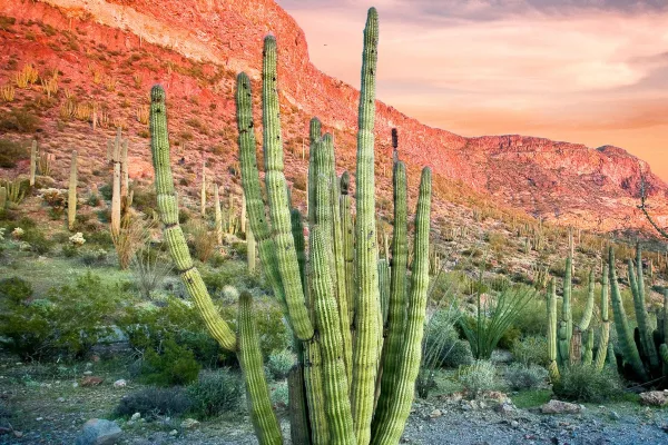
Look closely. Look again. The sights and sounds of Organ Pipe Cactus National Monument, an International Biosphere Reserve, reveal a thriving community of plants and animals. Human stories echo throug...
16 mi from route
~40 min detour
$25
near mile 120.6
Park data from the National Park Service API. Alerts update every 2 hours.
More Details
What kind of drive is this?
This route is almost entirely surface roads, with a 0% highway share. You'll encounter a longest stretch of 93.7 miles on West Tucson-Ajo Highway, indicating a significant period of consistent cruising. Expect a gradual transition from any potential urban merging near Tucson to more rural conditions as you head west. The predominantly surface road profile suggests you'll be navigating at more moderate speeds for most of the drive.
Only 0% highway — the rest is turn-by-turn surface driving.
17 navigation steps total — most of the decisions cluster near the start and finish.
Longest single stretch: 93.7 mi on West Tucson-Ajo Highway.
How Hard Is This Drive?
2/10
Expect a hands-on drive with frequent turns and local roads rather than long highway stretches. Navigation is very simple - set it and forget it for most of the drive. The trickiest moment comes early in the drive near North Country Club Road.
Driving Effort2/10
Very easy - short and simple to drive
Balances navigation complexity with total wheel time.
The drive from Tucson, AZ to Ajo, AZ is easy. At 2h 48m with 0% highway, most drivers will find it relaxed and low-stress.
Where does it get tricky?
The main spots that need attention: near the start (North Country Club Road): Navigation decision point; at 0.1 miles (East Broadway Boulevard): Navigation decision point; at 1.1 miles (South Campbell Avenue): Lane positioning matters here.
Tucson (TOO-sawn), also known as the "Old Pueblo", is the second-largest city in the state of Arizona and the county seat of Pima County in the Sonoran Desert. It is at a higher elevation than nearby Phoenix and is correspondingly cooler. Although with half a million residents it is smaller than the capital city, its cultural life is just as vibrant.
Top landmarks
•Pima Air & Space Museum — aerospace museum in Tucson, Arizona, USA
•Arizona State Museum — museum in Arizona, United States
•Rialto Theatre — theater and concert venue in Tucson, Arizona, United States
Mostly surface roads route profile with national parks nearby.
Frequently Asked Questions
The longest stretch is about 93.7 miles on West Tucson-Ajo Highway. The full list of main roads is in the Roads section above.
Yes — we found about 8 rest areas or service plazas within a short detour of the route (from OpenStreetMap). See the Rest Stops tab under Nearby Places for locations and mile markers. Plan to stretch, use the bathroom, and top off fluids every 2–3 hours on longer drives.
Yes, with realistic expectations. Build in a stop roughly every 2 hours, have snacks and activities ready, and check the Nearby Places tabs for kid-friendly stops along the way.
The main spots that need attention: near the start (North Country Club Road): Navigation decision point; at 0.1 miles (East Broadway Boulevard): Navigation decision point; at 1.1 miles (South Campbell Avenue): Lane positioning matters here.
Yes — Saguaro National Park and Organ Pipe Cactus National Monument. See the National Parks section for detour distances and tips on detours.
Yes. A round trip is manageable in a single day if you plan a break at Ajo, AZ before heading back.