Traveling from West Jordan to East Carbon City covers 133.4 miles, a journey that typically takes about 2 hours and 48 minutes. Given the manageable duration, this trip is perfectly suited as a one-day excursion, allowing you to reach your destination without the need for an overnight stay. You can expect to spend approximately $21 on fuel for the trip. Navigating through the Mountain West, you will transition from the suburban outskirts of West Jordan into the more remote, rugged landscapes near East Carbon City. Because both locations remain within the Mountain West region, the cultural shift is subtle, focusing more on the transition from metropolitan density to the quieter, winding roads of the interior. It is a straightforward route that offers a practical way to traverse this part of Utah in a single, efficient outing.
Trip Pace
Same-day drive is realistic
A same-day return is realistic if you keep stops short.
Break Rhythm
1 planned break
A short stop every 2 to 3 hours is enough for this drive.
Midpoint
66.7 miles from West Jordan, UT
A natural place for your longest stop of the day
, about 1h 19m into the drive
.
Since the drive takes under three hours, you have significant flexibility with your departure time, though leaving early helps avoid any midday traffic near West Jordan. You only need to plan for one scheduled stop to keep your trip on schedule and efficient. Keep a close eye on your fuel gauge, as the $21 estimated cost assumes steady driving conditions on these local roads. Because this is a turn-heavy route, ensure your vehicle is ready for frequent handling adjustments rather than long, straight-line cruising. My best advice for this specific path is to prioritize your single stop during the 76.1-mile stretch on the Dinosaur Diamond Prehistoric Highway to ensure you are well-rested before tackling the more technical turns that follow as you approach East Carbon City.
Morning Departure
Leave by 9 AM and you'll arrive before lunch.
Evening Departure
Even a 4 PM departure gets you there before dark in summer.
You can normally do this drive in one day.
Plan roughly 1 meaningful break for fuel, food, and rest.
The halfway point lands around 66.7 miles from West Jordan, UT, or about 1h 19m into the drive.
The longest continuous stretch on this route runs about 76.1 miles.
This is a comfortable same-day trip.
Departure
Before you leave
Start with fuel, water, and navigation already sorted so the first hour feels easy.
First stop
Around 29 miles or 34m in
Use this first pause for coffee, a restroom break, and a quick traffic check ahead.
Halfway reset
Around 66.7 miles or 1h 19m in
This is the best place for your longest stop, a real meal, and a full fuel check.
Final approach
Final hour starts around 2h 11m
Traffic, exits, and arrival timing usually matter more near East Carbon City, UT than in the middle of the route.
Before You Leave
+
Open the route before leaving West Jordan, UT so your first major turns are already loaded.
+
Leave with enough water and a charging cable within reach, not packed away.
+
Check your fuel range against the first long segment, especially if you are starting outside city service areas.
Day 1
Settle into the route from West Jordan, UT
This is one driving day of about 133.4 miles and 2h 48m.
Your first comfortable stop window is around 29 miles from West Jordan, UT.
This route can stay practical as a one-day drive if traffic stays reasonable.
Plan about 1 real break rather than only quick fuel stops.
The longest stretch is on Dinosaur Diamond Prehistoric Highway for about 76.1 miles.
Where to Stop
Rest stops, refuel points, and overnight suggestions along this route.
Place data sourced from public business listings. Hours and availability may vary.
Heads-up: tricky spots
5 of 12
5 decision points cluster between mile 1.5 and 132.9 — GPS handles the exact turns, but know they're coming. Your lane choice matters more than the turn itself.
6
1.5 mi into trip|~2m in|SR 209 / 9000 South
Turn left onto SR 209 / 9000 South
Lane positioning matters here
Use the left lane.
8
40.9 mi into trip|~47m in
Take the exit toward US 6 East, SR 156: Spanish Fork, Main Street, Price
Exit ramp - move to the correct lane early. Lane positioning matters here. Multiple destination signs - pick the right one
Use the straight / slight right lanes.
Exit 257B-A
Toward US 6 East, SR 156: Spanish Fork, Main St...
8
41.3 mi into trip|~48m in
Keep slight left at fork toward US 6 East: Price
Highway fork - watch signs carefully. Lane positioning matters here
Use the straight lane.
Exit 257B
Toward US 6 East: Price
6
124.4 mi into trip|~2h 31m in|SR 123
Turn left onto SR 123
Lane positioning matters here
Use the left lane.
6
132.9 mi into trip|~2h 46m in|Whitmore Drive
At end of road, turn right onto Whitmore Drive
Complex interchange - multiple decisions in a short stretch
Fuel & Cost
Regular Gas
$21.14 one way
$42.28 round trip
$4.03/gal25.4 MPG avg47 kg CO2
Fuel Type
$/gal
One Way
Round Trip
midgrade
$4.22
$22.16
$44.32
premium
$4.53
$23.80
$47.59
diesel
$5.61
$29.45
$58.91
No toll roads detected on this route.
Estimated Trip Cost (one way, 1 person)
Fuel
$21
Meals
$25–$50
Total
$46–$71
Rough estimate based on US averages. Hotel $80–$140/night, meals $25–$50/day.
Estimated CO2 emission: 46.7 kg one way.
Prices: EIA weekly data, 2026-04-13.
Driving Electric?
About $14 in charging
· 0 stops
· 66% less CO2
Vehicle Type
kWh
Stops
DC Fast
Home Charge
Average EV
40
0
$14.01
$6.40
Efficient EV
33.4
0
$11.67
$5.34
EV Truck/SUV
53.4
0
$18.68
$8.54
Gas CO2
47 kg
EV CO2
16 kg (66% less)
This trip is well within single-charge range for most EVs. No charging stops needed if you start fully charged.
DC fast charging avg $0.35/kWh. Home charging avg $0.16/kWh. US grid CO2: 0.39 kg/kWh.
Travel Intel
Current conditions at both ends of the drive.
Forecast as of Apr 12, 2026
Origin
West Jordan, UT
Night
in West Jordan on Saturday
Local time
10:49 PM
MDT
Current temp
68°F
Partly Sunny then Showers And Thunderstorms Likely
S 14 to 22 mph61% chanceLive forecast
Destination
East Carbon City, UT
Night
in East Carbon City on Saturday
Local time
10:49 PM
MDT
Current temp
46°F
Unavailable
Live forecast
71°F
Fairview, UT
67 mi in
Seasonal Notes
Summer travel usually means heavier construction, hotter rest stops, and busier weekend traffic around major cities.
Winter travel shortens daylight, so a route that looks manageable on paper can feel much longer after dark.
Holiday weekends tend to make both departure and arrival windows slower than the raw route time suggests.
Time zone
Same local time
Origin and destination are on the same clock, so arrival timing is easier to judge at a glance.
Temperature spread
22 degrees cooler at arrival
A meaningful temperature swing is a good cue to rethink layers, water, and how soon you want to arrive.
Road read
2h 48m on the road
The weather snapshot is not static. If you are leaving later, give both cities one more quick forecast check before departure.
Weather data from the National Weather Service. Conditions may change; check closer to your travel date.
National Parks Near This Route
Worth a detour if your schedule allows.
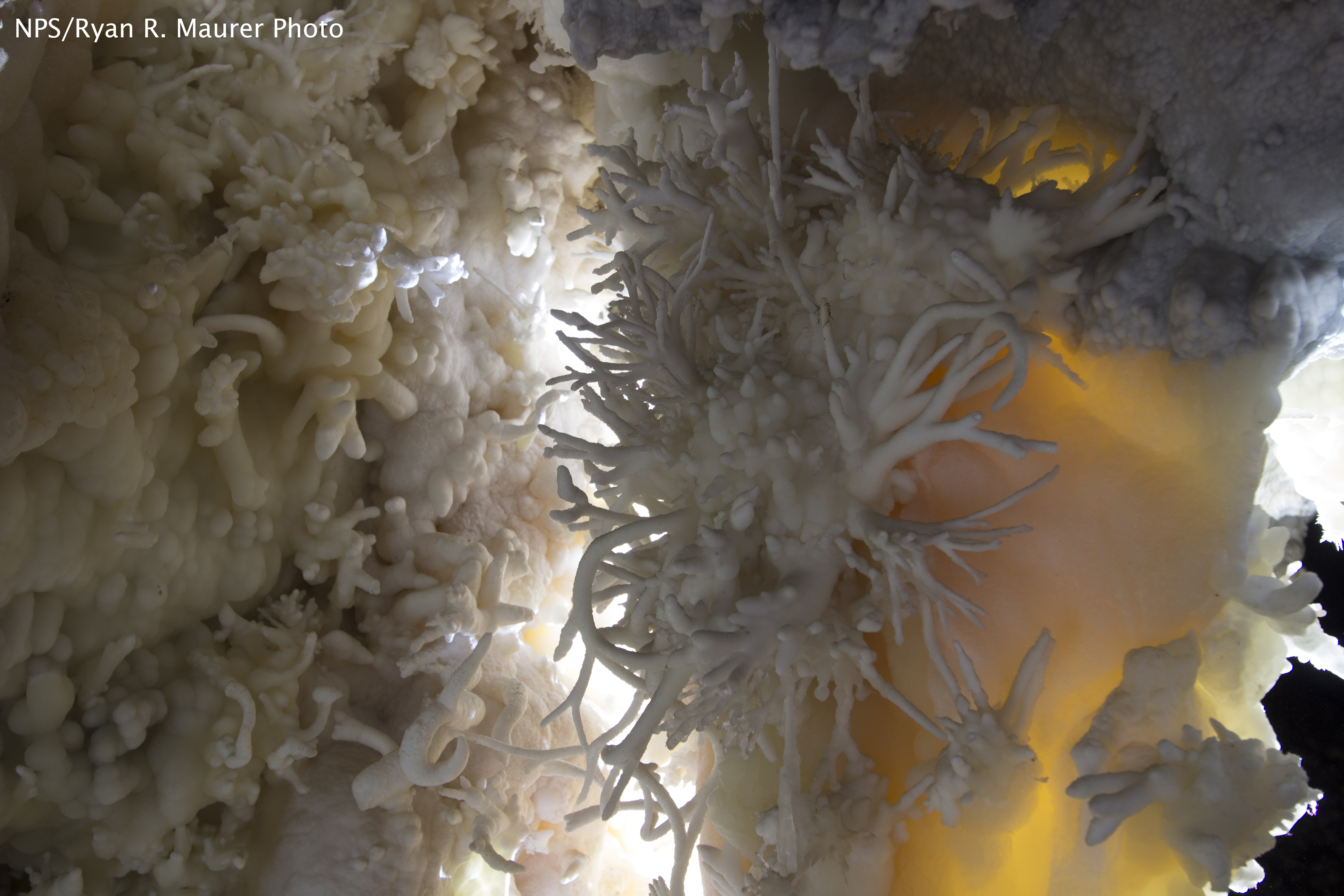
Timpanogos Cave National Monument
National Monument
The visitor center, caves, and cave tours have not yet opened for the 2026 season. Hike your way past stunning vistas to explore a hidden underground world. Taste the thrill of caving as you twist and...
7 mi from route
~17 min detour
$12
near mile 23
Caution: Tickets are required to enter Timpanogos Cave
Park data from the National Park Service API. Alerts update every 2 hours.
More Details
What kind of drive is this?
This 133.4-mile trek is far from a simple interstate cruise, as it is characterized as a turn-heavy local drive. You will spend only 9% of your time on major highways, meaning you should be prepared for more technical steering and frequent adjustments. The longest uninterrupted section is a 76.1-mile stretch along the Dinosaur Diamond Prehistoric Highway, which allows for a bit more steady momentum. You will also navigate segments of the Veterans Memorial Highway and SR 123 to complete the journey. Expect the road's personality to shift from well-traveled lanes to more localized paths, requiring your full attention as the route winds through the topography.
Only 9% highway — the rest is turn-by-turn surface driving.
22 navigation steps total — most of the decisions cluster near the start and finish.
Longest single stretch: 76.1 mi on Dinosaur Diamond Prehistoric Highway.
How Hard Is This Drive?
6/10
Expect a hands-on drive with frequent turns and local roads rather than long highway stretches. You will hit about 12 points where you need to pay attention to lane position or signs. The trickiest moment comes around 1.5 miles in near SR 209 / 9000 South.
Driving Effort6/10
Moderate - straightforward overall, but long enough or busy enough to require pacing
Balances navigation complexity with total wheel time.
This drive requires moderate attention. Across 133.4 miles you will encounter 12 spots where lane choice or exit timing matters. Not difficult for experienced highway drivers, but worth previewing the tricky sections before you go.
Where does it get tricky?
The main spots that need attention: at 1.5 miles (SR 209 / 9000 South): Lane positioning matters here; at 40.9 miles: Exit ramp - move to the correct lane early. Lane positioning matters here. Multiple destination signs - pick the right one; at 41.3 miles: Highway fork - watch signs carefully. Lane positioning matters here.
Elevation Profile
High-altitude sections with notable climbs
7,359 ft4,373 ft
Total Climb
4,003 ft
Total Descent
2,068 ft
Highest Point
7,359 ft
~77.8 mi in
Elevation Range
2,986 ft
Notable High Points
4,642 ft at ~11.1 miles+74 ft prominence
4,635 ft at ~27.8 miles+68 ft prominence
7,359 ft at ~77.8 miles+195 ft prominence
Towns Mentioned on Route Signs
Based on OSRM destination-sign hints, not a full list of every settlement the road passes.
On the drive from West Jordan, UT to East Carbon City, UT, road signs begin pointing toward Price along the way.
Price
40.9 mi in|~47m
Who Is This Route For?
Weekend Trip
Doable as a same-day drive at 2h 48m. Total distance: 133.4 miles.
Family Friendly
Moderate complexity with 1 natural rest stops along the way.
Solo Traveler
2h 48m drive, comfortable solo distance.
Scenic Drive
Mostly surface roads route profile with national parks nearby.
Frequently Asked Questions
The longest stretch is about 76.1 miles on Dinosaur Diamond Prehistoric Highway. The full list of main roads is in the Roads section above.
It helps. This route has a higher-than-average number of complex decision points, which get harder in the dark. If the last hour of the trip is on surface roads or mountain grades, aim to arrive at East Carbon City, UT before sunset when you can. Check the Trip Plan for departure windows that land you in daylight.
Only with planning. This is a long drive for kids — consider splitting it into two days rather than pushing through. Plan at least 1 meaningful breaks. Dedicated rest areas are limited, so plan gas or food stops as your bathroom breaks.
The main spots that need attention: at 1.5 miles (SR 209 / 9000 South): Lane positioning matters here; at 40.9 miles: Exit ramp - move to the correct lane early. Lane positioning matters here. Multiple destination signs - pick the right one; at 41.3 miles: Highway fork - watch signs carefully. Lane positioning matters here.
Yes — Timpanogos Cave National Monument. See the National Parks section for detour distances and tips on detours.
Yes. A round trip is manageable in a single day if you plan a break at East Carbon City, UT before heading back.