Origin
Orem, UT
Night in Orem on Saturday
Local time
10:49 PM
MDT
Current temp
64°F
Unavailable
Live forecast
Compiled and reviewed by the US Trip Planner planning team at COD Solutions Oy · Last reviewed Apr 19, 2026 · Editorial standards
Drive Time
2h 18m
Distance
106.6 mi
172 km
Drive Score
8/10
Great drive
Same Day?
Yes, doable
Fuel Cost
$17
one way
EV Charging
Unknown
Estimated drive times based on typical traffic patterns. Actual times may vary with weather, construction, and real-time conditions.

Orem, UT
Wikimedia Commons

East Carbon City, UT
Rockwell branding agency
Orem, UT to East Carbon City, UT is 106.6 miles and takes about 2h 18m via Dinosaur Diamond Prehistoric Highway and Veterans Memorial Highway, with a fuel budget near $17 and enough daylight to finish in a day. This trip stays within the Mountain West region, primarily within Utah, offering a focused drive through varied terrain. Given its relatively short duration and turn-heavy profile, it's best suited for a single day of travel. You'll be navigating local roads for a significant portion, so keep an eye on your surroundings as the landscape shifts. Consider this route if you're looking for a direct journey with a bit of winding character.
Trip Pace
Same-day drive is realistic
A same-day return is realistic if you keep stops short.
Midpoint
53.3 miles from Orem, UT
A natural place for your longest stop of the day , about 1h 5m into the drive .
| Road | Distance | Duration |
|---|---|---|
| Dinosaur Diamond Prehistoric Highway | 76.1 mi | 1h 32m |
| Veterans Memorial Highway | 12.1 mi | 12m |
| SR 123 | 8.4 mi | 14m |
| US 6 | 3.7 mi | 5m |
| East Main Street | 1.7 mi | 3m |
| West Center Street | 1.6 mi | 3m |
| State Street | 0.7 mi | 1m |
| West Highway Drive | 0.5 mi | <1m |
Step-by-step road directions between Orem, UT and East Carbon City, UT.
Start on US 89
Turn left onto West Center Street
Take the ramp
Merge onto I 15
Take the exit
Keep slight left at fork
Merge
Continue on US 6
Continue on US 6
Continue on US 6
Continue on US 6
Continue on US 6; US 191
Continue on US 6; US 191
Continue on US 6; US 191
Turn left onto SR 123
Turn left onto Grassy Trail Drive
At end of road, turn right onto Whitmore Drive
Turn left onto Grassy Trail Drive
Turn left onto Wilkins Street
Turn right onto Berkley Avenue
Arrive at destination
With a drive time of just over two hours and a modest fuel cost of around $17, this trip offers excellent flexibility. You can leave Orem in the morning and arrive in East Carbon City well before lunch, or even depart after lunch and still have plenty of daylight. Since the longest stretch is 76.1 miles, plan to refuel before you leave Orem to ensure you have ample gas, especially as opportunities for service might be less frequent on local roads. Pay close attention to the SR 123 section, as its turn-heavy nature suggests a need for careful navigation and awareness of your surroundings.
Morning Departure
Leave by 9 AM and you'll arrive before lunch.
Evening Departure
Even a 4 PM departure gets you there before dark in summer.
This is a comfortable same-day trip.
Departure
Before you leave
Start with fuel, water, and navigation already sorted so the first hour feels easy.
First stop
Around 23 miles or 29m in
Use this first pause for coffee, a restroom break, and a quick traffic check ahead.
Halfway reset
Around 53.3 miles or 1h 5m in
This is the best place for your longest stop, a real meal, and a full fuel check.
Final approach
Final hour starts around 1h 47m
Traffic, exits, and arrival timing usually matter more near East Carbon City, UT than in the middle of the route.
Open the route before leaving Orem, UT so your first major turns are already loaded.
Leave with enough water and a charging cable within reach, not packed away.
Check your fuel range against the first long segment, especially if you are starting outside city service areas.
Day 1
Settle into the route from Orem, UT
This is one driving day of about 106.6 miles and 2h 18m.
Rest stops, refuel points, and overnight suggestions along this route.

Mid-route town
Meal stop
53 mi into the route
Best for: Lunch, fuel, and a longer reset
This sits close to the middle of the route, so it works well for the longest stop of the day.
A short stop after about 23 miles helps settle the day before fatigue starts building.
The midpoint is around 53.3 miles from Orem, UT, which is a good place for a longer meal and fuel stop.
Before the longest stretch
Fuel checkTop up before Dinosaur Diamond Prehistoric Highway if your tank is already low. That segment runs about 76.1 miles.
These stop ideas are pacing suggestions — the exact town or exit can change with traffic, hotel plans, and fuel range.
5 decision points cluster between mile 1.7 and 106.1 — GPS handles the exact turns, but know they're coming. Your lane choice matters more than the turn itself.
Take the ramp toward I 15 South: Las Vegas
Lane positioning matters here
Take the exit toward US 6 East, SR 156: Spanish Fork, Main Street, Price
Exit ramp - move to the correct lane early. Lane positioning matters here. Multiple destination signs - pick the right one
Keep slight left at fork toward US 6 East: Price
Highway fork - watch signs carefully. Lane positioning matters here
Turn left onto SR 123
Lane positioning matters here
At end of road, turn right onto Whitmore Drive
Complex interchange - multiple decisions in a short stretch
Regular Gas
$16.89 one way
$33.78 round trip
| Fuel Type | $/gal | One Way | Round Trip |
|---|---|---|---|
| midgrade | $4.22 | $17.71 | $35.41 |
| premium | $4.53 | $19.02 | $38.03 |
| diesel | $5.61 | $23.54 | $47.07 |
No toll roads detected on this route.
Estimated Trip Cost (one way, 1 person)
Fuel
$17
Meals
$25–$50
Total
$42–$67
Rough estimate based on US averages. Hotel $80–$140/night, meals $25–$50/day.
Estimated CO2 emission: 37.3 kg one way. Prices: EIA weekly data, 2026-04-13.
Driving Electric?
About $11 in charging · 0 stops · 68% less CO2
| Vehicle Type | kWh | Stops | DC Fast | Home Charge |
|---|---|---|---|---|
| Average EV | 32 | 0 | $11.19 | $5.12 |
| Efficient EV | 26.7 | 0 | $9.33 | $4.26 |
| EV Truck/SUV | 42.6 | 0 | $14.92 | $6.82 |
Gas CO2
37 kg
EV CO2
12 kg (68% less)
This trip is well within single-charge range for most EVs. No charging stops needed if you start fully charged.
DC fast charging avg $0.35/kWh. Home charging avg $0.16/kWh. US grid CO2: 0.39 kg/kWh.
Current conditions at both ends of the drive.
Origin
Night in Orem on Saturday
Local time
10:49 PM
MDT
Current temp
64°F
Unavailable
Destination
Night in East Carbon City on Saturday
Local time
10:49 PM
MDT
Current temp
46°F
Unavailable
Seasonal Notes
Summer travel usually means heavier construction, hotter rest stops, and busier weekend traffic around major cities.
Winter travel shortens daylight, so a route that looks manageable on paper can feel much longer after dark.
Holiday weekends tend to make both departure and arrival windows slower than the raw route time suggests.
Time zone
Origin and destination are on the same clock, so arrival timing is easier to judge at a glance.
Temperature spread
A meaningful temperature swing is a good cue to rethink layers, water, and how soon you want to arrive.
Road read
Use the two city cards together: check the sky where you start, then compare it with the local time and temperature at arrival.
Weather data from the National Weather Service. Conditions may change; check closer to your travel date.
Worth a detour if your schedule allows.
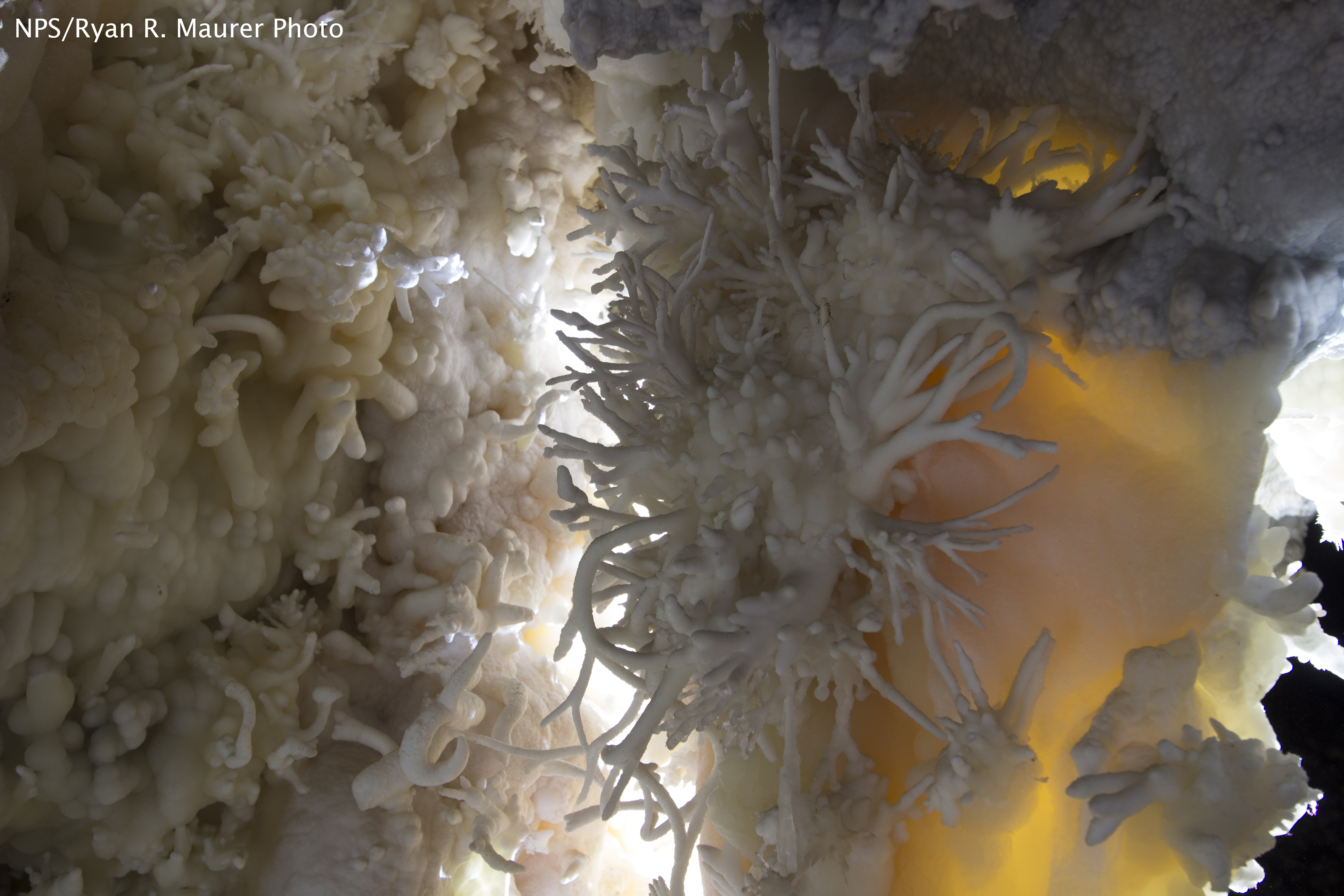
National Monument
The visitor center, caves, and cave tours have not yet opened for the 2026 season. Hike your way past stunning vistas to explore a hidden underground world. Taste the thrill of caving as you twist and...
Park data from the National Park Service API. Alerts update every 2 hours.
This drive is characterized as a turn-heavy local experience, meaning you'll be making frequent adjustments rather than settling into long, straight stretches. While 11% of the route is on highways, the majority involves navigating through towns and along secondary roads. The longest uninterrupted segment you'll encounter is 76.1 miles along the Dinosaur Diamond Prehistoric Highway, offering a more consistent pace before you transition back to more varied driving. Expect the road to feel more intimate and less like a major interstate, requiring your attention to navigate the curves and local transitions.
Expect a hands-on drive with frequent turns and local roads rather than long highway stretches. This route has several spots where lane changes, forks, or exits need your full attention. The trickiest moment comes around 1.7 miles in.
Demanding - plan breaks and stay ahead of the key maneuvers
Balances navigation complexity with total wheel time.
This is a demanding drive. With 11 significant decision points across 106.6 miles, you will need to stay alert - especially through interchange areas and urban stretches. Consider splitting it into segments if you are not comfortable with fast highway navigation.
Where does it get tricky?
The main spots that need attention: at 1.7 miles: Lane positioning matters here; at 14.1 miles: Exit ramp - move to the correct lane early. Lane positioning matters here. Multiple destination signs - pick the right one; at 14.5 miles: Highway fork - watch signs carefully. Lane positioning matters here.
Based on OSRM destination-sign hints, not a full list of every settlement the road passes.
On the drive from Orem, UT to East Carbon City, UT, road signs begin pointing toward Price along the way.
Price
Weekend Trip
Doable as a same-day drive at 2h 18m. Total distance: 106.6 miles.
Family Friendly
Moderate complexity with 0 natural rest stops along the way.
Solo Traveler
2h 18m drive, comfortable solo distance.
Scenic Drive
Mostly surface roads route profile with national parks nearby.
Compiled by the US Trip Planner planning team at COD Solutions Oy from open government datasets — OSRM over OpenStreetMap for geometry, EIA for fuel prices, and NPS for national parks. See our methodology for refresh cadence and limitations.
Was this helpful?
Thanks for your feedback!
Your tip has been submitted. Thanks!
/500
Recent Tips
·
Explore more options from Orem, UT or browse trips ending in East Carbon City, UT.
Looking for more statewide routes? Browse UT road trips.