Origin
Unity, NH
Night in Unity on Saturday
Local time
10:44 PM
EDT
Current temp
36°F
Unavailable
Live forecast
Compiled and reviewed by the US Trip Planner planning team at COD Solutions Oy · Last reviewed Apr 19, 2026 · Editorial standards
Drive Time
2h 23m
Distance
87.9 mi
141 km
Drive Score
9/10
Great drive
Same Day?
Yes, doable
Fuel Cost
$14
one way
EV Charging
Unknown
Estimated drive times based on typical traffic patterns. Actual times may vary with weather, construction, and real-time conditions.

Unity, NH
Wikimedia Commons

Dover, NH
Wikimedia Commons
This 87.9-mile drive from Unity, NH to Dover, NH is easily manageable as a day trip, taking approximately 2 hours and 23 minutes. You'll primarily travel on Franklin Pierce Highway and Dover Road, with some time spent on I-89, giving it a mixed-use highway character. With an estimated fuel cost of around $14, this trip is quite budget-friendly for a single day's excursion. The route stays within the Northeast region, offering a straightforward journey through New Hampshire. Given its relatively short length and manageable duration, you can comfortably complete this trip and return on the same day.
Trip Pace
Same-day drive is realistic
A same-day return is realistic if you keep stops short.
Midpoint
44 miles from Unity, NH
A natural place for your longest stop of the day , about 1h 11m into the drive .
| Road | Distance | Duration |
|---|---|---|
| Franklin Pierce Highway | 16.3 mi | 22m |
| Dover Road | 9.2 mi | 15m |
| I 89 | 8.3 mi | 10m |
| First New Hampshire Turnpike | 7.8 mi | 12m |
| 2nd New Hampshire Turnpike | 5.4 mi | 10m |
| Old Turnpike Road | 5.1 mi | 7m |
| North Main Street | 4.5 mi | 8m |
| I 393 | 4.4 mi | 6m |
Step-by-step road directions between Unity, NH and Dover, NH.
Start on 2nd NH Turnpike
Continue on Lempster Street
Continue on 2nd New Hampshire Turnpike
Continue on Mountain Road
Continue on Lempster Mountain Road
Turn right onto NH 31
Continue on NH 31
Continue on NH 31
Turn left onto NH 9
Turn straight onto NH 9
Merge onto I 89
Turn left onto NH 3A
Continue on NH 3A
Take the ramp
Merge onto I 93
Continue on I 93
Take the exit
Merge onto I 393; US 4; US 202
Continue on NH 9; US 4; US 202
Continue on US 4; US 202; NH 9
Enter roundabout onto US 4; US 202; NH 9
Continue on US 4; US 202; NH 9
Continue on US 4; US 202; NH 9; NH 107
Continue on US 4
Continue on US 4
Continue on US 4
Enter roundabout onto US 4
Continue on US 4
Take the exit
Turn left onto NH 155
Continue on NH 155
Continue on NH 155
Continue on NH 155
Enter roundabout onto NH 9
Continue on NH 9
Turn left onto Locust Street
Turn straight onto Chestnut Street
Turn right onto Third Street
Turn sharp right onto NH 4; NH 9; NH 108
Turn left
Arrive at destination
For this 2-hour and 23-minute journey, there's no need to split it, giving you flexibility on when to depart. Leaving in the morning or mid-afternoon will help you avoid potential peak traffic. With only 87.9 miles, you can easily complete this trip without needing to plan for extensive stops, though quick breaks are always advisable. Keep an eye on your fuel gauge, as the estimated cost is $14, indicating it's a relatively inexpensive trip to fuel up for. A specific tip for this route: pay attention to the transitions between Franklin Pierce Highway and Dover Road, as these can mark changes in speed limits and road conditions.
Morning Departure
Leave by 9 AM and you'll arrive before lunch.
Evening Departure
Even a 4 PM departure gets you there before dark in summer.
This is a comfortable same-day trip.
Departure
Before you leave
Start with fuel, water, and navigation already sorted so the first hour feels easy.
First stop
Around 19 miles or 37m in
Use this first pause for coffee, a restroom break, and a quick traffic check ahead.
Halfway reset
Around 44 miles or 1h 11m in
This is the best place for your longest stop, a real meal, and a full fuel check.
Final approach
Final hour starts around 2h
Traffic, exits, and arrival timing usually matter more near Dover, NH than in the middle of the route.
Open the route before leaving Unity, NH so your first major turns are already loaded.
Leave with enough water and a charging cable within reach, not packed away.
Check your fuel range against the first long segment, especially if you are starting outside city service areas.
Day 1
Settle into the route from Unity, NH
This is one driving day of about 87.9 miles and 2h 23m.
Rest stops, refuel points, and overnight suggestions along this route.

Mid-route town
Meal stop
44 mi into the route
Best for: Lunch, fuel, and a longer reset
This sits close to the middle of the route, so it works well for the longest stop of the day.
A short stop after about 19 miles helps settle the day before fatigue starts building.
The midpoint is around 44 miles from Unity, NH, which is a good place for a longer meal and fuel stop.
These stop ideas are pacing suggestions — the exact town or exit can change with traffic, hotel plans, and fuel range.
5 decision points cluster between mile 38.4 and 87.9 — GPS handles the exact turns, but know they're coming. Your lane choice matters more than the turn itself.
Merge onto I 89
Merge point - match speed before joining. Lane positioning matters here
Turn left onto NH 3A / Route 3-A
Lane positioning matters here
Take the exit toward I 393 East, US 4 East, US 202 East: Loudon, Portsmouth
Exit ramp - move to the correct lane early. Multiple destination signs - pick the right one
Enter roundabout onto US 4 / Concord Road
Roundabout - know your exit number before entering
Turn sharp right onto NH 4; NH 9; NH 108 / Central Avenue
Sharp turn - reduce speed on approach
Regular Gas
$14.15 one way
$28.30 round trip
| Fuel Type | $/gal | One Way | Round Trip |
|---|---|---|---|
| midgrade | $4.50 | $15.57 | $31.14 |
| premium | $4.86 | $16.83 | $33.67 |
| diesel | $5.61 | $19.41 | $38.81 |
Estimated Tolls: $1.66
Toll estimates based on average 2024-2025 rates. EZ-Pass/SunPass discounts may lower the actual cost.
Estimated Trip Cost (one way, 1 person)
Fuel
$14
Tolls
$2
Meals
$25–$50
Total
$41–$66
Rough estimate based on US averages. Hotel $80–$140/night, meals $25–$50/day.
Estimated CO2 emission: 30.8 kg one way. Prices: EIA weekly data, 2026-04-13.
Driving Electric?
About $9 in charging · 0 stops · 68% less CO2
| Vehicle Type | kWh | Stops | DC Fast | Home Charge |
|---|---|---|---|---|
| Average EV | 26.4 | 0 | $9.23 | $4.22 |
| Efficient EV | 22 | 0 | $7.69 | $3.52 |
| EV Truck/SUV | 35.2 | 0 | $12.31 | $5.63 |
Gas CO2
31 kg
EV CO2
10 kg (68% less)
This trip is well within single-charge range for most EVs. No charging stops needed if you start fully charged.
DC fast charging avg $0.35/kWh. Home charging avg $0.16/kWh. US grid CO2: 0.39 kg/kWh.
Current conditions at both ends of the drive.
Origin
Night in Unity on Saturday
Local time
10:44 PM
EDT
Current temp
36°F
Unavailable
Destination
Night in Dover on Saturday
Local time
10:44 PM
EDT
Current temp
51°F
Unavailable
51°F
Concord, NH
44 mi in
Seasonal Notes
Summer travel usually means heavier construction, hotter rest stops, and busier weekend traffic around major cities.
Winter travel shortens daylight, so a route that looks manageable on paper can feel much longer after dark.
Holiday weekends tend to make both departure and arrival windows slower than the raw route time suggests.
Time zone
Origin and destination are on the same clock, so arrival timing is easier to judge at a glance.
Temperature spread
A meaningful temperature swing is a good cue to rethink layers, water, and how soon you want to arrive.
Road read
Use the two city cards together: check the sky where you start, then compare it with the local time and temperature at arrival.
Weather data from the National Weather Service. Conditions may change; check closer to your travel date.
Worth a detour if your schedule allows.
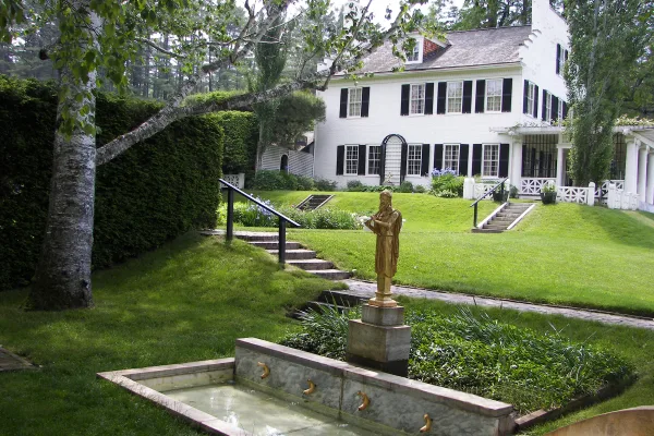
National Historical Park
Your National Park for the Arts preserves the home and studio of sculptor Augustus Saint-Gaudens (1848-1907). Here stories flow through a landscape of inspiration. Discover the history behind the capt...
Park data from the National Park Service API. Alerts update every 2 hours.
This route offers a varied driving experience, with 42% of it being highway driving. The longest uninterrupted stretch you'll encounter is 16.3 miles along Franklin Pierce Highway, which suggests a good balance between faster travel and more local road segments. Expect a mixed drive profile, meaning you'll transition between different types of roads, likely experiencing both quicker highway cruising and more winding, perhaps slower, sections as you navigate through New Hampshire. This blend ensures the drive isn't monotonous, keeping you engaged behind the wheel.
This route mixes highway mileage with some local-road sections near the start or finish. You will hit about 20 points where you need to pay attention to lane position or signs. The trickiest moment comes around 38.4 miles in near I 89.
Moderate - straightforward overall, but long enough or busy enough to require pacing
Balances navigation complexity with total wheel time.
This drive requires moderate attention. Across 87.9 miles you will encounter 20 spots where lane choice or exit timing matters. Not difficult for experienced highway drivers, but worth previewing the tricky sections before you go.
Where does it get tricky?
The main spots that need attention: at 38.4 miles (I 89): Merge point - match speed before joining. Lane positioning matters here; at 46.7 miles (NH 3A / Route 3-A): Lane positioning matters here; at 49.9 miles: Exit ramp - move to the correct lane early. Multiple destination signs - pick the right one.
Gently rolling terrain
Total Climb
836 ft
Total Descent
2,236 ft
Highest Point
1,542 ft
~12.6 mi in
Elevation Range
1,477 ft
Based on OSRM destination-sign hints, not a full list of every settlement the road passes.
Between Unity, NH and Dover, NH, road signs point toward Portsmouth and Madbury.
Portsmouth
Madbury
Weekend Trip
Doable as a same-day drive at 2h 23m. Total distance: 87.9 miles.
Family Friendly
Moderate complexity with 0 natural rest stops along the way.
Solo Traveler
2h 23m drive, comfortable solo distance.
First-Time Driver
Mostly highway driving (42%). Some complex stretches to watch for.
Scenic Drive
Mixed highway & surface route profile with national parks nearby.
Compiled by the US Trip Planner planning team at COD Solutions Oy from open government datasets — OSRM over OpenStreetMap for geometry, EIA for fuel prices, USGS 3DEP for elevation, and NPS for national parks. See our methodology for refresh cadence and limitations.
Was this helpful?
Thanks for your feedback!
Your tip has been submitted. Thanks!
/500
Recent Tips
·
Explore more options from Unity, NH or browse trips ending in Dover, NH.
Looking for more statewide routes? Browse NH road trips.