Dover to Alstead is 94.7 miles and takes about 2h 35m via US 202 and I-89, with a fuel budget near $15 and enough daylight to finish in a day. This drive stays within New Hampshire, moving from the Northeast region towards its western edge. It's a straightforward, mostly highway-focused trip, making it a practical choice for a single-day excursion. If you're looking for an efficient way to cover ground between these two points without extensive planning, this route will get you there reliably.
Trip Pace
Same-day drive is realistic
A same-day return is realistic if you keep stops short.
Break Rhythm
1 planned break
A short stop every 2 to 3 hours is enough for this drive.
Midpoint
47.3 miles from Dover, NH
A natural place for your longest stop of the day
, about 1h 14m into the drive
.
Main Roads
Road
Distance
Duration
US 202
15.5 mi
21m
Dover Road
9.2 mi
15m
I 89
7.8 mi
9m
First New Hampshire Turnpike
7.8 mi
12m
Route 123 North
7.4 mi
13m
Keene Road
5.7 mi
8m
Old Turnpike Road
5.1 mi
7m
I 393
4.9 mi
7m
Longest stretch:
US 202
— 15.5 mi, about 21m
Traffic on I-89
Hour-of-day weekday pattern from 3 FHWA count stations on your route.
Peak
4 PM
~2,385 veh/hr typical
· worst 2,924
Quietest
1 AM
~85 veh/hr
Peak-to-quiet ratio
28.1×
busier at peak than in the quiet hours
12a6anoon6p11p
Averaged across 51 weeks of 2023 FHWA Travel Monitoring Analysis System data. Weekday hours only (Mon–Fri).
Turn-by-Turn Driving Directions
Step-by-step road directions between Dover, NH and Alstead, NH.
1
Start on this road
21 ft·8 sec·this road
2
Turn sharp left onto NH 9; NH 108
320 ft·18 sec·Main Street
3
Turn sharp left onto NH 4; NH 9; NH 108
0.4 mi·57 sec·Central Avenue
Use the straight / left lanes.
4
Turn right onto Hale Street
344 ft·18 sec·Hale Street
5
Turn left onto Locust Street
0.2 mi·33 sec·Locust Street
6
Turn right onto NH 9
0.6 mi·1 min·Silver Street
7
Enter roundabout onto NH 9
215 ft·4 sec·Knox Marsh Road
8
Continue on NH 9
3.2 mi·5 min·Knox Marsh Road
Use the straight lane.
9
Continue on NH 155
347 ft·7 sec·Manchester Road
10
Continue on NH 155
1.3 mi·2 min·Lee Road
11
Continue on NH 155
1.1 mi·2 min·Turtle Pond Road
12
Take the ramp
0.2 mi·19 sec
13
Merge onto US 4
1.3 mi·1 min·Concord Road
14
Enter roundabout onto US 4
158 ft·4 sec·Concord Road
15
Continue on US 4
0.5 mi·55 sec·Concord Road
16
Continue on US 4
1.8 mi·2 min·Old Concord Turnpike
17
Continue on US 4
5.1 mi·7 min·Old Turnpike Road
Use the straight lane.
18
Continue on US 4
7.8 mi·12 min·First New Hampshire Turnpike
Use the right lane.
19
Continue on US 4; US 202; NH 9; NH 107
4.3 mi·7 min·Dover Road
Use the straight / right lanes.
20
Enter roundabout onto US 4; US 202; NH 9
265 ft·6 sec·Dover Road
21
Continue on US 4; US 202; NH 9
4.9 mi·7 min·Dover Road
Use the left / straight / right lanes.
22
Keep slight right at fork onto I 393; US 4; US 202
4.6 mi·6 min·I 393; US 4; US 202
23
Continue on I 393; US 202
0.2 mi·24 sec·I 393; US 202
24
Take the exit
0.3 mi·50 sec
Toward I 93 South: Manchester, Lebanon
25
Merge onto I 93
0.8 mi·1 min·Styles Bridges Highway
26
Continue on I 93
2.5 mi·3 min·Everett Turnpike
27
Take the exit
0.3 mi·41 sec
Toward I 89 North: Lebanon, White River Junction VermontUse the straight / slight right lanes.
28
Merge onto I 89
7.8 mi·9 min·I 89
29
Take the exit
0.9 mi·1 min
Exit 5Toward US 202 West, NH 9 West: Henniker, Keene
30
Continue on US 202; NH 9
15 mi·21 min·US 202; NH 9
Use the straight lane.
31
Continue on NH 9
1.9 mi·2 min·West Main Street
32
Continue on NH 9; NH 31
5.7 mi·8 min·Keene Road
33
Continue on NH 9
2.3 mi·3 min·Route 9
34
Turn right onto NH 123
7.4 mi·13 min·Route 123 North
35
Continue on NH 123
0.3 mi·28 sec·Forest Road East
36
Continue on NH 123
0.2 mi·19 sec·Telephone Road
37
Turn right onto NH 10; NH 123
1.0 mi·1 min·State Route 10
38
Turn left onto NH 123
4.8 mi·12 min·NH Route 123
39
Continue on NH 123
4.7 mi·11 min·Forest Road
40
Continue on NH 12A; NH 123
0.6 mi·1 min·Mechanic Street
41
Arrive at destination
NH 12A; NH 123
Trip Plan
Given the 2h 35m duration, this is a comfortable one-day trip, so consider leaving in the morning to maximize your time at your destination. With only one recommended stop and a fuel cost estimated at $15, you won't need extensive planning for amenities. Keep an eye on your fuel gauge, especially when transitioning between US 202 and I-89, as highway services can be more spread out. The longest stretch on US 202 is about 15.5 miles, so plan any brief stops before or after that segment.
Morning Departure
Leave by 9 AM and you'll arrive before lunch.
Evening Departure
Even a 4 PM departure gets you there before dark in summer.
You can normally do this drive in one day.
Plan roughly 1 meaningful break for fuel, food, and rest.
The halfway point lands around 47.3 miles from Dover, NH, or about 1h 14m into the drive.
The longest continuous stretch on this route runs about 15.5 miles.
This is a comfortable same-day trip.
Departure
Before you leave
Start with fuel, water, and navigation already sorted so the first hour feels easy.
First stop
Around 21 miles or 35m in
Use this first pause for coffee, a restroom break, and a quick traffic check ahead.
Halfway reset
Around 47.3 miles or 1h 14m in
This is the best place for your longest stop, a real meal, and a full fuel check.
Final approach
Final hour starts around 1h 58m
Traffic, exits, and arrival timing usually matter more near Alstead, NH than in the middle of the route.
Before You Leave
+
Open the route before leaving Dover, NH so your first major turns are already loaded.
+
Leave with enough water and a charging cable within reach, not packed away.
+
Check your fuel range against the first long segment, especially if you are starting outside city service areas.
Day 1
Settle into the route from Dover, NH
This is one driving day of about 94.7 miles and 2h 35m.
Your first comfortable stop window is around 21 miles from Dover, NH.
This route can stay practical as a one-day drive if traffic stays reasonable.
Plan about 1 real break rather than only quick fuel stops.
The longest stretch is on US 202 for about 15.5 miles.
Where to Stop
Rest stops, refuel points, and overnight suggestions along this route.
Place data sourced from public business listings. Hours and availability may vary.
Heads-up: tricky spots
5 of 21
5 decision points cluster between mile 0 and 49.5 — GPS handles the exact turns, but know they're coming. Your lane choice matters more than the turn itself.
6
0 mi into trip|~0m in|NH 9; NH 108 / Main Street
Turn sharp left onto NH 9; NH 108 / Main Street
Sharp turn - reduce speed on approach
7
0.1 mi into trip|~0m in|NH 4; NH 9; NH 108 / Central Avenue
Turn sharp left onto NH 4; NH 9; NH 108 / Central Avenue
Sharp turn - reduce speed on approach. Lane positioning matters here
Use the straight / left lanes.
6
37.7 mi into trip|~1h 2m in
Take the exit toward I 93 South: Manchester, Lebanon
Exit ramp - move to the correct lane early. Multiple destination signs - pick the right one
Toward I 93 South: Manchester, Lebanon
7
41.3 mi into trip|~1h 7m in
Take the exit toward I 89 North: Lebanon, White River Junction Vermont
Exit ramp - move to the correct lane early. Lane positioning matters here. Multiple destination signs - pick the right one
Use the straight / slight right lanes.
Toward I 89 North: Lebanon, White River Junctio...
6
49.5 mi into trip|~1h 17m in
Take the exit toward US 202 West, NH 9 West: Henniker, Keene
Exit ramp - move to the correct lane early. Multiple destination signs - pick the right one
Toll estimates based on average 2024-2025 rates. EZ-Pass/SunPass discounts may lower the actual cost.
Estimated Trip Cost (one way, 1 person)
Fuel
$15
Tolls
$1
Meals
$25–$50
Total
$41–$66
Rough estimate based on US averages. Hotel $80–$140/night, meals $25–$50/day.
Estimated CO2 emission: 33.1 kg one way.
Prices: EIA weekly data, 2026-07-13.
Driving Electric?
About $10 in charging
· 0 stops
· 67% less CO2
Vehicle Type
kWh
Stops
DC Fast
Home Charge
Average EV
28.4
0
$9.94
$4.55
Efficient EV
23.7
0
$8.29
$3.79
EV Truck/SUV
37.9
0
$13.26
$6.06
Gas CO2
33 kg
EV CO2
11 kg (67% less)
This trip is well within single-charge range for most EVs. No charging stops needed if you start fully charged.
DC fast charging avg $0.35/kWh. Home charging avg $0.16/kWh. US grid CO2: 0.39 kg/kWh.
Travel Intel
Current conditions at both ends of the drive.
Forecast as of Jul 5, 2026
Origin
Dover, NH
Night
in Dover on Saturday
Local time
9:30 PM
EDT
Current temp
62°F
Mostly Clear
0 mph1% chanceLive forecast
Destination
Alstead, NH
Night
in Alstead on Saturday
Local time
9:30 PM
EDT
Current temp
57°F
Patchy Fog
0 mph2% chanceLive forecast
80°F
Concord, NH
47 mi in
Seasonal Notes
Summer travel usually means heavier construction, hotter rest stops, and busier weekend traffic around major cities.
Winter travel shortens daylight, so a route that looks manageable on paper can feel much longer after dark.
Holiday weekends tend to make both departure and arrival windows slower than the raw route time suggests.
Time zone
Same local time
Origin and destination are on the same clock, so arrival timing is easier to judge at a glance.
Temperature spread
5 degrees cooler at arrival
A meaningful temperature swing is a good cue to rethink layers, water, and how soon you want to arrive.
Road read
2h 35m on the road
The weather snapshot is not static. If you are leaving later, give both cities one more quick forecast check before departure.
Weather data from the National Weather Service. Conditions may change; check closer to your travel date.
National Parks Near This Route
Worth a detour if your schedule allows.
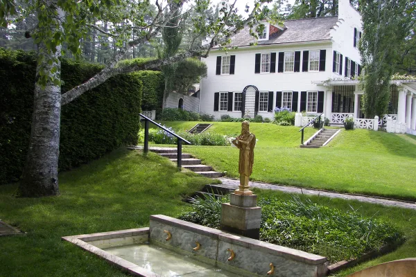
Saint-Gaudens National Historical Park
National Historical Park
Your National Park for the Arts preserves the home and studio of sculptor Augustus Saint-Gaudens (1848-1907). Here stories flow through a landscape of inspiration. Discover the history behind the capt...
24 mi from route
~61 min detour
$10
near mile 94.7
Park data from the National Park Service API. Alerts update every 2 hours.
More Details
What kind of drive is this?
This journey is primarily a highway-focused drive, with 64% of the total mileage on faster roads like I-89. You'll experience stretches of efficient travel, including a longest continuous segment of 15.5 miles on US 202. Expect a mix of speeds, transitioning from local roads near Dover to more open highway driving as you progress. The overall feel is one of steady forward momentum, designed for covering distance effectively rather than lingering at viewpoints.
64% highway — fuel and pacing are the main things to plan.
41 navigation steps total — most of the decisions cluster near the start and finish.
Longest single stretch: 15.5 mi on US 202.
How Hard Is This Drive?
8/10
This is a straightforward highway drive that stays mostly on US 202 and Dover Road. This route has several spots where lane changes, forks, or exits need your full attention. The trickiest moment comes early in the drive near NH 9; NH 108 / Main Street.
Driving Effort8/10
Demanding - plan breaks and stay ahead of the key maneuvers
Balances navigation complexity with total wheel time.
This is a demanding drive. With 21 significant decision points across 94.7 miles, you will need to stay alert - especially through interchange areas and urban stretches. Consider splitting it into segments if you are not comfortable with fast highway navigation.
Where does it get tricky?
The main spots that need attention: near the start (NH 9; NH 108 / Main Street): Sharp turn - reduce speed on approach; at 0.1 miles (NH 4; NH 9; NH 108 / Central Avenue): Sharp turn - reduce speed on approach. Lane positioning matters here; at 37.7 miles: Exit ramp - move to the correct lane early. Multiple destination signs - pick the right one.
Elevation Profile
Gently rolling terrain
1,642 ft66 ft
Total Climb
1,999 ft
Total Descent
1,585 ft
Highest Point
1,642 ft
~81.2 mi in
Elevation Range
1,577 ft
Towns Mentioned on Route Signs
Based on OSRM destination-sign hints, not a full list of every settlement the road passes.
Between Dover, NH and Alstead, NH, road signs point toward Lebanon, White River Junction Vermont and Keene.
Doable as a same-day drive at 2h 35m. Total distance: 94.7 miles.
Family Friendly
Moderate complexity with 1 natural rest stops along the way.
Solo Traveler
2h 35m drive, comfortable solo distance.
First-Time Driver
Mostly highway driving (64%). Some complex stretches to watch for.
Frequently Asked Questions
The longest stretch is about 15.5 miles on US 202. The full list of main roads is in the Roads section above.
Expect about $1.20 in tolls one way, starting with First New Hampshire Turnpike. Most Northeast and Midwest toll agencies accept E-ZPass; in the West and Texas, transponders like TxTag or FasTrak apply. If you do not have a transponder, cashless tolling plates will mail a bill to the vehicle's registered address — usually with a surcharge, so a rental-car toll pass is often cheaper than paying by mail.
It helps. This route has a higher-than-average number of complex decision points, which get harder in the dark. If the last hour of the trip is on surface roads or mountain grades, aim to arrive at Alstead, NH before sunset when you can. Check the Trip Plan for departure windows that land you in daylight.
Only with planning. This is a long drive for kids — consider splitting it into two days rather than pushing through. Plan at least 1 meaningful breaks. Dedicated rest areas are limited, so plan gas or food stops as your bathroom breaks.
Mostly yes along the main roads, but rural stretches through NH can have sparse or no coverage. Before you leave, download offline Google Maps or Apple Maps for the route, and consider downloading music or podcasts instead of streaming. If you depend on data for navigation, keep a paper backup of the turn-by-turn directions.
The main spots that need attention: near the start (NH 9; NH 108 / Main Street): Sharp turn - reduce speed on approach; at 0.1 miles (NH 4; NH 9; NH 108 / Central Avenue): Sharp turn - reduce speed on approach. Lane positioning matters here; at 37.7 miles: Exit ramp - move to the correct lane early. Multiple destination signs - pick the right one.
Yes — Saint-Gaudens National Historical Park. See the National Parks section for detour distances and tips on detours.
Yes. A round trip is manageable in a single day if you plan a break at Alstead, NH before heading back.