Brady Rest Area Eastbound
0 mi from route
Compiled and reviewed by the US Trip Planner planning team at COD Solutions Oy · Last reviewed Jul 19, 2026 · Editorial standards
Drive Time
6h 43m
Distance
369.5 mi
595 km
Drive Score
8/10
Great drive
Same Day?
Yes, doable
Fuel Cost
$55
one way
EV Charging
Unknown
Estimated drive times based on typical traffic patterns. Actual times may vary with weather, construction, and real-time conditions.

Scottsbluff, NE
Wikimedia Commons

Stromsburg, NE
Enric Cruz López
Scottsbluff, NE to Stromsburg, NE is 369.5 miles and takes about 6h 43m via I 80 and US 34, with a fuel budget near $56 and enough daylight to finish in a day. This trip stays within the Great Plains region of Nebraska, offering a straightforward drive across the state. Given its duration and mostly highway profile, it's a manageable one-day excursion for most drivers. You'll spend the bulk of your time on major interstates and highways, making it a relatively efficient way to travel between these two points.
Trip Pace
Same-day drive is realistic
A same-day return is possible, but it will make for a full day on the road.
Break Rhythm
1 planned break
Plan on a short reset every 3 to 4 hours to stay fresh behind the wheel.
Midpoint
184.7 miles from Scottsbluff, NE
A natural place for your longest stop of the day , about 3h 32m into the drive .
| Road | Distance | Duration |
|---|---|---|
| I 80 | 220.7 mi | 3h 40m |
| US 26 | 84 mi | 1h 39m |
| US 34 | 16.1 mi | 19m |
| US Highway 26 | 12.5 mi | 15m |
| Highway 92 | 11 mi | 12m |
| Highway 26 | 7.5 mi | 9m |
| Road H | 4.7 mi | 6m |
| Highway 34 | 4 mi | 4m |
Hour-of-day weekday pattern from 48 FHWA count stations on your route.
Peak
3 PM
~702 veh/hr typical · worst 1,053
Quietest
3 AM
~101 veh/hr
Peak-to-quiet ratio
7×
busier at peak than in the quiet hours
Averaged across 52 weeks of 2023 FHWA Travel Monitoring Analysis System data. Weekday hours only (Mon–Fri).
Step-by-step road directions between Scottsbluff, NE and Stromsburg, NE.
Start on Avenue C
Turn left onto West 20th Street
Continue on East 20th Street
Turn right onto US 26; N-71; N-92
Turn right onto L-79E
Turn left onto N-92
Continue on US 26; N-92
Turn left onto US 26; US 385
Continue on US 26
Turn right onto North Spruce Street
Turn left onto US 26; US 30; N-61; I 80 Alt
Turn right onto US 26; N-61
Turn left
Merge onto I 80
Take the exit
Turn left onto Road H
Turn right onto US 34; I 80 Alt
Turn left onto US 34; US 81; I 80 Alt
Turn left onto 4th Street
Arrive at destination
To make the most of this 6-hour drive, consider departing in the morning to allow ample time for any unscheduled stops. With a total drive time of under 7 hours and a fuel cost estimated at $56, you can comfortably complete this route in a single day. The longest stretch without a major town is 220.7 miles on I 80, so ensure you have sufficient fuel before entering that segment. Plan for at least one stop to stretch your legs and break up the drive, perhaps around the halfway point.
Morning Departure
Start early — leave by 6-7 AM to arrive at a reasonable hour.
Evening Departure
This is a long drive — plan for a morning departure or consider splitting it into two days.
This is a comfortable same-day trip.
Departure
Before you leave
Start with fuel, water, and navigation already sorted so the first hour feels easy.
First stop
Around 81 miles or 1h 38m in
Use this first pause for coffee, a restroom break, and a quick traffic check ahead.
Halfway reset
Around 184.7 miles or 3h 32m in
This is the best place for your longest stop, a real meal, and a full fuel check.
Final approach
Final hour starts around 5h 37m
Traffic, exits, and arrival timing usually matter more near Stromsburg, NE than in the middle of the route.
Open the route before leaving Scottsbluff, NE so your first major turns are already loaded.
Leave with enough water and a charging cable within reach, not packed away.
Check your fuel range against the first long segment, especially if you are starting outside city service areas.
Day 1
Settle into the route from Scottsbluff, NE
This is one driving day of about 369.5 miles and 6h 43m.
Rest stops, refuel points, and overnight suggestions along this route.

Mid-route town
Meal stop
185 mi into the route
Best for: Lunch, fuel, and a longer reset
This sits close to the middle of the route, so it works well for the longest stop of the day.
A short stop after about 81 miles helps settle the day before fatigue starts building.
The midpoint is around 184.7 miles from Scottsbluff, NE, which is a good place for a longer meal and fuel stop.
Before the longest stretch
Fuel checkTop up before I 80 if your tank is already low. That segment runs about 220.7 miles.
These stop ideas are pacing suggestions — the exact town or exit can change with traffic, hotel plans, and fuel range.
Picked by where they fit in your drive — first break, midpoint reset, final stretch.
Place data sourced from public business listings. Hours and availability may vary.
5 decision points cluster between mile 0 and 122.3 — GPS handles the exact turns, but know they're coming. Your lane choice matters more than the turn itself.
Turn left onto West 20th Street
Navigation decision point
Turn right onto L-79E / Highway L79E
Lane positioning matters here
Turn right onto North Spruce Street
Navigation decision point
Turn left onto US 26; US 30; N-61; I 80 Alt
Navigation decision point
Turn right onto US 26; N-61 / South Highway 26/61
Navigation decision point
Regular Gas
$54.57 one way
$109.13 round trip
| Fuel Type | $/gal | One Way | Round Trip |
|---|---|---|---|
| midgrade | $4.14 | $60.24 | $120.48 |
| premium | $4.72 | $68.60 | $137.21 |
| diesel | $4.80 | $69.77 | $139.54 |
No toll roads detected on this route.
Estimated Trip Cost (one way, 1 person)
Fuel
$55
Meals
$25–$50
Total
$80–$105
Rough estimate based on US averages. Hotel $80–$140/night, meals $25–$50/day.
Estimated CO2 emission: 129.3 kg one way. Prices: EIA weekly data, 2026-07-13.
Driving Electric?
About $39 in charging · 1 stop · 67% less CO2
| Vehicle Type | kWh | Stops | DC Fast | Home Charge |
|---|---|---|---|---|
| Average EV | 110.9 | 1 | $38.80 | $17.74 |
| Efficient EV | 92.4 | 1 | $32.33 | $14.78 |
| EV Truck/SUV | 147.8 | 1 | $51.73 | $23.65 |
Gas CO2
129 kg
EV CO2
43 kg (67% less)
Plan for 1 charging stop. A 30-minute DC fast charge mid-route should be enough to complete the trip comfortably.
DC fast charging avg $0.35/kWh. Home charging avg $0.16/kWh. US grid CO2: 0.39 kg/kWh.
Current conditions at both ends of the drive.
Origin
Evening in Scottsbluff on Saturday
Local time
7:30 PM
MDT
Current temp
63°F
Clear
Heat Advisory
Heat Advisory issued July 17 at 1:31AM CDT until July 17 at 9:00PM CDT by NWS Sioux Falls SD
Destination
Evening in Stromsburg on Saturday
Local time
8:30 PM
CDT
Current temp
70°F
Clear
Heat Advisory
Heat Advisory issued July 17 at 1:31AM CDT until July 17 at 9:00PM CDT by NWS Sioux Falls SD
Seasonal Notes
Summer travel usually means heavier construction, hotter rest stops, and busier weekend traffic around major cities.
Winter travel shortens daylight, so a route that looks manageable on paper can feel much longer after dark.
Holiday weekends tend to make both departure and arrival windows slower than the raw route time suggests.
Time zone
The destination clock does not match departure time, so double-check hotel check-in windows and late arrival plans.
Temperature spread
A meaningful temperature swing is a good cue to rethink layers, water, and how soon you want to arrive.
Road read
Start early — leave by 6-7 AM to arrive at a reasonable hour.
Weather data from the National Weather Service. Conditions may change; check closer to your travel date.
Worth a detour if your schedule allows.
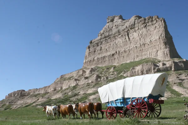
National Monument
Towering 800 feet above the North Platte River, Scotts Bluff has served as a landmark for peoples from Native Americans to emigrants on the Oregon, California and Mormon Trails to modern travelers. Ri...
Park data from the National Park Service API. Alerts update every 2 hours.
Expect to spend 97% of your 369.5-mile drive on highways. The longest continuous stretch on the interstate is 220.7 miles on I 80. You’ll experience rural cruising for the most part, with exits spaced out on the highway segments. The transition to surface roads will occur after the main highway portion of your trip concludes.
This is a straightforward highway drive that stays mostly on I 80 and US 26. There are only a few real navigation decisions along the way. The trickiest moment comes early in the drive near West 20th Street.
Easy - simple navigation with a manageable amount of wheel time
Balances navigation complexity with total wheel time.
The route itself is not hard, but at 6h 43m, endurance matters. Plan breaks every 2-3 hours. The 14 decision points are all manageable with basic attention.
Where does it get tricky?
The main spots that need attention: near the start (West 20th Street): Navigation decision point; at 8.9 miles (L-79E / Highway L79E): Lane positioning matters here; at 119.6 miles (North Spruce Street): Navigation decision point.
Gently rolling terrain
Total Climb
187 ft
Total Descent
2,398 ft
Highest Point
3,888 ft
Elevation Range
2,211 ft
Based on OSRM destination-sign hints, not a full list of every settlement the road passes.
On the drive from Scottsbluff, NE to Stromsburg, NE, road signs begin pointing toward Bradshaw along the way.
Bradshaw
Tagged by where each one fits in your drive — first break, midpoint, final stretch.
Cafe
Early in the drive, right off the route
Ogallala, NE
Cuisine: coffee_shop
Hours: Mo-Fr 05:30-20:00,Sa-Su 06:00-20:00
Visit websiteCafe
Near the end, right off the route
Stromsburg, NE
Cuisine: coffee_shop
Cafe
Near the end, right off the route
Stromsburg, NE
Cuisine: coffee_shop
Cafe
Near the start, right off the route
Cuisine: coffee_shop
Cafe
Around the midpoint, short detour
Gothenburg, NE
Cuisine: coffee_shop
Cafe
Around the midpoint, short detour
Cuisine: coffee_shop
Fast_food
Near the end, right off the route
Stromsburg, NE
Cuisine: sandwich
Hours: 08:30-21:30
Visit websiteRestaurant
Near the start, right off the route
Fast_food
Early in the drive, right off the route
Ogallala, NE
Cuisine: sandwich
Hours: Mo-Su 09:00-22:00
Visit websiteRestaurant
Near the end, right off the route
Stromsburg, NE
Cuisine: american
Restaurant
Near the end, right off the route
Stromsburg, NE
Restaurant
Near the start, right off the route
Scottsbluff, NE
Cuisine: mexican
Hours: Mo-Sa 09:00-18:00
Visit websitePark
Near the end, right off the route
Park
Early in the drive, right off the route
Ogallala, NE
Hours: 24/7
Camp_site
Near the end, right off the route
Stromsburg, NE
Attraction
Early in the drive, right off the route
NE
Park
Near the start, right off the route
Park
Around the midpoint, right off the route
Museum
Near the start, right off the route
NE
Museum
Early in the drive, right off the route
NE
Artwork
Near the start, right off the route
Artwork
Near the start, right off the route
Artwork
Near the start, right off the route
Artwork
Near the start, short detour
Hotel
Early in the drive, right off the route
Ogallala, NE
Hotel
Near the end, right off the route
Stromsburg, NE
Caravan_site
Early in the drive, right off the route
Ogallala, NE
Hours: 24/7
Caravan_site
Near the end, right off the route
Stromsburg, NE
Hotel
Near the start, right off the route
Scottsbluff, NE
Visit websiteMotel
Near the start, right off the route
Points of interest from OpenStreetMap contributors. Listings may not reflect current hours or availability.
Founded 1900
Scottsbluff is a town in the Panhandle region of Nebraska, USA. The geological structure that gives the town its name was an important waypoint on the Oregon Trail and is preserved today as a national monument. The town of Gering is 1½ miles (2 km) south.
Top landmarks
City content from Wikivoyage (CC BY-SA 4.0) and Wikidata (CC0).
Weekend Trip
Doable as a same-day drive at 6h 43m. Total distance: 369.5 miles.
Family Friendly
Moderate complexity with 1 natural rest stops along the way.
Solo Traveler
6h 43m drive, plan rest stops for pacing.
First-Time Driver
Mostly highway driving (97%). Straightforward navigation.
Compiled by the US Trip Planner planning team at COD Solutions Oy from open government datasets — OSRM over OpenStreetMap for geometry, EIA for fuel prices, USGS 3DEP for elevation, NPS for national parks, and FHWA TMAS for hourly traffic volumes. See our methodology for refresh cadence and limitations.
Was this helpful?
Thanks for your feedback!
Your tip has been submitted. Thanks!
/500
Recent Tips
·
Explore more options from Scottsbluff, NE or browse trips ending in Stromsburg, NE.
Looking for more statewide routes? Browse NE road trips.