Scottsbluff, NE to Lexington, NE is 235.5 miles and takes about 4h 26m via I 80 and US 26, with a fuel budget near $37 and enough daylight to finish in a day. This one-day drive stays within the Great Plains region, offering a straightforward journey across Nebraska. You'll primarily be on well-maintained highways, making it a practical and efficient trip for those looking to cover ground. Consider this route if you need a direct connection between these two points without extensive detours, as it's designed for steady progress.
Trip Pace
Same-day drive is realistic
A same-day return is possible, but it will make for a full day on the road.
Break Rhythm
1 planned break
Plan on a short reset every 3 to 4 hours to stay fresh behind the wheel.
Midpoint
117.7 miles from Scottsbluff, NE
A natural place for your longest stop of the day
, about 2h 22m into the drive
.
Main Roads
Road
Distance
Duration
I 80
103.8 mi
1h 43m
US 26
84 mi
1h 39m
US Highway 26
12.5 mi
15m
Highway 92
11 mi
12m
Highway 26
7.5 mi
9m
Highway 30
4.3 mi
4m
North Spruce Street
2.7 mi
4m
Highway L79E
2.1 mi
2m
Longest stretch:
I 80
— 103.8 mi, about 1h 43m
Traffic on I-80
Hour-of-day weekday pattern from 18 FHWA count stations on your route.
Peak
2 PM
~633 veh/hr typical
· worst 979
Quietest
3 AM
~97 veh/hr
Peak-to-quiet ratio
6.5×
busier at peak than in the quiet hours
12a6anoon6p11p
Averaged across 52 weeks of 2023 FHWA Travel Monitoring Analysis System data. Weekday hours only (Mon–Fri).
Turn-by-Turn Driving Directions
Step-by-step road directions between Scottsbluff, NE and Lexington, NE.
1
Start on Avenue C
54 ft·7 sec·Avenue C
2
Turn left onto West 20th Street
0.2 mi·36 sec·West 20th Street
3
Continue on East 20th Street
1.2 mi·3 min·East 20th Street
4
Turn right onto US 26; N-71; N-92
7.5 mi·9 min·Highway 26
5
Turn right onto L-79E
2.1 mi·2 min·Highway L79E
Use the right lane.
6
Turn left onto N-92
11 mi·12 min·Highway 92
7
Continue on US 26; N-92
13 mi·15 min·US Highway 26
8
Turn left onto US 26; US 385
1.0 mi·1 min·Main Street
9
Continue on US 26
84 mi·1 hr 39 min·US 26
10
Turn right onto North Spruce Street
2.7 mi·4 min·North Spruce Street
11
Turn left onto US 26; US 30; N-61; I 80 Alt
305 ft·7 sec·US 26; US 30; N-61; I 80 Alt
12
Turn right onto US 26; N-61
0.9 mi·1 min·South Highway 26/61
13
Turn left
0.4 mi·52 sec
Toward I 80 east
14
Merge onto I 80
104 mi·1 hr 43 min·I 80
15
Take the exit
0.4 mi·52 sec
Exit 231Toward NE 24A
16
Turn left onto L-24A
1.8 mi·2 min·Road 428
17
Turn right onto US 30; N-21; I 80 Alt
4.3 mi·4 min·Highway 30
18
Continue on US 30; N-21; I 80 Alt
0.7 mi·52 sec·West Pacific Avenue
19
Continue on US 30; N-21; I 80 Alt
0.8 mi·1 min·West Pacific Street
20
Turn left onto North Washington Street
0.3 mi·42 sec·North Washington Street
21
Arrive at destination
North Washington Street
Trip Plan
Given the 4h 26m duration, starting in the morning allows ample time to reach Lexington, NE, by late afternoon. With only one recommended stop and a highway share of 95%, you won't need to break up the 235.5 miles excessively. Keep an eye on your fuel gauge, especially during the 103.8-mile stretch on I 80, as services can sometimes be spaced out on interstate segments. The estimated fuel cost of $37 means you can budget accordingly for this straightforward, same-day trip.
Morning Departure
An early start around 7-8 AM gets you there with plenty of daylight left.
Evening Departure
A late afternoon start means arriving after dark. Morning is better.
You can normally do this drive in one day.
Plan roughly 1 meaningful break for fuel, food, and rest.
The halfway point lands around 117.7 miles from Scottsbluff, NE, or about 2h 22m into the drive.
The longest continuous stretch on this route runs about 103.8 miles.
This is a comfortable same-day trip.
Departure
Before you leave
Start with fuel, water, and navigation already sorted so the first hour feels easy.
First stop
Around 52 miles or 1h 4m in
Use this first pause for coffee, a restroom break, and a quick traffic check ahead.
Halfway reset
Around 117.7 miles or 2h 22m in
This is the best place for your longest stop, a real meal, and a full fuel check.
Final approach
Final hour starts around 3h 41m
Traffic, exits, and arrival timing usually matter more near Lexington, NE than in the middle of the route.
Before You Leave
+
Open the route before leaving Scottsbluff, NE so your first major turns are already loaded.
+
Leave with enough water and a charging cable within reach, not packed away.
+
Check your fuel range against the first long segment, especially if you are starting outside city service areas.
Day 1
Settle into the route from Scottsbluff, NE
This is one driving day of about 235.5 miles and 4h 26m.
Your first comfortable stop window is around 52 miles from Scottsbluff, NE.
This route can stay practical as a one-day drive if traffic stays reasonable.
Plan about 1 real break rather than only quick fuel stops.
The longest stretch is on I 80 for about 103.8 miles.
Where to Stop
Rest stops, refuel points, and overnight suggestions along this route.
Place data sourced from public business listings. Hours and availability may vary.
Heads-up: tricky spots
5 of 14
5 decision points cluster between mile 0 and 227.3 — GPS handles the exact turns, but know they're coming. Your lane choice matters more than the turn itself.
5
0 mi into trip|~0m in|West 20th Street
Turn left onto West 20th Street
Navigation decision point
5
8.9 mi into trip|~12m in|L-79E / Highway L79E
Turn right onto L-79E / Highway L79E
Lane positioning matters here
Use the right lane.
4
119.6 mi into trip|~2h 24m in|North Spruce Street
Turn right onto North Spruce Street
Navigation decision point
4
122.2 mi into trip|~2h 29m in|US 26; US 30; N-61; I 80 Alt
Turn left onto US 26; US 30; N-61; I 80 Alt
Navigation decision point
5
227.3 mi into trip|~4h 15m in
Take the exit toward NE 24A
Exit ramp - move to the correct lane early
Exit 231
Toward NE 24A
Fuel & Cost
Regular Gas
$34.78 one way
$69.56 round trip
$3.75/gal25.4 MPG avg82 kg CO2
Fuel Type
$/gal
One Way
Round Trip
midgrade
$4.14
$38.39
$76.79
premium
$4.72
$43.73
$87.45
diesel
$4.80
$44.47
$88.93
No toll roads detected on this route.
Estimated Trip Cost (one way, 1 person)
Fuel
$35
Meals
$25–$50
Total
$60–$85
Rough estimate based on US averages. Hotel $80–$140/night, meals $25–$50/day.
Estimated CO2 emission: 82.4 kg one way.
Prices: EIA weekly data, 2026-07-13.
Driving Electric?
About $25 in charging
· 0 stops
· 66% less CO2
Vehicle Type
kWh
Stops
DC Fast
Home Charge
Average EV
70.7
0
$24.73
$11.30
Efficient EV
58.9
0
$20.61
$9.42
EV Truck/SUV
94.2
1
$32.97
$15.07
Gas CO2
82 kg
EV CO2
28 kg (66% less)
Plan for 0 charging stops, roughly every 270 miles. Allow 25-40 minutes per stop at a DC fast charger.
DC fast charging avg $0.35/kWh. Home charging avg $0.16/kWh. US grid CO2: 0.39 kg/kWh.
Travel Intel
Current conditions at both ends of the drive.
Forecast as of Jul 18, 2026
Origin
Scottsbluff, NE
Late night
in Scottsbluff on Sunday
Local time
3:22 AM
MDT
Current temp
98°F
Unavailable
Live forecast
Destination
Lexington, NE
Late night
in Lexington on Sunday
Local time
4:22 AM
CDT
Current temp
94°F
Sunny then Slight Chance Rain Showers
E 0 to 5 mph15% chanceLive forecast
Heat Advisory
Heat Advisory issued July 18 at 1:09AM CDT until July 19 at 10:00PM CDT by NWS North Platte NE
Heat Advisory
Heat Advisory issued July 18 at 1:09AM CDT until July 20 at 9:00PM CDT by NWS North Platte NE
Seasonal Notes
Summer travel usually means heavier construction, hotter rest stops, and busier weekend traffic around major cities.
Winter travel shortens daylight, so a route that looks manageable on paper can feel much longer after dark.
Holiday weekends tend to make both departure and arrival windows slower than the raw route time suggests.
Time zone
1 hour later
The destination clock does not match departure time, so double-check hotel check-in windows and late arrival plans.
Temperature spread
4 degrees cooler at arrival
A meaningful temperature swing is a good cue to rethink layers, water, and how soon you want to arrive.
Road read
4h 26m on the road
An early start around 7-8 AM gets you there with plenty of daylight left.
Weather data from the National Weather Service. Conditions may change; check closer to your travel date.
National Parks Near This Route
Worth a detour if your schedule allows.
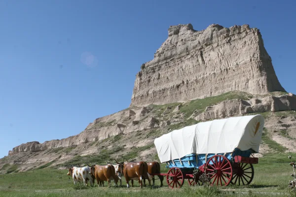
Scotts Bluff National Monument
National Monument
Towering 800 feet above the North Platte River, Scotts Bluff has served as a landmark for peoples from Native Americans to emigrants on the Oregon, California and Mormon Trails to modern travelers. Ri...
Park data from the National Park Service API. Alerts update every 2 hours.
More Details
What kind of drive is this?
This is a highway-focused drive with 95% of the route on interstates and major US highways. You'll experience a long, uninterrupted stretch of 103.8 miles on I 80, so be prepared for extended periods of consistent driving. The character of the road is predominantly that of a fast, efficient transit route, typical of the Great Plains. Expect smooth sailing and minimal traffic delays for most of this 235.5-mile journey, allowing for a consistent pace.
95% highway — fuel and pacing are the main things to plan.
21 navigation steps total — most of the decisions cluster near the start and finish.
Longest single stretch: 103.8 mi on I 80.
How Hard Is This Drive?
3/10
This is a straightforward highway drive that stays mostly on I 80 and US 26. There are only a few real navigation decisions along the way. The trickiest moment comes early in the drive near West 20th Street.
Driving Effort3/10
Easy - simple navigation with a manageable amount of wheel time
Balances navigation complexity with total wheel time.
This is a straightforward 4h 26m drive. You will face about 14 decision points, but nothing that requires special attention if you follow navigation.
Where does it get tricky?
The main spots that need attention: near the start (West 20th Street): Navigation decision point; at 8.9 miles (L-79E / Highway L79E): Lane positioning matters here; at 119.6 miles (North Spruce Street): Navigation decision point.
Scottsbluff is a town in the Panhandle region of Nebraska, USA. The geological structure that gives the town its name was an important waypoint on the Oregon Trail and is preserved today as a national monument. The town of Gering is 1½ miles (2 km) south.
Top landmarks
•Western Public Service Building — building in Scottsbluff, United States of America
•Lincoln Hotel — hotel in Scottsbluff, Nebraska, United States
•Fontenelle Apartment House — apartment building in Scottsbluff, United States of America
The longest stretch is about 103.8 miles on I 80. The full list of main roads is in the Roads section above.
Yes — we found about 11 rest areas or service plazas within a short detour of the route (from OpenStreetMap). See the Rest Stops tab under Nearby Places for locations and mile markers. Plan to stretch, use the bathroom, and top off fluids every 2–3 hours on longer drives.
Yes, with realistic expectations. Build in a stop roughly every 2 hours, have snacks and activities ready, and check the Nearby Places tabs for kid-friendly stops along the way.
Mostly yes along the main roads, but rural stretches through NE can have sparse or no coverage. Before you leave, download offline Google Maps or Apple Maps for the route, and consider downloading music or podcasts instead of streaming. If you depend on data for navigation, keep a paper backup of the turn-by-turn directions.
The main spots that need attention: near the start (West 20th Street): Navigation decision point; at 8.9 miles (L-79E / Highway L79E): Lane positioning matters here; at 119.6 miles (North Spruce Street): Navigation decision point.
Yes — Scotts Bluff National Monument. See the National Parks section for detour distances and tips on detours.
Possible but tiring. At 4.4 hours each way, an in-and-out day trip would put you behind the wheel for 8.9 hours — manageable with a long break at Lexington, NE, but most travelers stay overnight.