This 327-mile journey from Sanborn, WI, to Janesville, WI, is an efficient drive that can be completed in about 6 hours and 42 minutes. Primarily utilizing I-39, State Highway 13, and US 51, this trip is almost entirely highway, making it a straightforward option for a single-day excursion. With an estimated fuel cost of $51, it's an economical choice for travelers within the Midwest region. The drive is characterized by its highway focus, suggesting a consistent pace with minimal detours. Consider this route if you're looking for a direct and predictable drive between two points in Wisconsin.
Trip Pace
Same-day drive is realistic
A same-day return is possible, but it will make for a full day on the road.
Break Rhythm
1 planned break
Plan on a short reset every 3 to 4 hours to stay fresh behind the wheel.
Midpoint
163.5 miles from Sanborn, WI
A natural place for your longest stop of the day
, about 3h 42m into the drive
.
Main Roads
Road
Distance
Duration
I 39
165.7 mi
2h 57m
State Highway 13
65.2 mi
1h 29m
US 51
46.3 mi
53m
US 8
32.2 mi
45m
State Highway 112
3.2 mi
4m
4th Avenue North
3 mi
6m
North Lake Avenue
2.4 mi
5m
Milton Avenue
2.3 mi
5m
Longest stretch:
I 39
— 165.7 mi, about 2h 57m
Traffic on I-39
Hour-of-day weekday pattern from 44 FHWA count stations on your route.
Peak
4 PM
~1,741 veh/hr typical
· worst 2,204
Quietest
2 AM
~132 veh/hr
Peak-to-quiet ratio
13.2×
busier at peak than in the quiet hours
12a6anoon6p11p
Averaged across 52 weeks of 2023 FHWA Travel Monitoring Analysis System data. Weekday hours only (Mon–Fri).
Turn-by-Turn Driving Directions
Step-by-step road directions between Sanborn, WI and City of Janesville, WI.
1
Start on CTH E
0.7 mi·1 min·County Road E
2
Turn right onto Petrin Road
258 ft·13 sec·Petrin Road
3
Turn straight onto WI 112
3.2 mi·4 min·State Highway 112
4
Turn right onto WI 13
13 mi·17 min·State Highway 13
5
Continue on WI 13
1.6 mi·3 min·North Main Street
6
Continue on WI 13; WI 77
14 mi·19 min·State Highway 13
7
Continue on WI 13
0.6 mi·1 min·West Broadway
8
Continue on WI 13
8.9 mi·12 min·State Highway 13
9
Continue on WI 13
1.1 mi·2 min·North 5th Street
10
Continue on WI 13
4.6 mi·6 min·State Highway 13
11
Continue on WI 13
3.0 mi·6 min·4th Avenue North
Use the straight / right lanes.
12
Continue on WI 13
372 ft·5 sec·4th Ave S
13
Continue on WI 13
2.1 mi·2 min·State Highway 13
14
Continue on WI 13
0.8 mi·1 min·Flambeau Avenue
15
Continue on WI 13
12 mi·16 min·State Highway 13
16
Continue on WI 13
2.4 mi·5 min·North Lake Avenue
Use the straight / right lanes.
17
Continue on WI 13
11 mi·14 min·State Highway 13
18
Turn straight
0.2 mi·46 sec
19
Turn left onto US 8
32 mi·45 min·US 8
Use the straight lane.
20
Take the exit
0.4 mi·51 sec
Use the right lane.
21
Merge onto US 51
46 mi·53 min·US 51
Use the straight lane.
22
Keep slight left at fork onto I 39; US 51
22 mi·24 min·I 39; US 51
Toward I 39 South, US 51 South: Stevens Point, Madison
23
Continue on I 39; US 10; US 51
7.4 mi·7 min·I 39; US 10; US 51
24
Continue on I 39; US 51
73 mi·1 hr 18 min·I 39; US 51
25
Keep slight right at fork onto I 39
30 mi·31 min·I 39
Use the straight / slight right lanes.
26
Keep slight right at fork onto I 39; I 90
33 mi·35 min·I 39; I 90
Toward I 39, I 90: ChicagoUse the straight / slight right lanes.
27
Take the exit
0.2 mi·30 sec
28
Keep slight right at fork
0.2 mi·31 sec
Exit 171AToward WI 26: State Highway 26
29
Keep slight right at fork
414 ft·10 sec
Toward WI 26 South: Janesville
30
Turn slight right onto WI 26
2.3 mi·5 min·Milton Avenue
31
Turn left onto East Memorial Drive
261 ft·11 sec·East Memorial Drive
32
Continue on North Garfield Avenue
0.5 mi·1 min·North Garfield Avenue
33
Turn right onto East Court Street
467 ft·15 sec·East Court Street
34
Arrive at destination
East Court Street
Trip Plan
Given the 6-hour 42-minute duration, it's feasible to tackle this 327-mile drive in one day, allowing for flexibility in your departure time. Plan for one strategic stop to break up the journey and refuel, especially considering the longest stretch without a break is over 165 miles. Keep an eye on your fuel gauge as you navigate the mix of I-39, State Highway 13, and US 51. A good tip is to check your tire pressure before departing, as consistent highway speeds can impact efficiency and safety on longer drives.
Morning Departure
Start early — leave by 6-7 AM to arrive at a reasonable hour.
Evening Departure
This is a long drive — plan for a morning departure or consider splitting it into two days.
You can normally do this drive in one day.
Plan roughly 1 meaningful break for fuel, food, and rest.
The halfway point lands around 163.5 miles from Sanborn, WI, or about 3h 42m into the drive.
The longest continuous stretch on this route runs about 165.7 miles.
This is a comfortable same-day trip.
Departure
Before you leave
Start with fuel, water, and navigation already sorted so the first hour feels easy.
First stop
Around 72 miles or 1h 46m in
Use this first pause for coffee, a restroom break, and a quick traffic check ahead.
Halfway reset
Around 163.5 miles or 3h 42m in
This is the best place for your longest stop, a real meal, and a full fuel check.
Final approach
Final hour starts around 5h 34m
Traffic, exits, and arrival timing usually matter more near City of Janesville, WI than in the middle of the route.
Before You Leave
+
Open the route before leaving Sanborn, WI so your first major turns are already loaded.
+
Leave with enough water and a charging cable within reach, not packed away.
+
Check your fuel range against the first long segment, especially if you are starting outside city service areas.
Day 1
Settle into the route from Sanborn, WI
This is one driving day of about 327 miles and 6h 42m.
Your first comfortable stop window is around 72 miles from Sanborn, WI.
This route can stay practical as a one-day drive if traffic stays reasonable.
Plan about 1 real break rather than only quick fuel stops.
The longest stretch is on I 39 for about 165.7 miles.
Where to Stop
Rest stops, refuel points, and overnight suggestions along this route.
Place data sourced from public business listings. Hours and availability may vary.
Heads-up: tricky spots
5 of 12
5 decision points cluster between mile 111.2 and 323.8 — GPS handles the exact turns, but know they're coming. Your lane choice matters more than the turn itself.
7
111.2 mi into trip|~2h 42m in
Take the exit
Exit ramp - move to the correct lane early. Lane positioning matters here
Use the right lane.
6
157.8 mi into trip|~3h 36m in|I 39; US 51
Keep slight left at fork onto I 39; US 51 toward I 39 South, US 51 South: Stevens Point, Madison
Highway fork - watch signs carefully. Multiple destination signs - pick the right one
Toward I 39 South, US 51 South: Stevens Point,...
6
260.8 mi into trip|~5h 26m in|I 39
Keep slight right at fork onto I 39
Highway fork - watch signs carefully. Lane positioning matters here
Use the straight / slight right lanes.
8
290.4 mi into trip|~5h 58m in|I 39; I 90
Keep slight right at fork onto I 39; I 90 toward I 39, I 90: Chicago
Highway fork - watch signs carefully. Lane positioning matters here. Multiple destination signs - pick the right one
Use the straight / slight right lanes.
Toward I 39, I 90: Chicago
7
323.8 mi into trip|~6h 34m in
Keep slight right at fork toward WI 26: State Highway 26
Highway fork - watch signs carefully
Exit 171A
Toward WI 26: State Highway 26
Fuel & Cost
Regular Gas
$48.29 one way
$96.58 round trip
$3.75/gal25.4 MPG avg114 kg CO2
Fuel Type
$/gal
One Way
Round Trip
midgrade
$4.14
$53.31
$106.62
premium
$4.72
$60.71
$121.43
diesel
$4.80
$61.74
$123.49
No toll roads detected on this route.
Estimated Trip Cost (one way, 1 person)
Fuel
$48
Meals
$25–$50
Total
$73–$98
Rough estimate based on US averages. Hotel $80–$140/night, meals $25–$50/day.
Estimated CO2 emission: 114.4 kg one way.
Prices: EIA weekly data, 2026-07-13.
Driving Electric?
About $34 in charging
· 1 stop
· 67% less CO2
Vehicle Type
kWh
Stops
DC Fast
Home Charge
Average EV
98.1
1
$34.34
$15.70
Efficient EV
81.8
0
$28.61
$13.08
EV Truck/SUV
130.8
1
$45.78
$20.93
Gas CO2
114 kg
EV CO2
38 kg (67% less)
Plan for 1 charging stop. A 30-minute DC fast charge mid-route should be enough to complete the trip comfortably.
DC fast charging avg $0.35/kWh. Home charging avg $0.16/kWh. US grid CO2: 0.39 kg/kWh.
Travel Intel
Current conditions at both ends of the drive.
Forecast as of Jul 17, 2026
Origin
Sanborn, WI
Late night
in Sanborn on Saturday
Local time
4:39 AM
CDT
Current temp
92°F
Patchy Smoke then Slight Chance Showers And Thunderstorms
SW 10 to 15 mph17% chanceLive forecast
Heat Advisory
Heat Advisory issued July 17 at 1:04AM CDT until July 17 at 9:00PM CDT by NWS Twin Cities/Chanhassen MN
Heat Advisory
Heat Advisory issued July 17 at 12:55AM CDT until July 17 at 9:00PM CDT by NWS Duluth MN
Destination
City of Janesville, WI
Late night
in City of Janesville on Saturday
Local time
4:39 AM
CDT
Current temp
91°F
Mostly Sunny then Slight Chance Showers And Thunderstorms
SW 5 to 10 mph28% chanceLive forecast
Heat Advisory
Heat Advisory issued July 17 at 1:04AM CDT until July 17 at 9:00PM CDT by NWS Twin Cities/Chanhassen MN
Heat Advisory
Heat Advisory issued July 17 at 12:55AM CDT until July 17 at 9:00PM CDT by NWS Duluth MN
Seasonal Notes
Summer travel usually means heavier construction, hotter rest stops, and busier weekend traffic around major cities.
Winter travel shortens daylight, so a route that looks manageable on paper can feel much longer after dark.
Holiday weekends tend to make both departure and arrival windows slower than the raw route time suggests.
Time zone
Same local time
Origin and destination are on the same clock, so arrival timing is easier to judge at a glance.
Temperature spread
1 degrees cooler at arrival
A meaningful temperature swing is a good cue to rethink layers, water, and how soon you want to arrive.
Road read
6h 42m on the road
Start early — leave by 6-7 AM to arrive at a reasonable hour.
Weather data from the National Weather Service. Conditions may change; check closer to your travel date.
National Parks Near This Route
Worth a detour if your schedule allows.
Ice Age National Scenic Trail
National Scenic Trail
The Ice Age National Scenic Trail spans 1,200 miles, traverses some of Wisconsin's finest geologic and glacial features, and passes through the ancestral lands of 15 Tribes. The Trail is built, manage...
3 mi from route
~8 min detour
Free
near mile 225.5
Caution: Averill–Kelly Creek Wilderness Segment — Dangerous Ford at New Wood River
Caution: Skunk and Foster Lakes Segment — Storm Damage
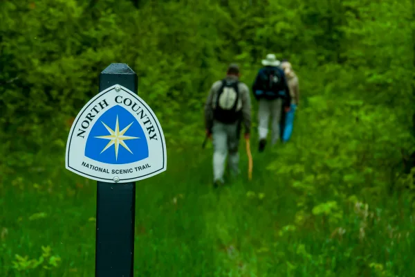
Come to the North Country. Trek the hills and valleys. Stand on the shores of lakes & streams from glaciers 10,000 years before. Clear-flowing water, red/gold of autumn, a fairyland of snow, open prai...
6 mi from route
~14 min detour
Free
near mile 11.3
Park data from the National Park Service API. Alerts update every 2 hours.
More Details
What kind of drive is this?
Expect a highway-focused experience on this route, with 96% of the drive taking place on major roadways. The personality of this drive is one of consistent forward motion, largely on I-39. You'll encounter a significant uninterrupted stretch of 165.7 miles on I-39, allowing you to settle into a rhythm. While predominantly interstate, the inclusion of State Highway 13 and US 51 might introduce slight variations in scenery and speed as you transition between them. Overall, it's a practical drive built for covering ground efficiently.
96% highway — fuel and pacing are the main things to plan.
34 navigation steps total — most of the decisions cluster near the start and finish.
Longest single stretch: 165.7 mi on I 39.
How Hard Is This Drive?
7/10
This is a straightforward highway drive that stays mostly on I 39 and State Highway 13. This route has several spots where lane changes, forks, or exits need your full attention. The trickiest moment comes around 111.2 miles in.
Driving Effort7/10
Demanding - plan breaks and stay ahead of the key maneuvers
Balances navigation complexity with total wheel time.
This is a demanding drive. With 12 significant decision points across 327 miles, you will need to stay alert - especially through interchange areas and urban stretches. Consider splitting it into segments if you are not comfortable with fast highway navigation.
Where does it get tricky?
The main spots that need attention: at 111.2 miles: Exit ramp - move to the correct lane early. Lane positioning matters here; at 157.8 miles (I 39; US 51): Highway fork - watch signs carefully. Multiple destination signs - pick the right one; at 260.8 miles (I 39): Highway fork - watch signs carefully. Lane positioning matters here.
Elevation Profile
Mostly flat terrain
1,551 ft801 ft
Total Climb
877 ft
Total Descent
862 ft
Highest Point
1,551 ft
~93.4 mi in
Elevation Range
750 ft
Towns Mentioned on Route Signs
Based on OSRM destination-sign hints, not a full list of every settlement the road passes.
On the drive from Sanborn, WI to City of Janesville, WI, road signs begin pointing toward Madison along the way.
Madison
157.8 mi in|~3h 36m|via I 39; US 51
Detours Along the Way
Tagged by where each one fits in your drive — first break, midpoint, final stretch.
Doable as a same-day drive at 6h 42m. Total distance: 327 miles.
Family Friendly
Moderate complexity with 1 natural rest stops along the way.
Solo Traveler
6h 42m drive, plan rest stops for pacing.
Frequently Asked Questions
The longest stretch is about 165.7 miles on I 39. The full list of main roads is in the Roads section above.
Yes — we found about 15 rest areas or service plazas within a short detour of the route (from OpenStreetMap). See the Rest Stops tab under Nearby Places for locations and mile markers. Plan to stretch, use the bathroom, and top off fluids every 2–3 hours on longer drives.
It helps. This route has a higher-than-average number of complex decision points, which get harder in the dark. If the last hour of the trip is on surface roads or mountain grades, aim to arrive at City of Janesville, WI before sunset when you can. Check the Trip Plan for departure windows that land you in daylight.
Only with planning. This is a long drive for kids — consider splitting it into two days rather than pushing through. Plan at least 1 meaningful breaks. There are 15 rest areas along the route for bathroom stops.
The main spots that need attention: at 111.2 miles: Exit ramp - move to the correct lane early. Lane positioning matters here; at 157.8 miles (I 39; US 51): Highway fork - watch signs carefully. Multiple destination signs - pick the right one; at 260.8 miles (I 39): Highway fork - watch signs carefully. Lane positioning matters here.
Yes — Ice Age National Scenic Trail and North Country National Scenic Trail. See the National Parks section for detour distances and tips on detours.
Not recommended in a single day. At 6.7 hours each way, a round trip means 13.4 hours of driving — that is an unsafe level of fatigue for most drivers. Plan at least one night at City of Janesville, WI before the return drive.