Medina County Rest Area
0.1 mi from route
Compiled and reviewed by the US Trip Planner planning team at COD Solutions Oy · Last reviewed Apr 19, 2026 · Editorial standards
Drive Time
3h 9m
Distance
157.9 mi
254 km
Drive Score
9/10
Great drive
Same Day?
Yes, doable
Fuel Cost
$24
one way
EV Charging
Unknown
Estimated drive times based on typical traffic patterns. Actual times may vary with weather, construction, and real-time conditions.

San Antonio, TX
Wikimedia Commons

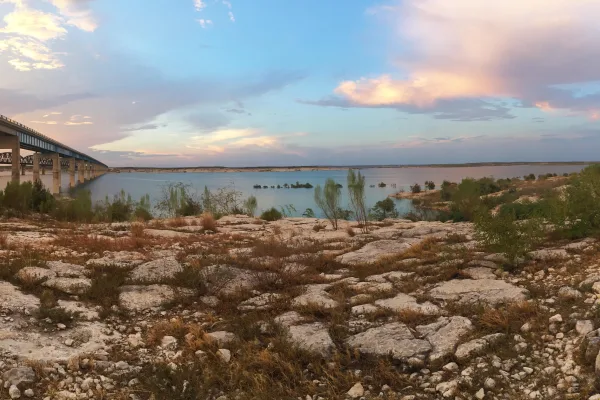
Cienegas Terrace, TX
Thomas balabaud
San Antonio to Cienegas Terrace is 157.9 miles and takes about 3h 9m via West US Highway 90, with a fuel budget near $24 and enough daylight to finish in a day. This drive stays within Texas, traversing the Great Plains region for its entirety. Expect a straightforward trip with a high percentage of highway driving, making it efficient for a single-day excursion. It’s a practical option if you need to get from point A to point B without much fuss.
Trip Pace
Same-day drive is realistic
A same-day return is realistic if you keep stops short.
Break Rhythm
1 planned break
A short stop every 2 to 3 hours is enough for this drive.
Midpoint
78.9 miles from San Antonio, TX
A natural place for your longest stop of the day , about 1h 33m into the drive .
| Road | Distance | Duration |
|---|---|---|
| West US Highway 90 | 62.8 mi | 1h 11m |
| US Highway 90 West | 37.7 mi | 43m |
| East Military Highway | 24.6 mi | 28m |
| Cleto Rodriguez Freeway | 12.5 mi | 14m |
| US Highway 90 East | 5.3 mi | 6m |
| East Main Street | 4.9 mi | 5m |
| 19th Street | 2.1 mi | 3m |
| Cienegas Road | 1.8 mi | 4m |
Step-by-step road directions between San Antonio, TX and Cienegas Terrace, TX.
Start on Dolorosa Street
Continue on West Market Street
Turn right onto South Saint Mary's Street
Turn right onto South Alamo Street
Turn left onto Spur 536
Take the ramp
Merge onto I 10; US 87; US 90
Continue on US 90
Continue on US 90
Continue on US 90
Continue on US 90
Continue on US 90
Continue on US 90
Continue on US 90
Continue on US 90
Continue on US 90
Turn left onto Avenue T
Continue on Lionel Martinez Boulevard
Continue on Cienegas Road
At end of road, turn right onto Park Drive
Turn right onto Mesa Drive
Arrive at destination
Given the 3h 9m estimated drive time, leaving San Antonio in the morning is ideal to maximize daylight and avoid any potential late-day traffic. With only one recommended stop and a relatively short distance, you have flexibility in pacing your trip. Keep an eye on fuel, especially during the 62.8-mile stretch on West US Highway 90, as services might be less frequent. The $24 fuel cost estimate is based on average prices, so adjust as needed for current conditions before you depart.
Morning Departure
An early start around 7-8 AM gets you there with plenty of daylight left.
Evening Departure
A late afternoon start means arriving after dark. Morning is better.
This is a comfortable same-day trip.
Departure
Before you leave
Start with fuel, water, and navigation already sorted so the first hour feels easy.
First stop
Around 35 miles or 42m in
Use this first pause for coffee, a restroom break, and a quick traffic check ahead.
Halfway reset
Around 78.9 miles or 1h 33m in
This is the best place for your longest stop, a real meal, and a full fuel check.
Final approach
Final hour starts around 2h 31m
Traffic, exits, and arrival timing usually matter more near Cienegas Terrace, TX than in the middle of the route.
Open the route before leaving San Antonio, TX so your first major turns are already loaded.
Leave with enough water and a charging cable within reach, not packed away.
Check your fuel range against the first long segment, especially if you are starting outside city service areas.
Day 1
Settle into the route from San Antonio, TX
This is one driving day of about 157.9 miles and 3h 9m.
Rest stops, refuel points, and overnight suggestions along this route.

Mid-route town
Meal stop
79 mi into the route
Best for: Lunch, fuel, and a longer reset
This sits close to the middle of the route, so it works well for the longest stop of the day.
A short stop after about 35 miles helps settle the day before fatigue starts building.
The midpoint is around 78.9 miles from San Antonio, TX, which is a good place for a longer meal and fuel stop.
Before the longest stretch
Fuel checkTop up before West US Highway 90 if your tank is already low. That segment runs about 62.8 miles.
These stop ideas are pacing suggestions — the exact town or exit can change with traffic, hotel plans, and fuel range.
Restaurants, cafes, gas stations and more along your route.
Near the start, right off the route
San Antonio, Texas
Hours: 9 am–5 pm
+12102077527
Visit websiteNear the start, right off the route
San Antonio, Texas
Hours: 10 am–10 pm
+12102274746
Visit websiteNear the start, right off the route
San Antonio, Texas
Hours: 9–9:30 pm
+12102259800
Visit websiteNear the start, right off the route
San Antonio, Texas
Hours: 5 am–12 pm
+12107094750
Visit websiteNear the start, right off the route
San Antonio, Texas
Hours: 10 am–3:30 pm
+12103907236
Visit websiteNear the start, right off the route
San Antonio, Texas
Hours: 10:30 am–8 pm
+12102242288
Visit websiteNear the start, right off the route
San Antonio, Texas
Hours: 10 am–5 pm
+12106101160
Visit websiteNear the start, right off the route
San Antonio, Texas
Hours: 9 am–10 pm
+12102271373
Visit websitePlace data sourced from public business listings. Hours and availability may vary.
5 decision points cluster between mile 0.1 and 157.2 — GPS handles the exact turns, but know they're coming. Your lane choice matters more than the turn itself.
Turn right onto South Saint Mary's Street
Navigation decision point
Turn right onto South Alamo Street
Navigation decision point
Merge onto I 10; US 87; US 90 / Jose Lopez Freeway
Merge point - match speed before joining. Lane positioning matters here
Turn left onto Avenue T
Navigation decision point
At end of road, turn right onto Park Drive
Navigation decision point
Regular Gas
$23.86 one way
$47.72 round trip
| Fuel Type | $/gal | One Way | Round Trip |
|---|---|---|---|
| midgrade | $4.20 | $26.12 | $52.23 |
| premium | $4.54 | $28.19 | $56.38 |
| diesel | $5.61 | $34.86 | $69.72 |
No toll roads detected on this route.
Estimated Trip Cost (one way, 1 person)
Fuel
$24
Meals
$25–$50
Total
$49–$74
Rough estimate based on US averages. Hotel $80–$140/night, meals $25–$50/day.
Estimated CO2 emission: 55.2 kg one way. Prices: EIA weekly data, 2026-04-13.
Driving Electric?
About $17 in charging · 0 stops · 67% less CO2
| Vehicle Type | kWh | Stops | DC Fast | Home Charge |
|---|---|---|---|---|
| Average EV | 47.4 | 0 | $16.58 | $7.58 |
| Efficient EV | 39.5 | 0 | $13.82 | $6.32 |
| EV Truck/SUV | 63.2 | 0 | $22.11 | $10.11 |
Gas CO2
55 kg
EV CO2
18 kg (67% less)
This trip is well within single-charge range for most EVs. No charging stops needed if you start fully charged.
DC fast charging avg $0.35/kWh. Home charging avg $0.16/kWh. US grid CO2: 0.39 kg/kWh.
Current conditions at both ends of the drive.
Origin
Morning in San Antonio on Sunday
Local time
9:32 AM
CDT
Current temp
54°F
Showers And Thunderstorms
Red Flag Warning
Red Flag Warning issued April 18 at 10:58PM CDT until April 19 at 8:00PM CDT by NWS Amarillo TX
Freeze Warning
Freeze Warning issued April 18 at 10:55PM CDT until April 19 at 9:00AM CDT by NWS Amarillo TX
Destination
Morning in Cienegas Terrace on Sunday
Local time
9:32 AM
CDT
Current temp
56°F
Slight Chance Showers And Thunderstorms
Red Flag Warning
Red Flag Warning issued April 18 at 10:58PM CDT until April 19 at 8:00PM CDT by NWS Amarillo TX
Freeze Warning
Freeze Warning issued April 18 at 10:55PM CDT until April 19 at 9:00AM CDT by NWS Amarillo TX
Seasonal Notes
Summer travel usually means heavier construction, hotter rest stops, and busier weekend traffic around major cities.
Winter travel shortens daylight, so a route that looks manageable on paper can feel much longer after dark.
Holiday weekends tend to make both departure and arrival windows slower than the raw route time suggests.
Time zone
Origin and destination are on the same clock, so arrival timing is easier to judge at a glance.
Temperature spread
A meaningful temperature swing is a good cue to rethink layers, water, and how soon you want to arrive.
Road read
The weather snapshot is not static. If you are leaving later, give both cities one more quick forecast check before departure.
Weather data from the National Weather Service. Conditions may change; check closer to your travel date.
Worth a detour if your schedule allows.

National Historical Park
Welcome to San Antonio Missions, a National Park Service site and the only UNESCO World Heritage Site in Texas. Each mission in the park is a center of community and has been since the early 1700s. Th...
National Recreation Area
An oasis in the desert, Amistad National Recreation Area consists of the US portion of the International Amistad Reservoir. Amistad, a Spanish word meaning "friendship," is known for excellent water-b...
Park data from the National Park Service API. Alerts update every 2 hours.
This route is mostly highway, with 75% of the 157.9 miles on paved roads. You'll experience a longest stretch of 62.8 miles on West US Highway 90, offering a good opportunity for steady cruising. As you get closer to Cienegas Terrace, expect the transition from highway to surface roads to become more apparent. The majority of the drive is on US Highway 90 West.
This is a straightforward highway drive that stays mostly on West US Highway 90 and US Highway 90 West. Navigation is very simple - set it and forget it for most of the drive. The trickiest moment comes around 0.1 miles in near South Saint Mary's Street.
Very easy - short and simple to drive
Balances navigation complexity with total wheel time.
The drive from San Antonio, TX to Cienegas Terrace, TX is easy. At 3h 9m with 75% highway, most drivers will find it relaxed and low-stress.
Where does it get tricky?
The main spots that need attention: at 0.1 miles (South Saint Mary's Street): Navigation decision point; at 0.7 miles (South Alamo Street): Navigation decision point; at 2.6 miles (I 10; US 87; US 90 / Jose Lopez Freeway): Merge point - match speed before joining. Lane positioning matters here.
Founded 1718
San Antonio is the second largest city in the state of Texas and the 7th largest in the United States. It's the 24th largest metropolitan area in the country. Visited by more than 31 million annual visitors, San Antonio is a beautiful city at the axis of three different geological terrains: Hill Country, South Texas Plains and Prairie and Lakes. There's a lot to do in this city: fine art museums, historical missions and plenty of amusement parks in addition to great dining and lots of drinking. The culture and people are vibrant and interesting. San Antonio's downtown is one of the most lively in the nation.
Top landmarks
City content from Wikivoyage (CC BY-SA 4.0) and Wikidata (CC0).
Weekend Trip
Doable as a same-day drive at 3h 9m. Total distance: 157.9 miles.
Family Friendly
Moderate complexity with 1 natural rest stops along the way.
Solo Traveler
3h 9m drive, comfortable solo distance.
First-Time Driver
Mostly highway driving (75%). Straightforward navigation.
Compiled by the US Trip Planner planning team at COD Solutions Oy from open government datasets — OSRM over OpenStreetMap for geometry, EIA for fuel prices, and NPS for national parks. See our methodology for refresh cadence and limitations.
Was this helpful?
Thanks for your feedback!
Your tip has been submitted. Thanks!
/500
Recent Tips
·
Explore more options from San Antonio, TX or browse trips ending in Cienegas Terrace, TX.
Looking for more statewide routes? Browse TX road trips.