Road Ranger
0.1 mi from route
Compiled and reviewed by the US Trip Planner planning team at COD Solutions Oy · Last reviewed Jul 20, 2026 · Editorial standards
Drive Time
5h 26m
Distance
283.8 mi
457 km
Drive Score
10/10
Great drive
Same Day?
Yes, doable
Fuel Cost
$39
one way
EV Charging
Unknown
Estimated drive times based on typical traffic patterns. Actual times may vary with weather, construction, and real-time conditions.

Corpus Christi, TX
Wikimedia Commons

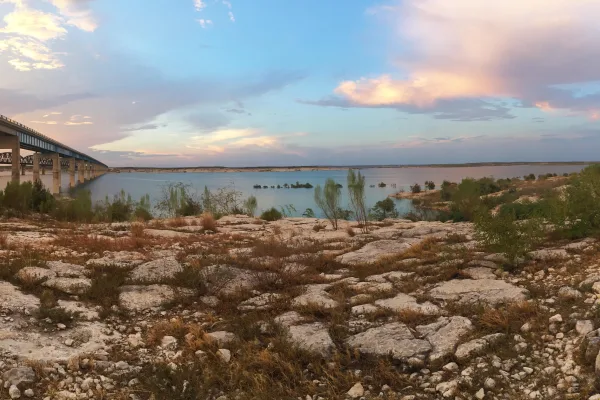
Cienegas Terrace, TX
Thomas balabaud
Corpus Christi, TX to Cienegas Terrace, TX is 283.8 miles and takes about 5h 26m via TX 44 and US Highway 83 North, with a fuel budget near $43 and enough daylight to finish in a day. This trip stays within the Great Plains region, offering a straightforward path through Texas. You'll primarily navigate highways before transitioning to surface roads as you near your destination. It's a manageable drive, suitable for a single day if you're looking to cover ground efficiently.
Trip Pace
Same-day drive is realistic
A same-day return is possible, but it will make for a full day on the road.
Break Rhythm
1 planned break
Plan on a short reset every 3 to 4 hours to stay fresh behind the wheel.
Midpoint
141.9 miles from Corpus Christi, TX
A natural place for your longest stop of the day , about 2h 39m into the drive .
| Road | Distance | Duration |
|---|---|---|
| TX 44 | 68.2 mi | 1h 14m |
| Del Río Boulevard | 52.3 mi | 1h 1m |
| US Highway 83 North | 42.3 mi | 43m |
| Peña Street | 42.1 mi | 48m |
| East Front Street | 34.5 mi | 39m |
| East Avenue J | 26.2 mi | 30m |
| I 37 | 4.2 mi | 5m |
| US 59 | 4 mi | 4m |
Step-by-step road directions between Corpus Christi, TX and Cienegas Terrace, TX.
Start on I 37
Take the exit
Continue on TX 358
Take the exit
Continue on TX 44
Turn right onto TX 44
Turn left onto TX 44
Turn left onto TX 44
Continue on TX 44; TX 359
Continue on TX 44; TX 359
Continue on US 59; TX 44
Turn right onto TX 44
At end of road, turn right onto US 83
Continue on US 83
Turn left onto US 277
Take the exit
Merge onto US 277
Turn right onto US 277
Continue on US 277
Turn left onto US 90; US 277
Turn left onto Avenue T
Continue on Lionel Martinez Boulevard
Continue on Cienegas Road
At end of road, turn right onto Park Drive
Turn right onto Mesa Drive
Arrive at destination
Given the 5h 26m estimated drive time, you can comfortably complete this trip in one day. Aim for an early morning departure from Corpus Christi to maximize daylight and minimize potential traffic. The longest stretch without significant stops is 68.2 miles on TX 44, so plan a break before or after this segment if needed. With a fuel cost estimated at $43, ensure your tank is sufficiently full before leaving, as services may become less frequent on the surface road portions closer to Cienegas Terrace.
Morning Departure
An early start around 7-8 AM gets you there with plenty of daylight left.
Evening Departure
A late afternoon start means arriving after dark. Morning is better.
This is a comfortable same-day trip.
Departure
Before you leave
Start with fuel, water, and navigation already sorted so the first hour feels easy.
First stop
Around 62 miles or 1h 11m in
Use this first pause for coffee, a restroom break, and a quick traffic check ahead.
Halfway reset
Around 141.9 miles or 2h 39m in
This is the best place for your longest stop, a real meal, and a full fuel check.
Final approach
Final hour starts around 4h 20m
Traffic, exits, and arrival timing usually matter more near Cienegas Terrace, TX than in the middle of the route.
Open the route before leaving Corpus Christi, TX so your first major turns are already loaded.
Leave with enough water and a charging cable within reach, not packed away.
Check your fuel range against the first long segment, especially if you are starting outside city service areas.
Day 1
Settle into the route from Corpus Christi, TX
This is one driving day of about 283.8 miles and 5h 26m.
Rest stops, refuel points, and overnight suggestions along this route.

Mid-route town
Meal stop
142 mi into the route
Best for: Lunch, fuel, and a longer reset
This sits close to the middle of the route, so it works well for the longest stop of the day.
A short stop after about 62 miles helps settle the day before fatigue starts building.
The midpoint is around 141.9 miles from Corpus Christi, TX, which is a good place for a longer meal and fuel stop.
Before the longest stretch
Fuel checkTop up before TX 44 if your tank is already low. That segment runs about 68.2 miles.
These stop ideas are pacing suggestions — the exact town or exit can change with traffic, hotel plans, and fuel range.
Picked by where they fit in your drive — first break, midpoint reset, final stretch.
Near the start, right off the route
Corpus Christi, Texas
Hours: 6 am–10 pm
+13618267529
Visit websiteNear the start, right off the route
Corpus Christi, Texas
+13618825500
Visit websiteNear the start, right off the route
Corpus Christi, Texas
Visit websiteNear the start, right off the route
Corpus Christi, Texas
Hours: 10 am–5 pm
+13618264667
Visit websiteNear the start, right off the route
Corpus Christi, Texas
Hours: 10 am–5 pm
+13618253500
Visit websiteNear the start, right off the route
Corpus Christi, Texas
Hours: 10 am–5 pm
+13618811200
Visit websiteNear the start, right off the route
Corpus Christi, Texas
Hours: 12–5 pm
+13618818827
Visit websiteNear the start, right off the route
Corpus Christi, Texas
Hours: 6 am–10 pm
+13618263460
Visit websitePlace data sourced from public business listings. Hours and availability may vary.
5 decision points cluster between mile 0 and 139.5 — GPS handles the exact turns, but know they're coming. Your lane choice matters more than the turn itself.
Depart onto I 37
Lane positioning matters here
Take the exit toward TX 358: Padre Island
Exit ramp - move to the correct lane early
Take the exit toward TX 44: Robstown, Alice
Exit ramp - move to the correct lane early. Multiple destination signs - pick the right one
Turn left onto TX 44
Lane positioning matters here
At end of road, turn right onto US 83 / US Highway 83 North
Navigation decision point
Regular Gas
$38.87 one way
$77.74 round trip
| Fuel Type | $/gal | One Way | Round Trip |
|---|---|---|---|
| midgrade | $3.89 | $43.42 | $86.84 |
| premium | $4.23 | $47.21 | $94.41 |
| diesel | $4.80 | $53.59 | $107.17 |
No toll roads detected on this route.
Estimated Trip Cost (one way, 1 person)
Fuel
$39
Meals
$25–$50
Total
$64–$89
Rough estimate based on US averages. Hotel $80–$140/night, meals $25–$50/day.
Estimated CO2 emission: 99.3 kg one way. Prices: EIA weekly data, 2026-07-13.
Driving Electric?
About $30 in charging · 1 stop · 67% less CO2
| Vehicle Type | kWh | Stops | DC Fast | Home Charge |
|---|---|---|---|---|
| Average EV | 85.1 | 1 | $29.80 | $13.62 |
| Efficient EV | 71 | 0 | $24.83 | $11.35 |
| EV Truck/SUV | 113.5 | 1 | $39.73 | $18.16 |
Gas CO2
99 kg
EV CO2
33 kg (67% less)
Plan for 1 charging stop. A 30-minute DC fast charge mid-route should be enough to complete the trip comfortably.
DC fast charging avg $0.35/kWh. Home charging avg $0.16/kWh. US grid CO2: 0.39 kg/kWh.
Current conditions at both ends of the drive.
Origin
Evening in Corpus Christi on Monday
Local time
6:34 PM
CDT
Current temp
82°F
Partly Cloudy
Flood Warning
Flood Warning issued July 17 at 8:32PM CDT until July 19 at 9:45AM CDT by NWS Austin/San Antonio TX
Flood Warning
Flood Warning issued July 17 at 8:22PM CDT until July 19 at 6:00AM CDT by NWS San Angelo TX
Destination
Evening in Cienegas Terrace on Monday
Local time
6:34 PM
CDT
Current temp
74°F
Mostly Cloudy
Flood Warning
Flood Warning issued July 17 at 8:32PM CDT until July 19 at 9:45AM CDT by NWS Austin/San Antonio TX
Flood Warning
Flood Warning issued July 17 at 8:22PM CDT until July 19 at 6:00AM CDT by NWS San Angelo TX
Seasonal Notes
Summer travel usually means heavier construction, hotter rest stops, and busier weekend traffic around major cities.
Winter travel shortens daylight, so a route that looks manageable on paper can feel much longer after dark.
Holiday weekends tend to make both departure and arrival windows slower than the raw route time suggests.
Time zone
Origin and destination are on the same clock, so arrival timing is easier to judge at a glance.
Temperature spread
A meaningful temperature swing is a good cue to rethink layers, water, and how soon you want to arrive.
Road read
An early start around 7-8 AM gets you there with plenty of daylight left.
Weather data from the National Weather Service. Conditions may change; check closer to your travel date.
Worth a detour if your schedule allows.
National Recreation Area
An oasis in the desert, Amistad National Recreation Area consists of the US portion of the International Amistad Reservoir. Amistad, a Spanish word meaning "friendship," is known for excellent water-b...
Park data from the National Park Service API. Alerts update every 2 hours.
This 283.8-mile drive features a 42% highway share, meaning you'll experience a mix of faster travel and more local roads. The longest continuous stretch on a highway is 68.2 miles along TX 44. Expect to transition from highway speeds to surface road cruising after this point, particularly as you merge onto Del Río Boulevard and US Highway 83 North. The latter part of the drive will likely involve more frequent intersections and slower traffic.
This route mixes highway mileage with some local-road sections near the start or finish. There are only a few real navigation decisions along the way. The trickiest moment comes early in the drive near I 37.
Easy - simple navigation with a manageable amount of wheel time
Balances navigation complexity with total wheel time.
This is a straightforward 5h 26m drive. You will face about 15 decision points, but nothing that requires special attention if you follow navigation.
Where does it get tricky?
The main spots that need attention: near the start (I 37): Lane positioning matters here; at 4.2 miles: Exit ramp - move to the correct lane early; at 5.6 miles: Exit ramp - move to the correct lane early. Multiple destination signs - pick the right one.
Gently rolling terrain
Total Climb
1,498 ft
Total Descent
545 ft
Highest Point
960 ft
~283.8 mi in
Elevation Range
953 ft
Corpus Christi (called Corpus by the locals) is Texas's largest coastal city and the gateway to Padre Island. While Corpus Christi isn't on the way to much of anything except itself (and the islands off its coast), it offers enough to fill a visit in its own right, or a multi-day trip from San Antonio, Austin, or Houston. The name is Latin for "Body of Christ".
Top landmarks
City content from Wikivoyage (CC BY-SA 4.0) and Wikidata (CC0).
Weekend Trip
Doable as a same-day drive at 5h 26m. Total distance: 283.8 miles.
Family Friendly
Moderate complexity with 1 natural rest stops along the way.
Solo Traveler
5h 26m drive, comfortable solo distance.
First-Time Driver
Mostly highway driving (42%). Straightforward navigation.
Scenic Drive
Mixed highway & surface route profile with national parks nearby.
Compiled by the US Trip Planner planning team at COD Solutions Oy from open government datasets — OSRM over OpenStreetMap for geometry, EIA for fuel prices, USGS 3DEP for elevation, and NPS for national parks. See our methodology for refresh cadence and limitations.
Was this helpful?
Thanks for your feedback!
Your tip has been submitted. Thanks!
/500
Recent Tips
·
Explore more options from Corpus Christi, TX or browse trips ending in Cienegas Terrace, TX.
Looking for more statewide routes? Browse TX road trips.