If you are looking to get from Richmond to Appomattox, expect a straightforward 90.4-mile journey that typically takes about 2 hours and 1 minute. Because of the relatively short distance, this trip is perfectly suited as a one-day excursion, meaning you won't need to worry about overnight lodging. You can anticipate spending roughly $14 on fuel for the round trip, making it an affordable regional outing within Virginia. The route utilizes a mix of local thoroughfares like the Midlothian Turnpike, Anderson Highway, and Old Courthouse Road to navigate the Southeast region. It is a practical drive for those who prefer navigating local roads over busy interstates, offering a consistent pace for travelers.
Trip Pace
Same-day drive is realistic
A same-day return is realistic if you keep stops short.
Midpoint
45.2 miles from Richmond, VA
A natural place for your longest stop of the day
, about 1h 7m into the drive
.
Main Roads
Road
Distance
Duration
Anderson Highway
36.7 mi
48m
Old Courthouse Road
10.3 mi
11m
Midlothian Turnpike
9.9 mi
16m
Mount Rush Highway
8.6 mi
9m
East James Anderson Highway
8.1 mi
9m
West James Anderson Highway
7.8 mi
9m
Powhite Parkway
3.5 mi
4m
E-ZPass Only (Powhite Parkway)
1 mi
1m
Longest stretch:
Anderson Highway
— 36.7 mi, about 48m
Turn-by-Turn Driving Directions
Step-by-step road directions between Richmond, VA and Appomattox, VA.
1
Start on Marcus-David Peters Circle
525 ft·14 sec·Marcus-David Peters Circle
2
Continue on Monument Avenue
0.1 mi·28 sec·Monument Avenue
3
Turn left onto North Meadow Street
0.5 mi·1 min·North Meadow Street
4
Turn right onto VA 147
0.6 mi·1 min·West Main Street
5
Continue on VA 147
0.2 mi·35 sec·Ellwood Avenue
6
Turn left onto South Sheppard Street
0.1 mi·24 sec·South Sheppard Street
7
Turn right onto Parkwood Avenue
0.2 mi·42 sec·Parkwood Avenue
8
Turn left onto McCloy Street
0.2 mi·44 sec·McCloy Street
9
Turn left onto Maplewood Avenue
30 ft·1 sec·Maplewood Avenue
10
Take the ramp
0.2 mi·26 sec
Toward VA 76 Toll South
11
Merge onto VA 146
0.6 mi·46 sec·VA 146
12
Merge onto VA 76
1.0 mi·1 min·Powhite Parkway
Use the straight / slight right lanes.
13
Keep slight left at fork onto VA 76
1.0 mi·1 min·E-ZPass Only (Powhite Parkway)
14
Merge onto VA 76
2.5 mi·3 min·Powhite Parkway
15
Take the exit
0.3 mi·36 sec
Toward US 60: Midlothian TurnpikeUse the slight right lane.
16
Continue on this road
0.1 mi·19 sec·this road
Toward US 60: Midlothian Turnpike
17
Keep slight right at fork
0.3 mi·40 sec
Toward US 60 West: Midlothian Turnpike, MidlothianUse the slight right lane.
18
Merge onto US 60
9.9 mi·16 min·Midlothian Turnpike
Use the straight / right lanes.
19
Continue on US 60
37 mi·48 min·Anderson Highway
20
Continue on US 60
8.1 mi·9 min·East James Anderson Highway
21
Continue on US 60
7.8 mi·9 min·West James Anderson Highway
22
Turn slight left onto VA 24
8.6 mi·9 min·Mount Rush Highway
23
Continue on VA 24
10 mi·11 min·Old Courthouse Road
24
Continue on VA 131
0.4 mi·40 sec·VA 131
25
Turn left onto US 460 BUS; VA 131
0.6 mi·1 min·Confederate Boulevard
26
Arrive at destination
US 460 BUS
Trip Plan
Since the trip is just over two hours, you have the flexibility to leave at your leisure without needing a rigorous schedule. Because there are zero planned stops in this data, you should plan your own breaks ahead of time to ensure you stay alert on the turn-heavy segments. Keep an eye on your fuel gauge before leaving Richmond, as the $14 estimate provides a good baseline for your budget but can fluctuate based on your vehicle's efficiency. Given the technical nature of the local roads, it is wise to avoid peak commuting hours on the Midlothian Turnpike to keep your drive time closer to the two-hour mark. Always double-check your GPS before departing, as the reliance on local roads means you will be making more turns than you would on a standard interstate route.
Morning Departure
Leave by 9 AM and you'll arrive before lunch.
Evening Departure
Even a 4 PM departure gets you there before dark in summer.
You can normally do this drive in one day.
You may only need one short stretch break if traffic stays light.
The halfway point lands around 45.2 miles from Richmond, VA, or about 1h 7m into the drive.
The longest continuous stretch on this route runs about 36.7 miles.
This is a comfortable same-day trip.
Departure
Before you leave
Start with fuel, water, and navigation already sorted so the first hour feels easy.
First stop
Around 20 miles or 34m in
Use this first pause for coffee, a restroom break, and a quick traffic check ahead.
Halfway reset
Around 45.2 miles or 1h 7m in
This is the best place for your longest stop, a real meal, and a full fuel check.
Final approach
Final hour starts around 1h 42m
Traffic, exits, and arrival timing usually matter more near Appomattox, VA than in the middle of the route.
Before You Leave
+
Open the route before leaving Richmond, VA so your first major turns are already loaded.
+
Leave with enough water and a charging cable within reach, not packed away.
+
Check your fuel range against the first long segment, especially if you are starting outside city service areas.
Day 1
Settle into the route from Richmond, VA
This is one driving day of about 90.4 miles and 2h 1m.
Your first comfortable stop window is around 20 miles from Richmond, VA.
This route can stay practical as a one-day drive if traffic stays reasonable.
The longest stretch is on Anderson Highway for about 36.7 miles.
Where to Stop
Rest stops, refuel points, and overnight suggestions along this route.
Place data sourced from public business listings. Hours and availability may vary.
Heads-up: tricky spots
5 of 15
5 decision points cluster between mile 1.6 and 7.7 — GPS handles the exact turns, but know they're coming. Your lane choice matters more than the turn itself.
5
1.6 mi into trip|~4m in|Parkwood Avenue
Turn right onto Parkwood Avenue
Navigation decision point
5
1.8 mi into trip|~5m in|McCloy Street
Turn left onto McCloy Street
Navigation decision point
5
2 mi into trip|~6m in|Maplewood Avenue
Turn left onto Maplewood Avenue
Navigation decision point
6
7.3 mi into trip|~13m in
Take the exit toward US 60: Midlothian Turnpike
Exit ramp - move to the correct lane early. Lane positioning matters here
Use the slight right lane.
Toward US 60: Midlothian Turnpike
9
7.7 mi into trip|~14m in
Keep slight right at fork toward US 60 West: Midlothian Turnpike, Midlothian
Highway fork - watch signs carefully. Lane positioning matters here. Multiple destination signs - pick the right one
Use the slight right lane.
Toward US 60 West: Midlothian Turnpike, Midloth...
Fuel & Cost
Regular Gas
$14.14 one way
$28.27 round trip
$3.97/gal25.4 MPG avg32 kg CO2
Fuel Type
$/gal
One Way
Round Trip
midgrade
$4.34
$15.46
$30.91
premium
$4.70
$16.73
$33.46
diesel
$5.61
$19.96
$39.92
Estimated Tolls: $0.69
Midlothian Turnpike
(9.9 mi)$0.69
Toll estimates based on average 2024-2025 rates. EZ-Pass/SunPass discounts may lower the actual cost.
Estimated Trip Cost (one way, 1 person)
Fuel
$14
Tolls
$1
Meals
$25–$50
Total
$40–$65
Rough estimate based on US averages. Hotel $80–$140/night, meals $25–$50/day.
Estimated CO2 emission: 31.6 kg one way.
Prices: EIA weekly data, 2026-04-13.
Driving Electric?
About $9 in charging
· 0 stops
· 66% less CO2
Vehicle Type
kWh
Stops
DC Fast
Home Charge
Average EV
27.1
0
$9.49
$4.34
Efficient EV
22.6
0
$7.91
$3.62
EV Truck/SUV
36.2
0
$12.66
$5.79
Gas CO2
32 kg
EV CO2
11 kg (66% less)
This trip is well within single-charge range for most EVs. No charging stops needed if you start fully charged.
DC fast charging avg $0.35/kWh. Home charging avg $0.16/kWh. US grid CO2: 0.39 kg/kWh.
Travel Intel
Current conditions at both ends of the drive.
Forecast as of Apr 15, 2026
Origin
Richmond, VA
Late night
in Richmond on Sunday
Local time
3:30 AM
EDT
Current temp
72°F
Unavailable
Live forecast
Destination
Appomattox, VA
Late night
in Appomattox on Sunday
Local time
3:30 AM
EDT
Current temp
80°F
Unavailable
Live forecast
Seasonal Notes
Summer travel usually means heavier construction, hotter rest stops, and busier weekend traffic around major cities.
Winter travel shortens daylight, so a route that looks manageable on paper can feel much longer after dark.
Holiday weekends tend to make both departure and arrival windows slower than the raw route time suggests.
Time zone
Same local time
Origin and destination are on the same clock, so arrival timing is easier to judge at a glance.
Temperature spread
8 degrees warmer at arrival
A meaningful temperature swing is a good cue to rethink layers, water, and how soon you want to arrive.
Road read
2h 1m on the road
Use the two city cards together: check the sky where you start, then compare it with the local time and temperature at arrival.
Weather data from the National Weather Service. Conditions may change; check closer to your travel date.
National Parks Near This Route
Worth a detour if your schedule allows.
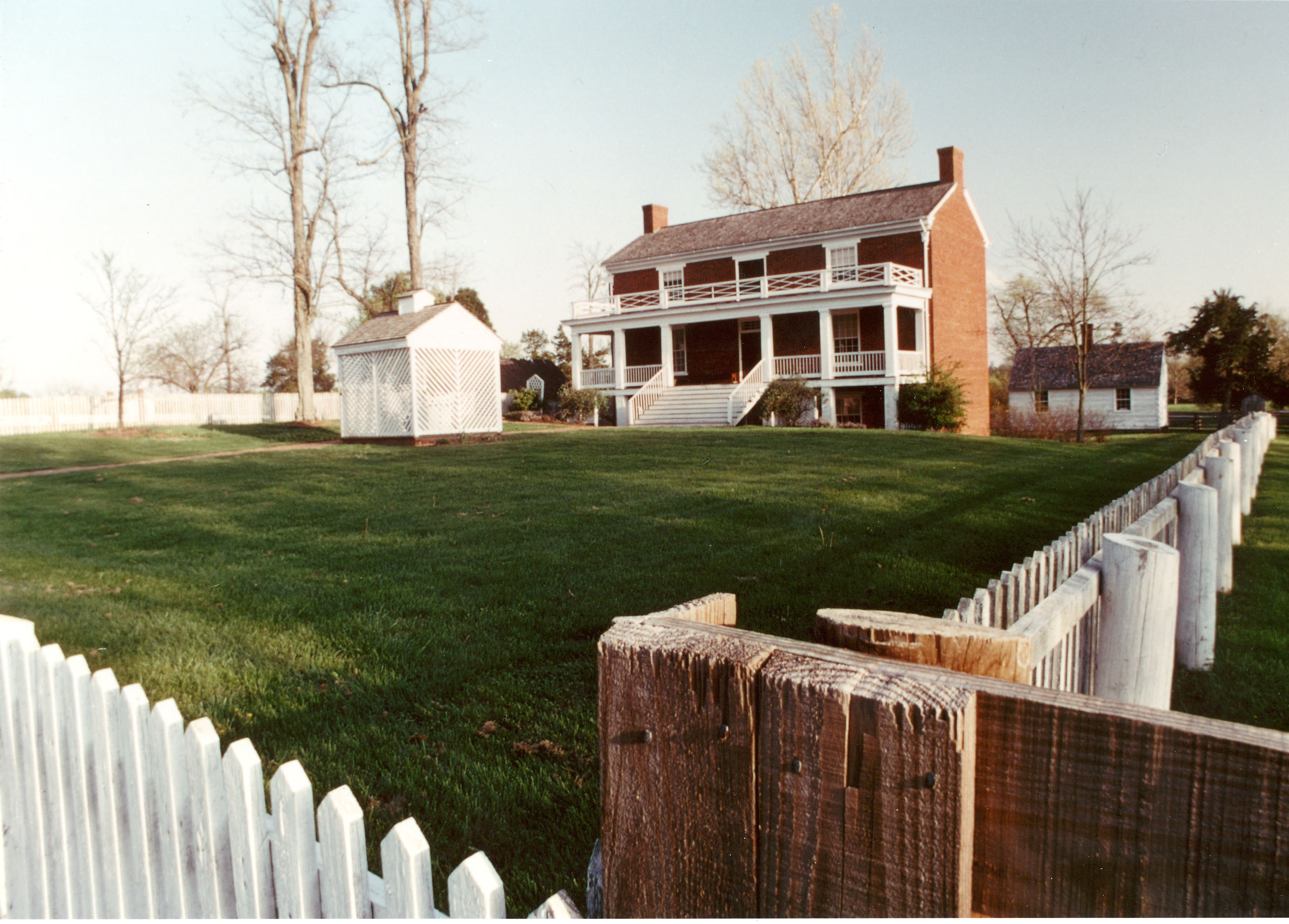
Appomattox Court House National Historical Park
National Historical Park
On April 9, 1865, the surrender of the Army of Northern Virginia in the McLean House in the village of Appomattox Court House, Virginia signaled the effective end of the nation's largest war. Question...
Two hundred ninety-two days, eight offensives, over 70,000 casualties, U. S. Colored Troops, and the decline of Gen. Lee's Army of Northern Virginia all describe the Siege of Petersburg. U.S. forces c...
22 mi from route
~56 min detour
Free
near mile 6.2
Park data from the National Park Service API. Alerts update every 2 hours.
More Details
What kind of drive is this?
This trip features a turn-heavy profile that keeps you engaged behind the wheel rather than relying on monotonous highway cruising. With only 17% of the journey spent on highways, you will spend the vast majority of your time on local roads that demand more active steering. The longest uninterrupted stretch you will encounter is a 36.7-mile segment along Anderson Highway, providing a brief period of steady driving. Expect the road character to shift as you transition from the suburban outskirts of Richmond into the more rural, winding sections of the Virginia countryside. It is a drive that rewards drivers who enjoy navigating local routes rather than simply following a straight interstate path.
Only 17% highway — the rest is turn-by-turn surface driving.
26 navigation steps total — most of the decisions cluster near the start and finish.
Longest single stretch: 36.7 mi on Anderson Highway.
How Hard Is This Drive?
8/10
Expect a hands-on drive with frequent turns and local roads rather than long highway stretches. This route has several spots where lane changes, forks, or exits need your full attention. The trickiest moment comes around 1.6 miles in near Parkwood Avenue.
Driving Effort8/10
Demanding - plan breaks and stay ahead of the key maneuvers
Balances navigation complexity with total wheel time.
This is a demanding drive. With 15 significant decision points across 90.4 miles, you will need to stay alert - especially through interchange areas and urban stretches. Consider splitting it into segments if you are not comfortable with fast highway navigation.
Where does it get tricky?
The main spots that need attention: at 1.6 miles (Parkwood Avenue): Navigation decision point; at 1.8 miles (McCloy Street): Navigation decision point; at 2 miles (Maplewood Avenue): Navigation decision point.
Towns Mentioned on Route Signs
Based on OSRM destination-sign hints, not a full list of every settlement the road passes.
On the drive from Richmond, VA to Appomattox, VA, road signs begin pointing toward Midlothian along the way.
Midlothian
7.7 mi in|~14m
Who Is This Route For?
Weekend Trip
Doable as a same-day drive at 2h 1m. Total distance: 90.4 miles.
Family Friendly
Moderate complexity with 0 natural rest stops along the way.
Solo Traveler
2h 1m drive, comfortable solo distance.
Scenic Drive
Mostly surface roads route profile with national parks nearby.
Frequently Asked Questions
The longest stretch is about 36.7 miles on Anderson Highway. The full list of main roads is in the Roads section above.
Expect about $0.69 in tolls one way, starting with Midlothian Turnpike. Most Northeast and Midwest toll agencies accept E-ZPass; in the West and Texas, transponders like TxTag or FasTrak apply. If you do not have a transponder, cashless tolling plates will mail a bill to the vehicle's registered address — usually with a surcharge, so a rental-car toll pass is often cheaper than paying by mail.
It helps. This route has a higher-than-average number of complex decision points, which get harder in the dark. If the last hour of the trip is on surface roads or mountain grades, aim to arrive at Appomattox, VA before sunset when you can. Check the Trip Plan for departure windows that land you in daylight.
Only with planning. This is a long drive for kids — consider splitting it into two days rather than pushing through. Dedicated rest areas are limited, so plan gas or food stops as your bathroom breaks.
The main spots that need attention: at 1.6 miles (Parkwood Avenue): Navigation decision point; at 1.8 miles (McCloy Street): Navigation decision point; at 2 miles (Maplewood Avenue): Navigation decision point.
Yes — Appomattox Court House National Historical Park and Petersburg National Battlefield. See the National Parks section for detour distances and tips on detours.
Yes. A round trip is manageable in a single day if you plan a break at Appomattox, VA before heading back.