This 359.2-mile journey from Peoria, AZ to Beaver Dam, AZ is a substantial undertaking, estimated to take around 7 hours and 7 minutes of driving time. Given its duration, it's well-suited as a single-day trip, though an early start is recommended to comfortably reach your destination. You'll primarily navigate the Wickenburg–Kingman Highway, Las Vegas Freeway, and Hoover Dam–Kingman Highway, with about 24% of the route being on highways. The estimated fuel cost for this drive is $72. This is a classic Desert Southwest road trip, traversing arid landscapes in both Arizona and Nevada.
Trip Pace
Same-day drive is realistic
A same-day return is possible, but it will make for a full day on the road.
Break Rhythm
2 planned breaks
Plan on a short reset every 3 to 4 hours to stay fresh behind the wheel.
Midpoint
179.6 miles from Peoria, AZ
A natural place for your longest stop of the day
, about 3h 41m into the drive
.
Main Roads
Road
Distance
Duration
Wickenburg–Kingman Highway
106.7 mi
2h 9m
Las Vegas Freeway
73.3 mi
1h 13m
Hoover Dam–Kingman Highway
66.2 mi
1h 16m
Grand Avenue
29 mi
40m
Purple Heart Trail
21.5 mi
21m
Purple Heart Highway
17.6 mi
20m
Phoenix–Wickenburg Highway
9 mi
10m
Veterans Memorial Highway
8.1 mi
8m
Longest stretch:
Wickenburg–Kingman Highway
— 106.7 mi, about 2h 9m
Traffic on I-15
Hour-of-day weekday pattern from 8 FHWA count stations on your route.
Peak
2 PM
~1,128 veh/hr typical
· worst 1,480
Quietest
1 AM
~155 veh/hr
Peak-to-quiet ratio
7.3×
busier at peak than in the quiet hours
12a6anoon6p11p
Averaged across 51 weeks of 2023 FHWA Travel Monitoring Analysis System data. Weekday hours only (Mon–Fri).
Turn-by-Turn Driving Directions
Step-by-step road directions between Peoria, AZ and Beaver Dam, AZ.
1
Start on North 83rd Avenue
128 ft·6 sec·North 83rd Avenue
2
Turn left onto US 60
22 mi·31 min·Grand Avenue
Use the left lane.
3
Keep slight right at fork onto US 60
159 ft·3 sec·Phoenix–Wickenburg Highway
4
Continue on US 60
0.9 mi·1 min·Grand Avenue
5
Continue on US 60
0.2 mi·15 sec·Phoenix–Wickenburg Highway
6
Continue on US 60
0.1 mi·8 sec·Wickenburg–Phoenix Highway
7
Continue on US 60
6.3 mi·7 min·Grand Avenue
8
Continue on US 60
0.5 mi·31 sec·Phoenix-Wickenburg Highway
9
Continue on US 60
8.7 mi·10 min·Phoenix–Wickenburg Highway
10
Continue on US 60
1.5 mi·2 min·East Wickenburg Way
11
Enter roundabout onto US 93
2 ft·0 sec·Wickenburg–Kingman Highway
12
Continue on US 93
1.2 mi·2 min·Wickenburg–Kingman Highway
13
Keep slight right at fork onto US 93
0.5 mi·1 min·Wickenburg–Kingman Highway
14
Keep slight right at fork onto US 93
0.9 mi·1 min·Wickenburg–Kingman Highway
15
Keep slight right at fork onto US 93
0.9 mi·1 min·Wickenburg–Kingman Highway
16
Enter roundabout onto US 93
100 ft·4 sec·Wickenburg–Kingman Highway
17
Continue on US 93
1.2 mi·2 min·Wickenburg–Kingman Highway
18
Enter roundabout onto US 93
155 ft·6 sec·Wickenburg–Kingman Highway
19
Continue on US 93
0.6 mi·1 min·Wickenburg–Kingman Highway
20
Turn left onto US 93
112 ft·4 sec·Wickenburg–Kingman Highway
21
Keep slight right at fork onto US 93
101 mi·1 hr 58 min·Wickenburg–Kingman Highway
22
Continue on US 93
0.3 mi·23 sec·Wickenburg-Kingman Highway
23
Take the exit onto US 93
0.7 mi·1 min·US 93
Toward I 40 West
24
Merge onto I 40; US 93
22 mi·21 min·Purple Heart Trail
25
Take the exit onto US 93
0.3 mi·42 sec·US 93
Exit 48Toward US 93: Beale Street, Las Vegas
26
Turn slight right onto US 93
222 ft·7 sec·US 93
Exit 48Toward US 93: Beale Street, Las VegasUse the right lane.
27
Merge onto US 93
1.8 mi·2 min·West Beale Street
Use the right lane.
28
Continue on US 93
66 mi·1 hr 16 min·Hoover Dam–Kingman Highway
Use the right lane.
29
Continue on US 93
3.4 mi·4 min·Hoover Dam Bypass
30
Take the exit onto US 93 BUS
0.2 mi·20 sec·US 93 BUS
Exit 2Toward US 93 BUS North, NV 172 East: Boulder City, Hoover Dam, Lake MeadUse the straight / slight right lanes.
31
Keep slight right at fork onto US 93 BUS
6.0 mi·10 min·US 93 BUS
Exit 2Toward US 93 BUS North: Boulder CityUse the right lane.
32
Continue on US 93 BUS
3.6 mi·4 min·Boulder City Parkway
Use the straight / slight right lanes.
33
Continue on I 11; US 93; US 95
18 mi·20 min·Purple Heart Highway
Use the straight / slight right lanes.
34
Take the exit
0.3 mi·30 sec
Exit 72Toward NV 159: Charleston BoulevardUse the slight right lane.
35
Turn right onto NV 159
0.6 mi·1 min·East Charleston Boulevard
36
Turn left onto South Lamb Boulevard
6.8 mi·11 min·South Lamb Boulevard
Use the left lane.
37
Take the ramp
0.4 mi·50 sec
Toward I 15 North: Salt Lake City
38
Merge onto I 15; US 93
73 mi·1 hr 13 min·Las Vegas Freeway
Use the straight / slight right lanes.
39
Continue on I 15
8.1 mi·8 min·Veterans Memorial Highway
40
Take the exit
0.5 mi·53 sec
Exit 8Toward Beaver Dam, Littlefield
41
Turn left onto CR 91
0.6 mi·1 min·Highway 91
42
Turn right
332 ft·26 sec
43
At end of road, turn left
412 ft·30 sec
44
Arrive at destination
Trip Plan
To make the most of this 7-hour, 359.2-mile drive, consider departing early to maximize daylight hours. With two planned stops, you'll have opportunities to stretch and refuel. Keep an eye on your fuel gauge, especially during the longest stretch of 106.7 miles on the Wickenburg–Kingman Highway, as services might be more spaced out in desert regions. The $72 fuel estimate is a good baseline for your budget. Since this is a single-day itinerary, you have flexibility in timing your breaks.
Morning Departure
Start early — leave by 6-7 AM to arrive at a reasonable hour.
Evening Departure
This is a long drive — plan for a morning departure or consider splitting it into two days.
You can normally do this drive in one day.
Plan roughly 2 meaningful breaks for fuel, food, and rest.
The halfway point lands around 179.6 miles from Peoria, AZ, or about 3h 41m into the drive.
The longest continuous stretch on this route runs about 106.7 miles.
This is a comfortable same-day trip.
Departure
Before you leave
Start with fuel, water, and navigation already sorted so the first hour feels easy.
First stop
Around 79 miles or 1h 45m in
Use this first pause for coffee, a restroom break, and a quick traffic check ahead.
Halfway reset
Around 179.6 miles or 3h 41m in
This is the best place for your longest stop, a real meal, and a full fuel check.
Final approach
Final hour starts around 6h 5m
Traffic, exits, and arrival timing usually matter more near Beaver Dam, AZ than in the middle of the route.
Before You Leave
+
Open the route before leaving Peoria, AZ so your first major turns are already loaded.
+
Leave with enough water and a charging cable within reach, not packed away.
+
Check your fuel range against the first long segment, especially if you are starting outside city service areas.
+
Pick one backup stop option before the midpoint in case traffic changes your pacing.
Day 1
Settle into the route from Peoria, AZ
This is one driving day of about 359.2 miles and 7h 7m.
Your first comfortable stop window is around 79 miles from Peoria, AZ.
This route can stay practical as a one-day drive if traffic stays reasonable.
Plan about 2 real breaks rather than only quick fuel stops.
The longest stretch is on Wickenburg–Kingman Highway for about 106.7 miles.
Where to Stop
Rest stops, refuel points, and overnight suggestions along this route.
Place data sourced from public business listings. Hours and availability may vary.
Heads-up: tricky spots
5 of 26
5 decision points cluster between mile 169.3 and 268.5 — GPS handles the exact turns, but know they're coming. Your lane choice matters more than the turn itself.
6
169.3 mi into trip|~3h 28m in|US 93
Take the exit onto US 93 toward US 93: Beale Street, Las Vegas
Exit ramp - move to the correct lane early. Multiple destination signs - pick the right one
Exit 48
Toward US 93: Beale Street, Las Vegas
6
169.7 mi into trip|~3h 28m in|US 93
Turn slight right onto US 93 toward US 93: Beale Street, Las Vegas
Lane positioning matters here. Multiple destination signs - pick the right one
Use the right lane.
Exit 48
Toward US 93: Beale Street, Las Vegas
8
241.1 mi into trip|~4h 52m in|US 93 BUS
Take the exit onto US 93 BUS toward US 93 BUS North, NV 172 East: Boulder City, Hoover Dam, Lake Mead
Exit ramp - move to the correct lane early. Lane positioning matters here. Multiple destination signs - pick the right one
Use the straight / slight right lanes.
Exit 2
Toward US 93 BUS North, NV 172 East: Boulder Ci...
8
241.2 mi into trip|~4h 53m in|US 93 BUS
Keep slight right at fork onto US 93 BUS toward US 93 BUS North: Boulder City
Highway fork - watch signs carefully. Lane positioning matters here
Use the right lane.
Exit 2
Toward US 93 BUS North: Boulder City
7
268.5 mi into trip|~5h 29m in
Take the exit toward NV 159: Charleston Boulevard
Exit ramp - move to the correct lane early. Lane positioning matters here
Use the slight right lane.
Exit 72
Toward NV 159: Charleston Boulevard
Fuel & Cost
Regular Gas
$63.65 one way
$127.30 round trip
$4.50/gal25.4 MPG avg126 kg CO2
Fuel Type
$/gal
One Way
Round Trip
midgrade
$4.82
$68.16
$136.33
premium
$5.04
$71.30
$142.61
diesel
$4.80
$67.82
$135.65
No toll roads detected on this route.
Estimated Trip Cost (one way, 1 person)
Fuel
$64
Meals
$25–$50
Total
$89–$114
Rough estimate based on US averages. Hotel $80–$140/night, meals $25–$50/day.
Estimated CO2 emission: 125.7 kg one way.
Prices: EIA weekly data, 2026-07-13.
Driving Electric?
About $38 in charging
· 1 stop
· 67% less CO2
Vehicle Type
kWh
Stops
DC Fast
Home Charge
Average EV
107.8
1
$37.72
$17.24
Efficient EV
89.8
1
$31.43
$14.37
EV Truck/SUV
143.7
1
$50.29
$22.99
Gas CO2
126 kg
EV CO2
42 kg (67% less)
Plan for 1 charging stop. A 30-minute DC fast charge mid-route should be enough to complete the trip comfortably.
DC fast charging avg $0.35/kWh. Home charging avg $0.16/kWh. US grid CO2: 0.39 kg/kWh.
Travel Intel
Current conditions at both ends of the drive.
Forecast as of Jul 17, 2026
Origin
Peoria, AZ
Evening
in Peoria on Saturday
Local time
7:53 PM
MST
Current temp
77°F
Showers And Thunderstorms Likely
ESE 5 mph68% chanceLive forecast
Flash Flood Warning
Flash Flood Warning issued July 17 at 12:30AM MST until July 17 at 2:30AM MST by NWS Phoenix AZ
Flash Flood Warning
Flash Flood Warning issued July 16 at 11:59PM MST until July 17 at 3:00AM MST by NWS Flagstaff AZ
Destination
Beaver Dam, AZ
Evening
in Beaver Dam on Saturday
Local time
7:53 PM
MST
Current temp
83°F
Isolated Showers And Thunderstorms
NNE 3 mph30% chanceLive forecast
Flash Flood Warning
Flash Flood Warning issued July 17 at 12:30AM MST until July 17 at 2:30AM MST by NWS Phoenix AZ
Flash Flood Warning
Flash Flood Warning issued July 16 at 11:59PM MST until July 17 at 3:00AM MST by NWS Flagstaff AZ
Seasonal Notes
Summer travel usually means heavier construction, hotter rest stops, and busier weekend traffic around major cities.
Winter travel shortens daylight, so a route that looks manageable on paper can feel much longer after dark.
Holiday weekends tend to make both departure and arrival windows slower than the raw route time suggests.
Time zone
Same local time
Origin and destination are on the same clock, so arrival timing is easier to judge at a glance.
Temperature spread
6 degrees warmer at arrival
A meaningful temperature swing is a good cue to rethink layers, water, and how soon you want to arrive.
Road read
7h 7m on the road
Start early — leave by 6-7 AM to arrive at a reasonable hour.
Weather data from the National Weather Service. Conditions may change; check closer to your travel date.
National Parks Near This Route
Worth a detour if your schedule allows.
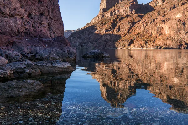
Lake Mead National Recreation Area
National Recreation Area
Experience outdoor thrills, striking landscapes, and brilliant blue waters. This year-round recreation area spreads across 1.5 million acres of mountains, canyons, valleys and two vast reservoirs. Vis...
15 mi from route
~38 min detour
$25
near mile 223
Danger: A harmful algal bloom (HAB) has been detected in Government Wash
Park data from the National Park Service API. Alerts update every 2 hours.
More Details
What kind of drive is this?
Expect a turn-heavy local drive for a significant portion of this 359.2-mile route. While 24% of the journey is on highways, much of it involves navigating local roads and junctions. The longest uninterrupted stretch you'll encounter is 106.7 miles on the Wickenburg–Kingman Highway. This means you'll be making frequent adjustments and experiencing a varied driving pace, rather than a monotonous interstate cruise. The road's character will likely shift between faster highway sections and more engaged local driving as you progress.
Only 24% highway — the rest is turn-by-turn surface driving.
44 navigation steps total — most of the decisions cluster near the start and finish.
Longest single stretch: 106.7 mi on Wickenburg–Kingman Highway.
How Hard Is This Drive?
9/10
Expect a hands-on drive with frequent turns and local roads rather than long highway stretches. This route has several spots where lane changes, forks, or exits need your full attention. The trickiest moment comes around 169.3 miles in near US 93.
Driving Effort9/10
High effort - long or complex enough to need steady focus all day
Balances navigation complexity with total wheel time.
This is a demanding drive. With 26 significant decision points across 359.2 miles, you will need to stay alert - especially through interchange areas and urban stretches. Consider splitting it into segments if you are not comfortable with fast highway navigation.
Where does it get tricky?
The main spots that need attention: at 169.3 miles (US 93): Exit ramp - move to the correct lane early. Multiple destination signs - pick the right one; at 169.7 miles (US 93): Lane positioning matters here. Multiple destination signs - pick the right one; at 241.1 miles (US 93 BUS): Exit ramp - move to the correct lane early. Lane positioning matters here. Multiple destination signs - pick the right one.
Elevation Profile
Hilly terrain with moderate elevation changes
4,216 ft1,141 ft
Total Climb
4,037 ft
Total Descent
3,343 ft
Highest Point
4,216 ft
~153.9 mi in
Elevation Range
3,075 ft
Notable High Points
2,668 ft at ~51.3 miles+587 ft prominence
4,216 ft at ~153.9 miles+891 ft prominence
Towns Mentioned on Route Signs
Based on OSRM destination-sign hints, not a full list of every settlement the road passes.
Between Peoria, AZ and Beaver Dam, AZ, road signs point toward Las Vegas, Hoover Dam and Lake Mead.
Las Vegas
169.3 mi in|~3h 28m|via US 93
Hoover Dam
241.1 mi in|~4h 52m|via US 93 BUS
Lake Mead
241.1 mi in|~4h 52m|via US 93 BUS
Detours Along the Way
Tagged by where each one fits in your drive — first break, midpoint, final stretch.
Peoria is a city inside of Phoenix, Arizona. Many visitors come to the area during the spring to see their favorite professional baseball team during Spring Training in the Cactus League.
Top landmarks
•Central School — school building in Peoria, Arizona
Doable as a same-day drive at 7h 7m. Total distance: 359.2 miles.
Family Friendly
Moderate complexity with 2 natural rest stops along the way.
Solo Traveler
7h 7m drive, plan rest stops for pacing.
Scenic Drive
Mostly surface roads route profile with national parks nearby.
Frequently Asked Questions
The longest stretch is about 106.7 miles on Wickenburg–Kingman Highway. The full list of main roads is in the Roads section above.
Yes — we found about 32 rest areas or service plazas within a short detour of the route (from OpenStreetMap). See the Rest Stops tab under Nearby Places for locations and mile markers. Plan to stretch, use the bathroom, and top off fluids every 2–3 hours on longer drives.
It helps. This route has a higher-than-average number of complex decision points, which get harder in the dark. If the last hour of the trip is on surface roads or mountain grades, aim to arrive at Beaver Dam, AZ before sunset when you can. Check the Trip Plan for departure windows that land you in daylight.
Only with planning. This is a long drive for kids — consider splitting it into two days rather than pushing through. Plan at least 2 meaningful breaks. There are 32 rest areas along the route for bathroom stops.
The main spots that need attention: at 169.3 miles (US 93): Exit ramp - move to the correct lane early. Multiple destination signs - pick the right one; at 169.7 miles (US 93): Lane positioning matters here. Multiple destination signs - pick the right one; at 241.1 miles (US 93 BUS): Exit ramp - move to the correct lane early. Lane positioning matters here. Multiple destination signs - pick the right one.
Yes — Lake Mead National Recreation Area. See the National Parks section for detour distances and tips on detours.
Not recommended in a single day. At 7.1 hours each way, a round trip means 14.3 hours of driving — that is an unsafe level of fatigue for most drivers. Plan at least one night at Beaver Dam, AZ before the return drive.