Chilton County Rest Area (Northbound)
0 mi from route
Compiled and reviewed by the US Trip Planner planning team at COD Solutions Oy · Last reviewed Jul 18, 2026 · Editorial standards
Drive Time
6h 55m
Distance
374.2 mi
602 km
Drive Score
8/10
Great drive
Same Day?
Yes, doable
Fuel Cost
$52
one way
EV Charging
Unknown
Estimated drive times based on typical traffic patterns. Actual times may vary with weather, construction, and real-time conditions.

Pennsylvania, AL
K6

Stevenson, AL
Taryn Elliott
Pennsylvania, AL to Stevenson, AL is 374.2 miles and takes about 6h 55m via I 65 and I 59, with a fuel budget near $59 and enough daylight to finish in a day. This trip stays within Alabama, connecting two points in the Southeast region. Given its mostly highway profile and manageable duration, it's a straightforward drive. You'll spend the majority of your time on major interstates, making it a practical choice for a day trip or a quick leg of a longer journey.
Trip Pace
Same-day drive is realistic
A same-day return is possible, but it will make for a full day on the road.
Break Rhythm
1 planned break
Plan on a short reset every 3 to 4 hours to stay fresh behind the wheel.
Midpoint
187.1 miles from Pennsylvania, AL
A natural place for your longest stop of the day , about 3h 23m into the drive .
| Road | Distance | Duration |
|---|---|---|
| I 65 | 229.8 mi | 4h 7m |
| I 59 | 80.8 mi | 1h 26m |
| John M. Harbert III Freeway | 17.1 mi | 18m |
| John T Reid Parkway | 16.8 mi | 19m |
| Tammy Little Drive | 12.6 mi | 16m |
| East Main Street | 8.9 mi | 12m |
| Glenn Boulevard Southwest | 3.8 mi | 5m |
| AL 117 | 1.4 mi | 2m |
Hour-of-day weekday pattern from 63 FHWA count stations on your route.
Peak
4 PM
~3,603 veh/hr typical
Quietest
2 AM
~191 veh/hr
Peak-to-quiet ratio
18.9×
busier at peak than in the quiet hours
Averaged across 52 weeks of 2023 FHWA Travel Monitoring Analysis System data. Weekday hours only (Mon–Fri).
Step-by-step road directions between Pennsylvania, AL and Stevenson, AL.
Start on this road
Turn left onto US 43
Take the ramp
Merge onto I 65
Take the exit
Keep slight right at fork
Merge onto I 459
Keep slight right at fork
Continue on this road
Merge onto I 59
Take the exit
Turn left onto AL 35
Continue on AL 35
Continue on AL 35
Take the ramp
Merge onto US 72
Take the exit
Turn left onto AL 117
Turn left onto AL 117
Turn right
Arrive at destination
To make the most of this 6h 55m drive, consider an early morning departure to maximize daylight and avoid potential afternoon traffic. With 374.2 miles, you could comfortably complete this in one day, but if you prefer a more relaxed pace, a brief stop for lunch around the halfway point would be ideal. Keep an eye on your fuel levels, especially during the 229.8-mile stretch on I 65, as services can sometimes be spaced out on interstates. The estimated fuel cost of $59 is a good baseline for your budget.
Morning Departure
Start early — leave by 6-7 AM to arrive at a reasonable hour.
Evening Departure
This is a long drive — plan for a morning departure or consider splitting it into two days.
This is a comfortable same-day trip.
Departure
Before you leave
Start with fuel, water, and navigation already sorted so the first hour feels easy.
First stop
Around 82 miles or 1h 29m in
Use this first pause for coffee, a restroom break, and a quick traffic check ahead.
Halfway reset
Around 187.1 miles or 3h 23m in
This is the best place for your longest stop, a real meal, and a full fuel check.
Final approach
Final hour starts around 5h 41m
Traffic, exits, and arrival timing usually matter more near Stevenson, AL than in the middle of the route.
Open the route before leaving Pennsylvania, AL so your first major turns are already loaded.
Leave with enough water and a charging cable within reach, not packed away.
Check your fuel range against the first long segment, especially if you are starting outside city service areas.
Day 1
Settle into the route from Pennsylvania, AL
This is one driving day of about 374.2 miles and 6h 55m.
Rest stops, refuel points, and overnight suggestions along this route.

Mid-route town
Meal stop
187 mi into the route
Best for: Lunch, fuel, and a longer reset
This sits close to the middle of the route, so it works well for the longest stop of the day.
A short stop after about 82 miles helps settle the day before fatigue starts building.
The midpoint is around 187.1 miles from Pennsylvania, AL, which is a good place for a longer meal and fuel stop.
Before the longest stretch
Fuel checkTop up before I 65 if your tank is already low. That segment runs about 229.8 miles.
These stop ideas are pacing suggestions — the exact town or exit can change with traffic, hotel plans, and fuel range.
Picked by where they fit in your drive — first break, midpoint reset, final stretch.
Place data sourced from public business listings. Hours and availability may vary.
5 decision points cluster between mile 0.8 and 329.9 — GPS handles the exact turns, but know they're coming. Your lane choice matters more than the turn itself.
Merge onto I 65
Merge point - match speed before joining. Lane positioning matters here
Take the exit toward I 459: Atlanta, Gadsden, Tuscaloosa
Exit ramp - move to the correct lane early. Lane positioning matters here. Multiple destination signs - pick the right one
Keep slight right at fork toward I 459 North: Atlanta, Gadsden
Highway fork - watch signs carefully. Lane positioning matters here. Multiple destination signs - pick the right one
Keep slight right at fork toward I 59 North: Gadsden
Highway fork - watch signs carefully. Lane positioning matters here
Take the exit toward 35: Fort Payne, Rainsville
Exit ramp - move to the correct lane early. Multiple destination signs - pick the right one
Regular Gas
$51.95 one way
$103.89 round trip
| Fuel Type | $/gal | One Way | Round Trip |
|---|---|---|---|
| midgrade | $3.95 | $58.12 | $116.24 |
| premium | $4.29 | $63.19 | $126.37 |
| diesel | $4.80 | $70.66 | $141.31 |
No toll roads detected on this route.
Estimated Trip Cost (one way, 1 person)
Fuel
$52
Meals
$25–$50
Total
$77–$102
Rough estimate based on US averages. Hotel $80–$140/night, meals $25–$50/day.
Estimated CO2 emission: 130.9 kg one way. Prices: EIA weekly data, 2026-07-13.
Driving Electric?
About $39 in charging · 1 stop · 66% less CO2
| Vehicle Type | kWh | Stops | DC Fast | Home Charge |
|---|---|---|---|---|
| Average EV | 112.3 | 1 | $39.29 | $17.96 |
| Efficient EV | 93.6 | 1 | $32.74 | $14.97 |
| EV Truck/SUV | 149.7 | 1 | $52.39 | $23.95 |
Gas CO2
131 kg
EV CO2
44 kg (66% less)
Plan for 1 charging stop. A 30-minute DC fast charge mid-route should be enough to complete the trip comfortably.
DC fast charging avg $0.35/kWh. Home charging avg $0.16/kWh. US grid CO2: 0.39 kg/kWh.
Current conditions at both ends of the drive.
Origin
Evening in Pennsylvania on Saturday
Local time
6:22 PM
CDT
Current temp
76°F
Mostly Clear
Destination
Evening in Stevenson on Saturday
Local time
6:22 PM
CDT
Current temp
71°F
Areas Of Fog
94°F
Helena, AL
187 mi in
Seasonal Notes
Summer travel usually means heavier construction, hotter rest stops, and busier weekend traffic around major cities.
Winter travel shortens daylight, so a route that looks manageable on paper can feel much longer after dark.
Holiday weekends tend to make both departure and arrival windows slower than the raw route time suggests.
Time zone
Origin and destination are on the same clock, so arrival timing is easier to judge at a glance.
Temperature spread
A meaningful temperature swing is a good cue to rethink layers, water, and how soon you want to arrive.
Road read
Start early — leave by 6-7 AM to arrive at a reasonable hour.
Weather data from the National Weather Service. Conditions may change; check closer to your travel date.
Worth a detour if your schedule allows.
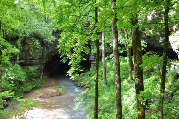
National Monument
Russell Cave National Monument is an archeological site with one of the most complete records of prehistoric cultures in the Southeast. In the 1950s, archeologists uncovered a large quantity of artifa...

National Monument
In 1963, images of snarling police dogs unleashed against non-violent protesters and of children being sprayed with high-pressure hoses appeared in print and television news around the world. These dr...

National Monument
In 1961, a small interracial band of “Freedom Riders” challenged discriminatory laws requiring separation of the races in interstate travel. They were attacked by white segregationists, who firebombed...
Park data from the National Park Service API. Alerts update every 2 hours.
This route is predominantly highway, with 93% of the drive on major roads like I 65 and I 59. You'll experience a long stretch of 229.8 miles on I 65 before transitioning. Expect many exits and potential for urban merging as you navigate through populated areas. The final leg will likely involve more surface roads as you approach Stevenson.
This is a straightforward highway drive that stays mostly on I 65 and I 59. This route has several spots where lane changes, forks, or exits need your full attention. The trickiest moment comes around 0.8 miles in near I 65.
High effort - long or complex enough to need steady focus all day
Balances navigation complexity with total wheel time.
This is a demanding drive. With 15 significant decision points across 374.2 miles, you will need to stay alert - especially through interchange areas and urban stretches. Consider splitting it into segments if you are not comfortable with fast highway navigation.
Where does it get tricky?
The main spots that need attention: at 0.8 miles (I 65): Merge point - match speed before joining. Lane positioning matters here; at 230.6 miles: Exit ramp - move to the correct lane early. Lane positioning matters here. Multiple destination signs - pick the right one; at 230.8 miles: Highway fork - watch signs carefully. Lane positioning matters here. Multiple destination signs - pick the right one.
Gently rolling terrain
Total Climb
1,557 ft
Total Descent
943 ft
Highest Point
1,312 ft
~347.5 mi in
Elevation Range
1,291 ft
Notable High Points
Based on OSRM destination-sign hints, not a full list of every settlement the road passes.
Between Pennsylvania, AL and Stevenson, AL, road signs point toward Gadsden, Tuscaloosa, 35: Fort Payne and Rainsville.
Gadsden
Tuscaloosa
35: Fort Payne
Rainsville
“Keystone State” · Founded 1787
Pennsylvania is a state in the eastern United States. It is known for its Revolutionary War-era historical sites like Valley Forge, its large cities like Philadelphia and Pittsburgh, its farming regions (some occupied by the Amish), and a (once)-strong industrial history. With equally large swaths of cities and towns as fields and mountains, Pennsylvania is a rich and varied state, as well as a worthy travel destination.
Top landmarks
City content from Wikivoyage (CC BY-SA 4.0) and Wikidata (CC0).
Weekend Trip
Doable as a same-day drive at 6h 55m. Total distance: 374.2 miles.
Family Friendly
Moderate complexity with 1 natural rest stops along the way.
Solo Traveler
6h 55m drive, plan rest stops for pacing.
Compiled by the US Trip Planner planning team at COD Solutions Oy from open government datasets — OSRM over OpenStreetMap for geometry, EIA for fuel prices, USGS 3DEP for elevation, NPS for national parks, and FHWA TMAS for hourly traffic volumes. See our methodology for refresh cadence and limitations.
Was this helpful?
Thanks for your feedback!
Your tip has been submitted. Thanks!
/500
Recent Tips
·
Explore more options from Pennsylvania, AL or browse trips ending in Stevenson, AL.
Looking for more statewide routes? Browse AL road trips.