Pennsylvania, AL to Bynum, AL is 258.5 miles and takes about 4h 53m via I 65 and US 231, with a fuel budget near $39 and enough daylight to finish in a day. This drive stays within Alabama, traversing the Southeast region for its entirety. It's a straightforward, highway-focused trip perfect for a single day's travel. Given its relatively short duration and highway nature, it’s a practical option when you need to get from point A to point B efficiently.
Trip Pace
Same-day drive is realistic
A same-day return is possible, but it will make for a full day on the road.
Break Rhythm
1 planned break
Plan on a short reset every 3 to 4 hours to stay fresh behind the wheel.
Midpoint
129.2 miles from Pennsylvania, AL
A natural place for your longest stop of the day
, about 2h 20m into the drive
.
Main Roads
Road
Distance
Duration
I 65
152.8 mi
2h 44m
US 231
82 mi
1h 33m
Curry Station Road
7.4 mi
10m
Northern Boulevard
6.3 mi
8m
Wetumpka Highway
3.3 mi
3m
Bynum Boulevard
2.1 mi
3m
US 78
1.5 mi
2m
John N Wills Avenue
1.4 mi
2m
Longest stretch:
I 65
— 152.8 mi, about 2h 44m
Traffic on I-65
Hour-of-day weekday pattern from 36 FHWA count stations on your route.
Peak
3 PM
~825 veh/hr typical
· worst 1,223
Quietest
1 AM
~118 veh/hr
Peak-to-quiet ratio
7×
busier at peak than in the quiet hours
12a6anoon6p11p
Averaged across 52 weeks of 2023 FHWA Travel Monitoring Analysis System data. Weekday hours only (Mon–Fri).
Turn-by-Turn Driving Directions
Step-by-step road directions between Pennsylvania, AL and Bynum, AL.
1
Start on this road
0.2 mi·1 min·this road
2
Turn left onto US 43
0.4 mi·46 sec·US 43
3
Take the ramp
0.2 mi·22 sec
4
Merge onto I 65
153 mi·2 hr 44 min·I 65
5
Take the exit
0.3 mi·35 sec
Exit 173Toward AL 152 East: North Blvd
6
Continue on AL 152
6.3 mi·8 min·Northern Boulevard
Use the left / straight lanes.
7
Take the exit
0.2 mi·25 sec
Toward US 231 North, AL 21 North: WetumpkaUse the straight / slight right lanes.
8
Keep slight left at fork
133 ft·5 sec
Toward US 231 North, AL 21 North: WetumpkaUse the left lane.
9
Turn left onto Wetumpka Highway
3.3 mi·3 min·Wetumpka Highway
Use the straight lane.
10
Continue on US 231; AL 21
5.1 mi·5 min·US 231; AL 21
Use the straight / right lanes.
11
Continue on US 231; AL 21
0.2 mi·18 sec·US 231; AL 21
Use the straight / right lanes.
12
Continue on US 231; AL 21
77 mi·1 hr 27 min·US 231; AL 21
Use the straight / right lanes.
13
Turn left onto Curry Station Road
7.4 mi·10 min·Curry Station Road
14
At end of road, turn right onto Eastaboga Road
0.2 mi·23 sec·Eastaboga Road
15
Continue on John N Wills Avenue
1.4 mi·2 min·John N Wills Avenue
16
Continue on Mudd Street
0.2 mi·21 sec·Mudd Street
17
Turn right onto US 78
1.5 mi·2 min·US 78
18
Turn slight left onto Bynum Boulevard
2.1 mi·3 min·Bynum Boulevard
19
Arrive at destination
Bynum Boulevard
Trip Plan
To make the most of this 4h 53m drive, consider an early morning departure to avoid any potential traffic. With a single recommended stop, you can easily complete this trip in one day. Keep an eye on your fuel gauge, as the longest stretch without a major exit could be around 152.8 miles on I 65. For this route, ensure you have enough fuel before beginning that longest segment, as service areas can sometimes be spaced out on interstates.
Morning Departure
An early start around 7-8 AM gets you there with plenty of daylight left.
Evening Departure
A late afternoon start means arriving after dark. Morning is better.
You can normally do this drive in one day.
Plan roughly 1 meaningful break for fuel, food, and rest.
The halfway point lands around 129.2 miles from Pennsylvania, AL, or about 2h 20m into the drive.
The longest continuous stretch on this route runs about 152.8 miles.
This is a comfortable same-day trip.
Departure
Before you leave
Start with fuel, water, and navigation already sorted so the first hour feels easy.
First stop
Around 57 miles or 1h 2m in
Use this first pause for coffee, a restroom break, and a quick traffic check ahead.
Halfway reset
Around 129.2 miles or 2h 20m in
This is the best place for your longest stop, a real meal, and a full fuel check.
Final approach
Final hour starts around 3h 56m
Traffic, exits, and arrival timing usually matter more near Bynum, AL than in the middle of the route.
Before You Leave
+
Open the route before leaving Pennsylvania, AL so your first major turns are already loaded.
+
Leave with enough water and a charging cable within reach, not packed away.
+
Check your fuel range against the first long segment, especially if you are starting outside city service areas.
Day 1
Settle into the route from Pennsylvania, AL
This is one driving day of about 258.5 miles and 4h 53m.
Your first comfortable stop window is around 57 miles from Pennsylvania, AL.
This route can stay practical as a one-day drive if traffic stays reasonable.
Plan about 1 real break rather than only quick fuel stops.
The longest stretch is on I 65 for about 152.8 miles.
Where to Stop
Rest stops, refuel points, and overnight suggestions along this route.
Place data sourced from public business listings. Hours and availability may vary.
Heads-up: tricky spots
5 of 9
5 decision points cluster between mile 153.5 and 253.1 — GPS handles the exact turns, but know they're coming. Your lane choice matters more than the turn itself.
5
153.5 mi into trip|~2h 47m in
Take the exit toward AL 152 East: North Blvd
Exit ramp - move to the correct lane early
Exit 173
Toward AL 152 East: North Blvd
7
160.1 mi into trip|~2h 56m in
Take the exit toward US 231 North, AL 21 North: Wetumpka
Exit ramp - move to the correct lane early. Lane positioning matters here. Multiple destination signs - pick the right one
Use the straight / slight right lanes.
Toward US 231 North, AL 21 North: Wetumpka
9
160.3 mi into trip|~2h 56m in
Keep slight left at fork toward US 231 North, AL 21 North: Wetumpka
Highway fork - watch signs carefully. Lane positioning matters here. Multiple destination signs - pick the right one
Use the left lane.
Toward US 231 North, AL 21 North: Wetumpka
4
160.3 mi into trip|~2h 56m in|Wetumpka Highway
Turn left onto Wetumpka Highway
Lane positioning matters here
Use the straight lane.
5
253.1 mi into trip|~4h 44m in|Eastaboga Road
At end of road, turn right onto Eastaboga Road
Navigation decision point
Fuel & Cost
Regular Gas
$35.88 one way
$71.77 round trip
$3.53/gal25.4 MPG avg90 kg CO2
Fuel Type
$/gal
One Way
Round Trip
midgrade
$3.95
$40.15
$80.30
premium
$4.29
$43.65
$87.30
diesel
$4.80
$48.81
$97.62
No toll roads detected on this route.
Estimated Trip Cost (one way, 1 person)
Fuel
$36
Meals
$25–$50
Total
$61–$86
Rough estimate based on US averages. Hotel $80–$140/night, meals $25–$50/day.
Estimated CO2 emission: 90.4 kg one way.
Prices: EIA weekly data, 2026-07-13.
Driving Electric?
About $27 in charging
· 0 stops
· 67% less CO2
Vehicle Type
kWh
Stops
DC Fast
Home Charge
Average EV
77.6
0
$27.14
$12.41
Efficient EV
64.6
0
$22.62
$10.34
EV Truck/SUV
103.4
1
$36.19
$16.54
Gas CO2
90 kg
EV CO2
30 kg (67% less)
Plan for 0 charging stops, roughly every 270 miles. Allow 25-40 minutes per stop at a DC fast charger.
DC fast charging avg $0.35/kWh. Home charging avg $0.16/kWh. US grid CO2: 0.39 kg/kWh.
Travel Intel
Current conditions at both ends of the drive.
Forecast as of Jul 18, 2026
Origin
Pennsylvania, AL
Late night
in Pennsylvania on Sunday
Local time
2:42 AM
CDT
Current temp
76°F
Clear
NW 0 to 5 mph1% chanceLive forecast
Destination
Bynum, AL
Late night
in Bynum on Sunday
Local time
2:42 AM
CDT
Current temp
71°F
Partly Cloudy
0 mph4% chanceLive forecast
Seasonal Notes
Summer travel usually means heavier construction, hotter rest stops, and busier weekend traffic around major cities.
Winter travel shortens daylight, so a route that looks manageable on paper can feel much longer after dark.
Holiday weekends tend to make both departure and arrival windows slower than the raw route time suggests.
Time zone
Same local time
Origin and destination are on the same clock, so arrival timing is easier to judge at a glance.
Temperature spread
5 degrees cooler at arrival
A meaningful temperature swing is a good cue to rethink layers, water, and how soon you want to arrive.
Road read
4h 53m on the road
An early start around 7-8 AM gets you there with plenty of daylight left.
Weather data from the National Weather Service. Conditions may change; check closer to your travel date.
National Parks Near This Route
Worth a detour if your schedule allows.
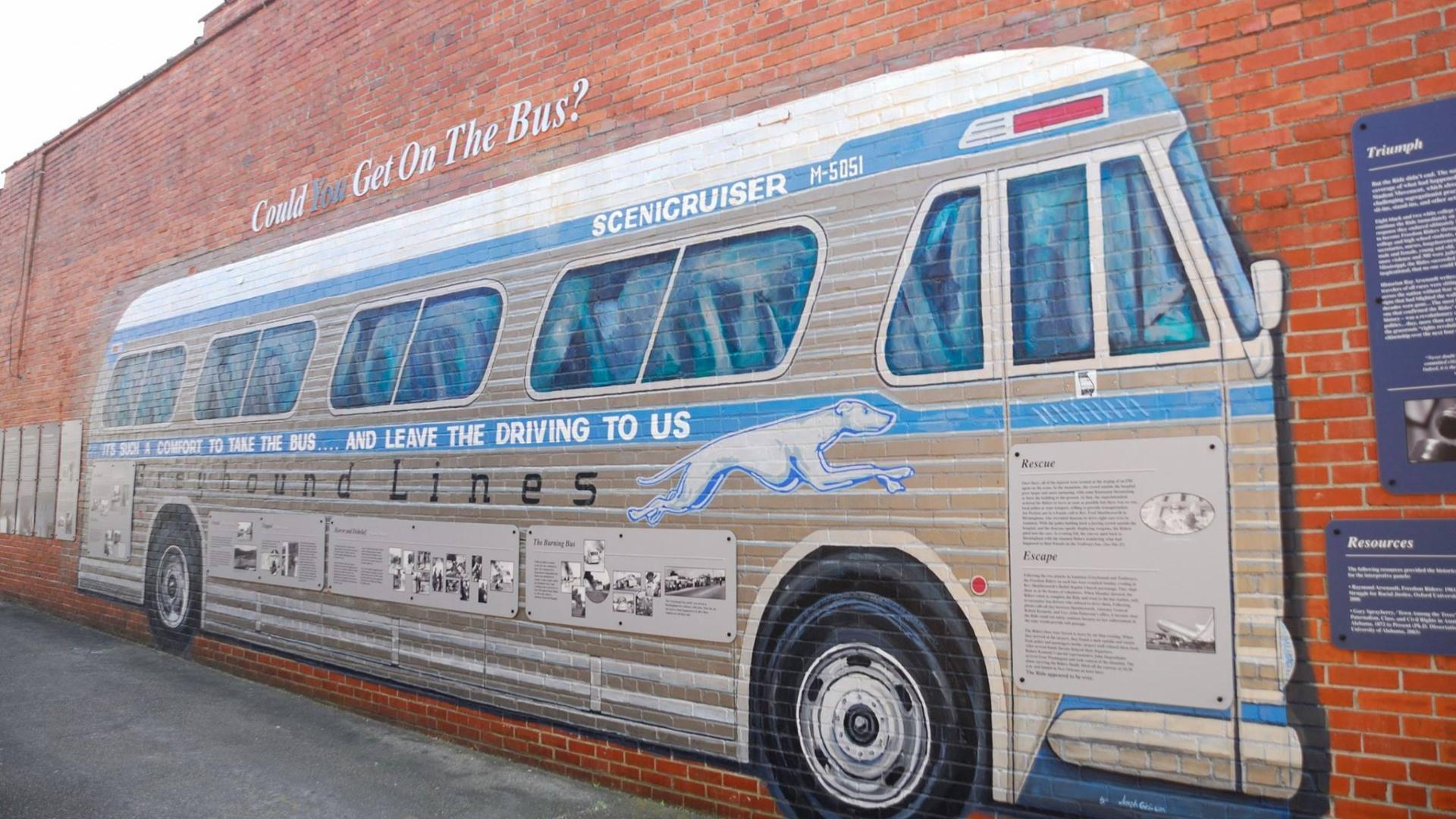
Freedom Riders National Monument
National Monument
In 1961, a small interracial band of “Freedom Riders” challenged discriminatory laws requiring separation of the races in interstate travel. They were attacked by white segregationists, who firebombed...
3 mi from route
~9 min detour
Free
near mile 258.5
Park data from the National Park Service API. Alerts update every 2 hours.
More Details
What kind of drive is this?
This route is predominantly a highway-focused drive, with 92% of the journey on major roadways. You'll experience a significant stretch of 152.8 miles on I 65, offering a consistent pace. The majority of your travel will be on high-speed interstates and US highways, making for a quick transit. While the primary roads are fast, keep in mind that Curry Station Road introduces a different character towards the end of your trip, likely a more local feel.
92% highway — fuel and pacing are the main things to plan.
19 navigation steps total — most of the decisions cluster near the start and finish.
Longest single stretch: 152.8 mi on I 65.
How Hard Is This Drive?
5/10
This is a straightforward highway drive that stays mostly on I 65 and US 231. You will hit about 9 points where you need to pay attention to lane position or signs. The trickiest moment comes around 153.5 miles in.
Driving Effort5/10
Moderate - straightforward overall, but long enough or busy enough to require pacing
Balances navigation complexity with total wheel time.
This drive requires moderate attention. Across 258.5 miles you will encounter 9 spots where lane choice or exit timing matters. Not difficult for experienced highway drivers, but worth previewing the tricky sections before you go.
Where does it get tricky?
The main spots that need attention: at 153.5 miles: Exit ramp - move to the correct lane early; at 160.1 miles: Exit ramp - move to the correct lane early. Lane positioning matters here. Multiple destination signs - pick the right one; at 160.3 miles: Highway fork - watch signs carefully. Lane positioning matters here. Multiple destination signs - pick the right one.
Pennsylvania is a state in the eastern United States. It is known for its Revolutionary War-era historical sites like Valley Forge, its large cities like Philadelphia and Pittsburgh, its farming regions (some occupied by the Amish), and a (once)-strong industrial history. With equally large swaths of cities and towns as fields and mountains, Pennsylvania is a rich and varied state, as well as a worthy travel destination.
Top landmarks
•Susquehanna River — river in the northeastern United States
•Appalachian Trail — 2,198.4-mile (3,538 km) trail going through fourteen US states managed by the Na...
Doable as a same-day drive at 4h 53m. Total distance: 258.5 miles.
Family Friendly
Moderate complexity with 1 natural rest stops along the way.
Solo Traveler
4h 53m drive, comfortable solo distance.
First-Time Driver
Mostly highway driving (92%). Some complex stretches to watch for.
Frequently Asked Questions
The longest stretch is about 152.8 miles on I 65. The full list of main roads is in the Roads section above.
Yes — we found about 12 rest areas or service plazas within a short detour of the route (from OpenStreetMap). See the Rest Stops tab under Nearby Places for locations and mile markers. Plan to stretch, use the bathroom, and top off fluids every 2–3 hours on longer drives.
Yes, with realistic expectations. Build in a stop roughly every 2 hours, have snacks and activities ready, and check the Nearby Places tabs for kid-friendly stops along the way.
The main spots that need attention: at 153.5 miles: Exit ramp - move to the correct lane early; at 160.1 miles: Exit ramp - move to the correct lane early. Lane positioning matters here. Multiple destination signs - pick the right one; at 160.3 miles: Highway fork - watch signs carefully. Lane positioning matters here. Multiple destination signs - pick the right one.
Yes — Freedom Riders National Monument. See the National Parks section for detour distances and tips on detours.
Possible but tiring. At 4.9 hours each way, an in-and-out day trip would put you behind the wheel for 9.8 hours — manageable with a long break at Bynum, AL, but most travelers stay overnight.