Olive Branch, MS to Natchez, MS is 310.9 miles and takes about 5h 51m via I 55 and US 61, with a fuel budget near $45 and enough daylight to finish in a day. This trip stays within Mississippi, moving from the Southeast region to the Southeast region. It's a mostly highway route that should feel straightforward and efficient for a single-day drive. You'll spend most of your time on major interstates and highways, making it a practical choice if you want to get to your destination without much fuss.
Trip Pace
Same-day drive is realistic
A same-day return is possible, but it will make for a full day on the road.
Break Rhythm
1 planned break
Plan on a short reset every 3 to 4 hours to stay fresh behind the wheel.
Midpoint
155.5 miles from Olive Branch, MS
A natural place for your longest stop of the day
, about 2h 52m into the drive
.
Main Roads
Road
Distance
Duration
I 55
176.5 mi
3h 9m
US 61
66.6 mi
1h 15m
I 20
32.8 mi
35m
I 269
9.2 mi
9m
Natchez Trace Parkway
6.4 mi
9m
Cockrum Road
6.2 mi
11m
I 220
5.9 mi
6m
Medgar Evers Boulevard
2 mi
2m
Longest stretch:
I 55
— 176.5 mi, about 3h 9m
Traffic on I-55
Hour-of-day weekday pattern from 20 FHWA count stations on your route.
Peak
4 PM
~1,069 veh/hr typical
· worst 1,314
Quietest
2 AM
~101 veh/hr
Peak-to-quiet ratio
10.6×
busier at peak than in the quiet hours
12a6anoon6p11p
Averaged across 52 weeks of 2023 FHWA Travel Monitoring Analysis System data. Weekday hours only (Mon–Fri).
Turn-by-Turn Driving Directions
Step-by-step road directions between Olive Branch, MS and Natchez, MS.
1
Start on Goodman Road
260 ft·12 sec·Goodman Road
2
Turn left onto MS 305
6.2 mi·11 min·Cockrum Road
3
Take the ramp
0.3 mi·41 sec
Toward Tunica
4
Merge onto I 269; MS 304
9.2 mi·9 min·I 269; MS 304
5
Take the exit
0.3 mi·44 sec
Toward I 55 South: Jackson
6
Keep slight left at fork
0.7 mi·1 min
Toward I 55 South: Jackson
7
Merge onto I 55
176 mi·3 hr 9 min·I 55
8
Take the exit
0.4 mi·45 sec
Toward I 220 South: West Jackson
9
Continue on I 220
5.9 mi·6 min·I 220
10
Take the exit
0.3 mi·40 sec
Toward US 49 North: Yazoo City
11
Keep slight right at fork
301 ft·8 sec
Toward US 49 North: Yazoo City
12
Merge onto US 49
2.0 mi·2 min·Medgar Evers Boulevard
13
Take the exit
0.3 mi·43 sec
Toward NTP
14
Turn right onto Natchez Trace Parkway
6.4 mi·9 min·Natchez Trace Parkway
15
Take the ramp
0.2 mi·30 sec
Toward 20
16
Merge onto I 20; US 80
29 mi·31 min·I 20; US 80
17
Merge onto I 20; US 61; US 80
3.8 mi·4 min·I 20; US 61; US 80
18
Keep slight left at fork onto US 61
67 mi·1 hr 15 min·US 61
Toward US 61 South: NatchezUse the slight left / straight lanes.
19
Take the exit onto Devereaux Drive
0.2 mi·31 sec·Devereaux Drive
20
Keep slight right at fork onto Devereaux Drive
1.2 mi·1 min·Devereaux Drive
21
Continue on St Catherine Street
0.8 mi·1 min·St Catherine Street
22
Continue on St Catherine Street
294 ft·12 sec·St Catherine Street
23
Turn left onto North Martin Luther King Jr Street
0.1 mi·18 sec·North Martin Luther King Jr Street
24
Turn right onto Main Street
0.2 mi·33 sec·Main Street
25
Turn left onto South Commerce Street
142 ft·8 sec·South Commerce Street
26
Turn right onto Bracken Alley
347 ft·27 sec·Bracken Alley
27
Turn right onto South Pearl Street
128 ft·5 sec·South Pearl Street
28
Arrive at destination
South Pearl Street
Trip Plan
Given the 5-hour 51-minute drive time, you can comfortably complete this trip in one day. Aim to leave Olive Branch in the morning to maximize daylight hours. With only one recommended stop, plan your refueling and breaks strategically, especially before the longest stretch on I 55. Keep an eye on your fuel gauge, as services can sometimes be spread out on highway segments. The $45 fuel estimate is a good baseline, but always factor in potential price variations.
Morning Departure
An early start around 7-8 AM gets you there with plenty of daylight left.
Evening Departure
A late afternoon start means arriving after dark. Morning is better.
You can normally do this drive in one day.
Plan roughly 1 meaningful break for fuel, food, and rest.
The halfway point lands around 155.5 miles from Olive Branch, MS, or about 2h 52m into the drive.
The longest continuous stretch on this route runs about 176.5 miles.
This is a comfortable same-day trip.
Departure
Before you leave
Start with fuel, water, and navigation already sorted so the first hour feels easy.
First stop
Around 68 miles or 1h 18m in
Use this first pause for coffee, a restroom break, and a quick traffic check ahead.
Halfway reset
Around 155.5 miles or 2h 52m in
This is the best place for your longest stop, a real meal, and a full fuel check.
Final approach
Final hour starts around 4h 46m
Traffic, exits, and arrival timing usually matter more near Natchez, MS than in the middle of the route.
Before You Leave
+
Open the route before leaving Olive Branch, MS so your first major turns are already loaded.
+
Leave with enough water and a charging cable within reach, not packed away.
+
Check your fuel range against the first long segment, especially if you are starting outside city service areas.
Day 1
Settle into the route from Olive Branch, MS
This is one driving day of about 310.9 miles and 5h 51m.
Your first comfortable stop window is around 68 miles from Olive Branch, MS.
This route can stay practical as a one-day drive if traffic stays reasonable.
Plan about 1 real break rather than only quick fuel stops.
The longest stretch is on I 55 for about 176.5 miles.
Where to Stop
Rest stops, refuel points, and overnight suggestions along this route.
Place data sourced from public business listings. Hours and availability may vary.
Heads-up: tricky spots
5 of 23
5 decision points cluster between mile 16.1 and 310.6 — GPS handles the exact turns, but know they're coming. Your lane choice matters more than the turn itself.
5
16.1 mi into trip|~22m in
Keep slight left at fork toward I 55 South: Jackson
Highway fork - watch signs carefully
Toward I 55 South: Jackson
5
199.9 mi into trip|~3h 41m in
Keep slight right at fork toward US 49 North: Yazoo City
Highway fork - watch signs carefully
Toward US 49 North: Yazoo City
5
208.6 mi into trip|~3h 54m in
Take the ramp toward 20
Navigation decision point
Toward 20
7
241.6 mi into trip|~4h 31m in|US 61
Keep slight left at fork onto US 61 toward US 61 South: Natchez
Highway fork - watch signs carefully. Lane positioning matters here
Use the slight left / straight lanes.
Toward US 61 South: Natchez
5
310.6 mi into trip|~5h 50m in|Main Street
Turn right onto Main Street
Navigation decision point
Fuel & Cost
Regular Gas
$43.16 one way
$86.32 round trip
$3.53/gal25.4 MPG avg109 kg CO2
Fuel Type
$/gal
One Way
Round Trip
midgrade
$3.95
$48.29
$96.57
premium
$4.29
$52.50
$105.00
diesel
$4.80
$58.70
$117.41
No toll roads detected on this route.
Estimated Trip Cost (one way, 1 person)
Fuel
$43
Meals
$25–$50
Total
$68–$93
Rough estimate based on US averages. Hotel $80–$140/night, meals $25–$50/day.
Estimated CO2 emission: 108.8 kg one way.
Prices: EIA weekly data, 2026-07-13.
Driving Electric?
About $33 in charging
· 1 stop
· 67% less CO2
Vehicle Type
kWh
Stops
DC Fast
Home Charge
Average EV
93.3
1
$32.64
$14.92
Efficient EV
77.7
0
$27.20
$12.44
EV Truck/SUV
124.4
1
$43.53
$19.90
Gas CO2
109 kg
EV CO2
36 kg (67% less)
Plan for 1 charging stop. A 30-minute DC fast charge mid-route should be enough to complete the trip comfortably.
DC fast charging avg $0.35/kWh. Home charging avg $0.16/kWh. US grid CO2: 0.39 kg/kWh.
Travel Intel
Current conditions at both ends of the drive.
Forecast as of Jul 17, 2026
Origin
Olive Branch, MS
Late night
in Olive Branch on Sunday
Local time
2:03 AM
CDT
Current temp
93°F
Mostly Sunny
W 10 mph5% chanceLive forecast
Special Weather Statement
Special Weather Statement issued July 17 at 1:35PM CDT by NWS Jackson MS
Destination
Natchez, MS
Late night
in Natchez on Sunday
Local time
2:03 AM
CDT
Current temp
92°F
Mostly Sunny
W 5 mph1% chanceLive forecast
Special Weather Statement
Special Weather Statement issued July 17 at 1:35PM CDT by NWS Jackson MS
93°F
Clinton, MS
155 mi in
Seasonal Notes
Summer travel usually means heavier construction, hotter rest stops, and busier weekend traffic around major cities.
Winter travel shortens daylight, so a route that looks manageable on paper can feel much longer after dark.
Holiday weekends tend to make both departure and arrival windows slower than the raw route time suggests.
Time zone
Same local time
Origin and destination are on the same clock, so arrival timing is easier to judge at a glance.
Temperature spread
1 degrees cooler at arrival
A meaningful temperature swing is a good cue to rethink layers, water, and how soon you want to arrive.
Road read
5h 51m on the road
An early start around 7-8 AM gets you there with plenty of daylight left.
Weather data from the National Weather Service. Conditions may change; check closer to your travel date.
National Parks Near This Route
Worth a detour if your schedule allows.
Natchez National Historical Park
National Historical Park
Discover the history of all the peoples of Natchez, Mississippi, from European settlement, African enslavement, the American cotton economy, to the Civil Rights struggle on the lower Mississippi River...
1 mi from route
~3 min detour
Free
near mile 310.9
Medgar and Myrlie Evers were partners in the civil rights struggle. The assassination of Medgar Evers in the carport of their home on June 12, 1963, was the first murder of a nationally significant le...
4 mi from route
~11 min detour
Free
near mile 203.7
Emmett Till and Mamie Till-Mobley National Monument
National Monument
In 1955, 14-year-old Emmett Till traveled to Money, Mississippi, to visit relatives. He was kidnapped, tortured, and murdered after reportedly whistling at a white woman. His mother, Mamie Till-Mobley...
28 mi from route
~71 min detour
Free
near mile 75.1
Park data from the National Park Service API. Alerts update every 2 hours.
More Details
What kind of drive is this?
This route is predominantly highway, with 96% of the drive on major roads like I 55 and US 61. You'll encounter a long stretch of 176.5 miles on I 55 before transitioning. The vast majority of your travel will be on high-speed roads, meaning you’ll see fewer traffic lights and more merges. Expect a consistent cruising experience for most of the trip.
96% highway — fuel and pacing are the main things to plan.
28 navigation steps total — most of the decisions cluster near the start and finish.
Longest single stretch: 176.5 mi on I 55.
How Hard Is This Drive?
8/10
This is a straightforward highway drive that stays mostly on I 55 and US 61. This route has several spots where lane changes, forks, or exits need your full attention. The trickiest moment comes around 16.1 miles in.
Driving Effort8/10
Demanding - plan breaks and stay ahead of the key maneuvers
Balances navigation complexity with total wheel time.
This is a demanding drive. With 23 significant decision points across 310.9 miles, you will need to stay alert - especially through interchange areas and urban stretches. Consider splitting it into segments if you are not comfortable with fast highway navigation.
Where does it get tricky?
The main spots that need attention: at 16.1 miles: Highway fork - watch signs carefully; at 199.9 miles: Highway fork - watch signs carefully; at 208.6 miles: Navigation decision point.
Elevation Profile
Mostly flat terrain
384 ft164 ft
Total Climb
404 ft
Total Descent
569 ft
Highest Point
384 ft
Elevation Range
221 ft
Towns Mentioned on Route Signs
Based on OSRM destination-sign hints, not a full list of every settlement the road passes.
On the drive from Olive Branch, MS to Natchez, MS, road signs begin pointing toward Ntp along the way.
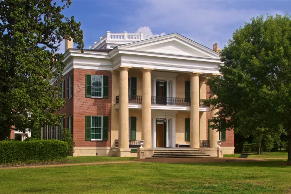
Natchez is a city near the southwest corner of the U.S. state of Mississippi. This historic town is perched on a high bluff above the Mississippi River 100 miles upriver from New Orleans. It was an important, wealthy city before the Civil War. That history gave it the South's grandest collection of antebellum homes.
Top landmarks
•Fort Rosalie — United States historic place in Mississippi
•Dunleith — human settlement in United States of America
•Grand Village of the Natchez — archaeological site in Natchez, United States of America
Doable as a same-day drive at 5h 51m. Total distance: 310.9 miles.
Family Friendly
Moderate complexity with 1 natural rest stops along the way.
Solo Traveler
5h 51m drive, comfortable solo distance.
First-Time Driver
Mostly highway driving (96%). Some complex stretches to watch for.
Frequently Asked Questions
The longest stretch is about 176.5 miles on I 55. The full list of main roads is in the Roads section above.
Yes — we found about 11 rest areas or service plazas within a short detour of the route (from OpenStreetMap). See the Rest Stops tab under Nearby Places for locations and mile markers. Plan to stretch, use the bathroom, and top off fluids every 2–3 hours on longer drives.
It helps. This route has a higher-than-average number of complex decision points, which get harder in the dark. If the last hour of the trip is on surface roads or mountain grades, aim to arrive at Natchez, MS before sunset when you can. Check the Trip Plan for departure windows that land you in daylight.
Only with planning. This is a long drive for kids — consider splitting it into two days rather than pushing through. Plan at least 1 meaningful breaks. There are 11 rest areas along the route for bathroom stops.
The main spots that need attention: at 16.1 miles: Highway fork - watch signs carefully; at 199.9 miles: Highway fork - watch signs carefully; at 208.6 miles: Navigation decision point.
Yes — Natchez National Historical Park, Medgar and Myrlie Evers Home National Monument and Emmett Till and Mamie Till-Mobley National Monument. See the National Parks section for detour distances and tips on detours.
Not recommended in a single day. At 5.9 hours each way, a round trip means 11.7 hours of driving — that is an unsafe level of fatigue for most drivers. Plan at least one night at Natchez, MS before the return drive.