Lomira Rest Area 63
0.1 mi from route
Compiled and reviewed by the US Trip Planner planning team at COD Solutions Oy · Last reviewed Jul 19, 2026 · Editorial standards
Drive Time
7h 6m
Distance
340.7 mi
548 km
Drive Score
8/10
Great drive
Same Day?
Yes, doable
Fuel Cost
$50
one way
EV Charging
Unknown
Estimated drive times based on typical traffic patterns. Actual times may vary with weather, construction, and real-time conditions.

Milwaukee, WI
Wikimedia Commons

Sanborn, WI
Quang Vuong
Milwaukee to Sanborn is 340.7 miles and takes about 7h 6m via I 41 and State Highway 13, with a fuel budget near $60 and enough daylight to finish in a day. This drive stays within Wisconsin, moving from the Midwest region to another part of the Midwest. The route is predominantly highway driving, making it a relatively straightforward trip. With only 2 planned stops and a manageable duration, this trip is well-suited for a single day of travel.
Trip Pace
Same-day drive is realistic
A same-day return is possible, but it will make for a full day on the road.
Break Rhythm
2 planned breaks
Plan on a short reset every 3 to 4 hours to stay fresh behind the wheel.
Midpoint
170.3 miles from Milwaukee, WI
A natural place for your longest stop of the day , about 3h 16m into the drive .
| Road | Distance | Duration |
|---|---|---|
| State Highway 13 | 65.2 mi | 1h 29m |
| I 41 | 61.6 mi | 1h 6m |
| US Highway 10 | 46.6 mi | 54m |
| US 51 | 46.5 mi | 53m |
| US 8 | 32.2 mi | 45m |
| I 39 | 23.3 mi | 25m |
| Zoo Freeway | 19.5 mi | 23m |
| US 45 | 15.2 mi | 17m |
Hour-of-day weekday pattern from 58 FHWA count stations on your route.
Peak
7 AM
~5,644 veh/hr typical
Quietest
2 AM
~352 veh/hr
Peak-to-quiet ratio
16×
busier at peak than in the quiet hours
Averaged across 52 weeks of 2023 FHWA Travel Monitoring Analysis System data. Weekday hours only (Mon–Fri).
Step-by-step road directions between Milwaukee, WI and Sanborn, WI.
Start on US 18; WI 32
Turn left onto East Wisconsin Avenue
Turn right onto North Jackson Street
Take the ramp
Merge onto I 794
Continue on I 794
Take the exit
Keep slight right at fork
Merge onto I 41; US 41; US 45
Keep slight left at fork onto I 41; US 41
Take the exit
Keep slight left at fork
Merge onto US 45
Keep slight left at fork onto US 10
Continue on US 10
Take the exit onto US 10
Continue on I 39; US 51
Merge onto US 51; WI 29
Take the exit
Keep slight left at fork
Merge onto US 8
Turn right
Turn straight onto WI 13
Continue on WI 13
Continue on WI 13
Continue on WI 13
Continue on WI 13
Continue on WI 13
Continue on WI 13
Continue on WI 13
Continue on WI 13
Continue on WI 13
Continue on WI 13
Continue on WI 13
Continue on WI 13; WI 77
Continue on WI 13
Turn left onto WI 112
Turn sharp left onto CTH E
Arrive at destination
Given the 7-hour duration, leaving Milwaukee in the morning is your best bet to arrive in Sanborn before dark. You'll want to make your two stops strategically, perhaps one for lunch and another for a quick stretch, to break up the 340.7 miles. Keep an eye on your fuel gauge, as the estimated cost is around $60, and plan your fill-ups accordingly, especially during the longer 65.2-mile stretches on State Highway 13. This route is manageable in one day, so you have flexibility if you encounter unexpected delays.
Morning Departure
Start early — leave by 6-7 AM to arrive at a reasonable hour.
Evening Departure
This is a long drive — plan for a morning departure or consider splitting it into two days.
This is a comfortable same-day trip.
Departure
Before you leave
Start with fuel, water, and navigation already sorted so the first hour feels easy.
First stop
Around 75 miles or 1h 26m in
Use this first pause for coffee, a restroom break, and a quick traffic check ahead.
Halfway reset
Around 170.3 miles or 3h 16m in
This is the best place for your longest stop, a real meal, and a full fuel check.
Final approach
Final hour starts around 5h 38m
Traffic, exits, and arrival timing usually matter more near Sanborn, WI than in the middle of the route.
Open the route before leaving Milwaukee, WI so your first major turns are already loaded.
Leave with enough water and a charging cable within reach, not packed away.
Check your fuel range against the first long segment, especially if you are starting outside city service areas.
Pick one backup stop option before the midpoint in case traffic changes your pacing.
Day 1
Settle into the route from Milwaukee, WI
This is one driving day of about 340.7 miles and 7h 6m.
Rest stops, refuel points, and overnight suggestions along this route.

Mid-route town
Meal stop
170 mi into the route
Best for: Lunch, fuel, and a longer reset
This sits close to the middle of the route, so it works well for the longest stop of the day.
A short stop after about 75 miles helps settle the day before fatigue starts building.
The midpoint is around 170.3 miles from Milwaukee, WI, which is a good place for a longer meal and fuel stop.
Before the longest stretch
Fuel checkTop up before State Highway 13 if your tank is already low. That segment runs about 65.2 miles.
These stop ideas are pacing suggestions — the exact town or exit can change with traffic, hotel plans, and fuel range.
Picked by where they fit in your drive — first break, midpoint reset, final stretch.
Place data sourced from public business listings. Hours and availability may vary.
5 decision points cluster between mile 6.7 and 88.6 — GPS handles the exact turns, but know they're coming. Your lane choice matters more than the turn itself.
Take the exit toward I 41, US 45, I 894: Fond du Lac, Chicago
Exit ramp - move to the correct lane early. Lane positioning matters here. Multiple destination signs - pick the right one
Keep slight right at fork toward I 41 North, US 45 North: Fond du Lac
Highway fork - watch signs carefully. Lane positioning matters here. Multiple destination signs - pick the right one
Keep slight left at fork onto I 41; US 41 toward US 41 North: Fond du Lac, Appleton
Highway fork - watch signs carefully. Lane positioning matters here. Multiple destination signs - pick the right one
Take the exit toward US 45: New London, Algoma Boulevard
Exit ramp - move to the correct lane early. Lane positioning matters here. Multiple destination signs - pick the right one
Keep slight left at fork toward US 45 North: New London
Highway fork - watch signs carefully. Lane positioning matters here
Regular Gas
$50.31 one way
$100.63 round trip
| Fuel Type | $/gal | One Way | Round Trip |
|---|---|---|---|
| midgrade | $4.14 | $55.54 | $111.09 |
| premium | $4.72 | $63.26 | $126.52 |
| diesel | $4.80 | $64.33 | $128.66 |
No toll roads detected on this route.
Estimated Trip Cost (one way, 1 person)
Fuel
$50
Meals
$25–$50
Total
$75–$100
Rough estimate based on US averages. Hotel $80–$140/night, meals $25–$50/day.
Estimated CO2 emission: 119.2 kg one way. Prices: EIA weekly data, 2026-07-13.
Driving Electric?
About $36 in charging · 1 stop · 66% less CO2
| Vehicle Type | kWh | Stops | DC Fast | Home Charge |
|---|---|---|---|---|
| Average EV | 102.2 | 1 | $35.77 | $16.35 |
| Efficient EV | 85.2 | 0 | $29.81 | $13.63 |
| EV Truck/SUV | 136.3 | 1 | $47.70 | $21.80 |
Gas CO2
119 kg
EV CO2
40 kg (66% less)
Plan for 1 charging stop. A 30-minute DC fast charge mid-route should be enough to complete the trip comfortably.
DC fast charging avg $0.35/kWh. Home charging avg $0.16/kWh. US grid CO2: 0.39 kg/kWh.
Current conditions at both ends of the drive.
Origin
Evening in Milwaukee on Saturday
Local time
8:31 PM
CDT
Current temp
91°F
Smoke
Heat Advisory
Heat Advisory issued July 17 at 1:04AM CDT until July 17 at 9:00PM CDT by NWS Twin Cities/Chanhassen MN
Heat Advisory
Heat Advisory issued July 17 at 12:55AM CDT until July 17 at 9:00PM CDT by NWS Duluth MN
Destination
Evening in Sanborn on Saturday
Local time
8:31 PM
CDT
Current temp
92°F
Smoke then Slight Chance Showers And Thunderstorms
Heat Advisory
Heat Advisory issued July 17 at 1:04AM CDT until July 17 at 9:00PM CDT by NWS Twin Cities/Chanhassen MN
Heat Advisory
Heat Advisory issued July 17 at 12:55AM CDT until July 17 at 9:00PM CDT by NWS Duluth MN
Seasonal Notes
Summer travel usually means heavier construction, hotter rest stops, and busier weekend traffic around major cities.
Winter travel shortens daylight, so a route that looks manageable on paper can feel much longer after dark.
Holiday weekends tend to make both departure and arrival windows slower than the raw route time suggests.
Time zone
Origin and destination are on the same clock, so arrival timing is easier to judge at a glance.
Temperature spread
A meaningful temperature swing is a good cue to rethink layers, water, and how soon you want to arrive.
Road read
Start early — leave by 6-7 AM to arrive at a reasonable hour.
Weather data from the National Weather Service. Conditions may change; check closer to your travel date.
Worth a detour if your schedule allows.
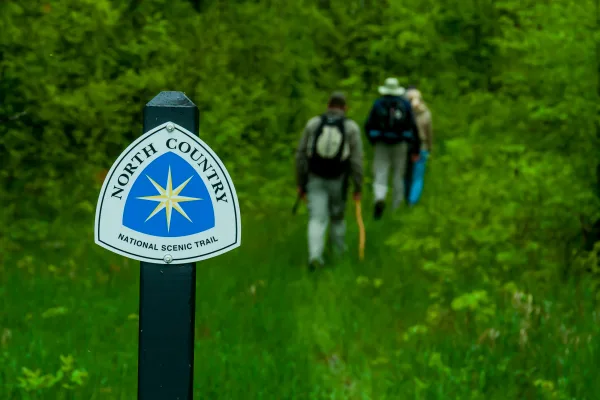
National Scenic Trail
Come to the North Country. Trek the hills and valleys. Stand on the shores of lakes & streams from glaciers 10,000 years before. Clear-flowing water, red/gold of autumn, a fairyland of snow, open prai...
Park data from the National Park Service API. Alerts update every 2 hours.
You'll spend 96% of this 340.7-mile trip on highways, with the remaining 4% on surface roads. Expect to encounter frequent exits and merging traffic for much of the drive, particularly on I 41. The longest continuous stretch without a major road change is 65.2 miles on State Highway 13. This means you'll have long periods of consistent cruising before transitioning to local roads.
This is a straightforward highway drive that stays mostly on State Highway 13 and I 41. This route has several spots where lane changes, forks, or exits need your full attention. The trickiest moment comes around 6.7 miles in.
High effort - long or complex enough to need steady focus all day
Balances navigation complexity with total wheel time.
This is a demanding drive. With 21 significant decision points across 340.7 miles, you will need to stay alert - especially through interchange areas and urban stretches. Consider splitting it into segments if you are not comfortable with fast highway navigation.
Where does it get tricky?
The main spots that need attention: at 6.7 miles: Exit ramp - move to the correct lane early. Lane positioning matters here. Multiple destination signs - pick the right one; at 6.9 miles: Highway fork - watch signs carefully. Lane positioning matters here. Multiple destination signs - pick the right one; at 26.8 miles (I 41; US 41): Highway fork - watch signs carefully. Lane positioning matters here. Multiple destination signs - pick the right one.
Gently rolling terrain
Total Climb
1,135 ft
Total Descent
911 ft
Highest Point
1,522 ft
~267.7 mi in
Elevation Range
907 ft
Based on OSRM destination-sign hints, not a full list of every settlement the road passes.
Between Milwaukee, WI and Sanborn, WI, road signs point toward Appleton and Rhinelander.
Appleton
Rhinelander
Tagged by where each one fits in your drive — first break, midpoint, final stretch.
Cafe
Near the start, right off the route
Cuisine: american
Hours: Mo-Fr 07:00-14:30
Visit websiteCafe
Near the start, right off the route
Milwaukee, WI
Cuisine: coffee_shop
Hours: Mo-Sa 06:00-19:00; Su 06:00-14:00
Visit websiteCafe
Near the start, right off the route
Milwaukee
Cuisine: american
Hours: Mo-Fr 07:00-15:00
Visit websiteCafe
Near the start, right off the route
Cuisine: coffee_shop
Hours: Mo-Th 05:00-21:30; Fr,Su 05:00-22:00; Sa...
Visit websiteCafe
Near the start, right off the route
Cuisine: sandwich
Hours: Mo-We,Fr 05:00-18:00; Th 06:00-13:00; Sa...
Visit websiteCafe
Around the midpoint, right off the route
Restaurant
Near the start, right off the route
Milwaukee
Hours: Mo-We 17:00-22:00; Th-Sa 17:00-23:00; Su...
Visit websiteRestaurant
Near the start, right off the route
Milwaukee
Cuisine: cuban
Hours: Mo-Th 11:00-23:00; Fr-Sa 11:00-01:00
Visit websiteFast_food
Near the start, right off the route
Milwaukee
Cuisine: sandwich
Hours: Mo-Fr 07:00-20:00; Sa 08:00-16:00
Visit websiteRestaurant
Near the start, right off the route
Milwaukee
Cuisine: new_american
Hours: Mo-Th 11:00-02:00; Fr 11:00-02:30; Sa 10...
Visit websiteFast_food
Near the start, right off the route
Milwaukee, WI
Cuisine: salad
Hours: Mo-Fr 08:00-16:00; Sa 10:00-14:00
Visit websiteFast_food
Near the start, right off the route
Milwaukee, WI
Cuisine: sandwich
Hours: Mo-Su 11:00-16:00
Visit websiteAttraction
Near the start, short detour
Park
Near the start, short detour
Camp_site
Around the midpoint, short detour
Park
Around the midpoint, short detour
Park
Around the midpoint, short detour
Park
Early in the drive, short detour
Artwork
Near the start, right off the route
Artwork
Near the start, right off the route
Memorial
Near the start, right off the route
Artwork
Near the start, right off the route
Artwork
Near the start, right off the route
Artwork
Near the start, short detour
Hotel
Near the start, right off the route
Milwaukee, WI
Visit websiteHotel
Around the midpoint, short detour
Wausau, WI
Hotel
Around the midpoint, short detour
Wausau, WI
Visit websiteCamp_site
Around the midpoint, short detour
Points of interest from OpenStreetMap contributors. Listings may not reflect current hours or availability.
“Mil Town” · Founded 1846
Milwaukee is the largest city in the state of Wisconsin, United States. The city celebrates its heritage as a major center for beer-brewing, and of it German and Polish communities. It is now known for its many festivals. The city's population is about 600,000 with about 1.6 million in the metropolitan area (2019). It is in the southeastern portion of the state on the western shore of Lake Michigan.
Top landmarks
City content from Wikivoyage (CC BY-SA 4.0) and Wikidata (CC0).
Weekend Trip
Doable as a same-day drive at 7h 6m. Total distance: 340.7 miles.
Family Friendly
Moderate complexity with 2 natural rest stops along the way.
Solo Traveler
7h 6m drive, plan rest stops for pacing.
Compiled by the US Trip Planner planning team at COD Solutions Oy from open government datasets — OSRM over OpenStreetMap for geometry, EIA for fuel prices, USGS 3DEP for elevation, NPS for national parks, and FHWA TMAS for hourly traffic volumes. See our methodology for refresh cadence and limitations.
Was this helpful?
Thanks for your feedback!
Your tip has been submitted. Thanks!
/500
Recent Tips
·
Explore more options from Milwaukee, WI or browse trips ending in Sanborn, WI.
Looking for more statewide routes? Browse WI road trips.