Embarking on the 437.4-mile journey from Laredo to Kermit is a significant commitment that spans approximately 8 hours and 38 minutes of drive time. Because this trip traverses the Great Plains, you should plan for a two-day itinerary to keep the pace manageable and enjoyable. You will navigate via a combination of US Highway 90 West, US Highway 285, and US Highway 83 North. Expect to budget around $67 for fuel to cover the distance. While it is technically possible to push through in one long day, breaking the trip into two days allows for a much more comfortable experience as you head across Texas.
Trip Pace
Best split across 2 days
Treat the return leg as its own travel day rather than an afterthought.
Break Rhythm
2 planned breaks
Plan on a short reset every 3 to 4 hours to stay fresh behind the wheel.
Midpoint
218.7 miles from Laredo, TX
A natural place for your longest stop of the day
, about 4h 3m into the drive
.
Main Roads
Road
Distance
Duration
US Highway 90 West
112.9 mi
2h 7m
US Highway 285
63.4 mi
1h 12m
US Highway 83 North
62.2 mi
1h 4m
Del Río Boulevard
47.5 mi
54m
Peña Street
42.1 mi
48m
North Front Street
32.6 mi
48m
State Highway 18 North
19.4 mi
28m
Purple Heart Trail
17.7 mi
19m
Longest stretch:
US Highway 90 West
— 112.9 mi, about 2h 7m
Traffic on I-35
Hour-of-day weekday pattern from 6 FHWA count stations on your route.
Peak
5 PM
~1,103 veh/hr typical
· worst 1,375
Quietest
2 AM
~159 veh/hr
Peak-to-quiet ratio
6.9×
busier at peak than in the quiet hours
12a6anoon6p11p
Averaged across 37 weeks of 2023 FHWA Travel Monitoring Analysis System data. Weekday hours only (Mon–Fri).
Turn-by-Turn Driving Directions
Step-by-step road directions between Laredo, TX and Kermit, TX.
1
Start on Matamoros Street
0.3 mi·46 sec·Matamoros Street
2
Turn left onto San Dario Avenue
0.1 mi·11 sec·San Dario Avenue
3
Continue on I 35; I 27; US 83
18 mi·19 min·Purple Heart Trail
4
Take the exit onto US 83
0.3 mi·34 sec·US 83
Exit 18Toward US 83 North: Carrizo Springs, Uvalde
5
Turn left onto US 83
484 ft·7 sec·US Highway 83 North
6
At end of road, turn right onto US 83
62 mi·1 hr 4 min·US Highway 83 North
7
Continue on US 83
0.3 mi·30 sec·South 1st Street
8
Turn left onto US 277
42 mi·48 min·Peña Street
9
Take the exit
230 ft·6 sec
10
Merge onto US 277
2.7 mi·4 min·North Veterans Boulevard
11
Turn right onto US 277
48 mi·54 min·Del Río Boulevard
12
Turn right onto Loop 79
12 mi·12 min·Judge Mike L Fernandez Loop
13
Take the exit onto Loop 79
0.1 mi·17 sec·Loop 79
14
Keep slight right at fork
0.1 mi·21 sec
15
Merge onto US 90
6.8 mi·7 min·US Highway 90 West
16
Continue on US 90
0.1 mi·7 sec·United States Highway 90
17
Merge onto US 90
106 mi·2 hr·US Highway 90 West
18
Continue on US 90
2.0 mi·2 min·East Oak Street
19
Take the exit
0.1 mi·19 sec
20
Merge onto US 285
63 mi·1 hr 12 min·US Highway 285
21
Continue on US 285
0.3 mi·27 sec·North Alamo Street
22
Turn left onto I 10 Bus; US 285; US 385
0.7 mi·56 sec·East Dickinson Boulevard
23
Turn right onto TX 18
33 mi·48 min·North Front Street
24
Continue on TX 18
13 mi·19 min·South Stockton Avenue
25
Turn left onto Loop 464
5.9 mi·8 min·South Loop Road
26
Turn left onto TX 18
19 mi·28 min·State Highway 18 North
27
Continue on TX 18
1.3 mi·1 min·South Poplar Street
28
Turn right onto TX 115
167 ft·5 sec·East Austin Street
29
Turn right
111 ft·8 sec
30
Arrive at destination
Trip Plan
To tackle this 437.4-mile route effectively, aim to split your travel into two days to account for the 8-hour and 38-minute duration. Since you have two recommended stops along the way, use them strategically to break up the monotony of the long, 112.9-mile stretch on US Highway 90 West. Given the $67 fuel estimate, verify your gas levels before entering the longer stretches of US Highway 285 and US Highway 83 North. Leaving early in the morning is your best strategy to avoid fatigue and ensure you reach your destination well before dark. Prioritize these rest breaks to keep your energy levels steady throughout this extensive Texas transit.
Morning Departure
Start early — leave by 6-7 AM to arrive at a reasonable hour.
Evening Departure
This is a long drive — plan for a morning departure or consider splitting it into two days.
This drive is better paced as a 2-day trip.
Plan roughly 2 meaningful breaks for fuel, food, and rest.
The halfway point lands around 218.7 miles from Laredo, TX, or about 4h 3m into the drive.
The longest continuous stretch on this route runs about 112.9 miles.
Consider an overnight stop or starting very early.
Departure
Before you leave
Start with fuel, water, and navigation already sorted so the first hour feels easy.
First stop
Around 96 miles or 1h 43m in
Use this first pause for coffee, a restroom break, and a quick traffic check ahead.
Halfway reset
Around 218.7 miles or 4h 3m in
This is the best place for your longest stop, a real meal, and a full fuel check.
Overnight split
Day 1 wrap after about 218.7 miles or 4h 3m
Stop before fatigue turns the last few hours into a grind. You want day two to start fresh, not just resumed.
Final approach
Final hour starts around 7h 8m
Traffic, exits, and arrival timing usually matter more near Kermit, TX than in the middle of the route.
Before You Leave
+
Open the route before leaving Laredo, TX so your first major turns are already loaded.
+
Leave with enough water and a charging cable within reach, not packed away.
+
Check your fuel range against the first long segment, especially if you are starting outside city service areas.
+
Pick one backup stop option before the midpoint in case traffic changes your pacing.
+
Treat this as a 2-day road trip and book the overnight stop before the busiest arrival window.
Day 1
Settle into the route from Laredo, TX
Aim for roughly 219 miles and 4.3 hours of wheel time on this day.
Day 2
Finish the approach into Kermit, TX
Aim for roughly 219 miles and 4.3 hours of wheel time on this day.
Your first comfortable stop window is around 96 miles from Laredo, TX.
This route usually feels better as a 2-day drive than as one long push.
Plan about 2 real breaks rather than only quick fuel stops.
The longest stretch is on US Highway 90 West for about 112.9 miles.
Where to Stop
Rest stops, refuel points, and overnight suggestions along this route.
Place data sourced from public business listings. Hours and availability may vary.
Heads-up: tricky spots
5 of 20
5 decision points cluster between mile 0.3 and 437.3 — GPS handles the exact turns, but know they're coming. Your lane choice matters more than the turn itself.
5
0.3 mi into trip|~0m in|San Dario Avenue
Turn left onto San Dario Avenue
Navigation decision point
6
18.1 mi into trip|~19m in|US 83
Take the exit onto US 83 toward US 83 North: Carrizo Springs, Uvalde
Exit ramp - move to the correct lane early. Multiple destination signs - pick the right one
Exit 18
Toward US 83 North: Carrizo Springs, Uvalde
4
18.6 mi into trip|~20m in|US 83 / US Highway 83 North
At end of road, turn right onto US 83 / US Highway 83 North
Navigation decision point
5
185.3 mi into trip|~3h 26m in
Keep slight right at fork
Highway fork - watch signs carefully
5
437.3 mi into trip|~8h 38m in
Turn right
Navigation decision point
Fuel & Cost
Regular Gas
$59.91 one way
$119.82 round trip
$3.48/gal25.4 MPG avg153 kg CO2
Fuel Type
$/gal
One Way
Round Trip
midgrade
$3.89
$66.92
$133.84
premium
$4.23
$72.76
$145.51
diesel
$4.80
$82.59
$165.18
No toll roads detected on this route.
Estimated Trip Cost (one way, 1 person)
Fuel
$60
Hotel (1n)
$80–$140
Meals
$50–$100
Total
$190–$300
Rough estimate based on US averages. Hotel $80–$140/night, meals $25–$50/day.
Estimated CO2 emission: 153 kg one way.
Prices: EIA weekly data, 2026-07-13.
Driving Electric?
About $46 in charging
· 1 stop
· 67% less CO2
Vehicle Type
kWh
Stops
DC Fast
Home Charge
Average EV
131.2
1
$45.93
$21.00
Efficient EV
109.4
1
$38.27
$17.50
EV Truck/SUV
175
2
$61.24
$27.99
Gas CO2
153 kg
EV CO2
51 kg (67% less)
Plan for 1 charging stop. A 30-minute DC fast charge mid-route should be enough to complete the trip comfortably.
DC fast charging avg $0.35/kWh. Home charging avg $0.16/kWh. US grid CO2: 0.39 kg/kWh.
Travel Intel
Current conditions at both ends of the drive.
Forecast as of Jul 17, 2026
Origin
Laredo, TX
Late night
in Laredo on Sunday
Local time
2:50 AM
CDT
Current temp
79°F
Mostly Cloudy
SE 15 mph7% chanceLive forecast
Flood Warning
Flood Warning issued July 16 at 7:48PM CDT until July 17 at 4:47PM CDT by NWS Houston/Galveston TX
Special Weather Statement
Special Weather Statement issued July 16 at 7:29PM CDT by NWS Shreveport LA
Destination
Kermit, TX
Late night
in Kermit on Sunday
Local time
2:50 AM
CDT
Current temp
67°F
Slight Chance Showers And Thunderstorms
SE 10 mph10% chanceLive forecast
Flood Warning
Flood Warning issued July 16 at 7:48PM CDT until July 17 at 4:47PM CDT by NWS Houston/Galveston TX
Special Weather Statement
Special Weather Statement issued July 16 at 7:29PM CDT by NWS Shreveport LA
Seasonal Notes
Summer travel usually means heavier construction, hotter rest stops, and busier weekend traffic around major cities.
Winter travel shortens daylight, so a route that looks manageable on paper can feel much longer after dark.
Holiday weekends tend to make both departure and arrival windows slower than the raw route time suggests.
For long drives, weather on day two can matter just as much as conditions at departure, so check the whole travel window rather than only the first day.
Time zone
Same local time
Origin and destination are on the same clock, so arrival timing is easier to judge at a glance.
Temperature spread
12 degrees cooler at arrival
A meaningful temperature swing is a good cue to rethink layers, water, and how soon you want to arrive.
Road read
8h 38m on the road
This is long enough that the arrival forecast matters almost as much as departure conditions. Recheck both ends before you roll.
Weather data from the National Weather Service. Conditions may change; check closer to your travel date.
National Parks Near This Route
Worth a detour if your schedule allows.
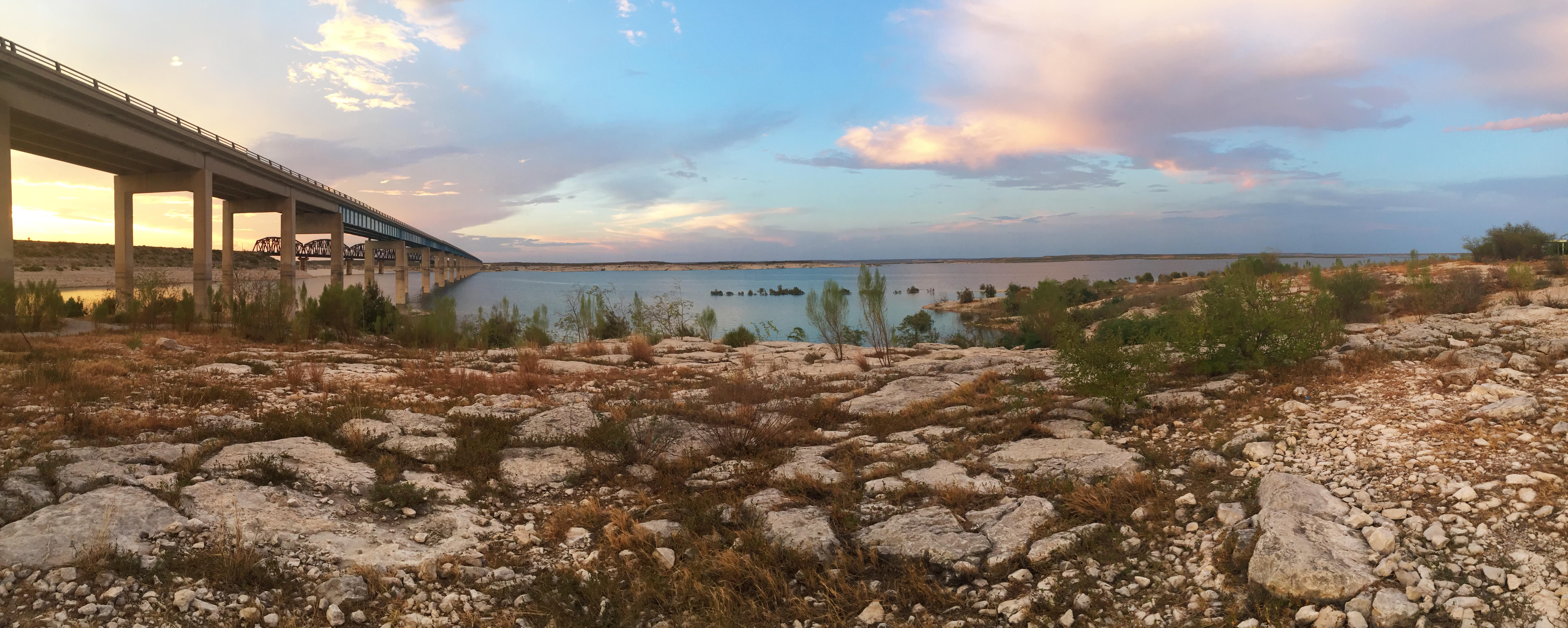
Amistad National Recreation Area
National Recreation Area
An oasis in the desert, Amistad National Recreation Area consists of the US portion of the International Amistad Reservoir. Amistad, a Spanish word meaning "friendship," is known for excellent water-b...
2 mi from route
~5 min detour
Free
near mile 196.1
Park Closure: Diablo East Marina Cove, Scuba Cove, and Walkway Access Are Closed
Caution: Help Prevent Aquatic Invasive Species (AIS) Infestation
Park data from the National Park Service API. Alerts update every 2 hours.
More Details
What kind of drive is this?
This trip features a mixed drive profile, offering a blend of road types rather than a singular highway experience. With a 59% highway share, you will encounter varying road conditions as you transition between the primary routes. The most significant uninterrupted section occurs on US Highway 90 West, where you will spend 112.9 miles on a single stretch. You should prepare for the road's personality to shift as you move from the initial highway segments into the more varied stretches of the later legs. Staying alert is key, as the terrain requires sustained focus over the course of the long drive.
59% highway, the rest on surface roads — varied driving throughout.
30 navigation steps total — most of the decisions cluster near the start and finish.
Longest single stretch: 112.9 mi on US Highway 90 West.
How Hard Is This Drive?
6/10
This route mixes highway mileage with some local-road sections near the start or finish. You will hit about 20 points where you need to pay attention to lane position or signs. The trickiest moment comes around 0.3 miles in near San Dario Avenue.
Driving Effort6/10
Moderate - straightforward overall, but long enough or busy enough to require pacing
Balances navigation complexity with total wheel time.
This drive requires moderate attention. Across 437.4 miles you will encounter 20 spots where lane choice or exit timing matters. Not difficult for experienced highway drivers, but worth previewing the tricky sections before you go.
Where does it get tricky?
The main spots that need attention: at 0.3 miles (San Dario Avenue): Navigation decision point; at 18.1 miles (US 83): Exit ramp - move to the correct lane early. Multiple destination signs - pick the right one; at 18.6 miles (US 83 / US Highway 83 North): Navigation decision point.
Moderate complexity with 2 natural rest stops along the way.
Solo Traveler
8h 38m drive, plan rest stops for pacing.
Scenic Drive
Mixed highway & surface route profile with national parks nearby.
Frequently Asked Questions
The longest stretch is about 112.9 miles on US Highway 90 West. The full list of main roads is in the Roads section above.
Yes — a 2-day pace is more comfortable than one long haul. A sensible stopping point is after roughly 219 miles on day one.
Yes — we found about 15 rest areas or service plazas within a short detour of the route (from OpenStreetMap). See the Rest Stops tab under Nearby Places for locations and mile markers. Plan to stretch, use the bathroom, and top off fluids every 2–3 hours on longer drives.
It helps. This route has a higher-than-average number of complex decision points, which get harder in the dark. If the last hour of the trip is on surface roads or mountain grades, aim to arrive at Kermit, TX before sunset when you can. Check the Trip Plan for departure windows that land you in daylight.
Only with planning. This is a long drive for kids — consider splitting it into two days rather than pushing through. Plan at least 2 meaningful breaks. There are 15 rest areas along the route for bathroom stops.
The main spots that need attention: at 0.3 miles (San Dario Avenue): Navigation decision point; at 18.1 miles (US 83): Exit ramp - move to the correct lane early. Multiple destination signs - pick the right one; at 18.6 miles (US 83 / US Highway 83 North): Navigation decision point.
Yes — Amistad National Recreation Area. See the National Parks section for detour distances and tips on detours.
Not recommended in a single day. At 8.6 hours each way, a round trip means 17.3 hours of driving — that is an unsafe level of fatigue for most drivers. Plan at least one night at Kermit, TX before the return drive.