Sunset Point Rest Area
0.1 mi from route
Compiled and reviewed by the US Trip Planner planning team at COD Solutions Oy · Last reviewed Jul 19, 2026 · Editorial standards
Drive Time
2h 52m
Distance
158.5 mi
255 km
Drive Score
9/10
Great drive
Same Day?
Yes, doable
Fuel Cost
$28
one way
EV Charging
Unknown
Estimated drive times based on typical traffic patterns. Actual times may vary with weather, construction, and real-time conditions.

Gilbert, AZ
Wikimedia Commons

Kachina Village, AZ
Abhishek Navlakha
Gilbert, AZ to Kachina Village, AZ is 158.5 miles and takes about 2h 52m via Arizona Veterans Highway, Black Canyon Freeway, and Superstition Freeway, with a fuel budget near $32 and enough daylight to finish in a day. This trip travels within the Desert Southwest region, offering a mixed drive experience. You'll spend about 38% of your time on highways, making it a practical choice for a single-day excursion. Consider this route if you're looking for a straightforward journey without extensive planning, allowing for a relaxed pace.
Trip Pace
Same-day drive is realistic
A same-day return is realistic if you keep stops short.
Break Rhythm
1 planned break
A short stop every 2 to 3 hours is enough for this drive.
Midpoint
79.2 miles from Gilbert, AZ
A natural place for your longest stop of the day , about 1h 31m into the drive .
| Road | Distance | Duration |
|---|---|---|
| Arizona Veterans Highway | 85 mi | 1h 25m |
| Black Canyon Freeway | 41.3 mi | 45m |
| Superstition Freeway | 9.8 mi | 11m |
| Maricopa Freeway | 9.1 mi | 10m |
| Phoenix–Cordes Junction Highway | 8.9 mi | 9m |
| North Gilbert Road | 2.1 mi | 4m |
| Kachina Trail | 0.6 mi | 1m |
| US 60 | 0.6 mi | <1m |
Step-by-step road directions between Gilbert, AZ and Kachina Village, AZ.
Start on this road
Turn left onto North Elm Street
At end of road, turn left onto East Vaughn Avenue
Turn right onto North Gilbert Road
Turn left
Merge onto US 60
Keep slight left at fork onto US 60
Merge onto I 10; US 60
Keep slight right at fork onto US 60
Continue on I 17; US 60
Continue on I 17
Continue on I 17
Keep slight left at fork onto I 17
Take the exit
Turn left onto Kachina Boulevard
Turn right onto Kachina Trail
Continue on Kachina Trail
Arrive at destination
Given the relatively short duration of just under 3 hours, this route is easily manageable in a single day. Leaving Gilbert, AZ in the morning will give you ample daylight to reach Kachina Village with time to spare. With only one recommended stop, you have flexibility in when and where you choose to break your journey. Keep an eye on your fuel levels, as the longest stretch without significant services is 85 miles on Arizona Veterans Highway, so ensure you're topped up before embarking on that segment.
Morning Departure
Leave by 9 AM and you'll arrive before lunch.
Evening Departure
Even a 4 PM departure gets you there before dark in summer.
This is a comfortable same-day trip.
Departure
Before you leave
Start with fuel, water, and navigation already sorted so the first hour feels easy.
First stop
Around 35 miles or 43m in
Use this first pause for coffee, a restroom break, and a quick traffic check ahead.
Halfway reset
Around 79.2 miles or 1h 31m in
This is the best place for your longest stop, a real meal, and a full fuel check.
Final approach
Final hour starts around 2h 22m
Traffic, exits, and arrival timing usually matter more near Kachina Village, AZ than in the middle of the route.
Open the route before leaving Gilbert, AZ so your first major turns are already loaded.
Leave with enough water and a charging cable within reach, not packed away.
Check your fuel range against the first long segment, especially if you are starting outside city service areas.
Day 1
Settle into the route from Gilbert, AZ
This is one driving day of about 158.5 miles and 2h 52m.
Rest stops, refuel points, and overnight suggestions along this route.

Mid-route town
Meal stop
79 mi into the route
Best for: Lunch, fuel, and a longer reset
This sits close to the middle of the route, so it works well for the longest stop of the day.
A short stop after about 35 miles helps settle the day before fatigue starts building.
The midpoint is around 79.2 miles from Gilbert, AZ, which is a good place for a longer meal and fuel stop.
Before the longest stretch
Fuel checkTop up before Arizona Veterans Highway if your tank is already low. That segment runs about 85 miles.
These stop ideas are pacing suggestions — the exact town or exit can change with traffic, hotel plans, and fuel range.
Picked by where they fit in your drive — first break, midpoint reset, final stretch.
Near the start, short detour
Tempe, Arizona
Hours: 11 am–5 pm
+14805657081
Visit websiteLater in the drive, short detour
Camp Verde, Arizona
Hours: 9:30 am–5 pm
+19285672840
Visit websiteNear the end, short detour
Flagstaff, Arizona
Hours: 6 am–10 pm
+19286798000
Visit websiteNear the start, short detour
Phoenix, Arizona
Hours: 10:30 am–4 pm
+16027162000
Visit websiteNear the start, short detour
Tempe, Arizona
+14803556060
Visit websiteNear the start, short detour
Tempe, Arizona
Near the end, short detour
Flagstaff, Arizona
+19282245938
Visit websiteNear the start, short detour
Phoenix, Arizona
Hours: 11 am–4 pm
+16022541200
Visit websitePlace data sourced from public business listings. Hours and availability may vary.
5 decision points cluster between mile 0.3 and 18 — GPS handles the exact turns, but know they're coming. Your lane choice matters more than the turn itself.
At end of road, turn left onto East Vaughn Avenue
Complex interchange - multiple decisions in a short stretch
Turn left toward US 60 West: Phoenix
Lane positioning matters here
Merge onto US 60 / Superstition Freeway
Merge point - match speed before joining. Lane positioning matters here
Keep slight left at fork onto US 60 toward I 10 North
Highway fork - watch signs carefully
Keep slight right at fork onto US 60 / Maricopa Freeway toward I-17 North, US-60 West: Flagstaff
Highway fork - watch signs carefully. Lane positioning matters here. Multiple destination signs - pick the right one
Regular Gas
$28.09 one way
$56.17 round trip
| Fuel Type | $/gal | One Way | Round Trip |
|---|---|---|---|
| midgrade | $4.82 | $30.08 | $60.16 |
| premium | $5.04 | $31.46 | $62.93 |
| diesel | $4.80 | $29.93 | $59.86 |
No toll roads detected on this route.
Estimated Trip Cost (one way, 1 person)
Fuel
$28
Meals
$25–$50
Total
$53–$78
Rough estimate based on US averages. Hotel $80–$140/night, meals $25–$50/day.
Estimated CO2 emission: 55.5 kg one way. Prices: EIA weekly data, 2026-07-13.
Driving Electric?
About $17 in charging · 0 stops · 65% less CO2
| Vehicle Type | kWh | Stops | DC Fast | Home Charge |
|---|---|---|---|---|
| Average EV | 47.6 | 0 | $16.64 | $7.61 |
| Efficient EV | 39.6 | 0 | $13.87 | $6.34 |
| EV Truck/SUV | 63.4 | 0 | $22.19 | $10.14 |
Gas CO2
55 kg
EV CO2
19 kg (65% less)
This trip is well within single-charge range for most EVs. No charging stops needed if you start fully charged.
DC fast charging avg $0.35/kWh. Home charging avg $0.16/kWh. US grid CO2: 0.39 kg/kWh.
Current conditions at both ends of the drive.
Origin
Late night in Gilbert on Sunday
Local time
4:24 AM
MST
Current temp
79°F
Slight Chance Showers And Thunderstorms
Flash Flood Warning
Flash Flood Warning issued July 18 at 9:11PM MST until July 19 at 12:15AM MST by NWS Flagstaff AZ
Flash Flood Warning
Flash Flood Warning issued July 18 at 8:18PM PDT until July 18 at 10:15PM PDT by NWS Las Vegas NV
Destination
Late night in Kachina Village on Sunday
Local time
4:24 AM
MST
Current temp
52°F
Chance Showers And Thunderstorms
Flash Flood Warning
Flash Flood Warning issued July 18 at 9:11PM MST until July 19 at 12:15AM MST by NWS Flagstaff AZ
Flash Flood Warning
Flash Flood Warning issued July 18 at 8:18PM PDT until July 18 at 10:15PM PDT by NWS Las Vegas NV
Seasonal Notes
Summer travel usually means heavier construction, hotter rest stops, and busier weekend traffic around major cities.
Winter travel shortens daylight, so a route that looks manageable on paper can feel much longer after dark.
Holiday weekends tend to make both departure and arrival windows slower than the raw route time suggests.
Time zone
Origin and destination are on the same clock, so arrival timing is easier to judge at a glance.
Temperature spread
A meaningful temperature swing is a good cue to rethink layers, water, and how soon you want to arrive.
Road read
The weather snapshot is not static. If you are leaving later, give both cities one more quick forecast check before departure.
Weather data from the National Weather Service. Conditions may change; check closer to your travel date.
Worth a detour if your schedule allows.
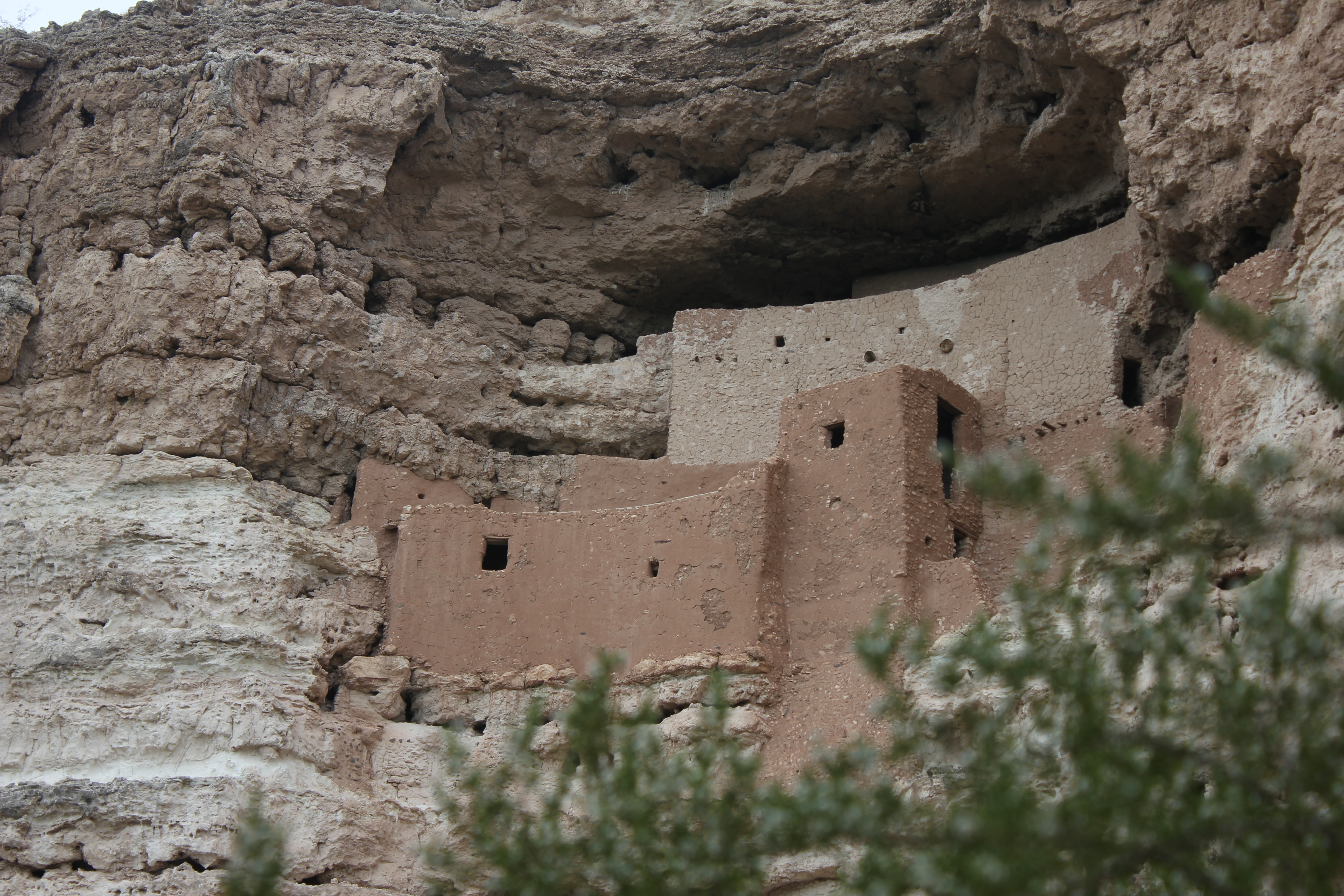
National Monument
Established December 8, 1906, Montezuma Castle is the third National Monument dedicated to preserving Native American culture. This 20 room high-rise apartment, nestled into a towering limestone cliff...
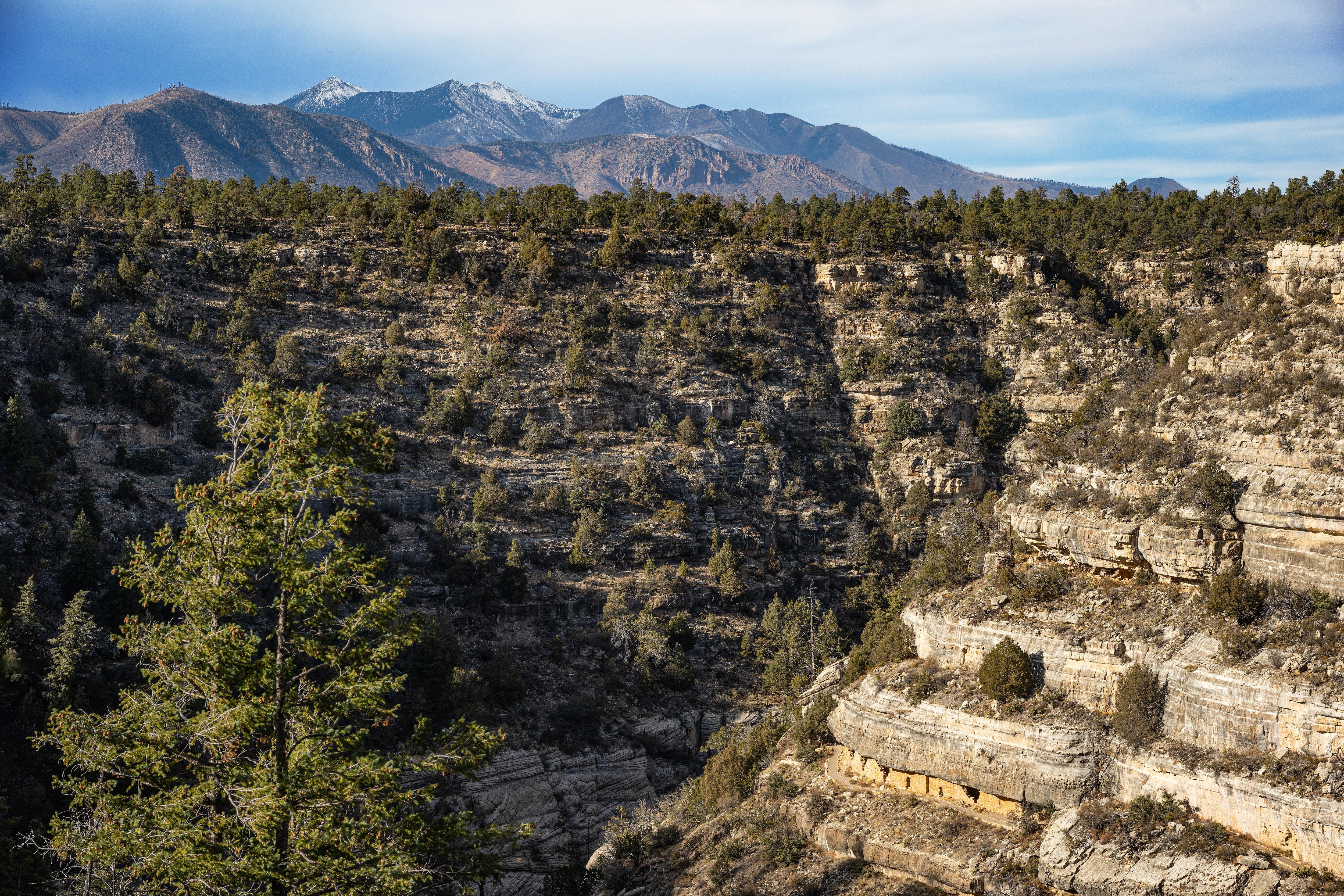
National Monument
Since time immemorial, Indigenous Peoples have lived and traveled throughout Walnut Canyon’s dynamic landscape. Vibrant communities built their homes in the cliffs and farmed along the canyon’s rim. T...
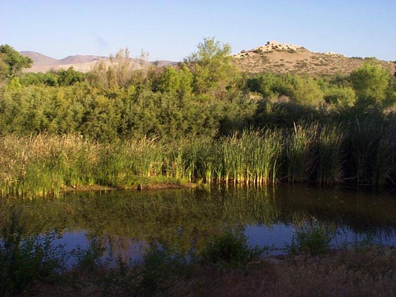
National Monument
Water flows under and through this landscape, feeding the growth of people and towns. The Verde Valley is watered by snowmelt, summer monsoons, and springs that well up from the ancient sedimentary ro...
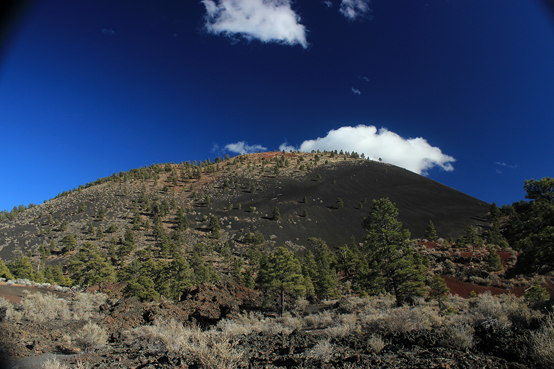
National Monument
The lava flow lies on the land like a dream, a wonderland of rock. A thousand years ago the ground was torn open and lava erupted into the sky, forever changing the landscape and the lives of the peop...

National Monument
An Ancestral Sonoran Desert People's farming community and "Great House" are preserved at Casa Grande Ruins. Whether a gathering place for people or simply a waypoint marker in an extensive system of...
Park data from the National Park Service API. Alerts update every 2 hours.
This journey presents a mixed drive, with 38% of the route on highways. You'll experience stretches of the Superstition Freeway and Black Canyon Freeway, offering a faster pace for significant portions of the trip. The longest uninterrupted drive will be approximately 85 miles along the Arizona Veterans Highway. Expect the road conditions to vary, transitioning between more urban highway segments and potentially more open desert stretches as you progress toward Kachina Village.
This route mixes highway mileage with some local-road sections near the start or finish. This route has several spots where lane changes, forks, or exits need your full attention. The trickiest moment comes around 0.3 miles in near East Vaughn Avenue.
Demanding - plan breaks and stay ahead of the key maneuvers
Balances navigation complexity with total wheel time.
This is a demanding drive. With 12 significant decision points across 158.5 miles, you will need to stay alert - especially through interchange areas and urban stretches. Consider splitting it into segments if you are not comfortable with fast highway navigation.
Where does it get tricky?
The main spots that need attention: at 0.3 miles (East Vaughn Avenue): Complex interchange - multiple decisions in a short stretch; at 2.5 miles: Lane positioning matters here; at 2.8 miles (US 60 / Superstition Freeway): Merge point - match speed before joining. Lane positioning matters here.
High-altitude sections with notable climbs
Total Climb
6,976 ft
Total Descent
1,433 ft
Highest Point
6,779 ft
~158.5 mi in
Elevation Range
5,725 ft
Notable High Points
Gilbert is in the southeast valley of the Greater Phoenix region of Arizona. With a population of 270,000 (2021 est.) it is the largest town in the US. people. Once a railway town and the "Hay Capital of the World", Gilbert is now a diverse suburban center, retaining its agricultural and railroad history and celebrating its "small town" feel.
City content from Wikivoyage (CC BY-SA 4.0) and Wikidata (CC0).
Weekend Trip
Doable as a same-day drive at 2h 52m. Total distance: 158.5 miles.
Family Friendly
Moderate complexity with 1 natural rest stops along the way.
Solo Traveler
2h 52m drive, comfortable solo distance.
First-Time Driver
Mostly highway driving (38%). Some complex stretches to watch for.
Scenic Drive
Mixed highway & surface route profile with national parks nearby.
Compiled by the US Trip Planner planning team at COD Solutions Oy from open government datasets — OSRM over OpenStreetMap for geometry, EIA for fuel prices, USGS 3DEP for elevation, and NPS for national parks. See our methodology for refresh cadence and limitations.
Was this helpful?
Thanks for your feedback!
Your tip has been submitted. Thanks!
/500
Recent Tips
·
Explore more options from Gilbert, AZ or browse trips ending in Kachina Village, AZ.
Looking for more statewide routes? Browse AZ road trips.