Fresno, CA to Cottonwood, CA is 314.5 miles and takes about 5h 56m via Westside Freeway and CA 99, with a fuel budget near $72 and enough daylight to finish in a day. This highway-focused drive stays within the Pacific Coast region, primarily following the well-traveled CA 99 corridor. Expect a straightforward journey with minimal deviations, making it a practical choice for efficient travel between these two points in California. It's a solid option if you're looking for a direct route without many scenic detours. Plan for a single day of travel to comfortably reach your destination.
Trip Pace
Same-day drive is realistic
A same-day return is possible, but it will make for a full day on the road.
Break Rhythm
1 planned break
Plan on a short reset every 3 to 4 hours to stay fresh behind the wheel.
Midpoint
157.3 miles from Fresno, CA
A natural place for your longest stop of the day
, about 3h 3m into the drive
.
Main Roads
Road
Distance
Duration
Westside Freeway
127.6 mi
2h 17m
Northbound California State Route 99
84.6 mi
1h 38m
CA 99
74.9 mi
1h 25m
Cascade Wonderland Highway
15.8 mi
16m
East Belmont Avenue
2.9 mi
5m
Golden State Highway
1.8 mi
2m
Old U.S. Route 99E
1.3 mi
1m
Main Street
1.2 mi
2m
Longest stretch:
Westside Freeway
— 127.6 mi, about 2h 17m
Traffic on I-5
Hour-of-day weekday pattern from 122 FHWA count stations on your route.
Peak
3 PM
~2,106 veh/hr typical
· worst 2,447
Quietest
2 AM
~226 veh/hr
Peak-to-quiet ratio
9.3×
busier at peak than in the quiet hours
12a6anoon6p11p
Averaged across 39 weeks of 2023 FHWA Travel Monitoring Analysis System data. Weekday hours only (Mon–Fri).
Turn-by-Turn Driving Directions
Step-by-step road directions between Fresno, CA and Cottonwood, CA.
1
Start on East Washington Avenue
28 ft·3 sec·East Washington Avenue
2
Turn right onto North First Street
0.2 mi·22 sec·North First Street
3
Turn left onto East Belmont Avenue
2.9 mi·5 min·East Belmont Avenue
Use the straight / right lanes.
4
Take the ramp
0.2 mi·23 sec
Toward CA 99 North
5
Merge onto CA 99
9.4 mi·10 min·CA 99
Use the straight / slight right lanes.
6
Take the exit
0.5 mi·30 sec
Exit 144Toward Avenue 7Use the straight / slight right lanes.
7
Merge onto CA 99
21 mi·24 min·CA 99
Use the straight / slight right lanes.
8
Keep slight right at fork onto CA 99
85 mi·1 hr 38 min·Northbound California State Route 99
Toward CA 99Use the straight / slight right lanes.
9
Continue on CA 99
1.8 mi·2 min·Golden State Highway
10
Continue on CA 99
1.3 mi·1 min·Old U.S. Route 99E
11
Keep slight left at fork onto CA 99
44 mi·50 min·CA 99
Use the straight / slight right lanes.
12
Take the exit
0.5 mi·33 sec
Toward US 50 West, US 50 East: San Francisco, South Lake TahoeUse the straight / slight right lanes.
13
Keep slight left at fork
0.8 mi·1 min
Toward US 50 West: San FranciscoUse the straight / slight right lanes.
14
Continue on US 50
1.2 mi·1 min·Capital City Freeway
Use the straight / slight right lanes.
15
Take the exit
0.2 mi·15 sec
Exit 4AToward I 5: Los Angeles, ReddingUse the slight right lane.
16
Keep slight right at fork
0.3 mi·30 sec
Exit 4AToward I 5 North: ReddingUse the slight right lane.
17
Keep slight left at fork
0.3 mi·39 sec
Toward I 5: Redding
18
Merge onto I 5
6.7 mi·7 min·Westside Freeway
Use the straight / slight right lanes.
19
Keep slight left at fork onto I 5
121 mi·2 hr 10 min·Westside Freeway
Use the straight / slight right lanes.
20
Continue on I 5
16 mi·16 min·Cascade Wonderland Highway
21
Take the exit
0.3 mi·32 sec
Toward Bowman Road, Cottonwood
22
Continue on CR A5
1.2 mi·2 min·Main Street
23
Turn right onto 1st Street
64 ft·1 sec·1st Street
24
Arrive at destination
1st Street
Trip Plan
Given the 5h 56m estimated duration, departing from Fresno in the morning will allow you to reach Cottonwood with plenty of daylight. Since this is a single-day trip and 92% highway, you can easily complete it in one go. Keep an eye on your fuel, especially during the 127.6-mile stretch on the Westside Freeway, as services might be spaced out. It's wise to plan a single refueling stop, perhaps midway, to ensure you arrive in Cottonwood without any concerns about your fuel gauge. This direct route offers flexibility, so you can adjust your timing as needed.
Morning Departure
An early start around 7-8 AM gets you there with plenty of daylight left.
Evening Departure
A late afternoon start means arriving after dark. Morning is better.
You can normally do this drive in one day.
Plan roughly 1 meaningful break for fuel, food, and rest.
The halfway point lands around 157.3 miles from Fresno, CA, or about 3h 3m into the drive.
The longest continuous stretch on this route runs about 127.6 miles.
This is a comfortable same-day trip.
Departure
Before you leave
Start with fuel, water, and navigation already sorted so the first hour feels easy.
First stop
Around 69 miles or 1h 21m in
Use this first pause for coffee, a restroom break, and a quick traffic check ahead.
Halfway reset
Around 157.3 miles or 3h 3m in
This is the best place for your longest stop, a real meal, and a full fuel check.
Final approach
Final hour starts around 4h 54m
Traffic, exits, and arrival timing usually matter more near Cottonwood, CA than in the middle of the route.
Before You Leave
+
Open the route before leaving Fresno, CA so your first major turns are already loaded.
+
Leave with enough water and a charging cable within reach, not packed away.
+
Check your fuel range against the first long segment, especially if you are starting outside city service areas.
Day 1
Settle into the route from Fresno, CA
This is one driving day of about 314.5 miles and 5h 56m.
Your first comfortable stop window is around 69 miles from Fresno, CA.
This route can stay practical as a one-day drive if traffic stays reasonable.
Plan about 1 real break rather than only quick fuel stops.
The longest stretch is on Westside Freeway for about 127.6 miles.
Where to Stop
Rest stops, refuel points, and overnight suggestions along this route.
Place data sourced from public business listings. Hours and availability may vary.
Heads-up: tricky spots
5 of 17
5 decision points cluster between mile 12.7 and 168.9 — GPS handles the exact turns, but know they're coming. Your lane choice matters more than the turn itself.
7
12.7 mi into trip|~16m in
Take the exit toward Avenue 7
Exit ramp - move to the correct lane early. Lane positioning matters here
Use the straight / slight right lanes.
Exit 144
Toward Avenue 7
7
34.5 mi into trip|~41m in|CA 99 / Northbound California State Route 99
Keep slight right at fork onto CA 99 / Northbound California State Route 99 toward CA 99
Highway fork - watch signs carefully. Lane positioning matters here
Use the straight / slight right lanes.
Toward CA 99
7
166.3 mi into trip|~3h 14m in
Take the exit toward US 50 West, US 50 East: San Francisco, South Lake Tahoe
Exit ramp - move to the correct lane early. Lane positioning matters here. Multiple destination signs - pick the right one
Use the straight / slight right lanes.
Toward US 50 West, US 50 East: San Francisco, S...
8
168.8 mi into trip|~3h 17m in
Take the exit toward I 5: Los Angeles, Redding
Exit ramp - move to the correct lane early. Lane positioning matters here. Multiple destination signs - pick the right one
Use the slight right lane.
Exit 4A
Toward I 5: Los Angeles, Redding
9
168.9 mi into trip|~3h 17m in
Keep slight right at fork toward I 5 North: Redding
Highway fork - watch signs carefully. Lane positioning matters here
Use the slight right lane.
Exit 4A
Toward I 5 North: Redding
Fuel & Cost
Regular Gas
$65.80 one way
$131.59 round trip
$5.31/gal25.4 MPG avg110 kg CO2
Fuel Type
$/gal
One Way
Round Trip
midgrade
$5.52
$68.34
$136.67
premium
$5.67
$70.14
$140.29
diesel
$4.80
$59.38
$118.77
No toll roads detected on this route.
Estimated Trip Cost (one way, 1 person)
Fuel
$66
Meals
$25–$50
Total
$91–$116
Rough estimate based on US averages. Hotel $80–$140/night, meals $25–$50/day.
Estimated CO2 emission: 110 kg one way.
Prices: EIA weekly data, 2026-07-13.
Driving Electric?
About $33 in charging
· 1 stop
· 66% less CO2
Vehicle Type
kWh
Stops
DC Fast
Home Charge
Average EV
94.4
1
$33.02
$15.10
Efficient EV
78.6
0
$27.52
$12.58
EV Truck/SUV
125.8
1
$44.03
$20.13
Gas CO2
110 kg
EV CO2
37 kg (66% less)
Plan for 1 charging stop. A 30-minute DC fast charge mid-route should be enough to complete the trip comfortably.
DC fast charging avg $0.35/kWh. Home charging avg $0.16/kWh. US grid CO2: 0.39 kg/kWh.
Travel Intel
Current conditions at both ends of the drive.
Forecast as of Jul 17, 2026
Origin
Fresno, CA
Late night
in Fresno on Sunday
Local time
2:37 AM
PDT
Current temp
100°F
Sunny
WNW 5 mph0% chanceLive forecast
Red Flag Warning
Red Flag Warning issued July 17 at 1:44AM PDT until July 17 at 8:00PM PDT by NWS Medford OR
Red Flag Warning
Red Flag Warning issued July 17 at 1:44AM PDT until July 17 at 8:00PM PDT by NWS Medford OR
Destination
Cottonwood, CA
Late night
in Cottonwood on Sunday
Local time
2:37 AM
PDT
Current temp
97°F
Sunny
S 2 to 9 mph0% chanceLive forecast
Red Flag Warning
Red Flag Warning issued July 17 at 1:44AM PDT until July 17 at 8:00PM PDT by NWS Medford OR
Red Flag Warning
Red Flag Warning issued July 17 at 1:44AM PDT until July 17 at 8:00PM PDT by NWS Medford OR
92°F
Woodlake, CA
157 mi in
Seasonal Notes
Summer travel usually means heavier construction, hotter rest stops, and busier weekend traffic around major cities.
Winter travel shortens daylight, so a route that looks manageable on paper can feel much longer after dark.
Holiday weekends tend to make both departure and arrival windows slower than the raw route time suggests.
Time zone
Same local time
Origin and destination are on the same clock, so arrival timing is easier to judge at a glance.
Temperature spread
3 degrees cooler at arrival
A meaningful temperature swing is a good cue to rethink layers, water, and how soon you want to arrive.
Road read
5h 56m on the road
An early start around 7-8 AM gets you there with plenty of daylight left.
Weather data from the National Weather Service. Conditions may change; check closer to your travel date.
National Parks Near This Route
Worth a detour if your schedule allows.
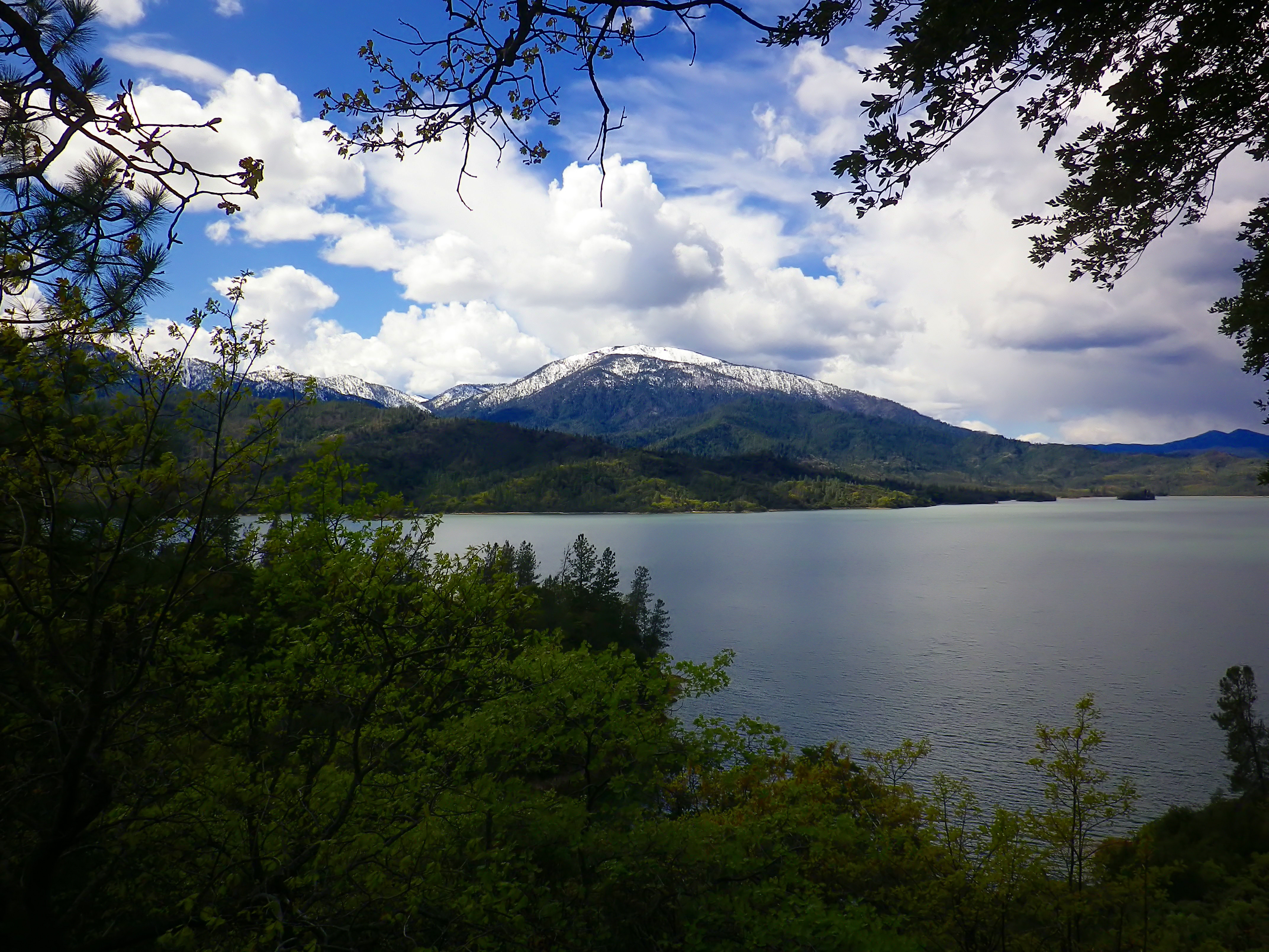
Whiskeytown National Recreation Area
National Recreation Area
Whiskeytown Lake’s crystal-clear waters are iconic, but this 42,000-acre National Recreation Area offers much more. Explore waterfalls, hike rugged trails, uncover Gold Rush history, and witness the r...
23 mi from route
~58 min detour
$15
near mile 314.5
Park data from the National Park Service API. Alerts update every 2 hours.
More Details
What kind of drive is this?
This route is predominantly a highway-focused drive, with 92% of the journey taking place on major roadways like the Westside Freeway and Northbound California State Route 99. You'll encounter a longest uninterrupted stretch of 127.6 miles on the Westside Freeway, indicating significant portions of consistent, high-speed travel. The character of the drive is largely consistent, characterized by its efficient, highway-oriented nature. Prepare for a steady pace as you navigate these primary arteries connecting Central and Northern California.
92% highway — fuel and pacing are the main things to plan.
24 navigation steps total — most of the decisions cluster near the start and finish.
Longest single stretch: 127.6 mi on Westside Freeway.
How Hard Is This Drive?
9/10
This is a straightforward highway drive that stays mostly on Westside Freeway and Northbound California State Route 99. This route has several spots where lane changes, forks, or exits need your full attention. The trickiest moment comes around 12.7 miles in.
Driving Effort9/10
High effort - long or complex enough to need steady focus all day
Balances navigation complexity with total wheel time.
This is a demanding drive. With 17 significant decision points across 314.5 miles, you will need to stay alert - especially through interchange areas and urban stretches. Consider splitting it into segments if you are not comfortable with fast highway navigation.
Where does it get tricky?
The main spots that need attention: at 12.7 miles: Exit ramp - move to the correct lane early. Lane positioning matters here; at 34.5 miles (CA 99 / Northbound California State Route 99): Highway fork - watch signs carefully. Lane positioning matters here; at 166.3 miles: Exit ramp - move to the correct lane early. Lane positioning matters here. Multiple destination signs - pick the right one.
Elevation Profile
Mostly flat terrain
434 ft17 ft
Total Climb
418 ft
Total Descent
295 ft
Highest Point
434 ft
~314.5 mi in
Elevation Range
418 ft
Towns Mentioned on Route Signs
Based on OSRM destination-sign hints, not a full list of every settlement the road passes.
Between Fresno, CA and Cottonwood, CA, road signs point toward Lake Tahoe and Redding.
Fresno is in the San Joaquin Valley of California. Many visitors find themselves stopping in Fresno on the way to Yosemite National Park, Sequoia and Kings Canyon National Parks, or other destinations in the Sierras.
Top landmarks
•Holy Trinity Church, Fresno — church building in Fresno, United States of America
•Fresno station — train station in Fresno, California
•Kearney Park — park in Fresno County, California, United States of America
Doable as a same-day drive at 5h 56m. Total distance: 314.5 miles.
Family Friendly
Moderate complexity with 1 natural rest stops along the way.
Solo Traveler
5h 56m drive, comfortable solo distance.
First-Time Driver
Mostly highway driving (92%). Some complex stretches to watch for.
Frequently Asked Questions
The longest stretch is about 127.6 miles on Westside Freeway. The full list of main roads is in the Roads section above.
Yes — we found about 34 rest areas or service plazas within a short detour of the route (from OpenStreetMap). See the Rest Stops tab under Nearby Places for locations and mile markers. Plan to stretch, use the bathroom, and top off fluids every 2–3 hours on longer drives.
It helps. This route has a higher-than-average number of complex decision points, which get harder in the dark. If the last hour of the trip is on surface roads or mountain grades, aim to arrive at Cottonwood, CA before sunset when you can. Check the Trip Plan for departure windows that land you in daylight.
Only with planning. This is a long drive for kids — consider splitting it into two days rather than pushing through. Plan at least 1 meaningful breaks. There are 34 rest areas along the route for bathroom stops.
The main spots that need attention: at 12.7 miles: Exit ramp - move to the correct lane early. Lane positioning matters here; at 34.5 miles (CA 99 / Northbound California State Route 99): Highway fork - watch signs carefully. Lane positioning matters here; at 166.3 miles: Exit ramp - move to the correct lane early. Lane positioning matters here. Multiple destination signs - pick the right one.
Yes — Whiskeytown National Recreation Area. See the National Parks section for detour distances and tips on detours.
Not recommended in a single day. At 5.9 hours each way, a round trip means 11.9 hours of driving — that is an unsafe level of fatigue for most drivers. Plan at least one night at Cottonwood, CA before the return drive.