Rest Area
0 mi from route
Compiled and reviewed by the US Trip Planner planning team at COD Solutions Oy · Last reviewed Jul 19, 2026 · Editorial standards
Drive Time
5h 10m
Distance
237.6 mi
382 km
Drive Score
9/10
Great drive
Same Day?
Yes, doable
Fuel Cost
$35
one way
EV Charging
Unknown
Estimated drive times based on typical traffic patterns. Actual times may vary with weather, construction, and real-time conditions.

Fayetteville, NC
Wikimedia Commons

Southern Shores, NC
Scott Platt
Fayetteville, NC to Southern Shores, NC is 237.6 miles and takes about 5h 10m via US 64 East, with a fuel budget near $37 and enough daylight to finish in a day. This trip stays within North Carolina, moving from the Southeast region to another part of the Southeast. It's a single-day drive, perfect if you're looking for a straightforward route to the Outer Banks. You'll encounter a mix of driving conditions, so be prepared for both highway cruising and surface roads. Plan for one stop along the way to break up the 5-hour drive.
Trip Pace
Same-day drive is realistic
A same-day return is possible, but it will make for a full day on the road.
Break Rhythm
1 planned break
Plan on a short reset every 3 to 4 hours to stay fresh behind the wheel.
Midpoint
118.8 miles from Fayetteville, NC
A natural place for your longest stop of the day , about 2h 28m into the drive .
| Road | Distance | Duration |
|---|---|---|
| North Eastern Boulevard | 57.3 mi | 1h 6m |
| US 64 | 47.7 mi | 59m |
| United States Highway 64 East | 40.5 mi | 49m |
| US 64 ALT | 20.2 mi | 28m |
| South Croatan Highway | 14.9 mi | 23m |
| South Church Street | 11.8 mi | 17m |
| NC 42 | 11.2 mi | 15m |
| I 587 | 10.6 mi | 11m |
Step-by-step road directions between Fayetteville, NC and Southern Shores, NC.
Start on Market Square
Continue on Person Street
Continue on Person Street
Enter roundabout onto B Street
Continue on B Street
Turn right onto NC 24; NC 210
Turn left onto I 95 Business; US 301
Take the exit
Turn right onto US 301
Take the exit
Merge onto I 587; US 264
Take the exit
Turn left onto NC 111; NC 222
Turn left onto NC 111
Turn right onto NC 124
Turn right onto NC 42
Take the ramp
Merge onto US 64
Turn right onto US 64 ALT
Continue on US 64; NC 32
Continue on US 64; NC 32
Continue on US 64
Keep slight right at fork onto US 64
Continue on US 64
Continue on US 158
Take the exit
Turn straight onto SR 1493
Turn straight onto NC 12
Turn right onto 3rd Avenue
Continue on 3rd Avenue
Arrive at destination
Given the 5-hour duration, leaving Fayetteville in the morning will get you to Southern Shores with plenty of daylight to spare. The recommended single stop is a good opportunity to stretch your legs and refuel. With a fuel cost estimated at $37, be sure to top off your tank before you leave Fayetteville, as gas availability can vary along US 64 East. This route is manageable in one day, so you have flexibility if you want to take a slightly longer break. Keep an eye out for the transition from faster highway driving to the slower speeds of coastal towns.
Morning Departure
An early start around 7-8 AM gets you there with plenty of daylight left.
Evening Departure
A late afternoon start means arriving after dark. Morning is better.
This is a comfortable same-day trip.
Departure
Before you leave
Start with fuel, water, and navigation already sorted so the first hour feels easy.
First stop
Around 52 miles or 1h 1m in
Use this first pause for coffee, a restroom break, and a quick traffic check ahead.
Halfway reset
Around 118.8 miles or 2h 28m in
This is the best place for your longest stop, a real meal, and a full fuel check.
Final approach
Final hour starts around 4h 4m
Traffic, exits, and arrival timing usually matter more near Southern Shores, NC than in the middle of the route.
Open the route before leaving Fayetteville, NC so your first major turns are already loaded.
Leave with enough water and a charging cable within reach, not packed away.
Check your fuel range against the first long segment, especially if you are starting outside city service areas.
Day 1
Settle into the route from Fayetteville, NC
This is one driving day of about 237.6 miles and 5h 10m.
Rest stops, refuel points, and overnight suggestions along this route.

Mid-route town
Meal stop
119 mi into the route
Best for: Lunch, fuel, and a longer reset
This sits close to the middle of the route, so it works well for the longest stop of the day.
A short stop after about 52 miles helps settle the day before fatigue starts building.
The midpoint is around 118.8 miles from Fayetteville, NC, which is a good place for a longer meal and fuel stop.
These stop ideas are pacing suggestions — the exact town or exit can change with traffic, hotel plans, and fuel range.
Picked by where they fit in your drive — first break, midpoint reset, final stretch.
Place data sourced from public business listings. Hours and availability may vary.
5 decision points cluster between mile 0.3 and 130 — GPS handles the exact turns, but know they're coming. Your lane choice matters more than the turn itself.
Enter roundabout onto Person Street
Roundabout - know your exit number before entering
Enter roundabout onto B Street
Roundabout - know your exit number before entering
Turn right onto NC 24; NC 210 / Grove Street
Lane positioning matters here
Take the exit toward US 301: Kenly, Wilson
Exit ramp - move to the correct lane early. Multiple destination signs - pick the right one
Turn right onto US 64 ALT
Lane positioning matters here
Regular Gas
$35.08 one way
$70.16 round trip
| Fuel Type | $/gal | One Way | Round Trip |
|---|---|---|---|
| midgrade | $4.12 | $38.55 | $77.10 |
| premium | $4.49 | $42.02 | $84.04 |
| diesel | $4.80 | $44.86 | $89.73 |
No toll roads detected on this route.
Estimated Trip Cost (one way, 1 person)
Fuel
$35
Meals
$25–$50
Total
$60–$85
Rough estimate based on US averages. Hotel $80–$140/night, meals $25–$50/day.
Estimated CO2 emission: 83.1 kg one way. Prices: EIA weekly data, 2026-07-13.
Driving Electric?
About $25 in charging · 0 stops · 66% less CO2
| Vehicle Type | kWh | Stops | DC Fast | Home Charge |
|---|---|---|---|---|
| Average EV | 71.3 | 0 | $24.95 | $11.40 |
| Efficient EV | 59.4 | 0 | $20.79 | $9.50 |
| EV Truck/SUV | 95 | 1 | $33.26 | $15.21 |
Gas CO2
83 kg
EV CO2
28 kg (66% less)
Plan for 0 charging stops, roughly every 270 miles. Allow 25-40 minutes per stop at a DC fast charger.
DC fast charging avg $0.35/kWh. Home charging avg $0.16/kWh. US grid CO2: 0.39 kg/kWh.
Current conditions at both ends of the drive.
Origin
Late night in Fayetteville on Sunday
Local time
2:44 AM
EDT
Current temp
99°F
Mostly Sunny
Heat Advisory
Heat Advisory issued July 18 at 9:28AM EDT until July 18 at 8:00PM EDT by NWS Wakefield VA
Beach Hazards Statement
Beach Hazards Statement issued July 18 at 2:41AM EDT until July 18 at 8:00PM EDT by NWS Wilmington NC
Destination
Late night in Southern Shores on Sunday
Local time
2:44 AM
EDT
Current temp
92°F
Mostly Sunny
Heat Advisory
Heat Advisory issued July 18 at 9:28AM EDT until July 18 at 8:00PM EDT by NWS Wakefield VA
Beach Hazards Statement
Beach Hazards Statement issued July 18 at 2:41AM EDT until July 18 at 8:00PM EDT by NWS Wilmington NC
71°F
Washington, NC
119 mi in
Seasonal Notes
Summer travel usually means heavier construction, hotter rest stops, and busier weekend traffic around major cities.
Winter travel shortens daylight, so a route that looks manageable on paper can feel much longer after dark.
Holiday weekends tend to make both departure and arrival windows slower than the raw route time suggests.
Time zone
Origin and destination are on the same clock, so arrival timing is easier to judge at a glance.
Temperature spread
A meaningful temperature swing is a good cue to rethink layers, water, and how soon you want to arrive.
Road read
An early start around 7-8 AM gets you there with plenty of daylight left.
Weather data from the National Weather Service. Conditions may change; check closer to your travel date.
Worth a detour if your schedule allows.
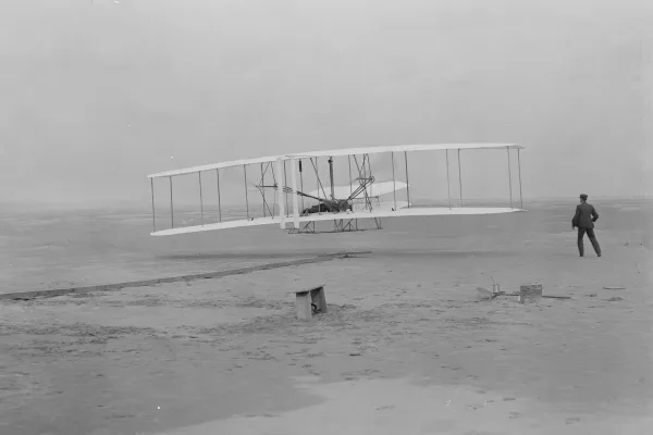
National Memorial
Wind, sand, and a dream of flight brought Wilbur and Orville Wright to Kitty Hawk, North Carolina where, after four years of scientific experimentation, they achieved the first successful airplane fli...
Park data from the National Park Service API. Alerts update every 2 hours.
This is a mixed drive, with 59% of the route on highways. You'll spend a significant portion on US 64 East. The longest stretch without a major road change is 57.3 miles. Expect to transition from more urban-influenced areas to more open cruising as you head east. The density of exits will likely decrease as you get closer to the coast.
This route mixes highway mileage with some local-road sections near the start or finish. You will hit about 20 points where you need to pay attention to lane position or signs. The trickiest moment comes around 0.3 miles in near Person Street.
Moderate - straightforward overall, but long enough or busy enough to require pacing
Balances navigation complexity with total wheel time.
This drive requires moderate attention. Across 237.6 miles you will encounter 20 spots where lane choice or exit timing matters. Not difficult for experienced highway drivers, but worth previewing the tricky sections before you go.
Where does it get tricky?
The main spots that need attention: at 0.3 miles (Person Street): Roundabout - know your exit number before entering; at 0.6 miles (B Street): Roundabout - know your exit number before entering; at 0.9 miles (NC 24; NC 210 / Grove Street): Lane positioning matters here.
Mostly flat terrain
Total Climb
103 ft
Total Descent
194 ft
Highest Point
175 ft
~50.9 mi in
Elevation Range
171 ft
Based on OSRM destination-sign hints, not a full list of every settlement the road passes.
On the drive from Fayetteville, NC to Southern Shores, NC, road signs begin pointing toward Wilson along the way.
Wilson
Founded 1762
Fayetteville is a city in Cumberland County, in the western part of the North Carolina Coastal Plain region. It is the county seat of Cumberland County, and is best known as the home of Fort Bragg/Liberty/Bragg (the name of which changed thrice in as many years,) a major U.S. Army installation northwest of the city. Fayetteville has received the prestigious All-America City Award from the National Civic League three times. According to the 2020 United States Census estimate, the city has a population of 208,501. It ranks as the sixth-largest municipality in North Carolina. With an estimated population of 529,252, the Fayetteville metropolitan area is the largest in southeastern North Carolina, and the fifth-largest in the state.
Top landmarks
Southern Shores is a town in the Outer Banks of North Carolina. From the beautiful oceanfront to the sound, Southern Shores has been the best kept secret on the Outer Banks since 1947. The beaches are private and uncrowded. A community soundside bathing beach and playground are great for families with small children. And while it is a residential area, Southern Shores is just minutes from shops, restaurants, and area attractions.
City content from Wikivoyage (CC BY-SA 4.0) and Wikidata (CC0).
Weekend Trip
Doable as a same-day drive at 5h 10m. Total distance: 237.6 miles.
Family Friendly
Moderate complexity with 1 natural rest stops along the way.
Solo Traveler
5h 10m drive, comfortable solo distance.
Scenic Drive
Mixed highway & surface route profile with national parks nearby.
Compiled by the US Trip Planner planning team at COD Solutions Oy from open government datasets — OSRM over OpenStreetMap for geometry, EIA for fuel prices, USGS 3DEP for elevation, and NPS for national parks. See our methodology for refresh cadence and limitations.
Was this helpful?
Thanks for your feedback!
Your tip has been submitted. Thanks!
/500
Recent Tips
·
Explore more options from Fayetteville, NC or browse trips ending in Southern Shores, NC.
Looking for more statewide routes? Browse NC road trips.