Origin
Cohoe, AK
Evening in Cohoe on Saturday
Local time
5:07 PM
AKDT
Current temp
40°F
Unavailable
Live forecast
Compiled and reviewed by the US Trip Planner planning team at COD Solutions Oy · Last reviewed Apr 19, 2026 · Editorial standards
Drive Time
51h 49m
Distance
889 mi
1,431 km
Drive Score
7/10
Good drive
Same Day?
4-day trip
Fuel Cost
$193
one way
EV Charging
Unknown
Estimated drive times based on typical traffic patterns. Actual times may vary with weather, construction, and real-time conditions.

Cohoe, AK
Tima Miroshnichenko

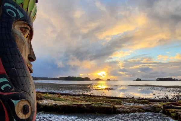
Sitka, AK
Wikimedia Commons
Cohoe, AK to Sitka, AK is 889 miles and takes about 51 hours 49 minutes via Alaska Marine Highway - Whittier-Yakutat, Alaska Marine Highway - Juneau-Yakutat, Alaska Marine Highway - Sitka-Juneau, with a fuel budget near $193 and an estimated 4 recommended days. This extensive Alaska Marine Highway route covers a significant distance between the two Alaskan regions. With over 50 hours of travel time, this trip is designed for those who want to fully immerse themselves in the Alaskan landscape, using a network of ferry services as the primary mode of transit. Planning for multiple days is essential to comfortably experience this long-distance passage.
Trip Pace
Best split across 4 days
Treat the return leg as its own travel day rather than an afterthought.
Break Rhythm
14 planned breaks
Plan on a short reset every 3 to 4 hours to stay fresh behind the wheel.
Midpoint
444.5 miles from Cohoe, AK
A natural place for your longest stop of the day , about 23h 43m into the drive .
| Road | Distance | Duration |
|---|---|---|
| Alaska Marine Highway - Whittier-Yakutat | 334.5 mi | 22h |
| Alaska Marine Highway - Juneau-Yakutat | 262.6 mi | 17h |
| Alaska Marine Highway - Sitka-Juneau | 153.9 mi | 9h 29m |
| Sterling Highway | 72.7 mi | 1h 46m |
| Seward Highway | 41.4 mi | 48m |
| Halibut Point Road | 6.6 mi | 11m |
| North Cohoe Loop Road | 5.4 mi | 9m |
| Portage Glacier Road | 5 mi | 7m |
Step-by-step road directions between Cohoe, AK and Sitka, AK.
Start on this road
Turn right onto Ness Road
Turn left onto North Cohoe Loop Road
Turn left onto AK 1
At end of road, turn left onto AK 1
Turn right onto FFH 35
Continue on Portage Glacier Highway
Continue on West Camp Road
Turn right
Turn left
Turn straight onto Alaska Marine Highway - Whittier-Yakutat
Turn sharp right onto Alaska Marine Highway - Juneau-Yakutat
Turn sharp right onto Alaska Marine Highway - Sitka-Juneau
Continue
At end of road, turn right onto F-99
Enter roundabout onto S-933
Continue on S-933
Turn right onto Baranof Street
Arrive at destination
Given the nearly 52-hour travel duration, it's best to break this trip into at least 4 days to avoid excessive fatigue. You'll be utilizing ferry services for the vast majority of this route, so consult the ferry schedules meticulously before departing. The longest continuous segment is over 334 miles on the Alaska Marine Highway - Whittier-Yakutat, so ensure you have adequate provisions for this extended ferry leg. Factor in the $193 fuel cost, though this primarily relates to your vehicle if you're transporting it via ferry; ferry ticket prices will be an additional, significant cost to consider.
Morning Departure
Start early — leave by 6-7 AM to arrive at a reasonable hour.
Evening Departure
This is a long drive — plan for a morning departure or consider splitting it into two days.
Consider an overnight stop or starting very early.
Departure
Before you leave
Start with fuel, water, and navigation already sorted so the first hour feels easy.
First stop
Around 196 miles or 7h 22m in
Use this first pause for coffee, a restroom break, and a quick traffic check ahead.
Halfway reset
Around 444.5 miles or 23h 43m in
This is the best place for your longest stop, a real meal, and a full fuel check.
Overnight split
Day 1 wrap after about 222.3 miles or 9h 6m
Stop before fatigue turns the last few hours into a grind. You want day two to start fresh, not just resumed.
Final approach
Final hour starts around 48h 20m
Traffic, exits, and arrival timing usually matter more near Sitka, AK than in the middle of the route.
Open the route before leaving Cohoe, AK so your first major turns are already loaded.
Leave with enough water and a charging cable within reach, not packed away.
Check your fuel range against the first long segment, especially if you are starting outside city service areas.
Pick one backup stop option before the midpoint in case traffic changes your pacing.
Treat this as a 4-day road trip and book the overnight stop before the busiest arrival window.
Day 1
Settle into the route from Cohoe, AK
Aim for roughly 222 miles and 13 hours of wheel time on this day.
Day 2
Keep the middle miles efficient
Aim for roughly 222 miles and 13 hours of wheel time on this day.
Day 3
Keep the middle miles efficient
Aim for roughly 222 miles and 13 hours of wheel time on this day.
Day 4
Finish the approach into Sitka, AK
Aim for roughly 222 miles and 13 hours of wheel time on this day.
Rest stops, refuel points, and overnight suggestions along this route.

First major stop
Coffee and fuel
293 mi into the route
Best for: Coffee, fuel, and an easy first stretch
This is a natural early stop once the first hours of the drive are behind you.
Night 1
222 mi · about 13h in
A practical overnight split lands near Sterling, AK after about 222 miles or 13 hours of driving.
Find hotelsNight 2
445 mi · about 25.9h in
A practical overnight split lands near Eagle River, AK after about 445 miles or 25.9 hours of driving.
Find hotelsNight 3
667 mi · about 38.9h in
A practical overnight split lands near Palmer, AK after about 667 miles or 38.9 hours of driving.
Find hotelsA short stop after about 196 miles helps settle the day before fatigue starts building.
Halfway reset
Meal breakThe midpoint is around 444.5 miles from Cohoe, AK, which is a good place for a longer meal and fuel stop.
Before the longest stretch
Fuel checkTop up before Alaska Marine Highway - Whittier-Yakutat if your tank is already low. That segment runs about 334.5 miles.
Overnight split
Hotel stopFor a steadier pace, wrap day one after about 222 miles or 13 hours on the road.
These stop ideas are pacing suggestions — the exact town or exit can change with traffic, hotel plans, and fuel range.
5 decision points cluster between mile 0 and 889 — GPS handles the exact turns, but know they're coming. Your lane choice matters more than the turn itself.
Turn right onto Ness Road
Navigation decision point
Turn left onto North Cohoe Loop Road
Navigation decision point
Turn sharp right onto Alaska Marine Highway - Juneau-Yakutat
Sharp turn - reduce speed on approach
Turn sharp right onto Alaska Marine Highway - Sitka-Juneau
Sharp turn - reduce speed on approach
Turn right onto Baranof Street
Navigation decision point
Regular Gas
$192.67 one way
$385.35 round trip
| Fuel Type | $/gal | One Way | Round Trip |
|---|---|---|---|
| midgrade | $5.79 | $202.61 | $405.23 |
| premium | $5.98 | $209.30 | $418.60 |
| diesel | $5.61 | $196.28 | $392.56 |
No toll roads detected on this route.
Estimated Trip Cost (one way, 1 person)
Fuel
$193
Hotel (3n)
$240–$420
Meals
$100–$200
Total
$533–$813
Rough estimate based on US averages. Hotel $80–$140/night, meals $25–$50/day.
Estimated CO2 emission: 311 kg one way. Prices: EIA weekly data, 2026-04-13.
Driving Electric?
About $93 in charging · 3 stops · 67% less CO2
| Vehicle Type | kWh | Stops | DC Fast | Home Charge |
|---|---|---|---|---|
| Average EV | 266.7 | 3 | $93.34 | $42.67 |
| Efficient EV | 222.3 | 2 | $77.79 | $35.56 |
| EV Truck/SUV | 355.6 | 4 | $124.46 | $56.90 |
Gas CO2
311 kg
EV CO2
104 kg (67% less)
Plan for 3 charging stops, roughly every 270 miles. Allow 25-40 minutes per stop at a DC fast charger.
DC fast charging avg $0.35/kWh. Home charging avg $0.16/kWh. US grid CO2: 0.39 kg/kWh.
Current conditions at both ends of the drive.
Origin
Evening in Cohoe on Saturday
Local time
5:07 PM
AKDT
Current temp
40°F
Unavailable
Destination
Evening in Sitka on Saturday
Local time
5:07 PM
AKDT
Current temp
38°F
Unavailable
Seasonal Notes
Summer travel usually means heavier construction, hotter rest stops, and busier weekend traffic around major cities.
Winter travel shortens daylight, so a route that looks manageable on paper can feel much longer after dark.
Holiday weekends tend to make both departure and arrival windows slower than the raw route time suggests.
For long drives, weather on day two can matter just as much as conditions at departure, so check the whole travel window rather than only the first day.
Time zone
Origin and destination are on the same clock, so arrival timing is easier to judge at a glance.
Temperature spread
A meaningful temperature swing is a good cue to rethink layers, water, and how soon you want to arrive.
Road read
This is long enough that the arrival forecast matters almost as much as departure conditions. Recheck both ends before you roll.
Weather data from the National Weather Service. Conditions may change; check closer to your travel date.
Worth a detour if your schedule allows.
National Historical Park
On an island amid towering spruce and hemlock, Sitka National Historical Park preserves the site of a battle between invading Russian traders and Indigenous Kiks.ádi Tlingit. Totem poles from Tlingit...
Park data from the National Park Service API. Alerts update every 2 hours.
This route is entirely on the Alaska Marine Highway system, meaning you'll spend 0% of your time on surface roads. The longest stretch you'll encounter is 334.5 miles along the Alaska Marine Highway - Whittier-Yakutat. Expect to be navigating by ferry for the majority of this trip. This extensive ferry travel means you will be cruising across water for the bulk of your travel time.
At 51h 49m, this is a long-haul route where pacing matters more than any single turn. This route has several spots where lane changes, forks, or exits need your full attention. The trickiest moment comes early in the drive near Ness Road.
Demanding - plan breaks and stay ahead of the key maneuvers
Balances navigation complexity with total wheel time.
This is a demanding drive. With 12 significant decision points across 889 miles, you will need to stay alert - especially through interchange areas and urban stretches. Consider splitting it into segments if you are not comfortable with fast highway navigation.
Where does it get tricky?
The main spots that need attention: near the start (Ness Road): Navigation decision point; at 0.5 miles (North Cohoe Loop Road): Navigation decision point; at 465.7 miles (Alaska Marine Highway - Juneau-Yakutat): Sharp turn - reduce speed on approach.
Solo Traveler
51h 49m drive, plan rest stops for pacing.
Scenic Drive
Long-haul drive route profile with national parks nearby.
Compiled by the US Trip Planner planning team at COD Solutions Oy from open government datasets — OSRM over OpenStreetMap for geometry, EIA for fuel prices, and NPS for national parks. See our methodology for refresh cadence and limitations.
Was this helpful?
Thanks for your feedback!
Your tip has been submitted. Thanks!
/500
Recent Tips
·
Explore more options from Cohoe, AK or browse trips ending in Sitka, AK.
Looking for more statewide routes? Browse AK road trips.