Driving from Coachella to Los Angeles covers 132.9 miles of Southern California terrain, typically taking about 2 hours and 30 minutes. Since both cities are located within the Pacific Coast region, you will stay within a consistent climate zone throughout the journey. This trip works perfectly as a straightforward day trip, meaning you do not need to worry about booking overnight accommodations along the way. Expect to budget roughly $18 for fuel to complete the transit. Given the efficient highway-focused nature of this route, it is a highly practical connection between the desert valley and the urban sprawl of the coast.
Trip Pace
Same-day drive is realistic
A same-day return is realistic if you keep stops short.
Break Rhythm
1 planned break
A short stop every 2 to 3 hours is enough for this drive.
Midpoint
66.5 miles from Coachella, CA
A natural place for your longest stop of the day
, about 1h 14m into the drive
.
Main Roads
Road
Distance
Duration
San Bernardino Freeway
45.3 mi
52m
Pearl Harbor Memorial Highway
39.9 mi
43m
Sonny Bono Memorial Freeway
32.6 mi
34m
I-10 Metro ExpressLanes
9.3 mi
9m
CA 86
2.9 mi
3m
Avenue 50
1 mi
1m
Grapefruit Boulevard
0.5 mi
<1m
Santa Ana Freeway
0.4 mi
<1m
Longest stretch:
San Bernardino Freeway
— 45.3 mi, about 52m
Turn-by-Turn Driving Directions
Step-by-step road directions between Coachella, CA and Los Angeles, CA.
1
Start on Grapefruit Boulevard
0.5 mi·51 sec·Grapefruit Boulevard
2
Turn left
0.1 mi·34 sec
3
Turn right onto Avenue 50
1.0 mi·1 min·Avenue 50
4
Continue on Tyler Street
0.1 mi·16 sec·Tyler Street
5
Turn left onto CA 86
2.9 mi·3 min·CA 86
6
Merge onto I 10
33 mi·34 min·Sonny Bono Memorial Freeway
Use the straight / slight right lanes.
7
Continue on I 10
40 mi·43 min·Pearl Harbor Memorial Highway
Use the straight / slight right lanes.
8
Continue on I 10
14 mi·15 min·San Bernardino Freeway
Use the straight / slight right lanes.
9
Keep slight left at fork onto I 10 EXPR
9.3 mi·9 min·I-10 Metro ExpressLanes
Use the straight / slight right lanes.
10
Merge onto I 10
1.2 mi·1 min·San Bernardino Freeway
Use the straight / slight right lanes.
11
Keep slight right at fork onto I 10
0.9 mi·1 min·San Bernardino Freeway
12
Keep slight right at fork onto I 10
1.3 mi·1 min·San Bernardino Freeway
13
Keep slight right at fork onto I 10
1.9 mi·2 min·San Bernardino Freeway
Use the straight / slight right lanes.
14
Keep slight right at fork onto I 10
1.9 mi·2 min·San Bernardino Freeway
Use the straight / slight right lanes.
15
Keep slight right at fork onto I 10
1.6 mi·1 min·San Bernardino Freeway
Use the straight / slight right lanes.
16
Keep slight right at fork onto I 10
1.4 mi·1 min·San Bernardino Freeway
Use the straight / slight right lanes.
17
Keep slight right at fork onto I 10
1.5 mi·1 min·San Bernardino Freeway
Use the slight right lane.
18
Keep slight right at fork onto I 10
1.1 mi·1 min·San Bernardino Freeway
19
Keep slight right at fork onto I 10
2.0 mi·2 min·San Bernardino Freeway
Use the straight / slight right lanes.
20
Keep slight right at fork onto I 10
1.6 mi·1 min·San Bernardino Freeway
Use the straight / slight right lanes.
21
Keep slight right at fork onto I 10
2.6 mi·2 min·San Bernardino Freeway
Use the slight right lane.
22
Keep slight right at fork onto I 10
12 mi·14 min·San Bernardino Freeway
Use the straight / slight right lanes.
23
Merge onto US 101
0.4 mi·36 sec·Santa Ana Freeway
Use the straight / slight right lanes.
24
Take the exit
0.2 mi·19 sec
Exit 2BToward Alameda Street, Union StationUse the slight right lane.
25
Continue on I 10 EXPR
0.2 mi·32 sec·East Arcadia Street
Use the left / straight lanes.
26
Turn left onto North Los Angeles Street
0.3 mi·44 sec·North Los Angeles Street
27
Turn right onto East 1st Street
461 ft·17 sec·East 1st Street
28
Arrive at destination
West 1st Street
Trip Plan
Because this is a relatively short 2.5-hour trip, you have plenty of flexibility to plan your departure around Los Angeles traffic patterns. You should plan for at least one stop during the drive to stretch your legs and manage the transit comfortably. Keep an eye on your fuel gauge before leaving Coachella to ensure you stay within your $18 estimated budget. Since the route relies heavily on major freeways, checking real-time traffic reports before you merge onto the San Bernardino Freeway is the best way to avoid unexpected delays. Use the simplicity of this 132.9-mile drive to your advantage by keeping your itinerary light and adaptable.
Morning Departure
Leave by 9 AM and you'll arrive before lunch.
Evening Departure
Even a 4 PM departure gets you there before dark in summer.
You can normally do this drive in one day.
Plan roughly 1 meaningful break for fuel, food, and rest.
The halfway point lands around 66.5 miles from Coachella, CA, or about 1h 14m into the drive.
The longest continuous stretch on this route runs about 45.3 miles.
This is a comfortable same-day trip.
Departure
Before you leave
Start with fuel, water, and navigation already sorted so the first hour feels easy.
First stop
Around 29 miles or 33m in
Use this first pause for coffee, a restroom break, and a quick traffic check ahead.
Halfway reset
Around 66.5 miles or 1h 14m in
This is the best place for your longest stop, a real meal, and a full fuel check.
Final approach
Final hour starts around 2h 1m
Traffic, exits, and arrival timing usually matter more near Los Angeles, CA than in the middle of the route.
Before You Leave
+
Open the route before leaving Coachella, CA so your first major turns are already loaded.
+
Leave with enough water and a charging cable within reach, not packed away.
+
Check your fuel range against the first long segment, especially if you are starting outside city service areas.
Day 1
Settle into the route from Coachella, CA
This is one driving day of about 132.9 miles and 2h 30m.
Your first comfortable stop window is around 29 miles from Coachella, CA.
This route can stay practical as a one-day drive if traffic stays reasonable.
Plan about 1 real break rather than only quick fuel stops.
The longest stretch is on San Bernardino Freeway for about 45.3 miles.
Where to Stop
Rest stops, refuel points, and overnight suggestions along this route.
Place data sourced from public business listings. Hours and availability may vary.
Heads-up: tricky spots
5 of 23
5 decision points cluster between mile 91 and 132.2 — GPS handles the exact turns, but know they're coming. Your lane choice matters more than the turn itself.
6
91 mi into trip|~1h 41m in|I 10 EXPR / I-10 Metro ExpressLanes
Keep slight left at fork onto I 10 EXPR / I-10 Metro ExpressLanes
Highway fork - watch signs carefully. Lane positioning matters here
Use the straight / slight right lanes.
6
103.7 mi into trip|~1h 55m in|I 10 / San Bernardino Freeway
Keep slight right at fork onto I 10 / San Bernardino Freeway
Highway fork - watch signs carefully. Lane positioning matters here
Use the straight / slight right lanes.
6
105.6 mi into trip|~1h 57m in|I 10 / San Bernardino Freeway
Keep slight right at fork onto I 10 / San Bernardino Freeway
Highway fork - watch signs carefully. Lane positioning matters here
Use the straight / slight right lanes.
6
107.5 mi into trip|~2h in|I 10 / San Bernardino Freeway
Keep slight right at fork onto I 10 / San Bernardino Freeway
Highway fork - watch signs carefully. Lane positioning matters here
Use the straight / slight right lanes.
8
132.2 mi into trip|~2h 28m in
Take the exit toward Alameda Street, Union Station
Exit ramp - move to the correct lane early. Lane positioning matters here. Multiple destination signs - pick the right one
Use the slight right lane.
Exit 2B
Toward Alameda Street, Union Station
Fuel & Cost
Regular Gas
$30.55 one way
$61.09 round trip
$5.84/gal25.4 MPG avg47 kg CO2
Fuel Type
$/gal
One Way
Round Trip
midgrade
$6.02
$31.48
$62.95
premium
$6.18
$32.32
$64.64
diesel
$5.61
$29.34
$58.69
No toll roads detected on this route.
Estimated Trip Cost (one way, 1 person)
Fuel
$31
Meals
$25–$50
Total
$56–$81
Rough estimate based on US averages. Hotel $80–$140/night, meals $25–$50/day.
Estimated CO2 emission: 46.5 kg one way.
Prices: EIA weekly data, 2026-04-13.
Driving Electric?
About $14 in charging
· 0 stops
· 65% less CO2
Vehicle Type
kWh
Stops
DC Fast
Home Charge
Average EV
39.9
0
$13.95
$6.38
Efficient EV
33.2
0
$11.63
$5.32
EV Truck/SUV
53.2
0
$18.61
$8.51
Gas CO2
46 kg
EV CO2
16 kg (65% less)
This trip is well within single-charge range for most EVs. No charging stops needed if you start fully charged.
DC fast charging avg $0.35/kWh. Home charging avg $0.16/kWh. US grid CO2: 0.39 kg/kWh.
Travel Intel
Current conditions at both ends of the drive.
Forecast as of Apr 18, 2026
Origin
Coachella, CA
Late night
in Coachella on Tuesday
Local time
2:19 AM
PDT
Current temp
57°F
Unavailable
Live forecast
Destination
Los Angeles, CA
Late night
in Los Angeles on Tuesday
Local time
2:19 AM
PDT
Current temp
53°F
Mostly Clear
N 5 to 10 mph0% chanceLive forecast
Freeze Warning
Freeze Warning issued April 17 at 7:10PM PDT until April 18 at 8:00AM PDT by NWS Eureka CA
Seasonal Notes
Summer travel usually means heavier construction, hotter rest stops, and busier weekend traffic around major cities.
Winter travel shortens daylight, so a route that looks manageable on paper can feel much longer after dark.
Holiday weekends tend to make both departure and arrival windows slower than the raw route time suggests.
Time zone
Same local time
Origin and destination are on the same clock, so arrival timing is easier to judge at a glance.
Temperature spread
4 degrees cooler at arrival
A meaningful temperature swing is a good cue to rethink layers, water, and how soon you want to arrive.
Road read
2h 30m on the road
The weather snapshot is not static. If you are leaving later, give both cities one more quick forecast check before departure.
Weather data from the National Weather Service. Conditions may change; check closer to your travel date.
National Parks Near This Route
Worth a detour if your schedule allows.
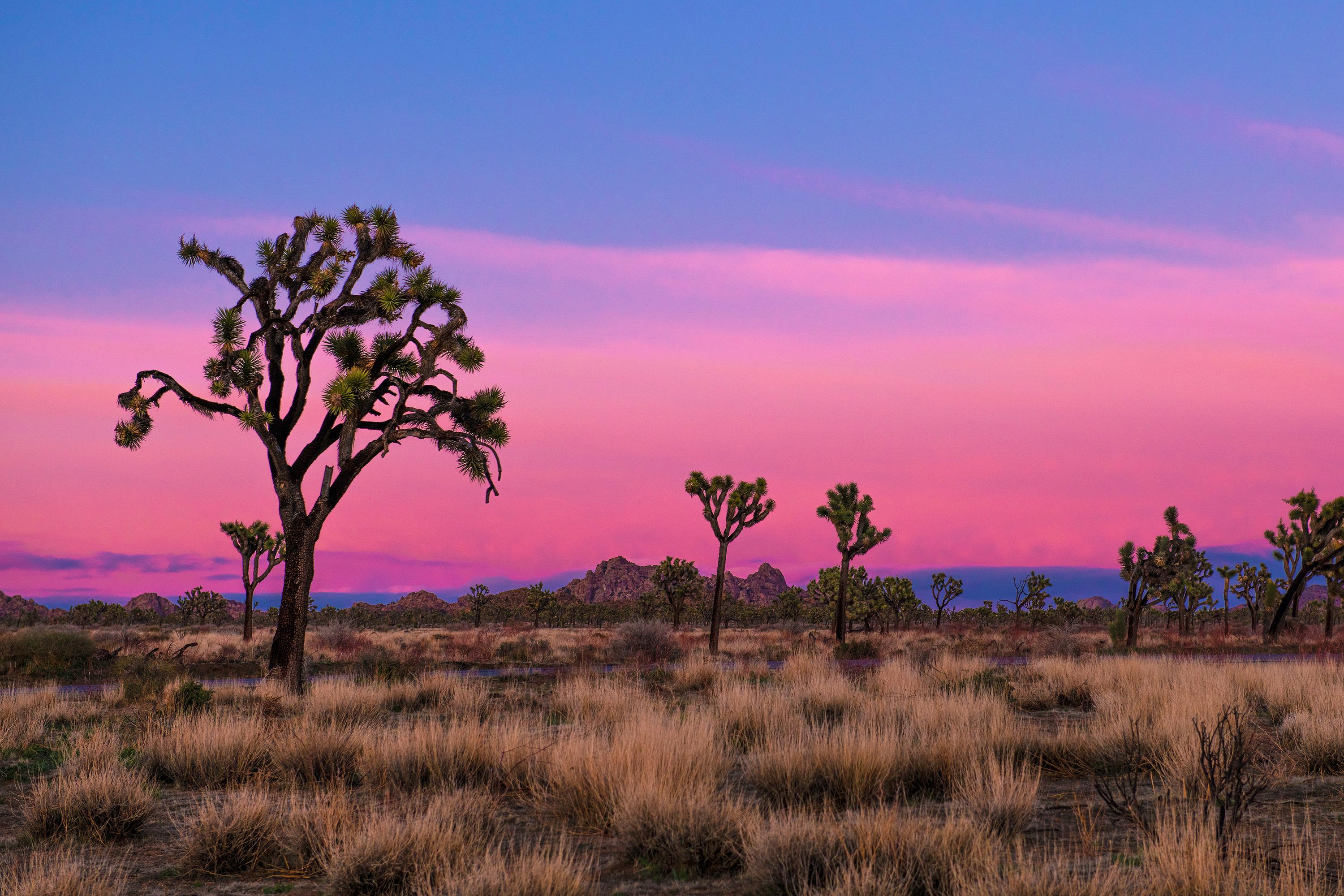
Joshua Tree National Park
National Park
Two distinct desert ecosystems, the Mojave and the Colorado, come together in Joshua Tree National Park. A fascinating variety of plants and animals make their homes in a land sculpted by strong winds...
Park data from the National Park Service API. Alerts update every 2 hours.
More Details
What kind of drive is this?
This journey is defined by a heavy reliance on major infrastructure, with 68% of the route consisting of highway driving. You will navigate via the Sonny Bono Memorial Freeway, the Pearl Harbor Memorial Highway, and the San Bernardino Freeway to reach your destination. Be prepared for a consistent pace, as your longest uninterrupted stretch spans 45.3 miles on the San Bernardino Freeway. While the path is primarily a highway-focused drive, the transition from the desert environment toward the metropolitan density of Los Angeles creates a distinct shift in traffic patterns and road scale.
68% highway — fuel and pacing are the main things to plan.
28 navigation steps total — most of the decisions cluster near the start and finish.
Longest single stretch: 45.3 mi on San Bernardino Freeway.
How Hard Is This Drive?
9/10
This is a straightforward highway drive that stays mostly on San Bernardino Freeway and Pearl Harbor Memorial Highway. This route has several spots where lane changes, forks, or exits need your full attention. The trickiest moment comes around 91 miles in near I 10 EXPR / I-10 Metro ExpressLanes.
Driving Effort9/10
High effort - long or complex enough to need steady focus all day
Balances navigation complexity with total wheel time.
This is a demanding drive. With 23 significant decision points across 132.9 miles, you will need to stay alert - especially through interchange areas and urban stretches. Consider splitting it into segments if you are not comfortable with fast highway navigation.
Where does it get tricky?
The main spots that need attention: at 91 miles (I 10 EXPR / I-10 Metro ExpressLanes): Highway fork - watch signs carefully. Lane positioning matters here; at 103.7 miles (I 10 / San Bernardino Freeway): Highway fork - watch signs carefully. Lane positioning matters here; at 105.6 miles (I 10 / San Bernardino Freeway): Highway fork - watch signs carefully. Lane positioning matters here.
Frank Lloyd Wright is said to have quipped, "Tip the world over on its side and everything loose will land in Los Angeles," a quote that has since been repeated both by those who love and hate L.A. The "City of Angels" is home to people who hail from all parts of the globe and an important center of culture, business, media, and international trade. However, it's most famous for being a major center of the world's television, motion picture, and music industry, which forms the base of the city's status and lures visitors for its show business history and celebrity culture. Visitors are also drawn to Los Angeles for its Mediterranean climate and numerous beaches, which gave birth to California's famed surf culture.
Top landmarks
•Hollywood Walk of Fame — more than 2,700 five-pointed terrazzo and brass stars embedded in the sidewalks...
•Hollywood Sign — sign reading "HOLLYWOOD" located in Los Angeles, California, United States
•Getty Center — campus of the Getty Museum and other programs of the Getty Trust in Los Angeles
Doable as a same-day drive at 2h 30m. Total distance: 132.9 miles.
Family Friendly
Moderate complexity with 1 natural rest stops along the way.
Solo Traveler
2h 30m drive, comfortable solo distance.
First-Time Driver
Mostly highway driving (68%). Some complex stretches to watch for.
Frequently Asked Questions
The longest stretch is about 45.3 miles on San Bernardino Freeway. The full list of main roads is in the Roads section above.
It helps. This route has a higher-than-average number of complex decision points, which get harder in the dark. If the last hour of the trip is on surface roads or mountain grades, aim to arrive at Los Angeles, CA before sunset when you can. Check the Trip Plan for departure windows that land you in daylight.
Only with planning. This is a long drive for kids — consider splitting it into two days rather than pushing through. Plan at least 1 meaningful breaks. Dedicated rest areas are limited, so plan gas or food stops as your bathroom breaks.
The main spots that need attention: at 91 miles (I 10 EXPR / I-10 Metro ExpressLanes): Highway fork - watch signs carefully. Lane positioning matters here; at 103.7 miles (I 10 / San Bernardino Freeway): Highway fork - watch signs carefully. Lane positioning matters here; at 105.6 miles (I 10 / San Bernardino Freeway): Highway fork - watch signs carefully. Lane positioning matters here.
Yes — Joshua Tree National Park. See the National Parks section for detour distances and tips on detours.
Yes. A round trip is manageable in a single day if you plan a break at Los Angeles, CA before heading back.