Traveling from Chinle to Scottsdale covers 330.7 miles across the Desert Southwest, typically requiring about 5 hours and 23 minutes of driving time. Because this route relies on local roads like Main Street, Route 7, and the Chambers-Mexican Water Highway rather than interstates, it works best as a dedicated day trip. You should budget approximately $64 for fuel to complete the journey in one go. While the drive is manageable for a single day, it is a turn-heavy route that requires your full attention. Expect a transition from the remote landscapes near Chinle to the urban environment of Scottsdale as you navigate these regional connections.
Trip Pace
Same-day drive is realistic
A same-day return is possible, but it will make for a full day on the road.
Break Rhythm
1 planned break
Plan on a short reset every 3 to 4 hours to stay fresh behind the wheel.
Midpoint
149.2 miles from Chinle, AZ
A natural place for your longest stop of the day
, about 3h 12m into the drive
.
Main Roads
Road
Distance
Duration
South Beeline Highway
72.8 mi
1h 26m
Purple Heart Trail
45.7 mi
45m
US 191
43.7 mi
1h 2m
Heber Road
30.9 mi
36m
Chambers-Mexican Water Highway
30.3 mi
45m
Payson-Show Low Highway
24.2 mi
30m
Hwy 260
15.9 mi
22m
Payson-Heber Highway
12.7 mi
17m
Longest stretch:
South Beeline Highway
— 72.8 mi, about 1h 26m
Turn-by-Turn Driving Directions
Step-by-step road directions between Chinle, AZ and Scottsdale, AZ.
1
Start on 4th Avenue
149 ft·11 sec·4th Avenue
2
Turn left onto Main Street
0.2 mi·53 sec·Main Street
3
At end of road, turn right onto N7
1.6 mi·2 min·Navajo Route 7
4
At end of road, turn left onto US 191
30 mi·45 min·Chambers-Mexican Water Highway
Use the left lane.
5
Enter roundabout onto US 191
278 ft·3 sec·US 191
6
Continue on US 191
5.9 mi·6 min·US 191
7
Turn right onto US 191
38 mi·56 min·US 191
8
Take the ramp
0.3 mi·33 sec
9
Merge onto I 40
46 mi·45 min·Purple Heart Trail
10
Take the exit onto AZ 77
0.4 mi·50 sec·AZ 77
Toward I 40 Business, AZ 77 South, AZ 377 South, US 180 East: Show Low, Heber
11
Turn left onto I 40 Bus; AZ 77; US 66 Hist
1.2 mi·2 min·Navajo Boulevard
12
Continue on US 180; AZ 77
0.5 mi·56 sec·Holbrook-Springerville Highway
13
Continue on AZ 77
1.6 mi·2 min·Show Low-Holbrook Highway
14
Turn right onto AZ 377
31 mi·36 min·Heber Road
15
Turn straight onto AZ 377
2.9 mi·3 min·Heber-Holbrook Highway
16
At end of road, turn right onto AZ 277
4.9 mi·6 min·West 3rd Street North
17
Continue on AZ 277
1.9 mi·3 min·Highway 277
18
At end of road, turn right onto AZ 260
0.2 mi·19 sec·Highway 260
19
Continue on AZ 260
16 mi·22 min·Hwy 260
20
Continue on AZ 260
13 mi·17 min·Payson-Heber Highway
Use the straight lane.
21
Continue on AZ 260
24 mi·30 min·Payson-Show Low Highway
Use the straight lane.
22
Turn left onto AZ 87
73 mi·1 hr 26 min·South Beeline Highway
Use the left lane.
23
Turn right onto East McDowell Road
2.6 mi·3 min·East McDowell Road
24
Take the ramp
0.4 mi·50 sec
Toward AZ 101 Loop North
25
Merge onto AZ 101 Loop
2.3 mi·2 min·Pima Freeway
26
Take the exit
0.4 mi·53 sec
Exit 46Toward Chaparral RoadUse the slight right lane.
27
Turn left onto East Chaparral Road
0.7 mi·1 min·East Chaparral Road
Use the left / straight / right lanes.
28
Turn left
64 ft·4 sec
29
Arrive at destination
Trip Plan
Since this is a 330.7-mile drive with no highway segments, you should plan for a full day on the road to account for the slower, turn-heavy pace. I recommend departing early in the morning to maximize daylight, especially since navigating local roads can be more taxing than cruising on a major thoroughfare. Budget for at least one planned stop to stretch your legs and refresh, as the constant steering will likely leave you ready for a break. Keep a close eye on your fuel gauge throughout the trip, as the $64 estimated cost can fluctuate based on local availability along these smaller routes. A helpful tip for this specific drive is to download your map data beforehand, as the reliance on regional highways and local roads can lead to spotty cell service.
Morning Departure
Start early — leave by 6-7 AM to arrive at a reasonable hour.
Evening Departure
This is a long drive — plan for a morning departure or consider splitting it into two days.
You can normally do this drive in one day.
Plan roughly 1 meaningful break for fuel, food, and rest.
The halfway point lands around 149.2 miles from Chinle, AZ, or about 3h 12m into the drive.
The longest continuous stretch on this route runs about 72.8 miles.
This is a comfortable same-day trip.
Departure
Before you leave
Start with fuel, water, and navigation already sorted so the first hour feels easy.
First stop
Around 66 miles or 1h 36m in
Use this first pause for coffee, a restroom break, and a quick traffic check ahead.
Halfway reset
Around 149.2 miles or 3h 12m in
This is the best place for your longest stop, a real meal, and a full fuel check.
Final approach
Final hour starts around 5h 16m
Traffic, exits, and arrival timing usually matter more near Scottsdale, AZ than in the middle of the route.
Before You Leave
+
Open the route before leaving Chinle, AZ so your first major turns are already loaded.
+
Leave with enough water and a charging cable within reach, not packed away.
+
Check your fuel range against the first long segment, especially if you are starting outside city service areas.
Day 1
Settle into the route from Chinle, AZ
This is one driving day of about 298.3 miles and 6h 22m.
Your first comfortable stop window is around 66 miles from Chinle, AZ.
This route can stay practical as a one-day drive if traffic stays reasonable.
Plan about 1 real break rather than only quick fuel stops.
The longest stretch is on South Beeline Highway for about 72.8 miles.
Where to Stop
Rest stops, refuel points, and overnight suggestions along this route.
Place data sourced from public business listings. Hours and availability may vary.
Heads-up: tricky spots
5 of 19
5 decision points cluster between mile 1.9 and 297.2 — GPS handles the exact turns, but know they're coming. Your lane choice matters more than the turn itself.
7
1.9 mi into trip|~3m in|US 191 / Chambers-Mexican Water Highway
At end of road, turn left onto US 191 / Chambers-Mexican Water Highway
Lane positioning matters here
Use the left lane.
5
32.2 mi into trip|~48m in|US 191
Enter roundabout onto US 191
Roundabout - know your exit number before entering
5
121.9 mi into trip|~2h 38m in|AZ 77
Take the exit onto AZ 77 toward I 40 Business, AZ 77 South, AZ 377 South, US 180 East: Show Low, Heber
Exit ramp - move to the correct lane early. Multiple destination signs - pick the right one
Toward I 40 Business, AZ 77 South, AZ 377 South...
5
294.6 mi into trip|~6h 16m in
Take the ramp toward AZ 101 Loop North
Navigation decision point
Toward AZ 101 Loop North
7
297.2 mi into trip|~6h 19m in
Take the exit toward Chaparral Road
Exit ramp - move to the correct lane early. Lane positioning matters here
Use the slight right lane.
Exit 46
Toward Chaparral Road
Fuel & Cost
Regular Gas
$52.86 one way
$105.72 round trip
$4.50/gal25.4 MPG avg104 kg CO2
Fuel Type
$/gal
One Way
Round Trip
midgrade
$4.82
$56.61
$113.21
premium
$5.04
$59.21
$118.43
diesel
$4.80
$56.32
$112.65
No toll roads detected on this route.
Estimated Trip Cost (one way, 1 person)
Fuel
$53
Meals
$25–$50
Total
$78–$103
Rough estimate based on US averages. Hotel $80–$140/night, meals $25–$50/day.
Estimated CO2 emission: 104.4 kg one way.
Prices: EIA weekly data, 2026-07-13.
Driving Electric?
About $31 in charging
· 1 stop
· 66% less CO2
Vehicle Type
kWh
Stops
DC Fast
Home Charge
Average EV
89.5
1
$31.32
$14.32
Efficient EV
74.6
0
$26.10
$11.93
EV Truck/SUV
119.3
1
$41.76
$19.09
Gas CO2
104 kg
EV CO2
35 kg (66% less)
Plan for 1 charging stop. A 30-minute DC fast charge mid-route should be enough to complete the trip comfortably.
DC fast charging avg $0.35/kWh. Home charging avg $0.16/kWh. US grid CO2: 0.39 kg/kWh.
Travel Intel
Current conditions at both ends of the drive.
Forecast as of Jul 17, 2026
Origin
Chinle, AZ
Late night
in Chinle on Sunday
Local time
3:47 AM
MDT
Current temp
86°F
Chance Showers And Thunderstorms
S 7 mph46% chanceLive forecast
Flash Flood Warning
Flash Flood Warning issued July 17 at 2:40PM MST until July 17 at 2:45PM MST by NWS Flagstaff AZ
Flash Flood Warning
Flash Flood Warning issued July 17 at 1:51PM MST until July 17 at 4:15PM MST by NWS Tucson AZ
Destination
Scottsdale, AZ
Late night
in Scottsdale on Sunday
Local time
2:47 AM
MST
Current temp
92°F
Chance Showers And Thunderstorms
E 5 mph30% chanceLive forecast
Flash Flood Warning
Flash Flood Warning issued July 17 at 2:40PM MST until July 17 at 2:45PM MST by NWS Flagstaff AZ
Flash Flood Warning
Flash Flood Warning issued July 17 at 1:51PM MST until July 17 at 4:15PM MST by NWS Tucson AZ
Seasonal Notes
Summer travel usually means heavier construction, hotter rest stops, and busier weekend traffic around major cities.
Winter travel shortens daylight, so a route that looks manageable on paper can feel much longer after dark.
Holiday weekends tend to make both departure and arrival windows slower than the raw route time suggests.
Time zone
1 hour earlier
The destination clock does not match departure time, so double-check hotel check-in windows and late arrival plans.
Temperature spread
6 degrees warmer at arrival
A meaningful temperature swing is a good cue to rethink layers, water, and how soon you want to arrive.
Road read
6h 22m on the road
Start early — leave by 6-7 AM to arrive at a reasonable hour.
Weather data from the National Weather Service. Conditions may change; check closer to your travel date.
National Parks Near This Route
Worth a detour if your schedule allows.
Petrified Forest National Park
National Park
A landscape where deep time lies fully on display, Petrified Forest National Park blends colorful badlands, vast grasslands, and one of the world’s largest and most vivid collections of petrified wood...
4 mi from route
~11 min detour
$25
near mile 102.9
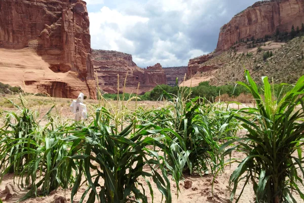
This canyon is home to Diné families who raise livestock, grow crops and live here. People have lived in these canyons for nearly 5,000 years, which is longer than anyone has lived continuously on the...
Located within the northern range of the Sonoran Desert lie two cliff dwellings that were occupied from 1300-1450 CE (common era). They represent a vibrant culture consisting of local and immigrant gr...
23 mi from route
~58 min detour
$10
near mile 267.4
Park data from the National Park Service API. Alerts update every 2 hours.
More Details
What kind of drive is this?
Expect a very different experience than a standard interstate cruise, as this route features zero percent highway travel. The drive is defined by its turn-heavy, local road personality, which keeps you engaged behind the wheel. You will navigate stretches of Main Street, Route 7, and the Chambers-Mexican Water Highway, meaning you won't encounter long, monotonous stretches of high-speed transit. In fact, the longest uninterrupted stretch on Main Street is 0 miles, reflecting the constant adjustments required along the path. Be prepared for a technical drive that demands steady focus as you traverse the desert terrain.
Only 22% highway — the rest is turn-by-turn surface driving.
29 navigation steps total — most of the decisions cluster near the start and finish.
Longest single stretch: 72.8 mi on South Beeline Highway.
How Hard Is This Drive?
5/10
Expect a hands-on drive with frequent turns and local roads rather than long highway stretches. You will hit about 19 points where you need to pay attention to lane position or signs. The trickiest moment comes around 1.9 miles in near US 191 / Chambers-Mexican Water Highway.
Driving Effort5/10
Moderate - straightforward overall, but long enough or busy enough to require pacing
Balances navigation complexity with total wheel time.
This drive requires moderate attention. Across 298.3 miles you will encounter 19 spots where lane choice or exit timing matters. Not difficult for experienced highway drivers, but worth previewing the tricky sections before you go.
Where does it get tricky?
The main spots that need attention: at 1.9 miles (US 191 / Chambers-Mexican Water Highway): Lane positioning matters here; at 32.2 miles (US 191): Roundabout - know your exit number before entering; at 121.9 miles (AZ 77): Exit ramp - move to the correct lane early. Multiple destination signs - pick the right one.
Elevation Profile
High-altitude sections with notable climbs
7,131 ft1,259 ft
Total Climb
2,747 ft
Total Descent
6,997 ft
Highest Point
7,131 ft
~191.8 mi in
Elevation Range
5,872 ft
Notable High Points
6,398 ft at ~63.9 miles+244 ft prominence
7,131 ft at ~191.8 miles+1,778 ft prominence
Towns Mentioned on Route Signs
Based on OSRM destination-sign hints, not a full list of every settlement the road passes.
On the drive from Chinle, AZ to Scottsdale, AZ, road signs begin pointing toward Heber along the way.
Canyon de Chelly National Monument (duh-SHAY) is a national monument within the Navajo Nation in Northern Arizona.
The park preserves ruins of the indigenous tribes that lived in the area, from the Ancestral Puebloans (formerly known as Anasazi) to the Navajo, and reflects one of the longest continuously inhabited landscapes of North America.
Scottsdale is a city in the state of Arizona. Scottsdale is home to many galleries, high quality resorts, and golf courses. It is also one of the wealthier parts of the Phoenix Metro Area.
Top landmarks
•Taliesin West — Frank Lloyd Wright's winter home and school, Scottsdale, Arizona, USA
•Scottsdale Museum of Contemporary Art — art museum
•Little Red Schoolhouse — now used as the Scottsdale Historical Museum, NRHP-listed
Doable as a same-day drive at 6h 22m. Total distance: 298.3 miles.
Family Friendly
Moderate complexity with 1 natural rest stops along the way.
Solo Traveler
6h 22m drive, plan rest stops for pacing.
Scenic Drive
Mostly surface roads route profile with national parks nearby.
Frequently Asked Questions
The longest stretch is about 72.8 miles on South Beeline Highway. The full list of main roads is in the Roads section above.
We did not find dedicated rest areas on this route. For a drive this long, plan bathroom and stretch breaks around gas stations, fast-food stops, or small-town downtowns — check the Nearby Places section for options.
It helps. This is a long drive, so arriving tired and in the dark compounds. If the last hour of the trip is on surface roads or mountain grades, aim to arrive at Scottsdale, AZ before sunset when you can. Check the Trip Plan for departure windows that land you in daylight.
Only with planning. This is a long drive for kids — consider splitting it into two days rather than pushing through. Plan at least 1 meaningful breaks. Dedicated rest areas are limited, so plan gas or food stops as your bathroom breaks.
The main spots that need attention: at 1.9 miles (US 191 / Chambers-Mexican Water Highway): Lane positioning matters here; at 32.2 miles (US 191): Roundabout - know your exit number before entering; at 121.9 miles (AZ 77): Exit ramp - move to the correct lane early. Multiple destination signs - pick the right one.
Yes — Petrified Forest National Park, Canyon de Chelly National Monument and Tonto National Monument. See the National Parks section for detour distances and tips on detours.
Not recommended in a single day. At 6.4 hours each way, a round trip means 12.7 hours of driving — that is an unsafe level of fatigue for most drivers. Plan at least one night at Scottsdale, AZ before the return drive.