Flying J Travel Center
0.1 mi from route
Compiled and reviewed by the US Trip Planner planning team at COD Solutions Oy · Last reviewed Jul 19, 2026 · Editorial standards
Drive Time
6h 37m
Distance
348.9 mi
562 km
Drive Score
9/10
Great drive
Same Day?
Yes, doable
Fuel Cost
$62
one way
EV Charging
Unknown
Estimated drive times based on typical traffic patterns. Actual times may vary with weather, construction, and real-time conditions.

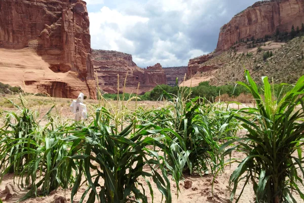
Chinle, AZ
Wikimedia Commons

Surprise, AZ
Wikimedia Commons
Embark on a 348.9-mile journey from Chinle, AZ, to Surprise, AZ, a trip that will take approximately 6 hours and 37 minutes. This drive is best tackled in a single day, making it a feasible option for a dedicated road trip. Expect to spend around $70 on fuel for this route, which primarily follows Arizona Veterans Highway and Arizona State Highway 264. The overall character of this drive is a turn-heavy local experience, so plan for a more engaged driving style. You'll be traveling within the Desert Southwest region for the entirety of your trip, staying within Arizona.
Trip Pace
Same-day drive is realistic
A same-day return is possible, but it will make for a full day on the road.
Break Rhythm
1 planned break
Plan on a short reset every 3 to 4 hours to stay fresh behind the wheel.
Midpoint
174.5 miles from Chinle, AZ
A natural place for your longest stop of the day , about 3h 30m into the drive .
| Road | Distance | Duration |
|---|---|---|
| Arizona Veterans Highway | 93 mi | 1h 33m |
| Purple Heart Trail | 61.2 mi | 1h 2m |
| Arizona State Highway 264 | 56.7 mi | 1h 5m |
| Winslow–Kayenta Highway | 55.5 mi | 1h 4m |
| Chambers-Mexican Water Highway | 30.3 mi | 45m |
| Black Canyon Freeway | 13.9 mi | 14m |
| Bob Stump Memorial Parkway | 12.3 mi | 14m |
| Phoenix–Cordes Junction Highway | 5.8 mi | 5m |
Step-by-step road directions between Chinle, AZ and Surprise, AZ.
Start on 4th Avenue
Turn left onto Main Street
At end of road, turn right onto N7
At end of road, turn left onto US 191
Enter roundabout onto AZ 246
Continue on AZ 246
Merge onto AZ 264
Turn left onto AZ 87
Continue on AZ 87
Continue on AZ 87
Take the ramp
Merge onto I 40; US 180
Take the exit
Keep slight left at fork
Merge onto I 17; AZ 89A
Continue on I 17
Continue on I 17
Continue on I 17
Continue on I 17
Take the exit
Turn right onto AZ 303 Loop
Take the exit
Continue on this road
Keep slight left at fork
Merge onto AZ 303 Loop
Take the exit
Continue on this road
Merge onto AZ 303 Loop
Take the exit
Continue on this road
Turn left onto North El Mirage Road
Turn right onto West Paradise Lane
Turn left onto North Nash Street
Arrive at destination
For this 6-hour, 37-minute drive, starting early in the morning is recommended to allow ample time for navigation and any unexpected delays. With only one recommended stop, you have flexibility in pacing your journey, but ensure you have sufficient fuel before departing Chinle, as services can be sparse. Keep an eye on your fuel gauge, especially during the 93-mile stretch on Arizona Veterans Highway, to avoid running low. Given the turn-heavy nature of this route, staying alert and focused on the road will make for a smoother and safer trip.
Morning Departure
Start early — leave by 6-7 AM to arrive at a reasonable hour.
Evening Departure
This is a long drive — plan for a morning departure or consider splitting it into two days.
This is a comfortable same-day trip.
Departure
Before you leave
Start with fuel, water, and navigation already sorted so the first hour feels easy.
First stop
Around 77 miles or 1h 40m in
Use this first pause for coffee, a restroom break, and a quick traffic check ahead.
Halfway reset
Around 174.5 miles or 3h 30m in
This is the best place for your longest stop, a real meal, and a full fuel check.
Final approach
Final hour starts around 5h 26m
Traffic, exits, and arrival timing usually matter more near Surprise, AZ than in the middle of the route.
Open the route before leaving Chinle, AZ so your first major turns are already loaded.
Leave with enough water and a charging cable within reach, not packed away.
Check your fuel range against the first long segment, especially if you are starting outside city service areas.
Day 1
Settle into the route from Chinle, AZ
This is one driving day of about 348.9 miles and 6h 37m.
Rest stops, refuel points, and overnight suggestions along this route.

Mid-route town
Meal stop
174 mi into the route
Best for: Lunch, fuel, and a longer reset
This sits close to the middle of the route, so it works well for the longest stop of the day.
A short stop after about 77 miles helps settle the day before fatigue starts building.
The midpoint is around 174.5 miles from Chinle, AZ, which is a good place for a longer meal and fuel stop.
Before the longest stretch
Fuel checkTop up before Arizona Veterans Highway if your tank is already low. That segment runs about 93 miles.
These stop ideas are pacing suggestions — the exact town or exit can change with traffic, hotel plans, and fuel range.
Picked by where they fit in your drive — first break, midpoint reset, final stretch.
Near the end, right off the route
Phoenix, Arizona
Hours: 9 am–4 pm
+16234651052
Visit websiteNear the start, right off the route
Chinle, Arizona
Hours: 8 am–5 pm
+19286745500
Visit websiteAround the midpoint, short detour
Winslow, AZ
Hours: Open 24 hours
Visit websiteLater in the drive, ~12 min detour
Rimrock, Arizona
Hours: 9 am–4:45 pm
+19285674521
Visit websitePlace data sourced from public business listings. Hours and availability may vary.
5 decision points cluster between mile 1.9 and 342.8 — GPS handles the exact turns, but know they're coming. Your lane choice matters more than the turn itself.
At end of road, turn left onto US 191 / Chambers-Mexican Water Highway
Lane positioning matters here
Keep slight left at fork toward I 17, AZ 89A South: Sedona, Phoenix
Highway fork - watch signs carefully. Multiple destination signs - pick the right one
Take the exit toward AZ 303 Loop South
Exit ramp - move to the correct lane early. Lane positioning matters here
Turn right onto AZ 303 Loop
Lane positioning matters here
Take the exit toward El Mirage Road
Exit ramp - move to the correct lane early. Lane positioning matters here
Regular Gas
$61.83 one way
$123.65 round trip
| Fuel Type | $/gal | One Way | Round Trip |
|---|---|---|---|
| midgrade | $4.82 | $66.21 | $132.42 |
| premium | $5.04 | $69.26 | $138.52 |
| diesel | $4.80 | $65.88 | $131.76 |
No toll roads detected on this route.
Estimated Trip Cost (one way, 1 person)
Fuel
$62
Meals
$25–$50
Total
$87–$112
Rough estimate based on US averages. Hotel $80–$140/night, meals $25–$50/day.
Estimated CO2 emission: 122.1 kg one way. Prices: EIA weekly data, 2026-07-13.
Driving Electric?
About $37 in charging · 1 stop · 66% less CO2
| Vehicle Type | kWh | Stops | DC Fast | Home Charge |
|---|---|---|---|---|
| Average EV | 104.7 | 1 | $36.63 | $16.75 |
| Efficient EV | 87.2 | 0 | $30.53 | $13.96 |
| EV Truck/SUV | 139.6 | 1 | $48.85 | $22.33 |
Gas CO2
122 kg
EV CO2
41 kg (66% less)
Plan for 1 charging stop. A 30-minute DC fast charge mid-route should be enough to complete the trip comfortably.
DC fast charging avg $0.35/kWh. Home charging avg $0.16/kWh. US grid CO2: 0.39 kg/kWh.
Current conditions at both ends of the drive.
Origin
Evening in Chinle on Saturday
Local time
7:32 PM
MDT
Current temp
62°F
Slight Chance Rain Showers
Flash Flood Warning
Flash Flood Warning issued July 17 at 3:29AM MST until July 17 at 6:30AM MST by NWS Flagstaff AZ
Flash Flood Warning
Flash Flood Warning issued July 17 at 2:52AM MST until July 17 at 5:00AM MST by NWS Flagstaff AZ
Destination
Evening in Surprise on Saturday
Local time
6:32 PM
MST
Current temp
77°F
Showers And Thunderstorms
Flash Flood Warning
Flash Flood Warning issued July 17 at 3:29AM MST until July 17 at 6:30AM MST by NWS Flagstaff AZ
Flash Flood Warning
Flash Flood Warning issued July 17 at 2:52AM MST until July 17 at 5:00AM MST by NWS Flagstaff AZ
Seasonal Notes
Summer travel usually means heavier construction, hotter rest stops, and busier weekend traffic around major cities.
Winter travel shortens daylight, so a route that looks manageable on paper can feel much longer after dark.
Holiday weekends tend to make both departure and arrival windows slower than the raw route time suggests.
Time zone
The destination clock does not match departure time, so double-check hotel check-in windows and late arrival plans.
Temperature spread
A meaningful temperature swing is a good cue to rethink layers, water, and how soon you want to arrive.
Road read
Start early — leave by 6-7 AM to arrive at a reasonable hour.
Weather data from the National Weather Service. Conditions may change; check closer to your travel date.
Worth a detour if your schedule allows.

National Monument
Established December 8, 1906, Montezuma Castle is the third National Monument dedicated to preserving Native American culture. This 20 room high-rise apartment, nestled into a towering limestone cliff...

National Monument
Since time immemorial, Indigenous Peoples have lived and traveled throughout Walnut Canyon’s dynamic landscape. Vibrant communities built their homes in the cliffs and farmed along the canyon’s rim. T...

National Monument
The lava flow lies on the land like a dream, a wonderland of rock. A thousand years ago the ground was torn open and lava erupted into the sky, forever changing the landscape and the lives of the peop...
National Monument
This canyon is home to Diné families who raise livestock, grow crops and live here. People have lived in these canyons for nearly 5,000 years, which is longer than anyone has lived continuously on the...

National Monument
Water flows under and through this landscape, feeding the growth of people and towns. The Verde Valley is watered by snowmelt, summer monsoons, and springs that well up from the ancient sedimentary ro...

National Monument
Nestled between the Painted Desert and ponderosa highlands of northern Arizona, Wupatki National Monument is an unlikely landscape for a thriving community. The early 1100's marked a time of cooler an...
Park data from the National Park Service API. Alerts update every 2 hours.
This route offers a turn-heavy local drive experience, with only 26% of the journey on highways. You'll encounter a dynamic road profile, shifting between various local and state routes. The longest uninterrupted stretch you'll experience is 93 miles along the Arizona Veterans Highway, offering a period of more consistent travel before the landscape of turns resumes. Be prepared for a driving experience that requires frequent adjustments and attention to navigation as you traverse these roads.
Expect a hands-on drive with frequent turns and local roads rather than long highway stretches. This route has several spots where lane changes, forks, or exits need your full attention. The trickiest moment comes around 1.9 miles in near US 191 / Chambers-Mexican Water Highway.
High effort - long or complex enough to need steady focus all day
Balances navigation complexity with total wheel time.
This is a demanding drive. With 23 significant decision points across 348.9 miles, you will need to stay alert - especially through interchange areas and urban stretches. Consider splitting it into segments if you are not comfortable with fast highway navigation.
Where does it get tricky?
The main spots that need attention: at 1.9 miles (US 191 / Chambers-Mexican Water Highway): Lane positioning matters here; at 210.5 miles: Highway fork - watch signs carefully. Multiple destination signs - pick the right one; at 327.5 miles: Exit ramp - move to the correct lane early. Lane positioning matters here.
High-altitude sections with notable climbs
Total Climb
3,064 ft
Total Descent
7,399 ft
Highest Point
6,716 ft
~224.3 mi in
Elevation Range
5,542 ft
Notable High Points
Based on OSRM destination-sign hints, not a full list of every settlement the road passes.
Between Chinle, AZ and Surprise, AZ, road signs point toward Flagstaff and Phoenix.
Flagstaff
Phoenix
Tagged by where each one fits in your drive — first break, midpoint, final stretch.
Cafe
Near the end, short detour
Sun City West, AZ
Cuisine: coffee_shop
Visit websiteCafe
Near the end, short detour
Cafe
Near the end, short detour
Cuisine: coffee_shop
Restaurant
Near the end, right off the route
Surprise, AZ
Cuisine: pizza
Hours: Su-Th 11:00-22:00; Fr 11:00-23:00; Sa 10...
Visit websiteFast_food
Near the end, right off the route
El Mirage, AZ
Cuisine: pizza
Visit websiteFast_food
Near the end, short detour
Surprise, AZ
Cuisine: burger
Hours: Mo-Su 11:00-22:00
Visit websiteRestaurant
Near the start, short detour
Chinle, AZ
Cuisine: pizza
Visit websiteFast_food
Near the start, right off the route
Restaurant
Near the end, short detour
Surprise, AZ
Cuisine: chinese
Hours: Mo-Su 12:00-22:30
Visit websiteAttraction
Near the end, short detour
Viewpoint
Near the start, short detour
Viewpoint
Near the start, short detour
Yes
Around the midpoint, short detour
Winslow, AZ
Cuisine: regional;western;fine_dining
Visit websiteArtwork
Around the midpoint, short detour
Artwork
Around the midpoint, short detour
Memorial
Around the midpoint, short detour
Ruins
Around the midpoint, short detour
Artwork
Around the midpoint, short detour
Hotel
Near the start, right off the route
Motel
Around the midpoint, short detour
Motel
Around the midpoint, short detour
Guest_house
Around the midpoint, short detour
AZ
Motel
Around the midpoint, short detour
Motel
Around the midpoint, short detour
Points of interest from OpenStreetMap contributors. Listings may not reflect current hours or availability.
Canyon de Chelly National Monument (duh-SHAY) is a national monument within the Navajo Nation in Northern Arizona. The park preserves ruins of the indigenous tribes that lived in the area, from the Ancestral Puebloans (formerly known as Anasazi) to the Navajo, and reflects one of the longest continuously inhabited landscapes of North America.
Founded 1937
Sun City is a suburb 20 miles (30km) northwest of downtown Phoenix, Arizona. It was built as a planned retirement community in Maricopa County in the 1960s. An adjacent retirement community Sun City West was built in the late 1970s; there is also a Sun City Grand. Directly northwest of the three "Sun City" suburbs is Surprise, Arizona.
City content from Wikivoyage (CC BY-SA 4.0) and Wikidata (CC0).
Weekend Trip
Doable as a same-day drive at 6h 37m. Total distance: 348.9 miles.
Family Friendly
Moderate complexity with 1 natural rest stops along the way.
Solo Traveler
6h 37m drive, plan rest stops for pacing.
Scenic Drive
Mostly surface roads route profile with national parks nearby.
Compiled by the US Trip Planner planning team at COD Solutions Oy from open government datasets — OSRM over OpenStreetMap for geometry, EIA for fuel prices, USGS 3DEP for elevation, and NPS for national parks. See our methodology for refresh cadence and limitations.
Was this helpful?
Thanks for your feedback!
Your tip has been submitted. Thanks!
/500
Recent Tips
·
Explore more options from Chinle, AZ or browse trips ending in Surprise, AZ.
Looking for more statewide routes? Browse AZ road trips.