Spanning 207 miles through the Mountain West, the drive from Cedar City to Provo takes approximately 3 hours and 27 minutes. This route functions perfectly as a single-day trip, allowing you to reach your destination without the need for an overnight stay. Expect to budget roughly $33 for fuel to cover the distance between these two Utah hubs. You will navigate via Veterans Memorial Highway, Main Street, and South University Avenue to complete the journey. Because the entire trip remains within the same region, you can anticipate a consistent travel experience from start to finish. It is a straightforward trek that balances efficiency with the practical reality of navigating local roads.
Trip Pace
Same-day drive is realistic
A same-day return is realistic if you keep stops short.
Break Rhythm
1 planned break
A short stop every 2 to 3 hours is enough for this drive.
Midpoint
103.5 miles from Cedar City, UT
A natural place for your longest stop of the day
, about 1h 43m into the drive
.
Main Roads
Road
Distance
Duration
Veterans Memorial Highway
200.6 mi
3h 15m
Main Street
3.8 mi
5m
South University Avenue
1.9 mi
4m
100 North
<0.1 mi
<1m
North 100 East
<0.1 mi
<1m
Center Street
<0.1 mi
<1m
Longest stretch:
Veterans Memorial Highway
— 200.6 mi, about 3h 15m
Traffic on I-15
Hour-of-day weekday pattern from 172 FHWA count stations on your route.
Peak
4 PM
~2,817 veh/hr typical
· worst 3,448
Quietest
2 AM
~151 veh/hr
Peak-to-quiet ratio
18.7×
busier at peak than in the quiet hours
12a6anoon6p11p
Averaged across 79 weeks of 2023 FHWA Travel Monitoring Analysis System data. Weekday hours only (Mon–Fri).
Turn-by-Turn Driving Directions
Step-by-step road directions between Cedar City, UT and Provo, UT.
1
Start on I 15 Bus; SR 130
3.8 mi·5 min·Main Street
2
Take the ramp
0.3 mi·38 sec
Toward I 15 North
3
Merge onto I 15
201 mi·3 hr 15 min·Veterans Memorial Highway
Use the straight / slight right lanes.
4
Take the exit
0.3 mi·38 sec
Exit 263Toward US 189 North: University AveUse the straight / slight right lanes.
5
Continue on US 189
1.9 mi·4 min·South University Avenue
Use the left / straight / right lanes.
6
Turn right onto 100 North
482 ft·18 sec·100 North
7
Turn right onto North 100 East
479 ft·20 sec·North 100 East
8
Turn right onto Center Street
466 ft·28 sec·Center Street
9
Arrive at destination
Center Street
Trip Plan
Since this is a relatively short drive, you have plenty of flexibility to plan your departure time around your personal schedule. With only one planned stop required, try to pace your trip early to avoid peak traffic as you approach the city limits. Keep in mind that the lack of highway miles means your travel time is more sensitive to local traffic patterns, so check your navigation app before heading out. Since you are budgeting about $33 for fuel, it is wise to fill up in Cedar City before you get onto the longer stretches of Veterans Memorial Highway. Taking advantage of that single planned stop will help you stay fresh behind the wheel for the duration of the 207-mile trek.
Morning Departure
An early start around 7-8 AM gets you there with plenty of daylight left.
Evening Departure
A late afternoon start means arriving after dark. Morning is better.
You can normally do this drive in one day.
Plan roughly 1 meaningful break for fuel, food, and rest.
The halfway point lands around 103.5 miles from Cedar City, UT, or about 1h 43m into the drive.
The longest continuous stretch on this route runs about 200.6 miles.
This is a comfortable same-day trip.
Departure
Before you leave
Start with fuel, water, and navigation already sorted so the first hour feels easy.
First stop
Around 46 miles or 47m in
Use this first pause for coffee, a restroom break, and a quick traffic check ahead.
Halfway reset
Around 103.5 miles or 1h 43m in
This is the best place for your longest stop, a real meal, and a full fuel check.
Final approach
Final hour starts around 2h 47m
Traffic, exits, and arrival timing usually matter more near Provo, UT than in the middle of the route.
Before You Leave
+
Open the route before leaving Cedar City, UT so your first major turns are already loaded.
+
Leave with enough water and a charging cable within reach, not packed away.
+
Check your fuel range against the first long segment, especially if you are starting outside city service areas.
Day 1
Settle into the route from Cedar City, UT
This is one driving day of about 207 miles and 3h 27m.
Your first comfortable stop window is around 46 miles from Cedar City, UT.
This route can stay practical as a one-day drive if traffic stays reasonable.
Plan about 1 real break rather than only quick fuel stops.
The longest stretch is on Veterans Memorial Highway for about 200.6 miles.
Where to Stop
Rest stops, refuel points, and overnight suggestions along this route.
Place data sourced from public business listings. Hours and availability may vary.
Heads-up: tricky spots
5 of 6
5 decision points cluster between mile 3.8 and 206.9 — GPS handles the exact turns, but know they're coming. Your lane choice matters more than the turn itself.
4
3.8 mi into trip|~5m in
Take the ramp toward I 15 North
Navigation decision point
Toward I 15 North
5
4.1 mi into trip|~6m in|I 15 / Veterans Memorial Highway
Merge onto I 15 / Veterans Memorial Highway
Merge point - match speed before joining. Lane positioning matters here
Use the straight / slight right lanes.
7
204.6 mi into trip|~3h 21m in
Take the exit toward US 189 North: University Ave
Exit ramp - move to the correct lane early. Lane positioning matters here
Use the straight / slight right lanes.
Exit 263
Toward US 189 North: University Ave
4
206.8 mi into trip|~3h 26m in|100 North
Turn right onto 100 North
Navigation decision point
5
206.9 mi into trip|~3h 27m in|Center Street
Turn right onto Center Street
Navigation decision point
Fuel & Cost
Regular Gas
$37.53 one way
$75.06 round trip
$4.61/gal25.4 MPG avg72 kg CO2
Fuel Type
$/gal
One Way
Round Trip
midgrade
$4.82
$39.31
$78.63
premium
$5.13
$41.79
$83.58
diesel
$6.28
$51.15
$102.29
No toll roads detected on this route.
Estimated Trip Cost (one way, 1 person)
Fuel
$38
Meals
$25–$50
Total
$63–$88
Rough estimate based on US averages. Hotel $80–$140/night, meals $25–$50/day.
Estimated CO2 emission: 72.4 kg one way.
Prices: EIA weekly data, 2026-10-19.
Driving Electric?
About $22 in charging
· 0 stops
· 67% less CO2
Vehicle Type
kWh
Stops
DC Fast
Home Charge
Average EV
62.1
0
$21.74
$9.94
Efficient EV
51.8
0
$18.11
$8.28
EV Truck/SUV
82.8
1
$28.98
$13.25
Gas CO2
72 kg
EV CO2
24 kg (67% less)
This trip is well within single-charge range for most EVs. No charging stops needed if you start fully charged.
DC fast charging avg $0.35/kWh. Home charging avg $0.16/kWh. US grid CO2: 0.39 kg/kWh.
Travel Intel
Current conditions at both ends of the drive.
Forecast as of Oct 19, 2026
Origin
Cedar City, UT
Morning
in Cedar City on Thursday
Local time
6:11 AM
MDT
Current temp
62°F
Partly Sunny then Slight Chance Showers And Thunderstorms
SSE 3 to 7 mph28% chanceLive forecast
Destination
Provo, UT
Morning
in Provo on Thursday
Local time
6:11 AM
MDT
Current temp
70°F
Mostly Sunny
SE 3 mph14% chanceLive forecast
63°F
Fillmore, UT
104 mi in
Seasonal Notes
Summer travel usually means heavier construction, hotter rest stops, and busier weekend traffic around major cities.
Winter travel shortens daylight, so a route that looks manageable on paper can feel much longer after dark.
Holiday weekends tend to make both departure and arrival windows slower than the raw route time suggests.
Time zone
Same local time
Origin and destination are on the same clock, so arrival timing is easier to judge at a glance.
Temperature spread
8 degrees warmer at arrival
A meaningful temperature swing is a good cue to rethink layers, water, and how soon you want to arrive.
Road read
3h 27m on the road
The weather snapshot is not static. If you are leaving later, give both cities one more quick forecast check before departure.
Weather data from the National Weather Service. Conditions may change; check closer to your travel date.
National Parks Near This Route
Worth a detour if your schedule allows.
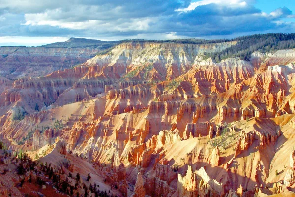
Cedar Breaks National Monument
National Monument
Crowning the Grand Staircase, Cedar Breaks sits at over 10,000 feet and looks down into a half-mile deep geologic amphitheater. Come wander among timeless bristlecone pines, stand in lush meadows of w...
12 mi from route
~30 min detour
$10
Danger: State Route 148 Closed Through Cedar Breaks National Monument
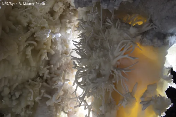
The visitor center, caves, and cave tours have not yet opened for the 2026 season. Hike your way past stunning vistas to explore a hidden underground world. Taste the thrill of caving as you twist and...
Follow the paths where people have walked for thousands of years. Gaze up at massive sandstone cliffs of cream, pink, and red that soar into a brilliant blue sky. Experience the tall, stretching walls...
Park data from the National Park Service API. Alerts update every 2 hours.
More Details
What kind of drive is this?
Expect a turn-heavy local drive rather than a monotonous interstate cruise, as this route features a 0% highway share. You will spend the vast majority of your time—specifically 200.6 miles—on Veterans Memorial Highway, which serves as the longest uninterrupted stretch of the trip. The road’s personality is defined by its local character, requiring your full attention as you transition between different road types. Unlike high-speed transit corridors, this drive demands a more engaged driving style due to the frequent turns. You will find that the feel of the road changes as you move away from Cedar City and eventually navigate into the urban environment of Provo.
Only 0% highway — the rest is turn-by-turn surface driving.
9 navigation steps total — most of the decisions cluster near the start and finish.
Longest single stretch: 200.6 mi on Veterans Memorial Highway.
How Hard Is This Drive?
3/10
Expect a hands-on drive with frequent turns and local roads rather than long highway stretches. There are only a few real navigation decisions along the way. The trickiest moment comes around 3.8 miles in.
Driving Effort3/10
Easy - simple navigation with a manageable amount of wheel time
Balances navigation complexity with total wheel time.
This is a straightforward 3h 27m drive. You will face about 6 decision points, but nothing that requires special attention if you follow navigation.
Where does it get tricky?
The main spots that need attention: at 3.8 miles: Navigation decision point; at 4.1 miles (I 15 / Veterans Memorial Highway): Merge point - match speed before joining. Lane positioning matters here; at 204.6 miles: Exit ramp - move to the correct lane early. Lane positioning matters here.
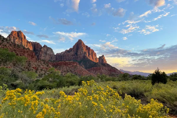
Cedar City is a small city in Dixie, Utah, and is a good place to stock up on supplies before heading into beautiful wilderness areas stretching out in all directions. The city is sandwiched between mountain ranges covered by Dixie National Forest, while further to the southwest lie the remotest areas of Zion National Park, and to the east Cedar Breaks National Monument and Bryce Canyon National Park.
Provo, a city in the Wasatch Range region of the state of Utah in the United States of America, is known as a base for exploring the surrounding countryside and national parks. Approximately 90% of the residents are members of the Church of Jesus Christ of Latter-day Saints (LDS or Mormon), compared to about 65% of the state as a whole. It is also the location of Brigham Young University, an LDS-owned university; the public Utah Valley University is located in the adjacent city of Orem.
Provo has a population of about 115,000 people, but the Provo-Orem metropolitan area that encompasses Utah Valley is home to over half a million people. Other cities in the valley are very accessible, especially Orem, which sits side-by-side with Provo. Because of Orem's proximity, visitors to Provo should also look at things to do in Orem, as well as places to eat and sleep, depending on their needs.
Top landmarks
•Brigham Young University Museum of Art — art museum in Provo, Utah, United States
•Provo City Center Temple — temple of The Church of Jesus Christ of Latter-day Saints in Provo, Utah, United...
•Hotel Roberts — former hotel in Provo, Utah, United States
Mostly surface roads route profile with national parks nearby.
Frequently Asked Questions
The longest stretch is about 200.6 miles on Veterans Memorial Highway. The full list of main roads is in the Roads section above.
We did not find dedicated rest areas on this route. For a drive this long, plan bathroom and stretch breaks around gas stations, fast-food stops, or small-town downtowns — check the Nearby Places section for options.
Yes, with realistic expectations. Build in a stop roughly every 2 hours, have snacks and activities ready, and check the Nearby Places tabs for kid-friendly stops along the way.
The main spots that need attention: at 3.8 miles: Navigation decision point; at 4.1 miles (I 15 / Veterans Memorial Highway): Merge point - match speed before joining. Lane positioning matters here; at 204.6 miles: Exit ramp - move to the correct lane early. Lane positioning matters here.
Yes — Cedar Breaks National Monument, Timpanogos Cave National Monument and Zion National Park. See the National Parks section for detour distances and tips on detours.
Possible but tiring. At 3.5 hours each way, an in-and-out day trip would put you behind the wheel for 6.9 hours — manageable with a long break at Provo, UT, but most travelers stay overnight.