Origin
Boothbay, ME
Late night in Boothbay on Sunday
Local time
12:29 AM
EDT
Current temp
37°F
Unavailable
Live forecast
Compiled and reviewed by the US Trip Planner planning team at COD Solutions Oy · Last reviewed Apr 19, 2026 · Editorial standards
Drive Time
1h 47m
Distance
59.8 mi
96 km
Drive Score
9/10
Great drive
Same Day?
Yes, doable
Fuel Cost
$10
one way
EV Charging
Unknown
Estimated drive times based on typical traffic patterns. Actual times may vary with weather, construction, and real-time conditions.

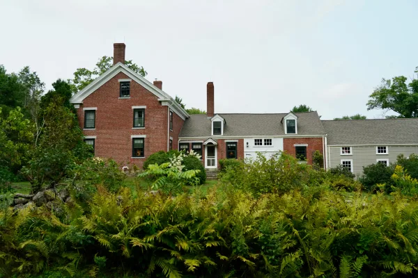
Boothbay, ME
Phil Evenden

City of Portland, ME
Brett Sayles
This 59.8-mile journey from Boothbay, ME, to the City of Portland, ME, is a 5-hour and 14-minute adventure that can easily be tackled in a single day. You'll navigate primarily via Boothbay Road and Route 1, with Main Street playing a role as you get closer to your destination. With a fuel cost estimated at around $10, this trip is quite budget-friendly. The drive is characterized by frequent turns, suggesting a more local, less highway-centric experience. Given its manageable distance and duration, it's well-suited for a day trip without the need to split it over multiple days. You'll be staying within the Northeast region for this entire drive.
Trip Pace
Same-day drive is realistic
A same-day return is realistic if you keep stops short.
Midpoint
29.9 miles from Boothbay, ME
A natural place for your longest stop of the day , about 48m into the drive .
| Road | Distance | Duration |
|---|---|---|
| I 295 | 21.1 mi | 24m |
| Leeman Highway | 9.2 mi | 13m |
| Route 1 | 6.1 mi | 8m |
| Wiscasset Road | 4.8 mi | 8m |
| Boothbay Road | 4.7 mi | 7m |
| Bath Road | 4 mi | 7m |
| Portland - Peaks Island | 2.5 mi | 20m |
| Main Street | 1.5 mi | 3m |
Step-by-step road directions between Boothbay, ME and City of Portland, ME.
Start on ME 27
Continue on ME 27
Turn left onto US 1; ME 27
Continue on US 1; ME 27
Turn straight onto US 1
Continue on US 1
Continue on US 1
Continue on US 1
Turn right onto US 1
Keep slight right at fork
Keep slight left at fork
Merge onto I 295
Take the exit onto US 1A
Continue on Maine State Pier
Turn slight right
Turn straight onto Portland - Peaks Island
Continue
Continue on Welch Street
Turn right onto Oakland Avenue
Turn slight left onto Whitehead Street
Continue on Seashore Avenue
Continue on Seashore Avenue
Arrive at destination
Since this trip is a manageable 59.8 miles and takes about 5 hours and 14 minutes, you have a lot of flexibility with when you depart. Leaving earlier in the morning could help you avoid any potential local traffic buildup, especially as you approach the City of Portland. With only one recommended stop and a low fuel cost of about $10, you can easily complete this drive in one go. Pay attention to the numerous turns indicated by the route's profile; it's a good idea to have your navigation set up before you leave Boothbay to ensure you don't miss any key turns on Boothbay Road or Route 1.
Morning Departure
Leave by 9 AM and you'll arrive before lunch.
Evening Departure
Even a 4 PM departure gets you there before dark in summer.
This is a comfortable same-day trip.
Departure
Before you leave
Start with fuel, water, and navigation already sorted so the first hour feels easy.
First stop
Around 13 miles or 22m in
Use this first pause for coffee, a restroom break, and a quick traffic check ahead.
Halfway reset
Around 29.9 miles or 48m in
This is the best place for your longest stop, a real meal, and a full fuel check.
Final approach
Final hour starts around 1h 15m
Traffic, exits, and arrival timing usually matter more near City of Portland, ME than in the middle of the route.
Open the route before leaving Boothbay, ME so your first major turns are already loaded.
Day 1
Settle into the route from Boothbay, ME
This is one driving day of about 59.8 miles and 1h 47m.
Rest stops, refuel points, and overnight suggestions along this route.

Mid-route town
Meal stop
30 mi into the route
Best for: Lunch, fuel, and a longer reset
This sits close to the middle of the route, so it works well for the longest stop of the day.
A short stop after about 13 miles helps settle the day before fatigue starts building.
The midpoint is around 29.9 miles from Boothbay, ME, which is a good place for a longer meal and fuel stop.
These stop ideas are pacing suggestions — the exact town or exit can change with traffic, hotel plans, and fuel range.
5 decision points cluster between mile 30.2 and 58.9 — GPS handles the exact turns, but know they're coming. Your lane choice matters more than the turn itself.
Turn right onto US 1 / Pleasant Street
Lane positioning matters here
Keep slight left at fork toward I 295 South: Freeport, Portland
Highway fork - watch signs carefully. Multiple destination signs - pick the right one
Merge onto I 295
Merge point - match speed before joining. Lane positioning matters here
Take the exit onto US 1A toward US 1A
Exit ramp - move to the correct lane early. Lane positioning matters here
Turn right onto Oakland Avenue
Navigation decision point
Regular Gas
$9.63 one way
$19.25 round trip
| Fuel Type | $/gal | One Way | Round Trip |
|---|---|---|---|
| midgrade | $4.50 | $10.59 | $21.18 |
| premium | $4.86 | $11.45 | $22.90 |
| diesel | $5.61 | $13.20 | $26.41 |
No toll roads detected on this route.
Estimated Trip Cost (one way, 1 person)
Fuel
$10
Meals
$25–$50
Total
$35–$60
Rough estimate based on US averages. Hotel $80–$140/night, meals $25–$50/day.
Estimated CO2 emission: 20.9 kg one way. Prices: EIA weekly data, 2026-04-13.
Driving Electric?
About $6 in charging · 0 stops · 67% less CO2
| Vehicle Type | kWh | Stops | DC Fast | Home Charge |
|---|---|---|---|---|
| Average EV | 17.9 | 0 | $6.28 | $2.87 |
| Efficient EV | 15 | 0 | $5.23 | $2.39 |
| EV Truck/SUV | 23.9 | 0 | $8.37 | $3.83 |
Gas CO2
21 kg
EV CO2
7 kg (67% less)
This trip is well within single-charge range for most EVs. No charging stops needed if you start fully charged.
DC fast charging avg $0.35/kWh. Home charging avg $0.16/kWh. US grid CO2: 0.39 kg/kWh.
Current conditions at both ends of the drive.
Origin
Late night in Boothbay on Sunday
Local time
12:29 AM
EDT
Current temp
37°F
Unavailable
Destination
Late night in City of Portland on Sunday
Local time
12:29 AM
EDT
Current temp
43°F
Unavailable
37°F
Bath, ME
30 mi in
Seasonal Notes
Summer travel usually means heavier construction, hotter rest stops, and busier weekend traffic around major cities.
Winter travel shortens daylight, so a route that looks manageable on paper can feel much longer after dark.
Holiday weekends tend to make both departure and arrival windows slower than the raw route time suggests.
Time zone
Origin and destination are on the same clock, so arrival timing is easier to judge at a glance.
Temperature spread
A meaningful temperature swing is a good cue to rethink layers, water, and how soon you want to arrive.
Road read
Use the two city cards together: check the sky where you start, then compare it with the local time and temperature at arrival.
Weather data from the National Weather Service. Conditions may change; check closer to your travel date.
Worth a detour if your schedule allows.
National Monument
Known as the first woman to hold a presidential cabinet position and the “Woman behind the New Deal,” Frances Perkins championed many labor rights that Americans enjoy today, including safety standard...
Park data from the National Park Service API. Alerts update every 2 hours.
Expect a 'turn-heavy local drive' for this 59.8-mile stretch, with no highway share to speak of. This means you'll be dealing with a consistent series of turns and changes in direction rather than long, uninterrupted stretches of high-speed travel. The longest uninterrupted stretch is not a factor here, as the route is designed around local roads. As you progress from Boothbay toward Portland, you'll likely experience a change in scenery and traffic patterns as you transition from coastal Maine towns to the more urban environment of Portland.
This route mixes highway mileage with some local-road sections near the start or finish. You will hit about 7 points where you need to pay attention to lane position or signs. The trickiest moment comes around 30.2 miles in near US 1 / Pleasant Street.
Moderate - straightforward overall, but long enough or busy enough to require pacing
Balances navigation complexity with total wheel time.
This drive requires moderate attention. Across 59.8 miles you will encounter 7 spots where lane choice or exit timing matters. Not difficult for experienced highway drivers, but worth previewing the tricky sections before you go.
Where does it get tricky?
The main spots that need attention: at 30.2 miles (US 1 / Pleasant Street): Lane positioning matters here; at 32.1 miles: Highway fork - watch signs carefully. Multiple destination signs - pick the right one; at 33.8 miles (I 295): Merge point - match speed before joining. Lane positioning matters here.
Based on OSRM destination-sign hints, not a full list of every settlement the road passes.
On the drive from Boothbay, ME to City of Portland, ME, road signs begin pointing toward Portland along the way.
Portland
Weekend Trip
Doable as a same-day drive at 1h 47m. Total distance: 59.8 miles.
Family Friendly
Moderate complexity with 0 natural rest stops along the way.
Solo Traveler
1h 47m drive, comfortable solo distance.
First-Time Driver
Mostly highway driving (47%). Some complex stretches to watch for.
Scenic Drive
Mixed highway & surface route profile with national parks nearby.
Compiled by the US Trip Planner planning team at COD Solutions Oy from open government datasets — OSRM over OpenStreetMap for geometry, EIA for fuel prices, and NPS for national parks. See our methodology for refresh cadence and limitations.
Was this helpful?
Thanks for your feedback!
Your tip has been submitted. Thanks!
/500
Recent Tips
·
Explore more options from Boothbay, ME or browse trips ending in City of Portland, ME.
Looking for more statewide routes? Browse ME road trips.