Spanning 69.8 miles of Maine’s coastline, this drive from Biddeford to Damariscotta typically takes about 1 hour and 36 minutes. Because the trip is relatively short, it functions perfectly as a straightforward day trip, allowing you to reach your destination without the need for an overnight stay. You should budget approximately $11 for fuel to complete the journey. The route primarily utilizes I-295, Route 1, and Mill Street to navigate through the Northeast region. It is a practical, efficient path for travelers looking to move between these two coastal Maine communities quickly. Whether you are heading out for business or a quick getaway, the logistics are simple enough to manage in a single morning or afternoon.
Trip Pace
Same-day drive is realistic
A same-day return is realistic if you keep stops short.
Midpoint
34.9 miles from Biddeford, ME
A natural place for your longest stop of the day
, about 42m into the drive
.
Main Roads
Road
Distance
Duration
I 295
28.2 mi
34m
Route 1
11.3 mi
15m
Mill Street
9.2 mi
13m
Maine Turnpike
8.8 mi
9m
Bath Road
4 mi
7m
Main Street
3.9 mi
7m
North Street
1.4 mi
2m
Pleasant Street
1.2 mi
2m
Longest stretch:
I 295
— 28.2 mi, about 34m
Traffic on I-295
Hour-of-day weekday pattern from 39 FHWA count stations on your route.
Peak
4 PM
~2,557 veh/hr typical
· worst 3,064
Quietest
2 AM
~87 veh/hr
Peak-to-quiet ratio
29.4×
busier at peak than in the quiet hours
12a6anoon6p11p
Averaged across 52 weeks of 2023 FHWA Travel Monitoring Analysis System data. Weekday hours only (Mon–Fri).
Turn-by-Turn Driving Directions
Step-by-step road directions between Biddeford, ME and Damariscotta, ME.
1
Start on US 1 Alternate
0.9 mi·1 min·Main Street
2
Turn left onto ME 112
162 ft·5 sec·Beach Street
3
Continue on ME 5; ME 112
1.4 mi·2 min·North Street
4
Take the ramp
0.6 mi·1 min
Toward I 95 North: Portland
5
Merge onto I 95
8.8 mi·9 min·Maine Turnpike
6
Keep slight right at fork onto I 295
28 mi·34 min·I 295
Exit 44Toward Downtown PortlandUse the slight right lane.
7
Take the exit
1.3 mi·2 min
Exit 28Toward US 1: Brunswick, Bath, Coastal RouteUse the straight / slight right lanes.
8
Continue on US 1
1.2 mi·2 min·Pleasant Street
Use the left lane.
9
Turn left onto Mill Street
9.2 mi·13 min·Mill Street
Use the left lane.
10
Continue on US 1
1.0 mi·2 min·Main Street
11
Continue on US 1
4.9 mi·6 min·Route 1
12
Continue on US 1
4.0 mi·7 min·Bath Road
13
Continue on US 1; ME 27
0.5 mi·1 min·Main Street
14
Continue on US 1; ME 27
6.4 mi·9 min·Route 1
15
Take the exit onto US 1 BUS
0.5 mi·57 sec·Main Street
Toward US 1 BUS: Pemaquid Beach, Pemaquid, Damariscotta, Bristol
16
Continue on US 1 BUS
1.0 mi·1 min·Main Street
17
Arrive at destination
US 1 BUS
Trip Plan
Since the total drive time is under two hours, you have significant flexibility regarding your departure schedule. We recommend checking traffic patterns on I-295 before you head out, as highway congestion can occasionally impact your travel time. Because there are no mandatory stops scheduled in this 69.8-mile itinerary, feel free to pull over whenever you need a break rather than sticking to a rigid plan. Keep your $11 fuel budget in mind, and consider topping off your tank in Biddeford before you merge onto the interstate to avoid higher prices along the highway. Taking advantage of the short duration allows you to arrive in Damariscotta refreshed and ready for your next activity.
Morning Departure
Leave by 9 AM and you'll arrive before lunch.
Evening Departure
Even a 4 PM departure gets you there before dark in summer.
You can normally do this drive in one day.
You may only need one short stretch break if traffic stays light.
The halfway point lands around 34.9 miles from Biddeford, ME, or about 42m into the drive.
The longest continuous stretch on this route runs about 28.2 miles.
This is a comfortable same-day trip.
Departure
Before you leave
Start with fuel, water, and navigation already sorted so the first hour feels easy.
First stop
Around 15 miles or 18m in
Use this first pause for coffee, a restroom break, and a quick traffic check ahead.
Halfway reset
Around 34.9 miles or 42m in
This is the best place for your longest stop, a real meal, and a full fuel check.
Final approach
Final hour starts around 1h 19m
Traffic, exits, and arrival timing usually matter more near Damariscotta, ME than in the middle of the route.
Before You Leave
+
Open the route before leaving Biddeford, ME so your first major turns are already loaded.
Day 1
Settle into the route from Biddeford, ME
This is one driving day of about 69.8 miles and 1h 36m.
Your first comfortable stop window is around 15 miles from Biddeford, ME.
This route can stay practical as a one-day drive if traffic stays reasonable.
The longest stretch is on I 295 for about 28.2 miles.
Where to Stop
Rest stops, refuel points, and overnight suggestions along this route.
Place data sourced from public business listings. Hours and availability may vary.
Heads-up: tricky spots
5 of 7
5 decision points cluster between mile 2.3 and 68.3 — GPS handles the exact turns, but know they're coming. Your lane choice matters more than the turn itself.
4
2.3 mi into trip|~4m in
Take the ramp toward I 95 North: Portland
Navigation decision point
Toward I 95 North: Portland
8
11.6 mi into trip|~14m in|I 295
Keep slight right at fork onto I 295 toward Downtown Portland
Highway fork - watch signs carefully. Lane positioning matters here
Use the slight right lane.
Exit 44
Toward Downtown Portland
8
39.9 mi into trip|~49m in
Take the exit toward US 1: Brunswick, Bath, Coastal Route
Exit ramp - move to the correct lane early. Lane positioning matters here. Multiple destination signs - pick the right one
Use the straight / slight right lanes.
Exit 28
Toward US 1: Brunswick, Bath, Coastal Route
5
42.3 mi into trip|~53m in|Mill Street
Turn left onto Mill Street
Lane positioning matters here
Use the left lane.
5
68.3 mi into trip|~1h 34m in|US 1 BUS / Main Street
Take the exit onto US 1 BUS / Main Street toward US 1 BUS: Pemaquid Beach, Pemaquid, Damariscotta, Bristol
Exit ramp - move to the correct lane early. Multiple destination signs - pick the right one
Toward US 1 BUS: Pemaquid Beach, Pemaquid, Dama...
Fuel & Cost
Regular Gas
$10.95 one way
$21.91 round trip
$3.99/gal25.4 MPG avg24 kg CO2
Fuel Type
$/gal
One Way
Round Trip
midgrade
$4.48
$12.30
$24.60
premium
$4.81
$13.22
$26.45
diesel
$4.80
$13.18
$26.36
Estimated Tolls: $0.53
Maine Turnpike
(8.8 mi)$0.53
Toll estimates based on average 2024-2025 rates. EZ-Pass/SunPass discounts may lower the actual cost.
Estimated Trip Cost (one way, 1 person)
Fuel
$11
Tolls
$1
Meals
$25–$50
Total
$36–$61
Rough estimate based on US averages. Hotel $80–$140/night, meals $25–$50/day.
Estimated CO2 emission: 24.4 kg one way.
Prices: EIA weekly data, 2026-07-13.
Driving Electric?
About $7 in charging
· 0 stops
· 67% less CO2
Vehicle Type
kWh
Stops
DC Fast
Home Charge
Average EV
20.9
0
$7.33
$3.35
Efficient EV
17.5
0
$6.11
$2.79
EV Truck/SUV
27.9
0
$9.77
$4.47
Gas CO2
24 kg
EV CO2
8 kg (67% less)
This trip is well within single-charge range for most EVs. No charging stops needed if you start fully charged.
DC fast charging avg $0.35/kWh. Home charging avg $0.16/kWh. US grid CO2: 0.39 kg/kWh.
Travel Intel
Current conditions at both ends of the drive.
Forecast as of Jul 11, 2026
Origin
Biddeford, ME
Morning
in Biddeford on Sunday
Local time
11:28 AM
EDT
Current temp
62°F
Mostly Clear
NW 5 mph0% chanceLive forecast
Destination
Damariscotta, ME
Morning
in Damariscotta on Sunday
Local time
11:28 AM
EDT
Current temp
61°F
Clear
NW 0 to 5 mph0% chanceLive forecast
80°F
Brunswick, ME
35 mi in
Seasonal Notes
Summer travel usually means heavier construction, hotter rest stops, and busier weekend traffic around major cities.
Winter travel shortens daylight, so a route that looks manageable on paper can feel much longer after dark.
Holiday weekends tend to make both departure and arrival windows slower than the raw route time suggests.
Time zone
Same local time
Origin and destination are on the same clock, so arrival timing is easier to judge at a glance.
Temperature spread
1 degrees cooler at arrival
A meaningful temperature swing is a good cue to rethink layers, water, and how soon you want to arrive.
Road read
1h 36m on the road
The weather snapshot is not static. If you are leaving later, give both cities one more quick forecast check before departure.
Weather data from the National Weather Service. Conditions may change; check closer to your travel date.
National Parks Near This Route
Worth a detour if your schedule allows.
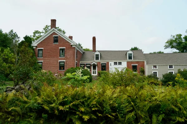
Frances Perkins National Monument
National Monument
Known as the first woman to hold a presidential cabinet position and the “Woman behind the New Deal,” Frances Perkins championed many labor rights that Americans enjoy today, including safety standard...
Park data from the National Park Service API. Alerts update every 2 hours.
More Details
What kind of drive is this?
This trip is a highway-focused drive, with 69% of your total mileage spent on high-speed roads. You will find your longest uninterrupted stretch on I-295, which covers 28.2 miles of the journey. As you progress from the interstate onto Route 1 and Mill Street, the character of the drive shifts from a fast-paced transit experience to more localized road conditions. Expect a consistent pace for the majority of the trip, though you should be prepared for the transition between major highway infrastructure and smaller thoroughfares as you approach Damariscotta. It is a functional, no-nonsense route that prioritizes efficiency over technical mountain driving or winding backroads.
69% highway — fuel and pacing are the main things to plan.
17 navigation steps total — most of the decisions cluster near the start and finish.
Longest single stretch: 28.2 mi on I 295.
How Hard Is This Drive?
3/10
This is a straightforward highway drive that stays mostly on I 295 and Route 1. There are only a few real navigation decisions along the way. The trickiest moment comes around 2.3 miles in.
Driving Effort3/10
Easy - simple navigation with a manageable amount of wheel time
Balances navigation complexity with total wheel time.
This is a straightforward 1h 36m drive. You will face about 7 decision points, but nothing that requires special attention if you follow navigation.
Where does it get tricky?
The main spots that need attention: at 2.3 miles: Navigation decision point; at 11.6 miles (I 295): Highway fork - watch signs carefully. Lane positioning matters here; at 39.9 miles: Exit ramp - move to the correct lane early. Lane positioning matters here. Multiple destination signs - pick the right one.
Elevation Profile
Mostly flat terrain
140 ft21 ft
Total Climb
365 ft
Total Descent
381 ft
Highest Point
140 ft
~49.8 mi in
Elevation Range
119 ft
Towns Mentioned on Route Signs
Based on OSRM destination-sign hints, not a full list of every settlement the road passes.
Between Biddeford, ME and Damariscotta, ME, road signs point toward Portland, Bath and Coastal Route.
Biddeford is a city located in southern Maine. It was once a booming town full of textile mills, the service and manufacturing industries are the major city employers. Approximately 33% of the population speaks French, due to the influx of French-Canadian immigrants to the city's mills in the 18th and early 19th centuries.
Top landmarks
•Biddeford City Hall — rathaus in Biddeford, United States of America
•Biddeford Main Street Historic District — historic district in Maine, United States
•St. Andre's Parish — historic church in Maine, United States
The longest stretch is about 28.2 miles on I 295. The full list of main roads is in the Roads section above.
Expect about $0.53 in tolls one way, starting with Maine Turnpike. Most Northeast and Midwest toll agencies accept E-ZPass; in the West and Texas, transponders like TxTag or FasTrak apply. If you do not have a transponder, cashless tolling plates will mail a bill to the vehicle's registered address — usually with a surcharge, so a rental-car toll pass is often cheaper than paying by mail.
Yes. At under 2 hours behind the wheel, this works well for families — plan one quick stop if you have younger kids.
Mostly yes along the main roads, but rural stretches through ME can have sparse or no coverage. Before you leave, download offline Google Maps or Apple Maps for the route, and consider downloading music or podcasts instead of streaming. If you depend on data for navigation, keep a paper backup of the turn-by-turn directions.
The main spots that need attention: at 2.3 miles: Navigation decision point; at 11.6 miles (I 295): Highway fork - watch signs carefully. Lane positioning matters here; at 39.9 miles: Exit ramp - move to the correct lane early. Lane positioning matters here. Multiple destination signs - pick the right one.
Yes — Frances Perkins National Monument. See the National Parks section for detour distances and tips on detours.
Yes. A round trip is manageable in a single day if you plan a break at Damariscotta, ME before heading back.