Ajo, AZ to Surprise, AZ is 106.7 miles and takes about 2h 19m via Gila Bend-Lukeville Highway and Arizona State Highway 85, with a fuel budget near $21 and enough daylight to finish in a day. This drive stays within Arizona's Desert Southwest region, offering a straightforward journey through arid landscapes. It’s a practical route for connecting these two communities, suitable for a single day of travel without feeling rushed. Consider this trip if you need a direct path between Ajo and Surprise, keeping the focus on efficient transit.
Trip Pace
Same-day drive is realistic
A same-day return is realistic if you keep stops short.
Midpoint
53.4 miles from Ajo, AZ
A natural place for your longest stop of the day
, about 1h 10m into the drive
.
Main Roads
Road
Distance
Duration
Gila Bend-Lukeville Highway
32.1 mi
37m
Arizona State Highway 85
28.1 mi
32m
Pearl Harbor Memorial Highway
10.4 mi
10m
Bob Stump Memorial Parkway
10.1 mi
11m
North Ajo Gila Bend Highway
8.1 mi
10m
West Greenway Road
5 mi
9m
South Oglesby Road
3.7 mi
5m
West Pima Street
2.1 mi
4m
Longest stretch:
Gila Bend-Lukeville Highway
— 32.1 mi, about 37m
Turn-by-Turn Driving Directions
Step-by-step road directions between Ajo, AZ and Surprise, AZ.
1
Start on AZ 85
0.1 mi·27 sec·East Taladro Avenue
2
Continue on AZ 85
0.2 mi·28 sec·North Pizal Lane
3
Continue on AZ 85
0.5 mi·1 min·West Solana Avenue
4
Continue on AZ 85
1.0 mi·2 min·North 2nd Avenue
5
Continue on AZ 85
8.1 mi·10 min·North Ajo Gila Bend Highway
6
Continue on AZ 85
32 mi·37 min·Gila Bend-Lukeville Highway
7
At end of road, turn left onto I 8 Bus; AZ 85; US 80 Hist
2.1 mi·4 min·West Pima Street
8
Continue on AZ 85
0.7 mi·1 min·Gila Bend-Buckeye Highway
9
Turn left onto AZ 85
0.3 mi·44 sec·Gila Bend-Buckeye Highway
Use the left lane.
10
Continue on AZ 85
28 mi·32 min·Arizona State Highway 85
11
Continue on AZ 85; US 80 Hist
1.0 mi·1 min·Gila Bend-Buckeye Highway
12
Continue on AZ 85
3.7 mi·5 min·South Oglesby Road
13
Keep slight right at fork
0.7 mi·1 min
Toward I 10 East: PhoenixUse the slight right lane.
14
Merge onto I 10
10 mi·10 min·Pearl Harbor Memorial Highway
Use the straight / slight right lanes.
15
Take the exit
1.7 mi·2 min
Exit 124AToward AZ 303 Loop NorthUse the slight right lane.
16
Merge onto AZ 303 Loop
10 mi·11 min·Bob Stump Memorial Parkway
Use the straight / slight right lanes.
17
Take the exit
0.4 mi·50 sec
Exit 115Toward Greenway RoadUse the slight right lane.
18
Turn right onto West Greenway Road
5.0 mi·9 min·West Greenway Road
Use the straight / left / right lanes.
19
Turn left onto West Greenway Road
279 ft·14 sec·West Greenway Road
Use the left lane.
20
Turn left onto Santa Fe Drive
0.3 mi·32 sec·Santa Fe Drive
Use the left lane.
21
Turn right onto North Nash Street
0.3 mi·50 sec·North Nash Street
22
Arrive at destination
North Nash Street
Trip Plan
Given the manageable 2h 19m duration, you can comfortably complete this trip in one day. Aim to depart in the morning to take advantage of daylight and allow for any unexpected delays. While there are no designated stops mentioned, you'll find opportunities for fuel and rest along Arizona State Highway 85. Keep an eye on your fuel gauge, especially before the 32.1-mile stretch on the Gila Bend-Lukeville Highway, as services might be less frequent in that section. This shorter drive offers flexibility, so you can adjust your departure time as needed.
Morning Departure
Leave by 9 AM and you'll arrive before lunch.
Evening Departure
Even a 4 PM departure gets you there before dark in summer.
You can normally do this drive in one day.
You may only need one short stretch break if traffic stays light.
The halfway point lands around 53.4 miles from Ajo, AZ, or about 1h 10m into the drive.
The longest continuous stretch on this route runs about 32.1 miles.
This is a comfortable same-day trip.
Departure
Before you leave
Start with fuel, water, and navigation already sorted so the first hour feels easy.
First stop
Around 23 miles or 31m in
Use this first pause for coffee, a restroom break, and a quick traffic check ahead.
Halfway reset
Around 53.4 miles or 1h 10m in
This is the best place for your longest stop, a real meal, and a full fuel check.
Final approach
Final hour starts around 1h 51m
Traffic, exits, and arrival timing usually matter more near Surprise, AZ than in the middle of the route.
Before You Leave
+
Open the route before leaving Ajo, AZ so your first major turns are already loaded.
+
Leave with enough water and a charging cable within reach, not packed away.
+
Check your fuel range against the first long segment, especially if you are starting outside city service areas.
Day 1
Settle into the route from Ajo, AZ
This is one driving day of about 106.7 miles and 2h 19m.
Your first comfortable stop window is around 23 miles from Ajo, AZ.
This route can stay practical as a one-day drive if traffic stays reasonable.
The longest stretch is on Gila Bend-Lukeville Highway for about 32.1 miles.
Where to Stop
Rest stops, refuel points, and overnight suggestions along this route.
Place data sourced from public business listings. Hours and availability may vary.
Heads-up: tricky spots
5 of 11
5 decision points cluster between mile 42 and 106.2 — GPS handles the exact turns, but know they're coming. Your lane choice matters more than the turn itself.
5
42 mi into trip|~53m in|I 8 Bus; AZ 85; US 80 Hist / West Pima Street
At end of road, turn left onto I 8 Bus; AZ 85; US 80 Hist / West Pima Street
Navigation decision point
7
77.9 mi into trip|~1h 40m in
Keep slight right at fork toward I 10 East: Phoenix
Highway fork - watch signs carefully. Lane positioning matters here
Use the slight right lane.
Toward I 10 East: Phoenix
7
89 mi into trip|~1h 52m in
Take the exit toward AZ 303 Loop North
Exit ramp - move to the correct lane early. Lane positioning matters here
Use the slight right lane.
Exit 124A
Toward AZ 303 Loop North
7
100.8 mi into trip|~2h 7m in
Take the exit toward Greenway Road
Exit ramp - move to the correct lane early. Lane positioning matters here
Use the slight right lane.
Exit 115
Toward Greenway Road
7
106.2 mi into trip|~2h 17m in|Santa Fe Drive
Turn left onto Santa Fe Drive
Lane positioning matters here
Use the left lane.
Fuel & Cost
Regular Gas
$21.26 one way
$42.51 round trip
$5.06/gal25.4 MPG avg37 kg CO2
Fuel Type
$/gal
One Way
Round Trip
midgrade
$5.36
$22.50
$44.99
premium
$5.59
$23.49
$46.97
diesel
$5.61
$23.56
$47.12
No toll roads detected on this route.
Estimated Trip Cost (one way, 1 person)
Fuel
$21
Meals
$25–$50
Total
$46–$71
Rough estimate based on US averages. Hotel $80–$140/night, meals $25–$50/day.
Estimated CO2 emission: 37.3 kg one way.
Prices: EIA weekly data, 2026-04-13.
Driving Electric?
About $11 in charging
· 0 stops
· 68% less CO2
Vehicle Type
kWh
Stops
DC Fast
Home Charge
Average EV
32
0
$11.20
$5.12
Efficient EV
26.7
0
$9.34
$4.27
EV Truck/SUV
42.7
0
$14.94
$6.83
Gas CO2
37 kg
EV CO2
12 kg (68% less)
This trip is well within single-charge range for most EVs. No charging stops needed if you start fully charged.
DC fast charging avg $0.35/kWh. Home charging avg $0.16/kWh. US grid CO2: 0.39 kg/kWh.
Travel Intel
Current conditions at both ends of the drive.
Forecast as of Apr 20, 2026
Origin
Ajo, AZ
Late night
in Ajo on Tuesday
Local time
2:11 AM
MST
Current temp
55°F
Unavailable
Live forecast
Destination
Surprise, AZ
Late night
in Surprise on Tuesday
Local time
2:11 AM
MST
Current temp
59°F
Unavailable
Live forecast
Seasonal Notes
Summer travel usually means heavier construction, hotter rest stops, and busier weekend traffic around major cities.
Winter travel shortens daylight, so a route that looks manageable on paper can feel much longer after dark.
Holiday weekends tend to make both departure and arrival windows slower than the raw route time suggests.
Time zone
Same local time
Origin and destination are on the same clock, so arrival timing is easier to judge at a glance.
Temperature spread
4 degrees warmer at arrival
A meaningful temperature swing is a good cue to rethink layers, water, and how soon you want to arrive.
Road read
2h 19m on the road
Use the two city cards together: check the sky where you start, then compare it with the local time and temperature at arrival.
Weather data from the National Weather Service. Conditions may change; check closer to your travel date.
National Parks Near This Route
Worth a detour if your schedule allows.
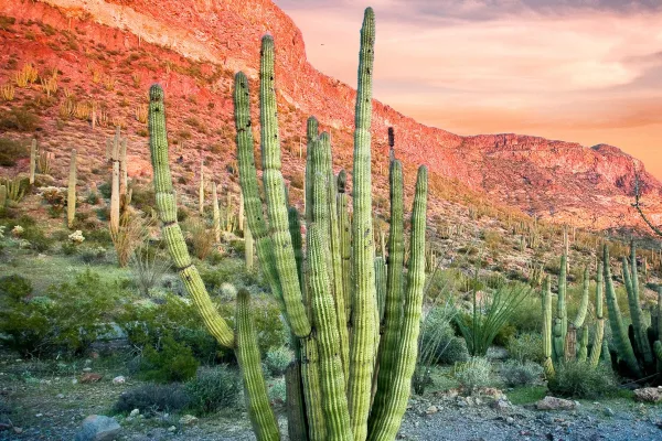
Organ Pipe Cactus National Monument
National Monument
Look closely. Look again. The sights and sounds of Organ Pipe Cactus National Monument, an International Biosphere Reserve, reveal a thriving community of plants and animals. Human stories echo throug...
23 mi from route
~58 min detour
$25
Park Closure: West and East Border Roads closed for public safety
Caution: Feral Dogs May Be Seen in Organ Pipe Cactus National Monument
Park data from the National Park Service API. Alerts update every 2 hours.
More Details
What kind of drive is this?
This route presents a mixed drive, with 36% of it on highways, balancing faster travel with more local road segments. You'll experience a significant uninterrupted stretch of 32.1 miles on the Gila Bend-Lukeville Highway, offering a consistent pace for a portion of your journey. As you transition to Arizona State Highway 85 and the Pearl Harbor Memorial Highway, expect the road character to evolve, potentially incorporating more varied driving conditions. It’s not a constant interstate grind but rather a blend that keeps things interesting without being overly complex.
36% highway, the rest on surface roads — varied driving throughout.
22 navigation steps total — most of the decisions cluster near the start and finish.
Longest single stretch: 32.1 mi on Gila Bend-Lukeville Highway.
How Hard Is This Drive?
7/10
This route mixes highway mileage with some local-road sections near the start or finish. This route has several spots where lane changes, forks, or exits need your full attention. The trickiest moment comes around 42 miles in near I 8 Bus; AZ 85; US 80 Hist / West Pima Street.
Driving Effort7/10
Demanding - plan breaks and stay ahead of the key maneuvers
Balances navigation complexity with total wheel time.
This is a demanding drive. With 11 significant decision points across 106.7 miles, you will need to stay alert - especially through interchange areas and urban stretches. Consider splitting it into segments if you are not comfortable with fast highway navigation.
Where does it get tricky?
The main spots that need attention: at 42 miles (I 8 Bus; AZ 85; US 80 Hist / West Pima Street): Navigation decision point; at 77.9 miles: Highway fork - watch signs carefully. Lane positioning matters here; at 89 miles: Exit ramp - move to the correct lane early. Lane positioning matters here.
Sun City is a suburb 20 miles (30km) northwest of downtown Phoenix, Arizona. It was built as a planned retirement community in Maricopa County in the 1960s. An adjacent retirement community Sun City West was built in the late 1970s; there is also a Sun City Grand. Directly northwest of the three "Sun City" suburbs is Surprise, Arizona.
Doable as a same-day drive at 2h 19m. Total distance: 106.7 miles.
Family Friendly
Moderate complexity with 0 natural rest stops along the way.
Solo Traveler
2h 19m drive, comfortable solo distance.
First-Time Driver
Mostly highway driving (36%). Some complex stretches to watch for.
Scenic Drive
Mixed highway & surface route profile with national parks nearby.
Frequently Asked Questions
The longest stretch is about 32.1 miles on Gila Bend-Lukeville Highway. The full list of main roads is in the Roads section above.
Yes — we found about 5 rest areas or service plazas within a short detour of the route (from OpenStreetMap). See the Rest Stops tab under Nearby Places for locations and mile markers. Plan to stretch, use the bathroom, and top off fluids every 2–3 hours on longer drives.
It helps. This route has a higher-than-average number of complex decision points, which get harder in the dark. If the last hour of the trip is on surface roads or mountain grades, aim to arrive at Surprise, AZ before sunset when you can. Check the Trip Plan for departure windows that land you in daylight.
Only with planning. This is a long drive for kids — consider splitting it into two days rather than pushing through. There are 5 rest areas along the route for bathroom stops.
The main spots that need attention: at 42 miles (I 8 Bus; AZ 85; US 80 Hist / West Pima Street): Navigation decision point; at 77.9 miles: Highway fork - watch signs carefully. Lane positioning matters here; at 89 miles: Exit ramp - move to the correct lane early. Lane positioning matters here.
Yes — Organ Pipe Cactus National Monument. See the National Parks section for detour distances and tips on detours.
Yes. A round trip is manageable in a single day if you plan a break at Surprise, AZ before heading back.